STS044-80-99
| NASA Photo ID | STS044-80-99 |
| Focal Length | 50mm |
| Date taken | 1991.12.01 |
| Time taken | 17:40:33 GMT |

Cloud masks available for this image:
Spacecraft nadir point: 24.5° N, 75.5° W
Photo center point: 28.5° N, 80.0° W
Photo center point by machine learning:
Photo center point: 28.5° N, 80.0° W
Photo center point by machine learning:
Nadir to Photo Center: Northwest
Spacecraft Altitude: 197 nautical miles (365km)
Country or Geographic Name: | USA-FLORIDA |
Features: | CAPE CANAVERAL |
| Features Found Using Machine Learning: | |
Cloud Cover Percentage: | 40 (26-50)% |
Sun Elevation Angle: | 22° |
Sun Azimuth: | 227° |
Camera: | Hasselblad |
Focal Length: | 50mm |
Camera Tilt: | High Oblique |
Format: | VELVI: Fuji, natural color positive, Velvia 50, CS 135-36, ASA 32, standard base |
Film Exposure: | Normal |
| Additional Information | |
| Width | Height | Annotated | Cropped | Purpose | Links |
|---|---|---|---|---|---|
| 5700 pixels | 6000 pixels | No | No | Download Image | |
| 500 pixels | 526 pixels | No | No | Download Image | |
| 640 pixels | 480 pixels | No | No | Download Image |
Download Packaged File
Download a Google Earth KML for this Image
View photo footprint information
Download a GeoTIFF for this photo
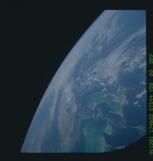
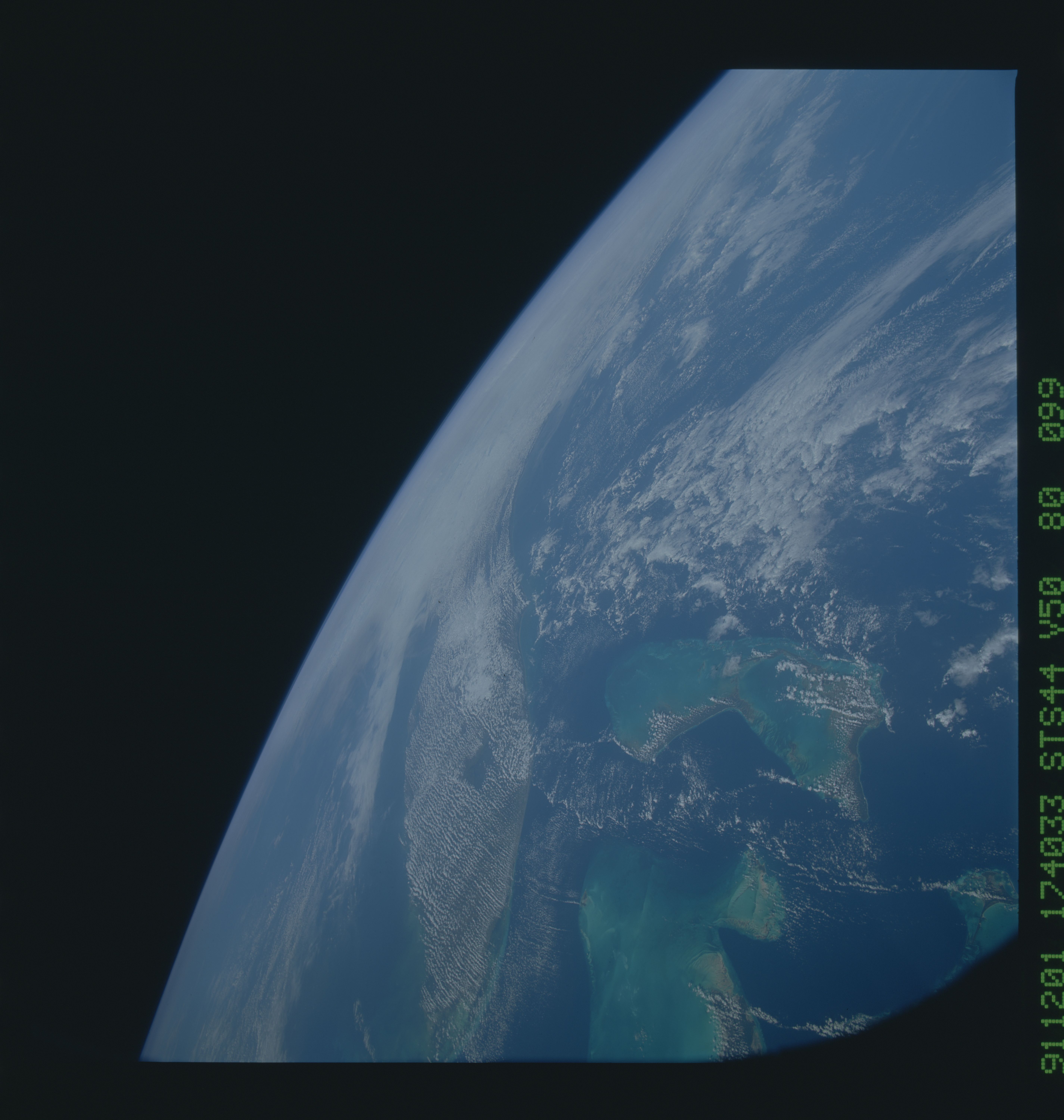
Image Caption: In this view of the Florida peninsula and the Bahamas (28.5N, 80.0W), the Bahamas are easily identified from orbit because of the vivid blue colors of the shallow Bahama Banks and dark blues of the ocean depths. The Florida peninsula is completely silhoutted by cumulus clouds except for the cloud hole over Lake Okeechobee. The rest of the U.S. Gulf Coast and eastern seaboard is completely obscured by the clouds of an approaching winter front.
