STS044-73-10

| NASA Photo ID | STS044-73-10 |
| Focal Length | 250mm |
| Date taken | 1991.11.27 |
| Time taken | 21:30:21 GMT |
Resolutions offered for this image:
3904 x 3895 pixels 639 x 638 pixels 5700 x 6000 pixels 500 x 526 pixels 640 x 480 pixels
3904 x 3895 pixels 639 x 638 pixels 5700 x 6000 pixels 500 x 526 pixels 640 x 480 pixels
Cloud masks available for this image:
Spacecraft nadir point: 25.0° S, 142.0° E
Photo center point: 26.0° S, 141.0° E
Photo center point by machine learning:
Photo center point: 26.0° S, 141.0° E
Photo center point by machine learning:
Nadir to Photo Center: Southwest
Spacecraft Altitude: 198 nautical miles (367km)
Country or Geographic Name: | AUSTRALIA-Q |
Features: | SIMPSON DESERT |
| Features Found Using Machine Learning: | |
Cloud Cover Percentage: | 0 (no clouds present) |
Sun Elevation Angle: | 45° |
Sun Azimuth: | 103° |
Camera: | Hasselblad |
Focal Length: | 250mm |
Camera Tilt: | 23 degrees |
Format: | 5017: Kodak, natural color positive, Ektachrome, X Professional, ASA 64, standard base |
Film Exposure: | Normal |
| Additional Information | |
| Width | Height | Annotated | Cropped | Purpose | Links |
|---|---|---|---|---|---|
| 3904 pixels | 3895 pixels | No | No | Earth From Space collection | Download Image |
| 639 pixels | 638 pixels | No | No | Earth From Space collection | Download Image |
| 5700 pixels | 6000 pixels | No | No | Download Image | |
| 500 pixels | 526 pixels | No | No | Download Image | |
| 640 pixels | 480 pixels | No | No | Download Image |
Download Packaged File
Download a Google Earth KML for this Image
View photo footprint information
Download a GeoTIFF for this photo
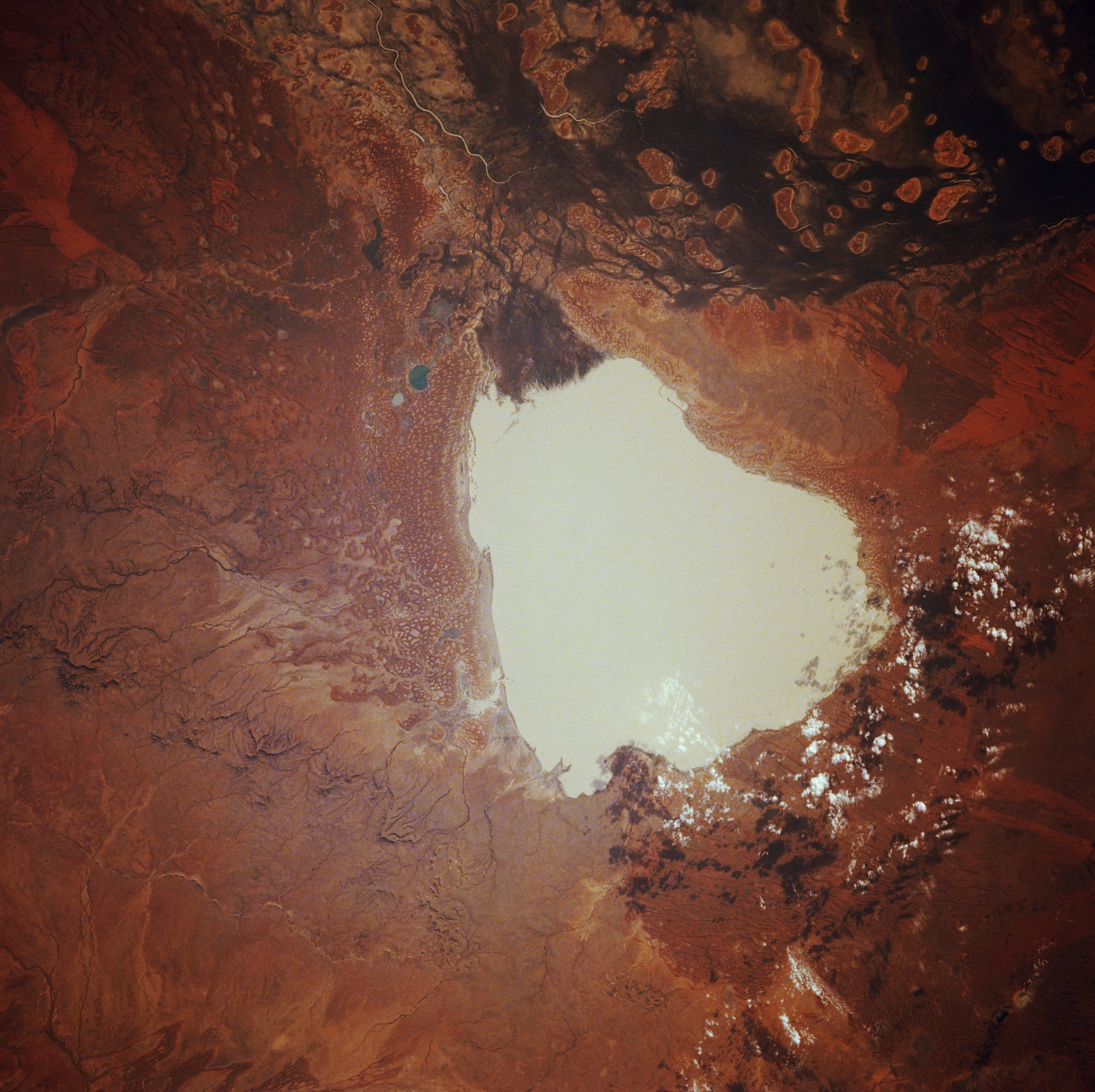
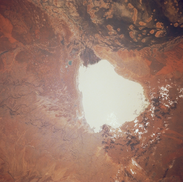
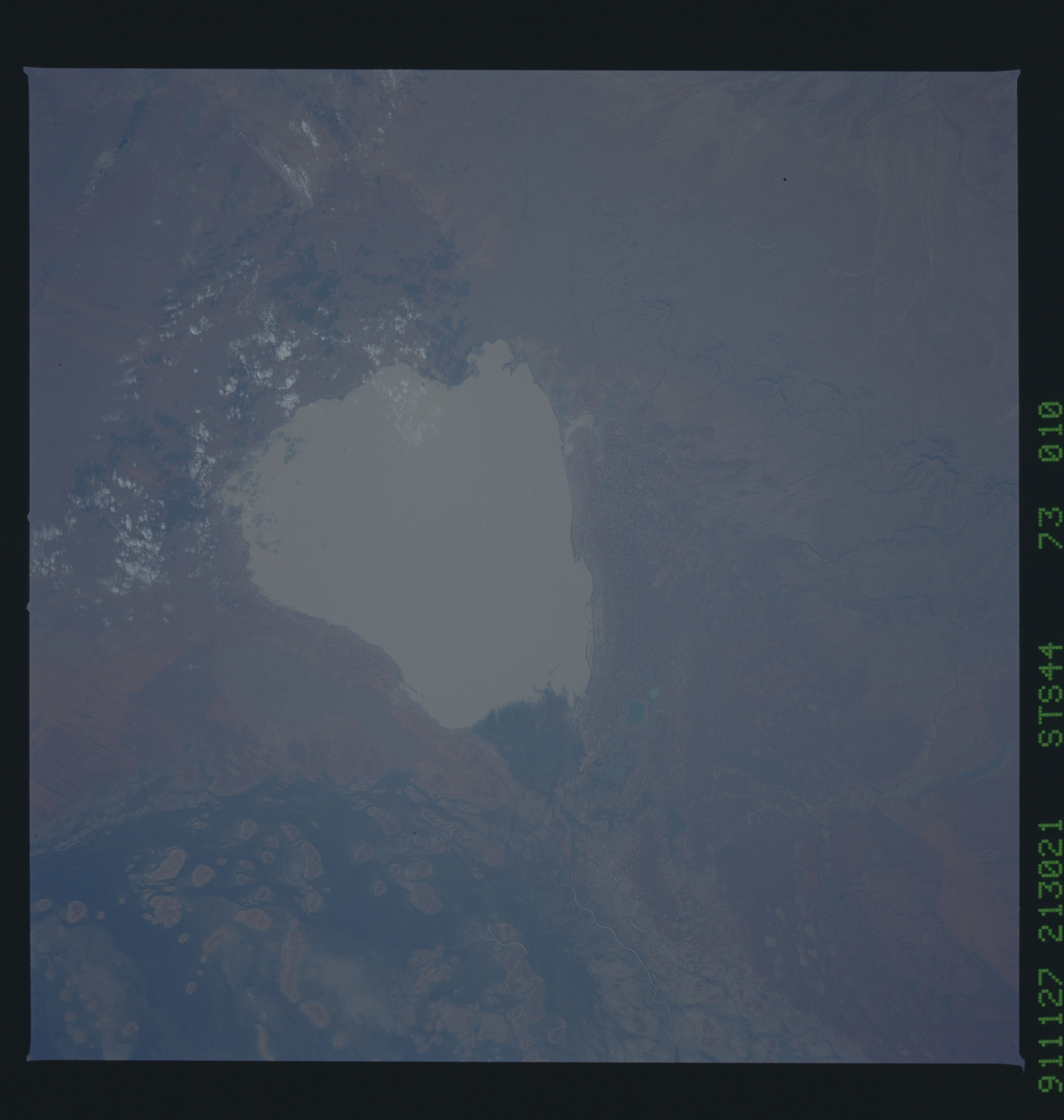
Image Caption: STS044-073-010 Lake Yamma Yamma, Queensland, Australia November 1991
A small section of Cooper Creek, one of the largest drainage basins associated with the extensive interior drainage of the arid center of Australia is visible along the upper edge of the image. Rivers in this region are generally dry but during the rare floods (several times per century) rivers can occupy a wide floodplain. The roughly oval shaped features within Cooper Creek become islands when flooding does occur. The large, whitish-looking feature is Queensland's largest inland ephemeral lake, Lake Yamma Yamma, which is located on the western edge of Cooper Creek near the Queensland-South Australia border. Through the years the overflow from the creek has formed a triangular-shaped delta (dark shape) along the northeast side (top) of the lake. The lake is a classic example of an Australian feature known as a "floodout," which fills during floods and then slowly drains as the flood subsides. The lake is surrounded by aeolian landforms, including sand dunes. A patch of scattered clouds (and their shadows) are visible along the south edge of the lake.
A small section of Cooper Creek, one of the largest drainage basins associated with the extensive interior drainage of the arid center of Australia is visible along the upper edge of the image. Rivers in this region are generally dry but during the rare floods (several times per century) rivers can occupy a wide floodplain. The roughly oval shaped features within Cooper Creek become islands when flooding does occur. The large, whitish-looking feature is Queensland's largest inland ephemeral lake, Lake Yamma Yamma, which is located on the western edge of Cooper Creek near the Queensland-South Australia border. Through the years the overflow from the creek has formed a triangular-shaped delta (dark shape) along the northeast side (top) of the lake. The lake is a classic example of an Australian feature known as a "floodout," which fills during floods and then slowly drains as the flood subsides. The lake is surrounded by aeolian landforms, including sand dunes. A patch of scattered clouds (and their shadows) are visible along the south edge of the lake.
