STS043-96-54

| NASA Photo ID | STS043-96-54 |
| Focal Length | 100mm |
| Date taken | 1991.08.07 |
| Time taken | 08:24:14 GMT |
Resolutions offered for this image:
5285 x 5285 pixels 639 x 639 pixels 4396 x 4600 pixels 500 x 523 pixels 640 x 480 pixels
5285 x 5285 pixels 639 x 639 pixels 4396 x 4600 pixels 500 x 523 pixels 640 x 480 pixels
Cloud masks available for this image:
Spacecraft nadir point: 28.5° N, 16.1° W
Photo center point: 28.0° N, 16.5° W
Photo center point by machine learning:
Photo center point: 28.0° N, 16.5° W
Photo center point by machine learning:
Nadir to Photo Center: Southwest
Spacecraft Altitude: 177 nautical miles (328km)
Country or Geographic Name: | CANARY ISLANDS |
Features: | CLOUD PATTERNS, I. WAKES |
| Features Found Using Machine Learning: | |
Cloud Cover Percentage: | 90 (76-100)% |
Sun Elevation Angle: | 23° |
Sun Azimuth: | 83° |
Camera: | Hasselblad |
Focal Length: | 100mm |
Camera Tilt: | 12 degrees |
Format: | 5017: Kodak, natural color positive, Ektachrome, X Professional, ASA 64, standard base |
Film Exposure: | Normal |
| Additional Information | |
| Width | Height | Annotated | Cropped | Purpose | Links |
|---|---|---|---|---|---|
| 5285 pixels | 5285 pixels | No | No | Earth From Space collection | Download Image |
| 639 pixels | 639 pixels | No | No | Earth From Space collection | Download Image |
| 4396 pixels | 4600 pixels | No | No | Download Image | |
| 500 pixels | 523 pixels | No | No | Download Image | |
| 640 pixels | 480 pixels | No | No | Download Image |
Download Packaged File
Download a Google Earth KML for this Image
View photo footprint information
Download a GeoTIFF for this photo
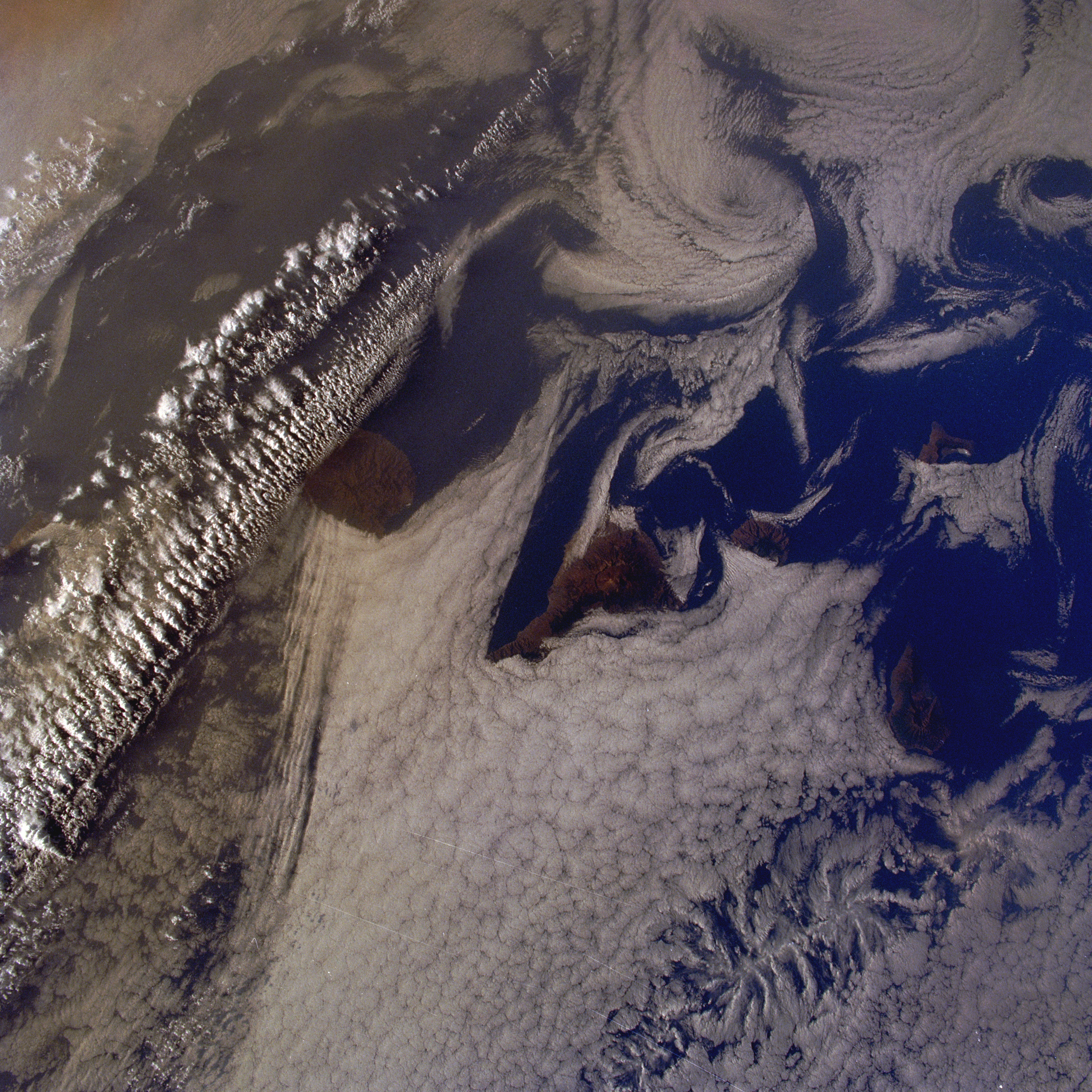
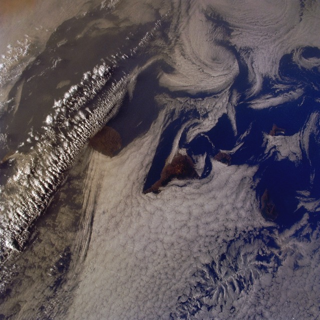
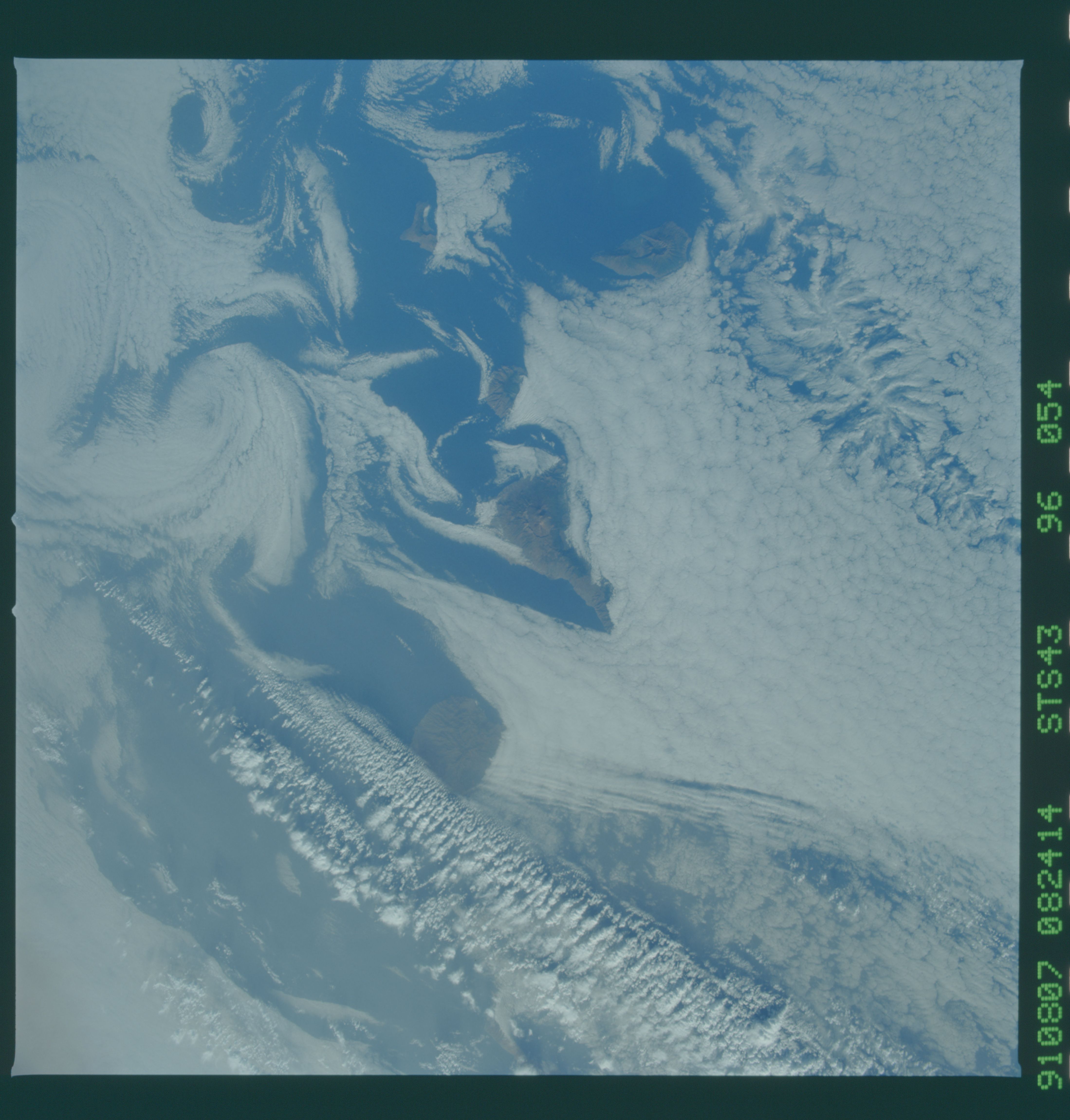
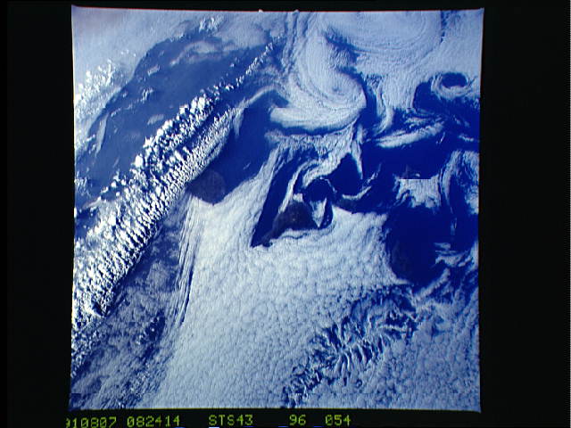
Image Caption: STS043-096-054 Von Karmen Vortices, Canary Islands August, 1991
Vortices have formed from strong winds passing the Canary Islands. The volcanic islands can be seen impeding low Stratus clouds as they are transported by the winds, moving from the bottom left to the upper right of the image. Vortices are being formed on the leeward side of the islands. These vortices can extend for several miles (kilometers) before breaking-up and reforming spiral clouds.
Vortices have formed from strong winds passing the Canary Islands. The volcanic islands can be seen impeding low Stratus clouds as they are transported by the winds, moving from the bottom left to the upper right of the image. Vortices are being formed on the leeward side of the islands. These vortices can extend for several miles (kilometers) before breaking-up and reforming spiral clouds.
