STS043-608-39

| NASA Photo ID | STS043-608-39 |
| Focal Length | 250mm |
| Date taken | 1991.08.__ |
| Time taken | GMT |
Resolutions offered for this image:
4096 x 4096 pixels 640 x 640 pixels 4396 x 4600 pixels 500 x 523 pixels 640 x 480 pixels
4096 x 4096 pixels 640 x 640 pixels 4396 x 4600 pixels 500 x 523 pixels 640 x 480 pixels

Cloud masks available for this image:
Spacecraft nadir point:
Photo center point: 25.0° N, 125.5° E
Photo center point by machine learning:
Photo center point: 25.0° N, 125.5° E
Photo center point by machine learning:
Nadir to Photo Center:
Spacecraft Altitude: nautical miles (0km)
Country or Geographic Name: | JAPAN |
Features: | SAKISHIMA ISLANDS |
| Features Found Using Machine Learning: | |
Cloud Cover Percentage: | 5 (1-10)% |
Sun Elevation Angle: | ° |
Sun Azimuth: | ° |
Camera: | Rolleiflex |
Focal Length: | 250mm |
Camera Tilt: | Low Oblique |
Format: | 5017: Kodak, natural color positive, Ektachrome, X Professional, ASA 64, standard base |
Film Exposure: | Normal |
| Additional Information | |
| Width | Height | Annotated | Cropped | Purpose | Links |
|---|---|---|---|---|---|
| 4096 pixels | 4096 pixels | No | No | Earth From Space collection | Download Image |
| 640 pixels | 640 pixels | No | No | Earth From Space collection | Download Image |
| 4396 pixels | 4600 pixels | No | No | Download Image | |
| 500 pixels | 523 pixels | No | No | Download Image | |
| 640 pixels | 480 pixels | No | No | Download Image |
Download Packaged File
Download a Google Earth KML for this Image
View photo footprint information
Download a GeoTIFF for this photo
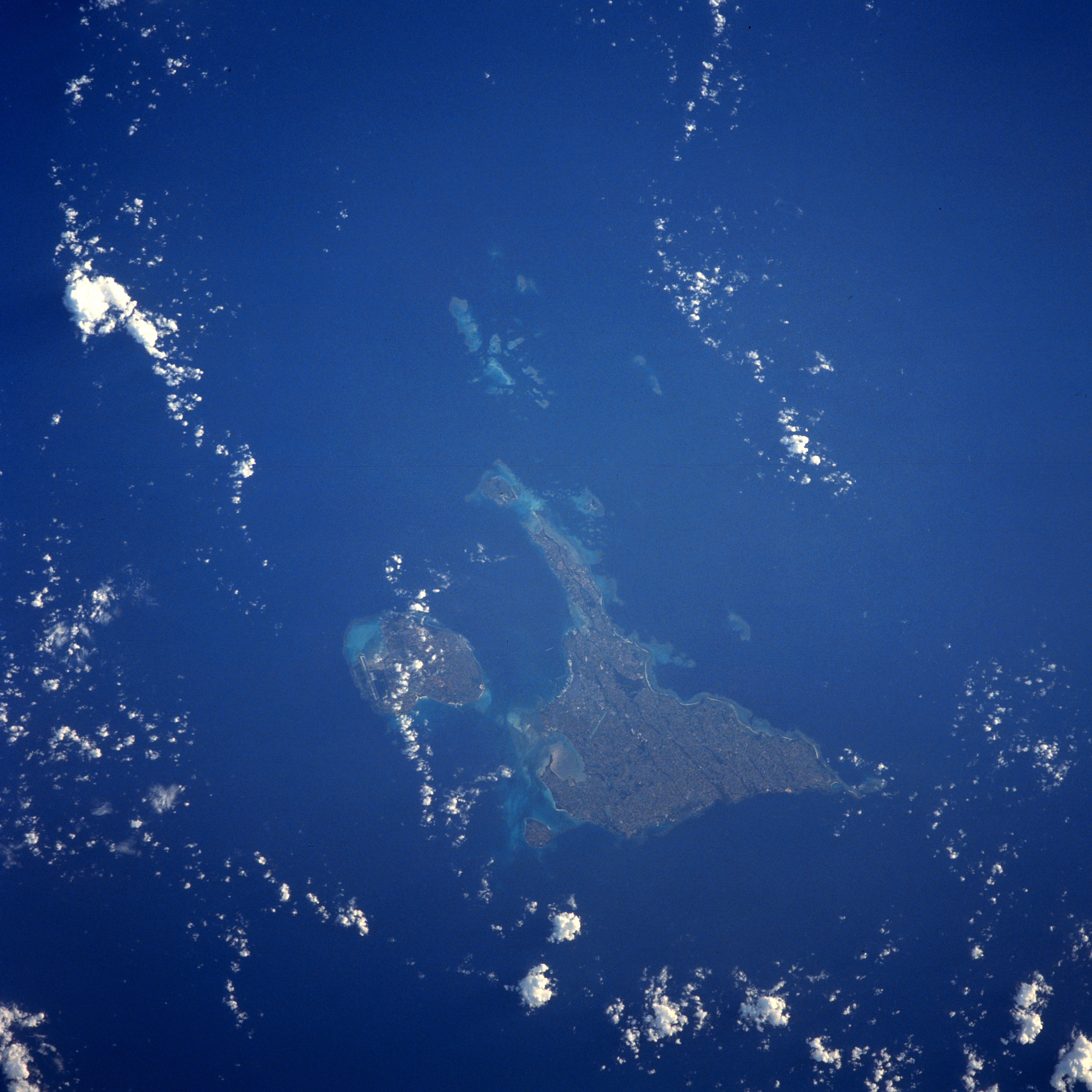
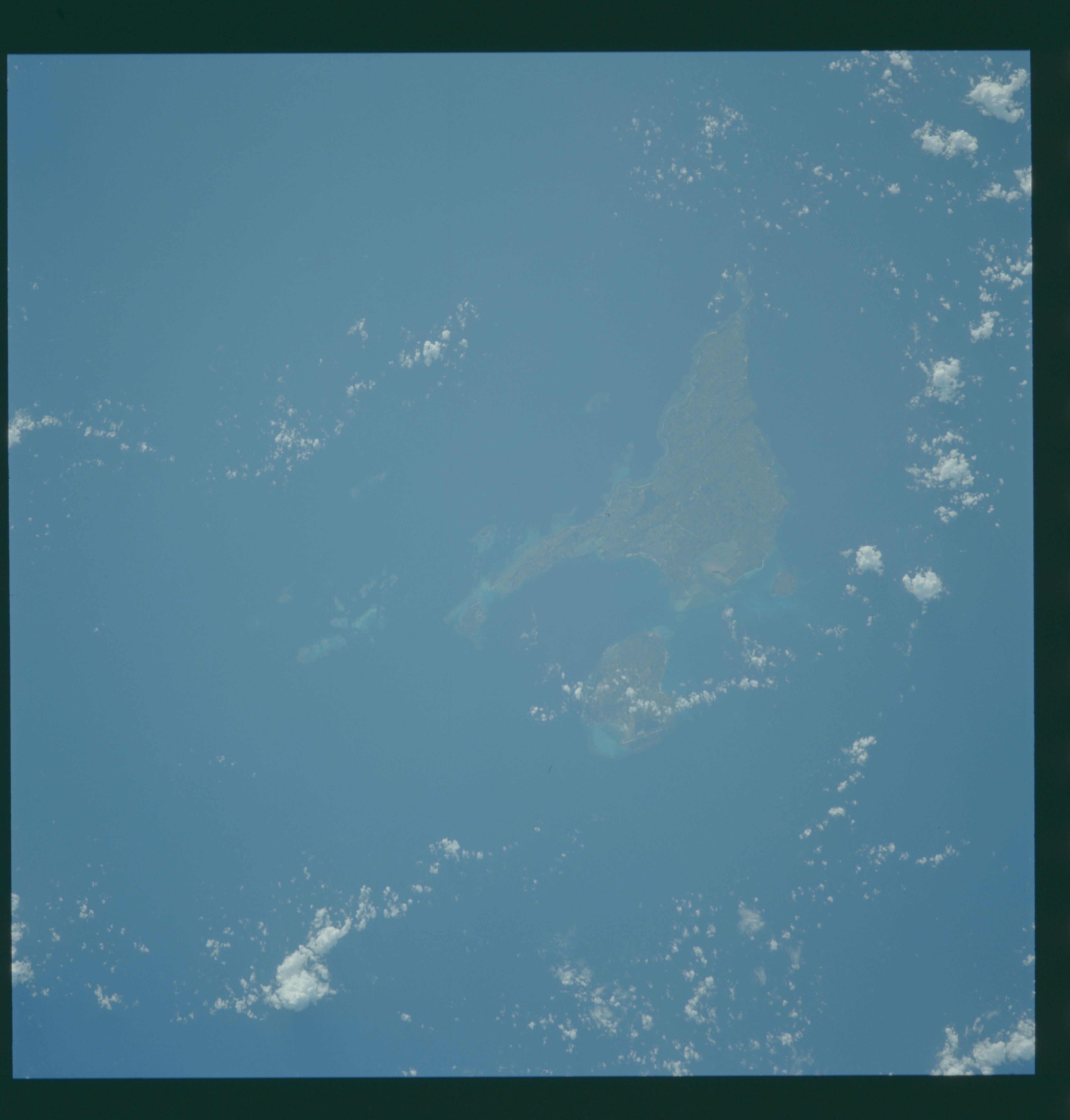
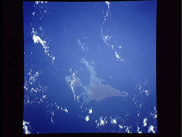
Image Caption: STS043-608-039 Miyako and Irabu Islands, Ryukyu Islands August 1991
This north-looking view shows Miyako Island and to its left (west) the smaller Irabu Island. Both are part of the Ryukyu Islands. The islands are the exposed tops of a submarine mountain range and are volcanic in origin. Miyako and Irabu Islands are generally flat with some low-undulating terrain. The land on the islands is used mostly for agriculture. Coral surrounds most of the coastlines of both islands.
This north-looking view shows Miyako Island and to its left (west) the smaller Irabu Island. Both are part of the Ryukyu Islands. The islands are the exposed tops of a submarine mountain range and are volcanic in origin. Miyako and Irabu Islands are generally flat with some low-undulating terrain. The land on the islands is used mostly for agriculture. Coral surrounds most of the coastlines of both islands.
