STS043-608-38
| NASA Photo ID | STS043-608-38 |
| Focal Length | 250mm |
| Date taken | 1991.08.__ |
| Time taken | GMT |
Resolutions offered for this image:
4096 x 4096 pixels 640 x 640 pixels 4396 x 4600 pixels 500 x 523 pixels 640 x 480 pixels
4096 x 4096 pixels 640 x 640 pixels 4396 x 4600 pixels 500 x 523 pixels 640 x 480 pixels
Cloud masks available for this image:
Spacecraft nadir point:
Photo center point: 24.5° N, 124.0° E
Photo center point by machine learning:
Photo center point: 24.5° N, 124.0° E
Photo center point by machine learning:
Nadir to Photo Center:
Spacecraft Altitude: nautical miles (0km)
Country or Geographic Name: | JAPAN |
Features: | ISHIGAKI ISLAND |
| Features Found Using Machine Learning: | |
Cloud Cover Percentage: | 5 (1-10)% |
Sun Elevation Angle: | ° |
Sun Azimuth: | ° |
Camera: | Rolleiflex |
Focal Length: | 250mm |
Camera Tilt: | Low Oblique |
Format: | 5017: Kodak, natural color positive, Ektachrome, X Professional, ASA 64, standard base |
Film Exposure: | Normal |
| Additional Information | |
| Width | Height | Annotated | Cropped | Purpose | Links |
|---|---|---|---|---|---|
| 4096 pixels | 4096 pixels | No | No | Earth From Space collection | Download Image |
| 640 pixels | 640 pixels | No | No | Earth From Space collection | Download Image |
| 4396 pixels | 4600 pixels | No | No | Download Image | |
| 500 pixels | 523 pixels | No | No | Download Image | |
| 640 pixels | 480 pixels | No | No | Download Image |
Download Packaged File
Download a Google Earth KML for this Image
View photo footprint information
Download a GeoTIFF for this photo
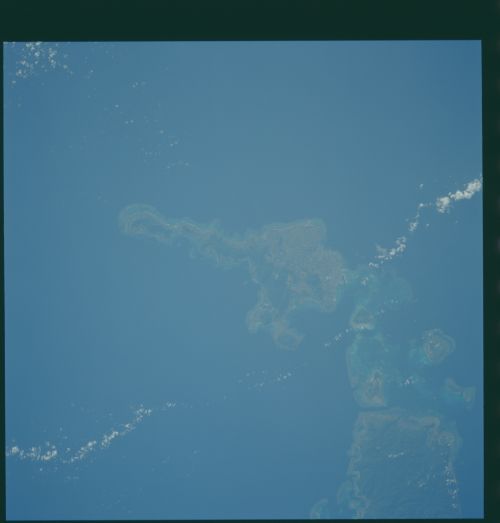
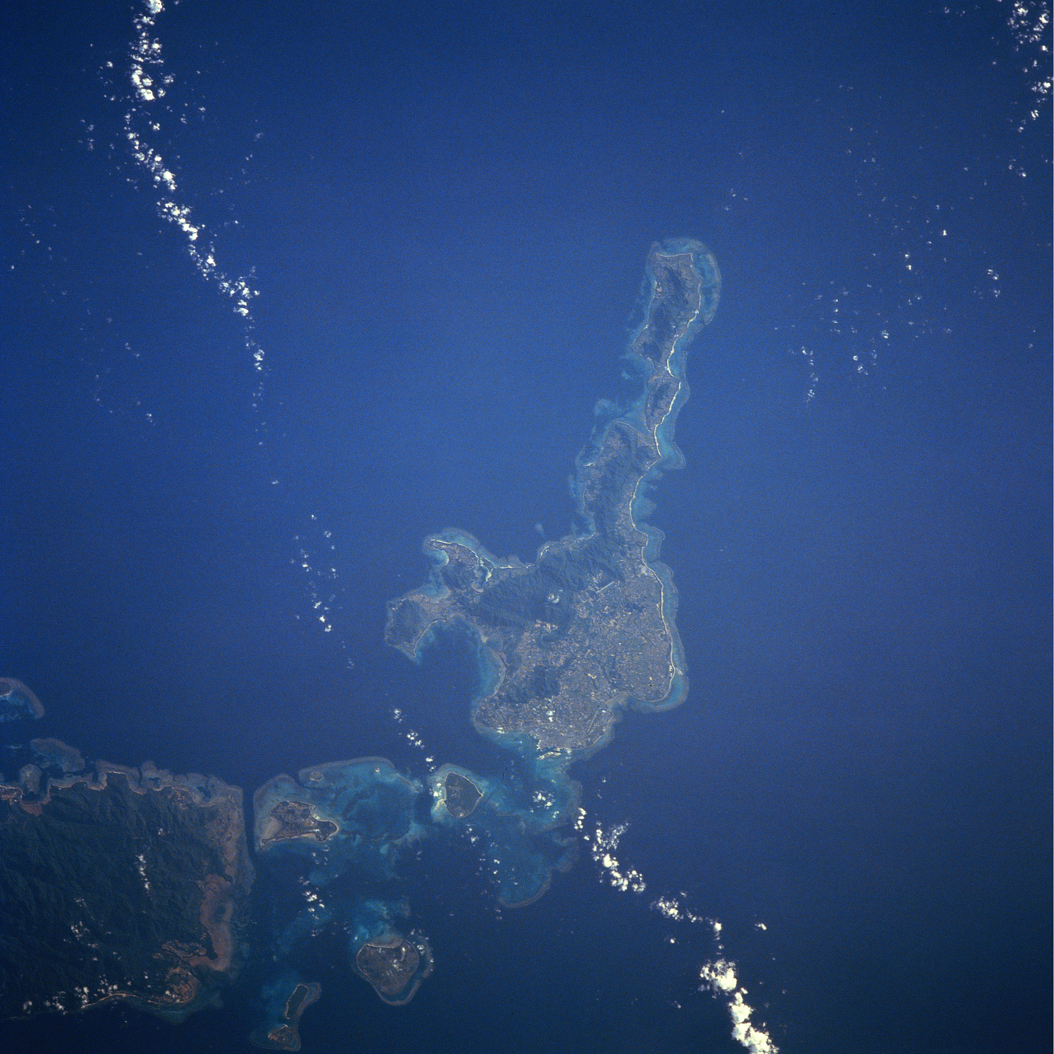
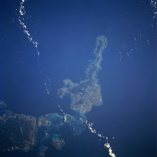
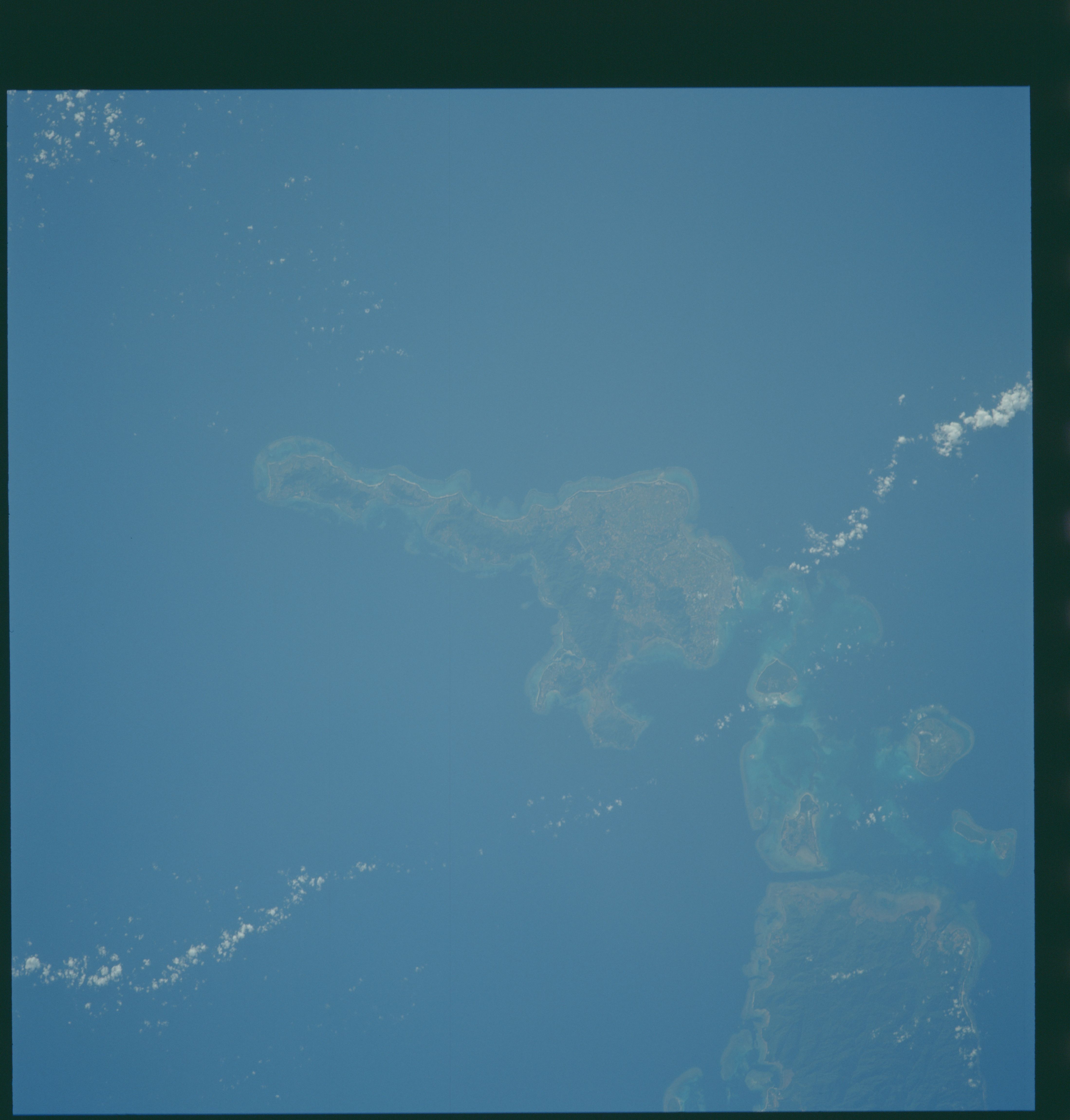
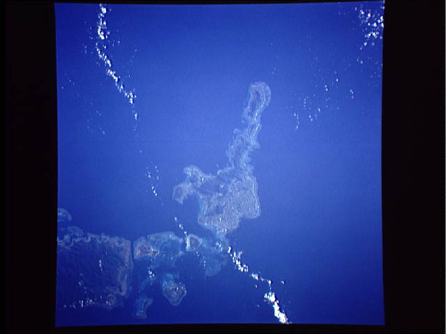
Image Caption: STS043-608-038 Ishigaki Island, Ryukyu Islands August 1991
The heavily populated island of Ishigaki in the southern Ryukyu Islands can be seen in the near-nadir looking view. As with all of the Ryukyu Islands, Ishigaki Island is the exposed top of a submarine mountain range and is volcanic in origin. Though some wooded hills can be seen on the island, Ishigaki is mostly flat with some slightly undulating terrain. Coral reefs surround most of the island. The city of Ishigaki is an agricultural center where sake and dried tuna are produced. The island of Iriomote is discernible at the bottom left of the image.
The heavily populated island of Ishigaki in the southern Ryukyu Islands can be seen in the near-nadir looking view. As with all of the Ryukyu Islands, Ishigaki Island is the exposed top of a submarine mountain range and is volcanic in origin. Though some wooded hills can be seen on the island, Ishigaki is mostly flat with some slightly undulating terrain. Coral reefs surround most of the island. The city of Ishigaki is an agricultural center where sake and dried tuna are produced. The island of Iriomote is discernible at the bottom left of the image.
