STS042-73-14

| NASA Photo ID | STS042-73-14 |
| Focal Length | 250mm |
| Date taken | 1992.01.26 |
| Time taken | 02:07:36 GMT |
Cloud masks available for this image:
Spacecraft nadir point: 56.9° N, 167.1° E
Photo center point: 60.5° N, 168.5° E
Photo center point by machine learning:
Photo center point: 60.5° N, 168.5° E
Photo center point by machine learning:
Nadir to Photo Center: North
Spacecraft Altitude: 168 nautical miles (311km)
Country or Geographic Name: | RUSSIAN FEDERATION |
Features: | GULF OF OLYUTOR |
| Features Found Using Machine Learning: | |
Cloud Cover Percentage: | 20 (11-25)% |
Sun Elevation Angle: | 13° |
Sun Azimuth: | 195° |
Camera: | Hasselblad |
Focal Length: | 250mm |
Camera Tilt: | 54 degrees |
Format: | 5017: Kodak, natural color positive, Ektachrome, X Professional, ASA 64, standard base |
Film Exposure: | Normal |
| Additional Information | |
| Width | Height | Annotated | Cropped | Purpose | Links |
|---|---|---|---|---|---|
| 5700 pixels | 6000 pixels | No | No | Download Image | |
| 500 pixels | 526 pixels | No | No | Download Image | |
| 640 pixels | 480 pixels | No | No | Download Image |
Download Packaged File
Download a Google Earth KML for this Image
View photo footprint information
Download a GeoTIFF for this photo
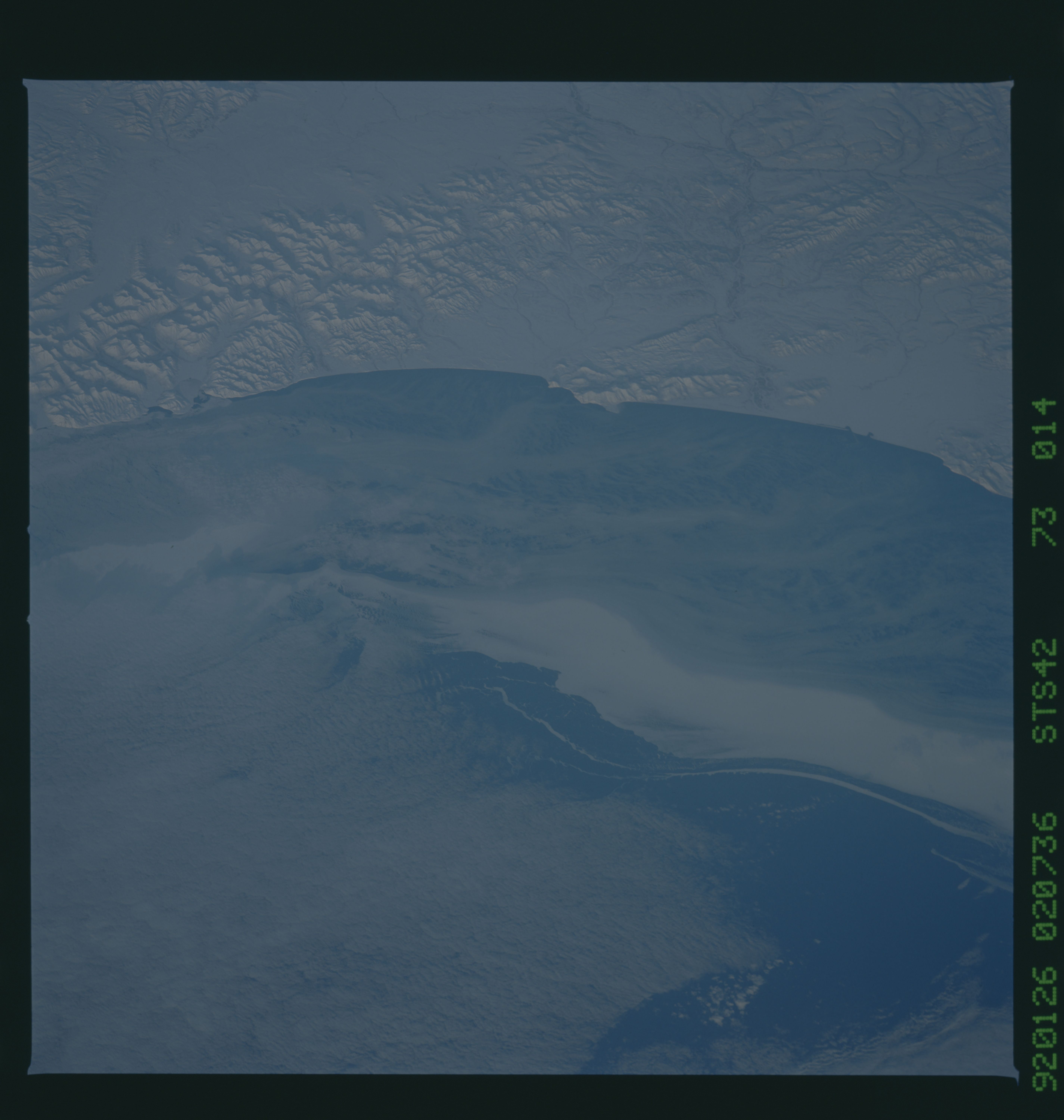
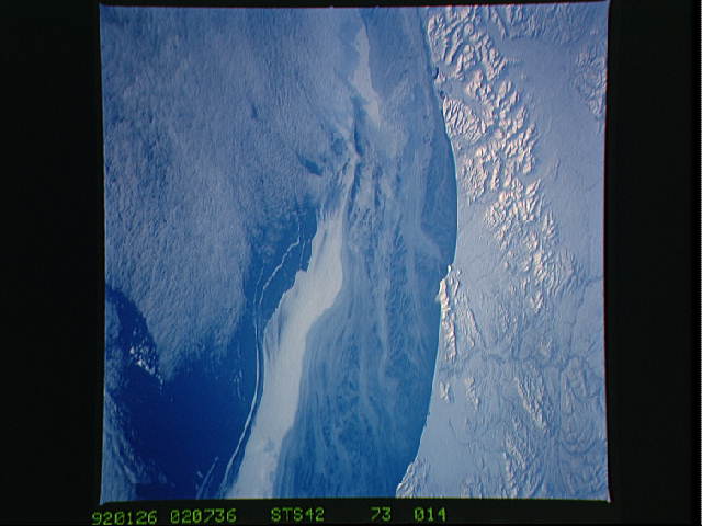
Image Caption:
STS042-73-014 & 017 Ice Flow in the Gulf of Olyutorskiy on the
Northern Coast of Kamchatka STS042-73-014 depicts an in-
teresting flow of pack ice around the Olyutorskiy [Pat--
Spelling?--M.F.] Mountain Range (57.0! N, 167.0! E). STS042-73-
017 shows the flow as it continues southwest (56.7! N, 172.0! E).
Offshore winds in a southwesterly direction are evident as thin
sea ice is formed in the inner area of the Gulf. Local currents
combined with the offshore winds may explain why the ice flow is
moving in a more westerly direction. This movement may also in-
dicate that the ice flow is not heavily packed. Low stratus
cloud formations are seen from the southern edge of the ice flow
southward.
