STS041-90-103
| NASA Photo ID | STS041-90-103 |
| Focal Length | 250mm |
| Date taken | 1990.10.09 |
| Time taken | 09:20:36 GMT |
Cloud masks available for this image:
Spacecraft nadir point: 15.4° N, 6.4° W
Photo center point: 15.0° N, 6.0° W
Photo center point by machine learning:
Photo center point: 15.0° N, 6.0° W
Photo center point by machine learning:
Nadir to Photo Center: Southeast
Spacecraft Altitude: 162 nautical miles (300km)
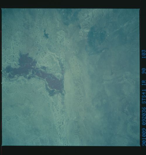
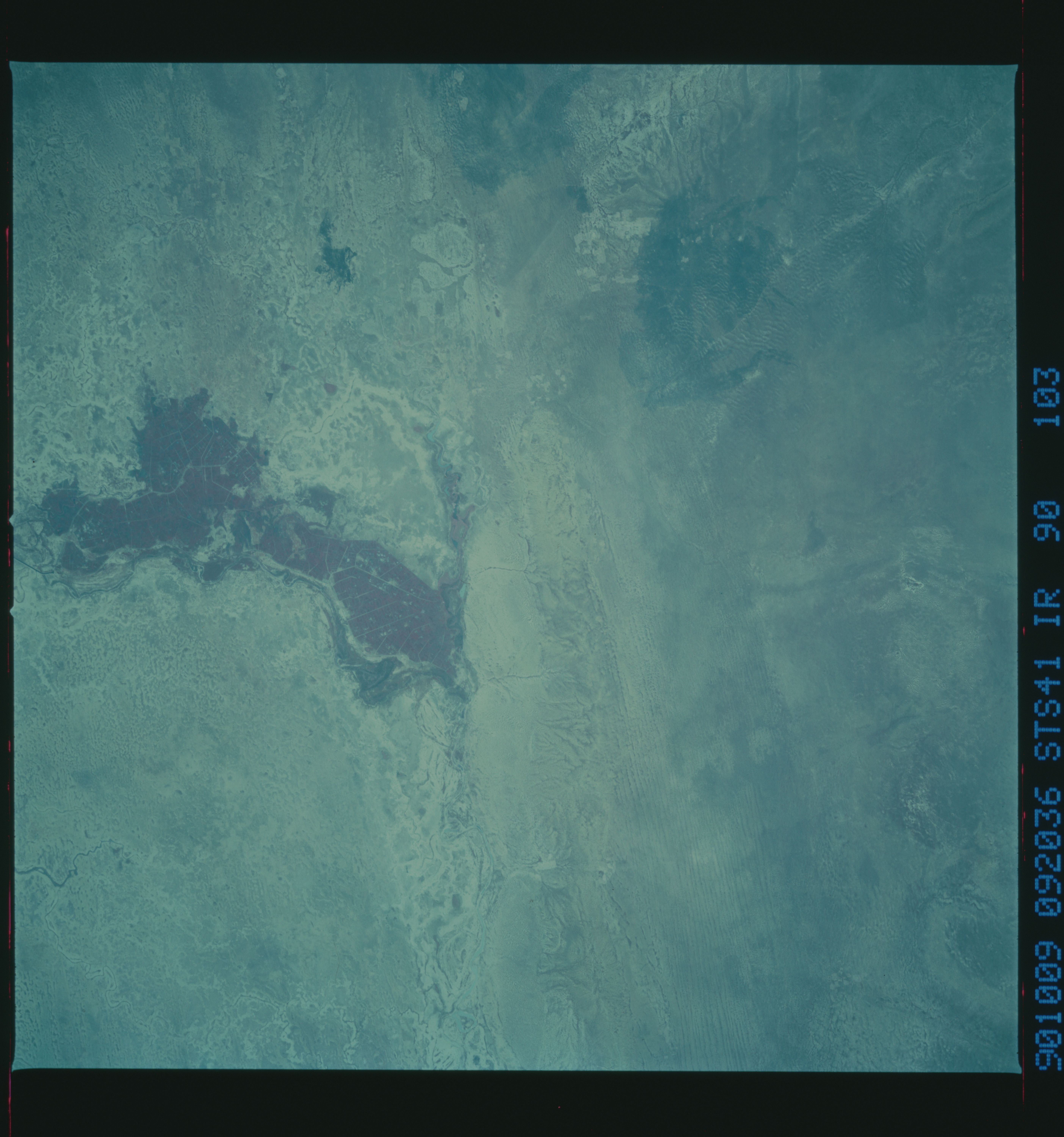
Country or Geographic Name: | MALI |
Features: | NIONO IRRIGATION PROJECT |
| Features Found Using Machine Learning: | |
Cloud Cover Percentage: | 0 (no clouds present) |
Sun Elevation Angle: | 42° |
Sun Azimuth: | 113° |
Camera: | Hasselblad |
Focal Length: | 250mm |
Camera Tilt: | 12 degrees |
Format: | 2443: Kodak Aerochrome 2443, color IR, thin base, EA-5 process thru June 1999, E-6 process afterward |
Film Exposure: | Normal |
| Additional Information | |
| Width | Height | Annotated | Cropped | Purpose | Links |
|---|---|---|---|---|---|
| 5614 pixels | 6000 pixels | No | No | Download Image | |
| 500 pixels | 534 pixels | No | No | Download Image |
Download Packaged File
Download a Google Earth KML for this Image
View photo footprint information
Download a GeoTIFF for this photo
Image Caption:
Niono Irrigation Project T5
The Niono Irrigation Project is seen in this low oblique, color
infrared view taken in October 1990. The French started irriga-
tion in the 1930's. The region is situated west and north of the
Niger River and the main inland delta region. (S41-90-103)
Niono Irrigation Project T5
The Niono Irrigation Project is seen in this low oblique, color
infrared view taken in October 1990. The French started irriga-
tion in the 1930's. The region is situated west and north of the
Niger River and the main inland delta region. (S41-90-103)
