STS041-79-70
| NASA Photo ID | STS041-79-70 |
| Focal Length | 250mm |
| Date taken | 1990.10.08 |
| Time taken | 21:15:53 GMT |
Resolutions offered for this image:
4096 x 4096 pixels 640 x 640 pixels 5700 x 5900 pixels 500 x 518 pixels 640 x 480 pixels 652 x 643 pixels
4096 x 4096 pixels 640 x 640 pixels 5700 x 5900 pixels 500 x 518 pixels 640 x 480 pixels 652 x 643 pixels


Cloud masks available for this image:
Spacecraft nadir point: 20.5° N, 166.2° E
Photo center point: 19.5° N, 166.5° E
Photo center point by machine learning:
Photo center point: 19.5° N, 166.5° E
Photo center point by machine learning:
Nadir to Photo Center: South
Spacecraft Altitude: 162 nautical miles (300km)
Country or Geographic Name: | MARSHALL ISLANDS |
Features: | WAKE ISLAND |
| Features Found Using Machine Learning: | |
Cloud Cover Percentage: | 30 (26-50)% |
Sun Elevation Angle: | 32° |
Sun Azimuth: | 111° |
Camera: | Hasselblad |
Focal Length: | 250mm |
Camera Tilt: | 21 degrees |
Format: | 5017: Kodak, natural color positive, Ektachrome, X Professional, ASA 64, standard base |
Film Exposure: | Normal |
| Additional Information | |
| Width | Height | Annotated | Cropped | Purpose | Links |
|---|---|---|---|---|---|
| 4096 pixels | 4096 pixels | No | No | Earth From Space collection | Download Image |
| 640 pixels | 640 pixels | No | No | Earth From Space collection | Download Image |
| 5700 pixels | 5900 pixels | No | No | Download Image | |
| 500 pixels | 518 pixels | No | No | Download Image | |
| 640 pixels | 480 pixels | No | No | Download Image | |
| 652 pixels | 643 pixels | No | No | Download Image |
Download Packaged File
Download a Google Earth KML for this Image
View photo footprint information
Download a GeoTIFF for this photo
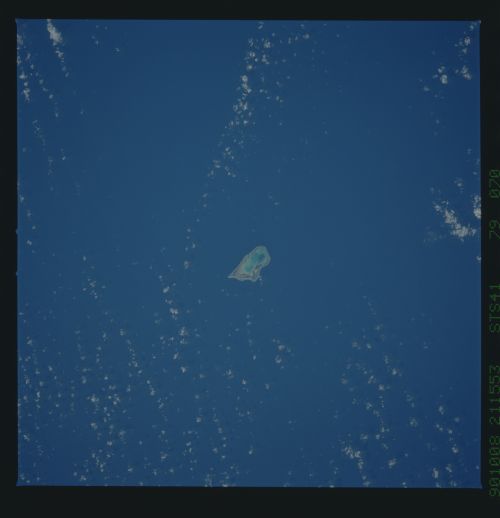
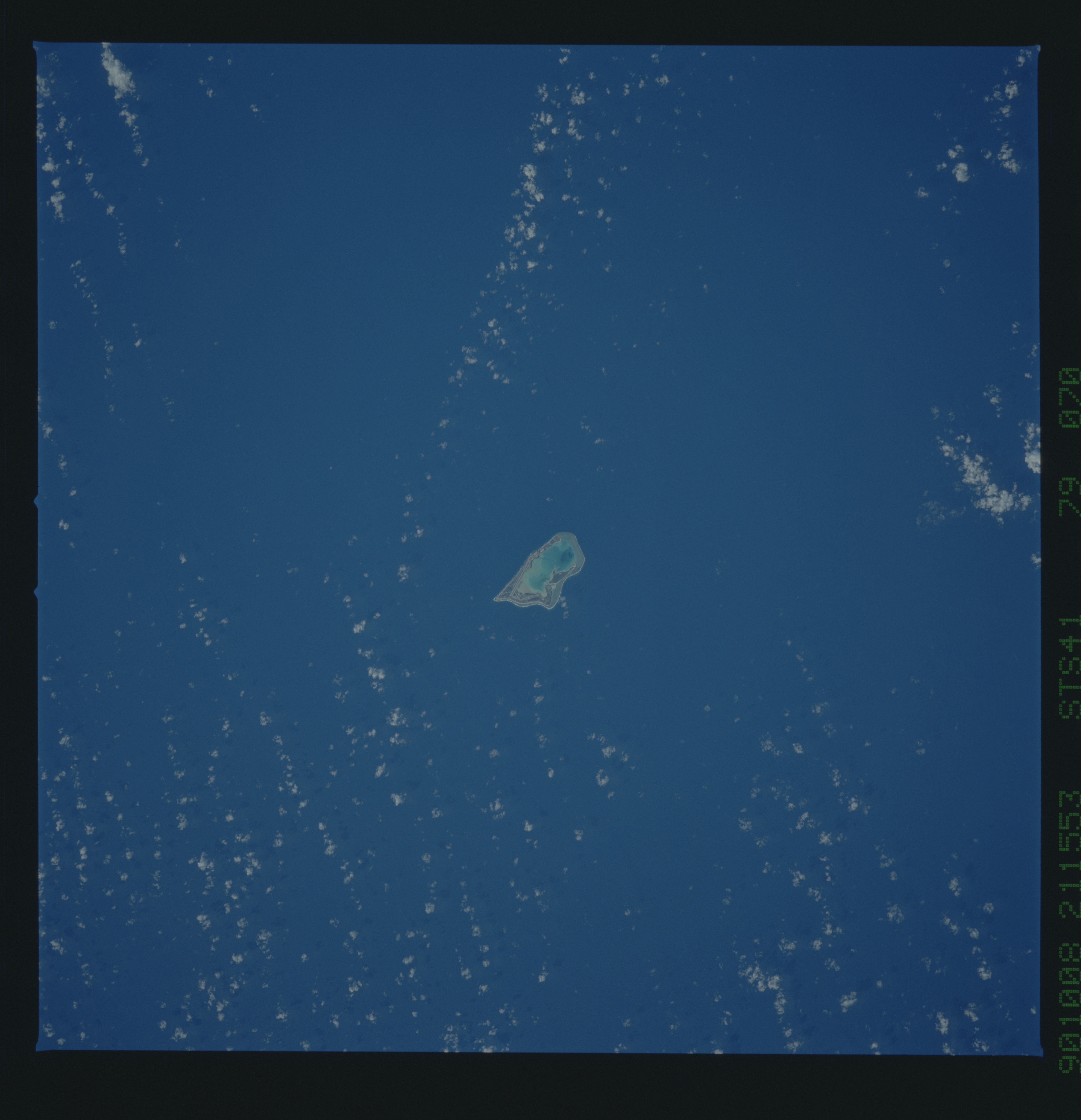
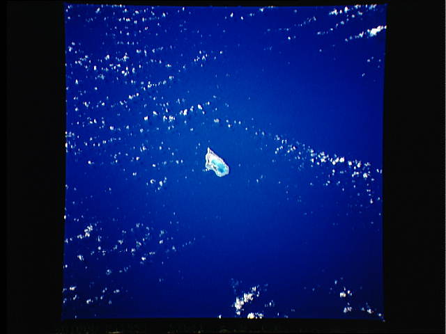
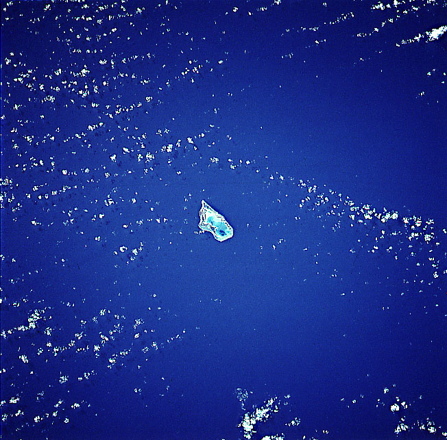
Image Caption: STS041-079-070 Wake Island, Pacific Ocean October 1990
Strategically located in the northern Pacific Ocean between the Hawaiian Islands and the North Mariana Islands, Wake Island can be seen in this south-looking view. Nearly triangular in shape, the atoll covers an area of 4 sq. miles (6.5 sq. km). The atoll is made up of three small coral islands built on an underwater volcano. The central lagoon is the former crater of the volcano and the three small islands are part of the rim. There are no native people on the island. All of the inhabitants living on the island are members of the United States Military. The island is used as a military crossroad for ships and airplanes crossing the Pacific. Wake Island has no fresh water and the vegetation on the island is mostly shrubs and bushes. All food, water, and supplies have to be imported. The island is occasionally hit by typhoons.
Strategically located in the northern Pacific Ocean between the Hawaiian Islands and the North Mariana Islands, Wake Island can be seen in this south-looking view. Nearly triangular in shape, the atoll covers an area of 4 sq. miles (6.5 sq. km). The atoll is made up of three small coral islands built on an underwater volcano. The central lagoon is the former crater of the volcano and the three small islands are part of the rim. There are no native people on the island. All of the inhabitants living on the island are members of the United States Military. The island is used as a military crossroad for ships and airplanes crossing the Pacific. Wake Island has no fresh water and the vegetation on the island is mostly shrubs and bushes. All food, water, and supplies have to be imported. The island is occasionally hit by typhoons.
