STS041-152-92
| NASA Photo ID | STS041-152-92 |
| Focal Length | 250mm |
| Date taken | 1990.10.09 |
| Time taken | 06:47:48 GMT |

Cloud masks available for this image:
Spacecraft nadir point: 27.6° S, 137.0° E
Photo center point: 28.0° S, 137.5° E
Photo center point by machine learning:
Photo center point: 28.0° S, 137.5° E
Photo center point by machine learning:
Nadir to Photo Center: Southeast
Spacecraft Altitude: 159 nautical miles (294km)
Country or Geographic Name: | AUSTRALIA-SA |
Features: | N. LAKE EYRE, WARBURTON CR |
| Features Found Using Machine Learning: | |
Cloud Cover Percentage: | 0 (no clouds present) |
Sun Elevation Angle: | 27° |
Sun Azimuth: | 277° |
Camera: | Linhof |
Focal Length: | 250mm |
Camera Tilt: | 14 degrees |
Format: | QX868: Kodak, natural color positive, Ektachrome QX868(5017 emulsion), ASA 64, thin base |
Film Exposure: | Normal |
| Additional Information | |
| Width | Height | Annotated | Cropped | Purpose | Links |
|---|---|---|---|---|---|
| 5088 pixels | 3968 pixels | No | No | Earth From Space collection | Download Image |
| 640 pixels | 499 pixels | No | No | Earth From Space collection | Download Image |
| 640 pixels | 480 pixels | No | No | ISD 1 | Download Image |
Download Packaged File
Download a Google Earth KML for this Image
View photo footprint information
Download a GeoTIFF for this photo
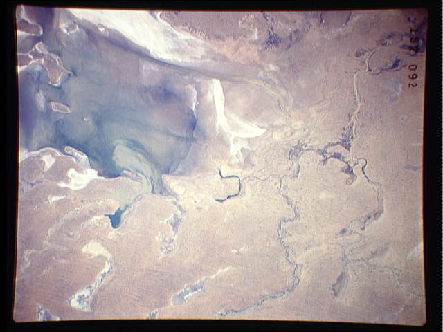
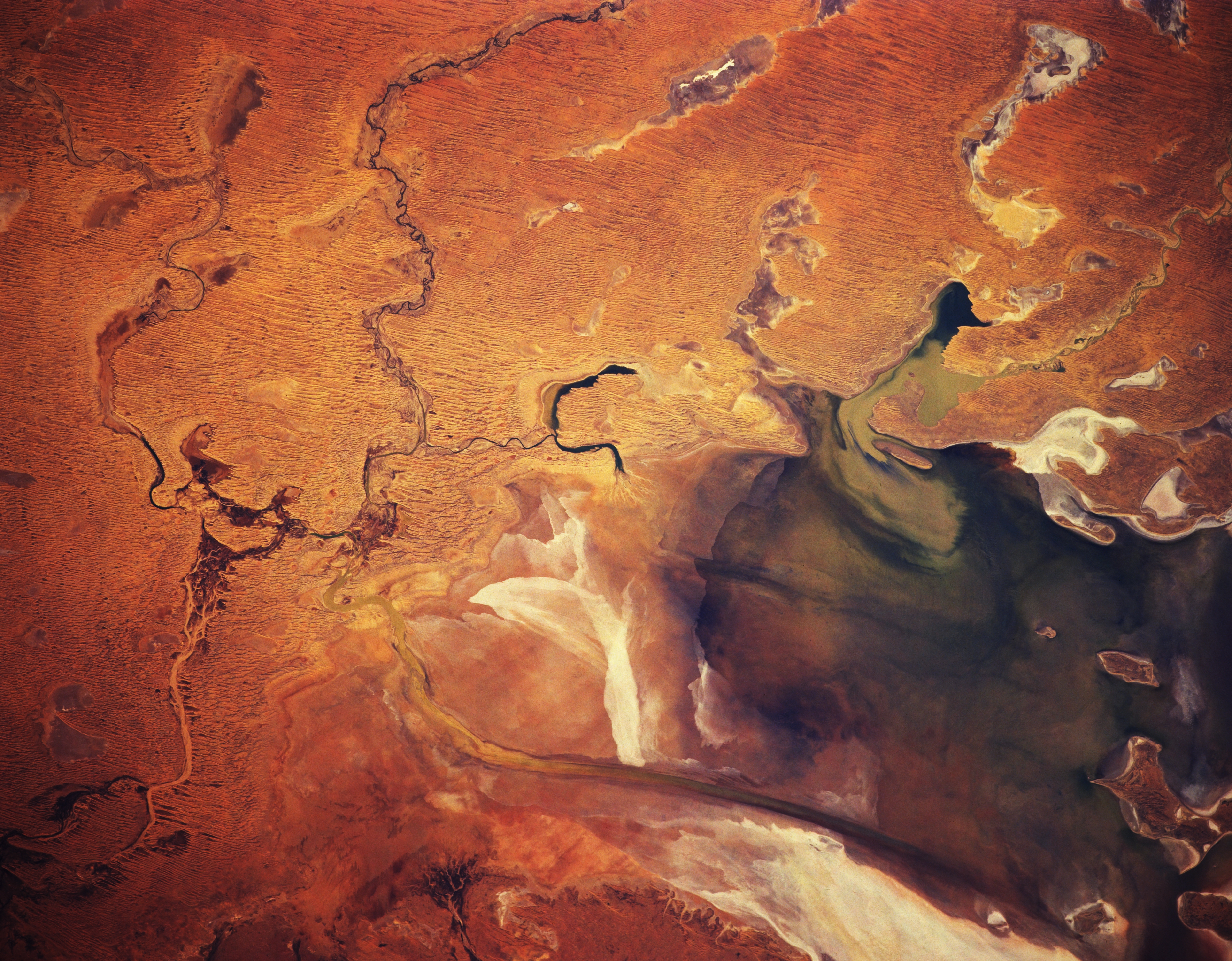
Image Caption: STS041-152-092 Lake Eyre, South Australia, Australia October 1990
The complicated drainage network that controls the quantity of water that enters the northern end of Lake Eyre is displayed in this view of the southwestern Simpson Desert. Three ephemeral creeks (Woodmurra from the west , Kallakoopah from the north, and Warburton from the east, northeast) are visible near the left center of the frame (northern end of Lake Eyre). These creeks are identifiable as dark (more vegetation), winding features. The very dark areas within Lake Eyre are limited areas of standing water. The elongate, narrow structure, oriented north-south, near the bottom of the image is the Warburton Groove, which is a channel that carries water from the northern part of Lake Eyre to the southern bays. The subtle dark, parallel lines north and east of Lake Eyre are sand ridges that are part of the large Simpson Desert. Numerous dry lake beds are visible, as they are reflective and contrast with an otherwise sandy environment.
The complicated drainage network that controls the quantity of water that enters the northern end of Lake Eyre is displayed in this view of the southwestern Simpson Desert. Three ephemeral creeks (Woodmurra from the west , Kallakoopah from the north, and Warburton from the east, northeast) are visible near the left center of the frame (northern end of Lake Eyre). These creeks are identifiable as dark (more vegetation), winding features. The very dark areas within Lake Eyre are limited areas of standing water. The elongate, narrow structure, oriented north-south, near the bottom of the image is the Warburton Groove, which is a channel that carries water from the northern part of Lake Eyre to the southern bays. The subtle dark, parallel lines north and east of Lake Eyre are sand ridges that are part of the large Simpson Desert. Numerous dry lake beds are visible, as they are reflective and contrast with an otherwise sandy environment.
