STS040-80-64
| NASA Photo ID | STS040-80-64 |
| Focal Length | 250mm |
| Date taken | 1991.06.11 |
| Time taken | 15:24:25 GMT |
Resolutions offered for this image:
5248 x 5248 pixels 640 x 640 pixels 5700 x 6000 pixels 500 x 526 pixels 640 x 480 pixels
5248 x 5248 pixels 640 x 640 pixels 5700 x 6000 pixels 500 x 526 pixels 640 x 480 pixels


Cloud masks available for this image:
Spacecraft nadir point: 38.4° N, 94.8° W
Photo center point: 39.0° N, 97.0° W
Photo center point by machine learning:
Photo center point: 39.0° N, 97.0° W
Photo center point by machine learning:
Nadir to Photo Center: West
Spacecraft Altitude: 152 nautical miles (282km)
Country or Geographic Name: | USA-KANSAS |
Features: | JUNCTION CITY, FT. RILEY |
| Features Found Using Machine Learning: | |
Cloud Cover Percentage: | 0 (no clouds present) |
Sun Elevation Angle: | 49° |
Sun Azimuth: | 99° |
Camera: | Hasselblad |
Focal Length: | 250mm |
Camera Tilt: | 42 degrees |
Format: | 5017: Kodak, natural color positive, Ektachrome, X Professional, ASA 64, standard base |
Film Exposure: | Normal |
| Additional Information | |
| Width | Height | Annotated | Cropped | Purpose | Links |
|---|---|---|---|---|---|
| 5248 pixels | 5248 pixels | No | No | Earth From Space collection | Download Image |
| 640 pixels | 640 pixels | No | No | Earth From Space collection | Download Image |
| 5700 pixels | 6000 pixels | No | No | Download Image | |
| 500 pixels | 526 pixels | No | No | Download Image | |
| 640 pixels | 480 pixels | No | No | Download Image |
Download Packaged File
Download a Google Earth KML for this Image
View photo footprint information
Download a GeoTIFF for this photo
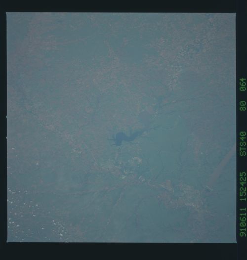
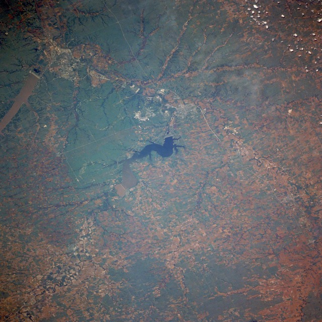
Image Caption: STS040-080-064 Junction City and Manhattan, Kansas, U.S.A. June 1991
The agricultural lands of the Smoky Hill River Valley and the green grasslands of the Flint Hills region of central Kansas can be seen in this west-northwest-looking, low-oblique photograph. The Flint Hills region is a beef cattle ranching area. The thin cherty or limestone soils in the region are not conducive to plowing required for dryland farming. The Smoky Hill River [560 miles (900 kilometers) long] rises on the Great Plains in eastern Colorado and flows east across Kansas; the Republican River [420 miles (675 kilometers) long] rises in western Nebraska and traverses a rich agricultural region before flowing through the Milford Reservoir (center of the photograph); and the confluence of the Smoky Hill and Republican Rivers in Junction City forms the Kansas River, which flows eastward 170 miles (274 kilometers) to join the Missouri River at Kansas City. Junction City, a rail and trade center for agricultural and dairy products, grew as a supply point for the U.S. Fort Riley Army Base located east of the city. Manhattan, a trade and food processing center 18 miles (29 kilometers) east of Junction City (discernible near the northeast quadrant of the photograph), is situated at the confluence of the Big Blue River and the Kansas River. North of Manhattan is sediment-laden Tuttle Creek Lake, a reservoir built on the Big Blue River in 1962. Agricultural machinery and dress patterns are made in Manhattan, but the city's economy is dependent on Kansas State University and nearby Fort Riley Army Base.
The agricultural lands of the Smoky Hill River Valley and the green grasslands of the Flint Hills region of central Kansas can be seen in this west-northwest-looking, low-oblique photograph. The Flint Hills region is a beef cattle ranching area. The thin cherty or limestone soils in the region are not conducive to plowing required for dryland farming. The Smoky Hill River [560 miles (900 kilometers) long] rises on the Great Plains in eastern Colorado and flows east across Kansas; the Republican River [420 miles (675 kilometers) long] rises in western Nebraska and traverses a rich agricultural region before flowing through the Milford Reservoir (center of the photograph); and the confluence of the Smoky Hill and Republican Rivers in Junction City forms the Kansas River, which flows eastward 170 miles (274 kilometers) to join the Missouri River at Kansas City. Junction City, a rail and trade center for agricultural and dairy products, grew as a supply point for the U.S. Fort Riley Army Base located east of the city. Manhattan, a trade and food processing center 18 miles (29 kilometers) east of Junction City (discernible near the northeast quadrant of the photograph), is situated at the confluence of the Big Blue River and the Kansas River. North of Manhattan is sediment-laden Tuttle Creek Lake, a reservoir built on the Big Blue River in 1962. Agricultural machinery and dress patterns are made in Manhattan, but the city's economy is dependent on Kansas State University and nearby Fort Riley Army Base.
