STS040-77-44
| NASA Photo ID | STS040-77-44 |
| Focal Length | 50mm |
| Date taken | 1991.06.06 |
| Time taken | 16:42:19 GMT |
Resolutions offered for this image:
3948 x 3934 pixels 639 x 637 pixels 5700 x 6000 pixels 500 x 526 pixels 640 x 480 pixels
3948 x 3934 pixels 639 x 637 pixels 5700 x 6000 pixels 500 x 526 pixels 640 x 480 pixels


Cloud masks available for this image:
Spacecraft nadir point: 39.1° N, 91.4° W
Photo center point: 44.0° N, 85.0° W
Photo center point by machine learning:
Photo center point: 44.0° N, 85.0° W
Photo center point by machine learning:
Nadir to Photo Center: Northeast
Spacecraft Altitude: 156 nautical miles (289km)
Country or Geographic Name: | USA-MICHIGAN |
Features: | L. MICHIGAN, HURON-S TAIL |
| Features Found Using Machine Learning: | |
Cloud Cover Percentage: | 60 (51-75)% |
Sun Elevation Angle: | 66° |
Sun Azimuth: | 127° |
Camera: | Hasselblad |
Focal Length: | 50mm |
Camera Tilt: | High Oblique |
Format: | 5017: Kodak, natural color positive, Ektachrome, X Professional, ASA 64, standard base |
Film Exposure: | Normal |
| Additional Information | |
| Width | Height | Annotated | Cropped | Purpose | Links |
|---|---|---|---|---|---|
| 3948 pixels | 3934 pixels | No | No | Earth From Space collection | Download Image |
| 639 pixels | 637 pixels | No | No | Earth From Space collection | Download Image |
| 5700 pixels | 6000 pixels | No | No | Download Image | |
| 500 pixels | 526 pixels | No | No | Download Image | |
| 640 pixels | 480 pixels | No | No | Download Image |
Download Packaged File
Download a Google Earth KML for this Image
View photo footprint information
Download a GeoTIFF for this photo
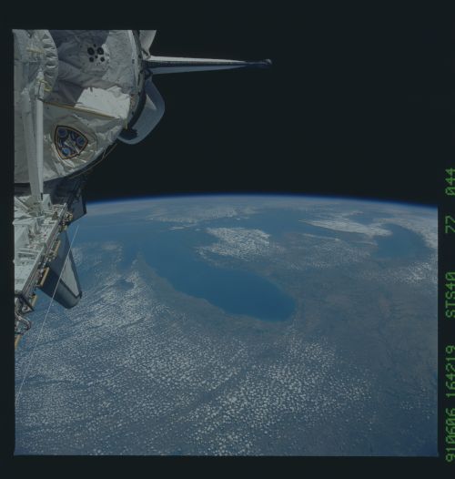
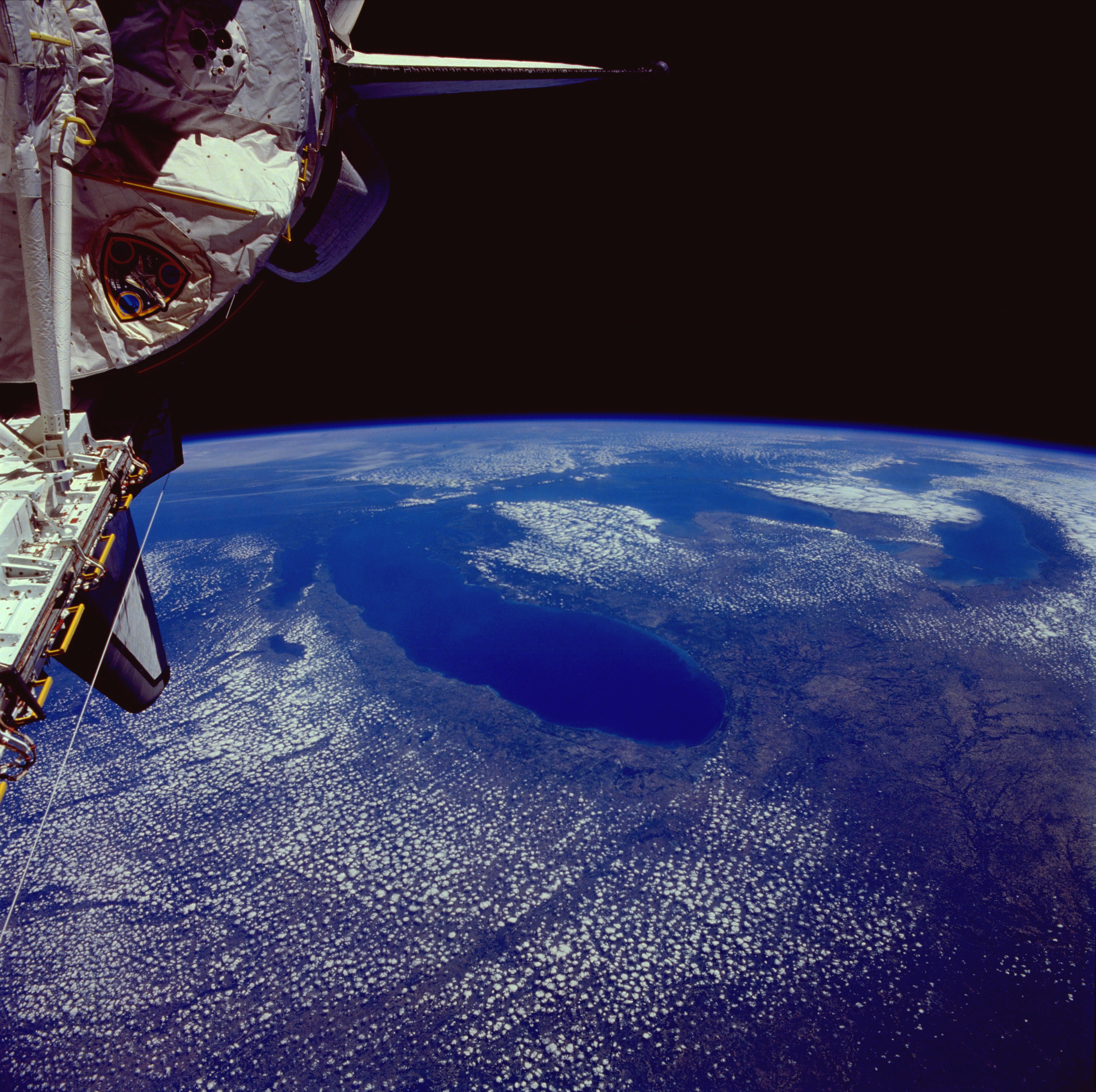
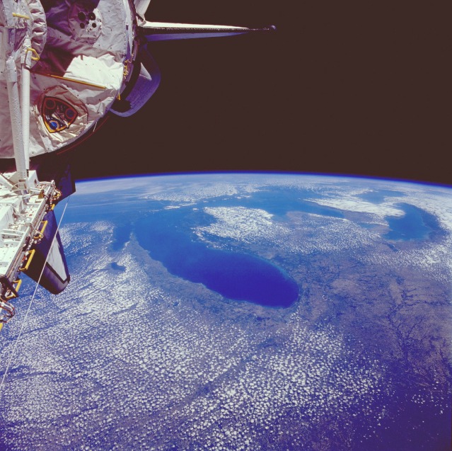
Image Caption: STS040-077-044 The Great Lakes, U.S.A. and Canada June 1991
Portions of all five Great Lakes, the largest combined body of fresh water in the world [covering an area of 95 000 square miles (246 050 square kilometers)], can be seen in this high-oblique, northeast-looking photograph. Lake Michigan alone covers an area of 22 300 square miles (57 755 square kilometers). This lake can be seen in the center of the photograph, with Chicago on its southwestern shore. The Great Lakes were formed about 12 000 years ago at the end of the ice age, when glacier-carved lake basins were filled with meltwater. The lakes are interconnected by straits, short rivers, and canals. Water from the Great Lakes exits at the eastern end of Lake Ontario into the Saint Lawrence River, which flows on eastward into the Atlantic Ocean.
Portions of all five Great Lakes, the largest combined body of fresh water in the world [covering an area of 95 000 square miles (246 050 square kilometers)], can be seen in this high-oblique, northeast-looking photograph. Lake Michigan alone covers an area of 22 300 square miles (57 755 square kilometers). This lake can be seen in the center of the photograph, with Chicago on its southwestern shore. The Great Lakes were formed about 12 000 years ago at the end of the ice age, when glacier-carved lake basins were filled with meltwater. The lakes are interconnected by straits, short rivers, and canals. Water from the Great Lakes exits at the eastern end of Lake Ontario into the Saint Lawrence River, which flows on eastward into the Atlantic Ocean.
