STS040-76-99
| NASA Photo ID | STS040-76-99 |
| Focal Length | 250mm |
| Date taken | 1991.06.08 |
| Time taken | 01:50:39 GMT |

Cloud masks available for this image:
Spacecraft nadir point: 36.5° N, 147.3° E
Photo center point: 38.0° N, 143.5° E
Photo center point by machine learning:
Photo center point: 38.0° N, 143.5° E
Photo center point by machine learning:
Nadir to Photo Center: West
Spacecraft Altitude: 156 nautical miles (289km)
Country or Geographic Name: | PACIFIC OCEAN |
Features: | OCEAN EDDY, SGLT, DARK |
| Features Found Using Machine Learning: | |
Cloud Cover Percentage: | 25 (11-25)% |
Sun Elevation Angle: | 75° |
Sun Azimuth: | 161° |
Camera: | Hasselblad |
Focal Length: | 250mm |
Camera Tilt: | Low Oblique |
Format: | 5017: Kodak, natural color positive, Ektachrome, X Professional, ASA 64, standard base |
Film Exposure: | Under Exposed |
| Additional Information | |
| Width | Height | Annotated | Cropped | Purpose | Links |
|---|---|---|---|---|---|
| 5700 pixels | 6000 pixels | No | No | Download Image | |
| 500 pixels | 526 pixels | No | No | Download Image | |
| 640 pixels | 480 pixels | No | No | Download Image |
Download Packaged File
Download a Google Earth KML for this Image
View photo footprint information
Download a GeoTIFF for this photo
Image Caption:
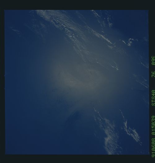
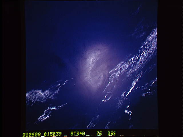
STS040-76-099 This photograph shows variations in the sunglint
pattern along the boundary of the Kuroshio Current. The Kuroshio
Current is similar to the Gulf Stream; they are both warm,
swift-flowing, western boundary currents responsible for the
transport of large quantities of heat energy from the tropics to
the high northern hemisphere latitudes. The clouds along the
right-hand portion of the photograph form as near-surface air is
warmed by the current and begins to rise. Two eddies, one quite
large and the other small, can be seen forming along the boundary
of the Kuroshio Current and the adjacent coastal water to the
left of these features.
