STS040-610-49
| NASA Photo ID | STS040-610-49 |
| Focal Length | 100mm |
| Date taken | 1991.06.__ |
| Time taken | GMT |
Resolutions offered for this image:
5230 x 5230 pixels 639 x 639 pixels 5700 x 6000 pixels 500 x 526 pixels 640 x 480 pixels
5230 x 5230 pixels 639 x 639 pixels 5700 x 6000 pixels 500 x 526 pixels 640 x 480 pixels

Cloud masks available for this image:
Spacecraft nadir point:
Photo center point: 38.0° N, 25.0° E
Photo center point by machine learning:
Photo center point: 38.0° N, 25.0° E
Photo center point by machine learning:
Nadir to Photo Center:
Spacecraft Altitude: nautical miles (0km)
Country or Geographic Name: | GREECE |
Features: | CYCLADES, AEGEAN SEA |
| Features Found Using Machine Learning: | |
Cloud Cover Percentage: | 5 (1-10)% |
Sun Elevation Angle: | ° |
Sun Azimuth: | ° |
Camera: | Rolleiflex |
Focal Length: | 100mm |
Camera Tilt: | Low Oblique |
Format: | 5017: Kodak, natural color positive, Ektachrome, X Professional, ASA 64, standard base |
Film Exposure: | Normal |
| Additional Information | |
| Width | Height | Annotated | Cropped | Purpose | Links |
|---|---|---|---|---|---|
| 5230 pixels | 5230 pixels | No | No | Earth From Space collection | Download Image |
| 639 pixels | 639 pixels | No | No | Earth From Space collection | Download Image |
| 5700 pixels | 6000 pixels | No | No | Download Image | |
| 500 pixels | 526 pixels | No | No | Download Image | |
| 640 pixels | 480 pixels | No | No | Download Image |
Download Packaged File
Download a Google Earth KML for this Image
View photo footprint information
Download a GeoTIFF for this photo
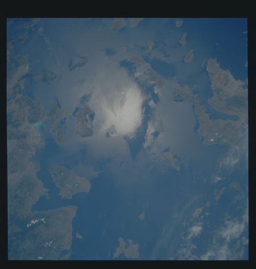
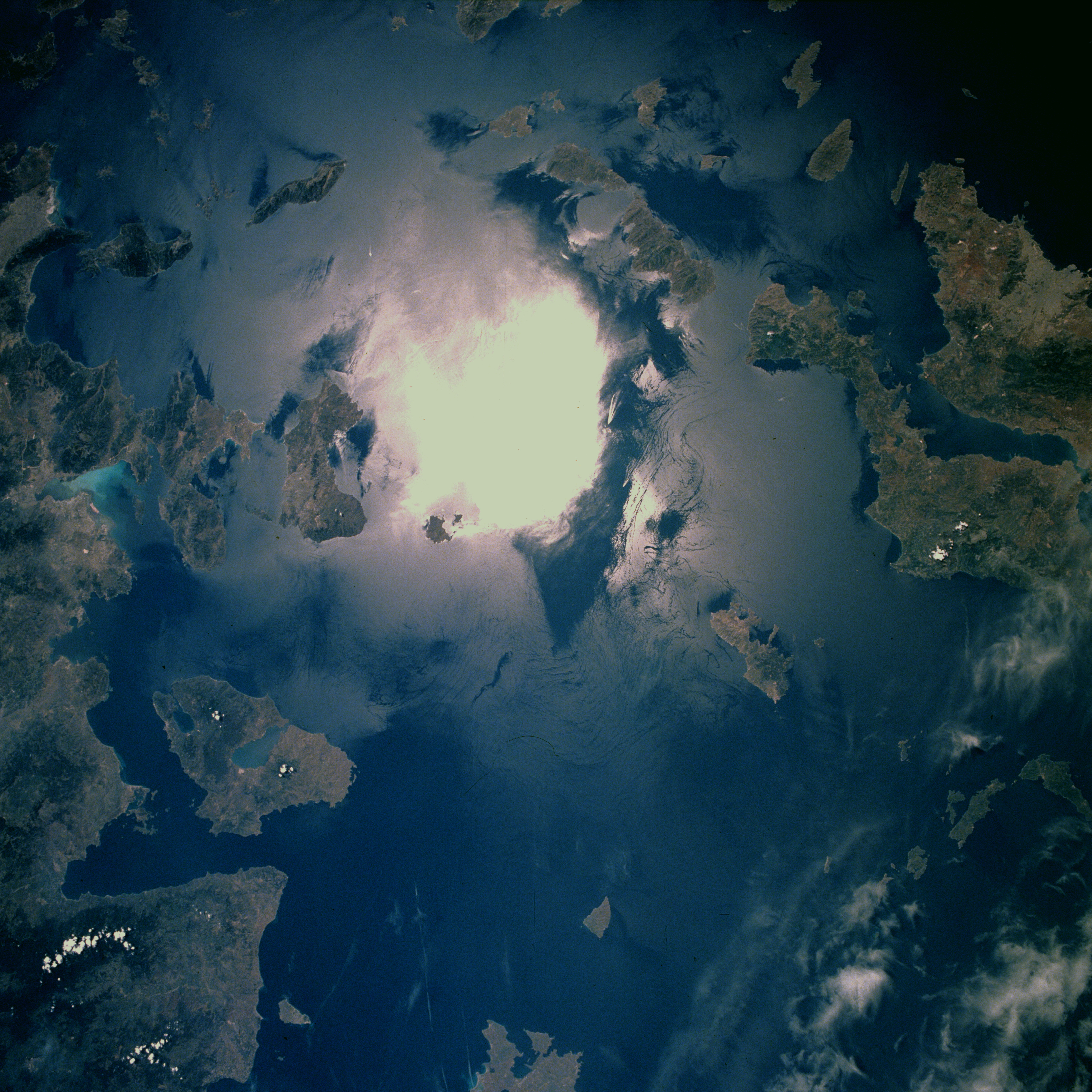
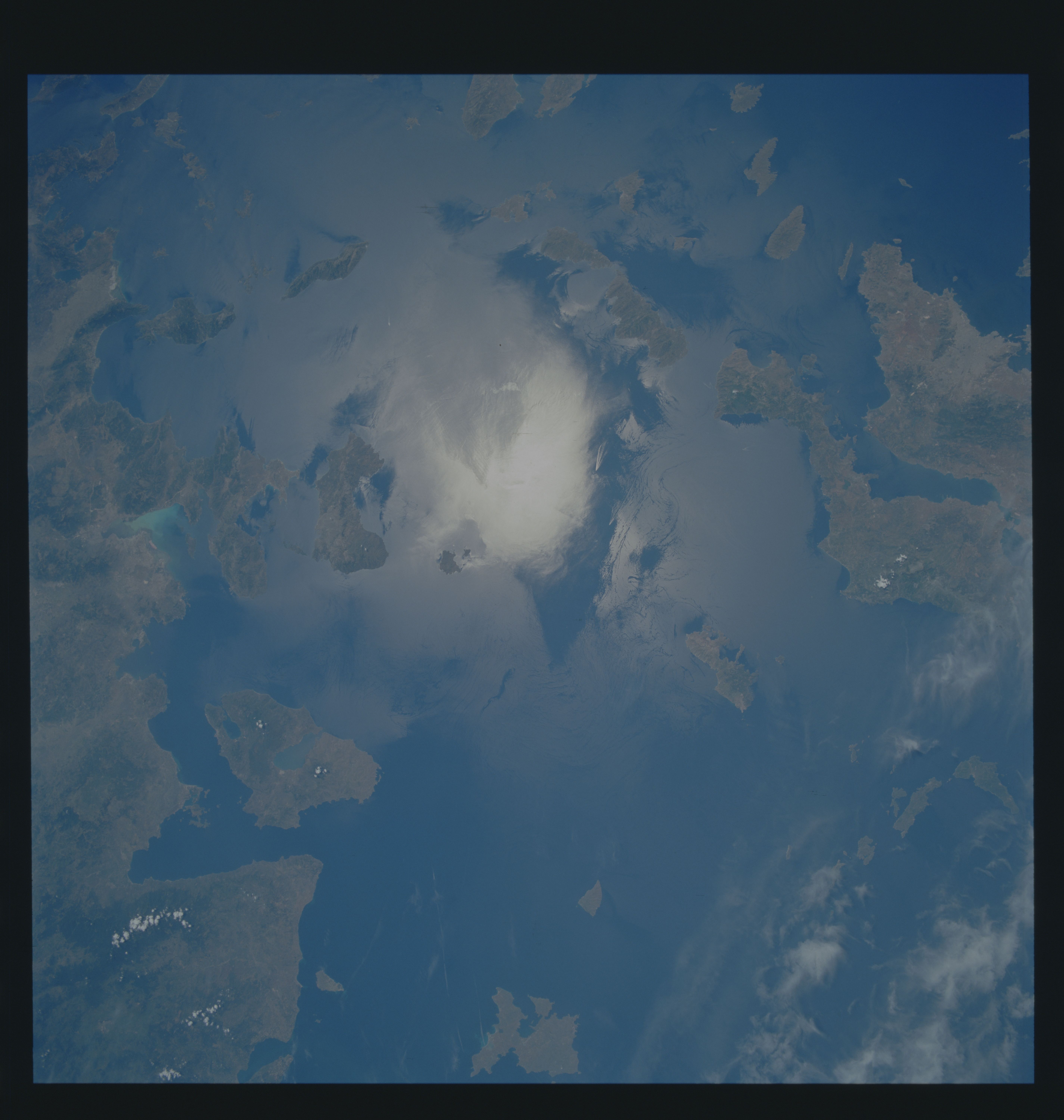
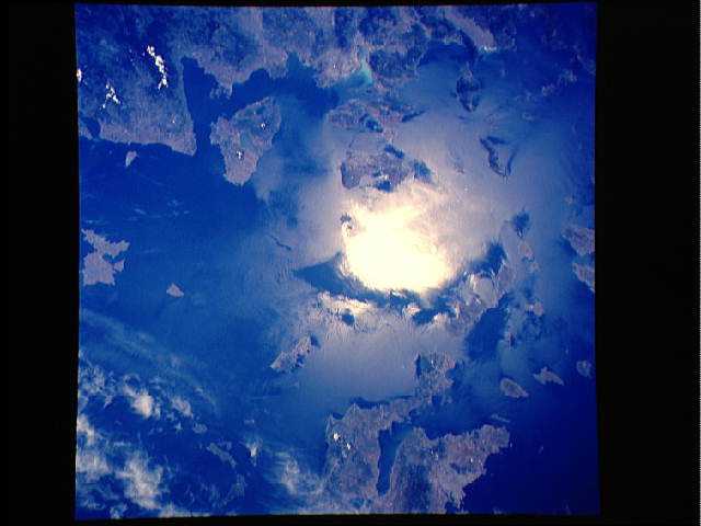
Image Caption: STS040-610-049 Aegean Sea June 1991
The highly reflective white area near the middle of the photograph is sun glitter, a result of the sun's reflection from the surface of the sea. Sun glitter provided an excellent opportunity to map the surface dynamics of the water, including water current patterns produced by the wind and two ship wakes near the center of the photograph. Viewing clockwise from the southeast Aegean Sea are several Greek islands--the Dodecanese group, with Rhodes (not in this photograph) as its administrative center; the Cyclades group; and Lesbos, the larger island that is notched from the south into the center by the Gulf of Kallonis. The Aegean Sea is flanked on the east by the mountainous coastal area of Turkey and on the west by the mountainous peninsulas and Euboea Island of Greece. Athens is barely discernible along the southern coast of the large peninsula on the western edge of the photograph. (Refer to STS-040-610-050 to see the area immediately northeast of this frame; Lesbos is a common landmark in both photographs.) Note: This caption refers to "Earth From Space collection" version of the image.
The highly reflective white area near the middle of the photograph is sun glitter, a result of the sun's reflection from the surface of the sea. Sun glitter provided an excellent opportunity to map the surface dynamics of the water, including water current patterns produced by the wind and two ship wakes near the center of the photograph. Viewing clockwise from the southeast Aegean Sea are several Greek islands--the Dodecanese group, with Rhodes (not in this photograph) as its administrative center; the Cyclades group; and Lesbos, the larger island that is notched from the south into the center by the Gulf of Kallonis. The Aegean Sea is flanked on the east by the mountainous coastal area of Turkey and on the west by the mountainous peninsulas and Euboea Island of Greece. Athens is barely discernible along the southern coast of the large peninsula on the western edge of the photograph. (Refer to STS-040-610-050 to see the area immediately northeast of this frame; Lesbos is a common landmark in both photographs.) Note: This caption refers to "Earth From Space collection" version of the image.
