STS040-609-39

| NASA Photo ID | STS040-609-39 |
| Focal Length | 100mm |
| Date taken | 1991.06.__ |
| Time taken | GMT |
Resolutions offered for this image:
3936 x 3904 pixels 639 x 634 pixels 5700 x 6000 pixels 500 x 526 pixels 640 x 480 pixels
3936 x 3904 pixels 639 x 634 pixels 5700 x 6000 pixels 500 x 526 pixels 640 x 480 pixels

Cloud masks available for this image:
Spacecraft nadir point:
Photo center point: 37.0° N, 120.0° W
Photo center point by machine learning:
Photo center point: 37.0° N, 120.0° W
Photo center point by machine learning:
Nadir to Photo Center:
Spacecraft Altitude: nautical miles (0km)
Country or Geographic Name: | USA-CALIFORNIA |
Features: | SAN JOAQUIN VALLEY |
| Features Found Using Machine Learning: | |
Cloud Cover Percentage: | 15 (11-25)% |
Sun Elevation Angle: | ° |
Sun Azimuth: | ° |
Camera: | Rolleiflex |
Focal Length: | 100mm |
Camera Tilt: | High Oblique |
Format: | 5017: Kodak, natural color positive, Ektachrome, X Professional, ASA 64, standard base |
Film Exposure: | Normal |
| Additional Information | |
| Width | Height | Annotated | Cropped | Purpose | Links |
|---|---|---|---|---|---|
| 3936 pixels | 3904 pixels | No | No | Earth From Space collection | Download Image |
| 639 pixels | 634 pixels | No | No | Earth From Space collection | Download Image |
| 5700 pixels | 6000 pixels | No | No | Download Image | |
| 500 pixels | 526 pixels | No | No | Download Image | |
| 640 pixels | 480 pixels | No | No | Download Image |
Download Packaged File
Download a Google Earth KML for this Image
View photo footprint information
Download a GeoTIFF for this photo
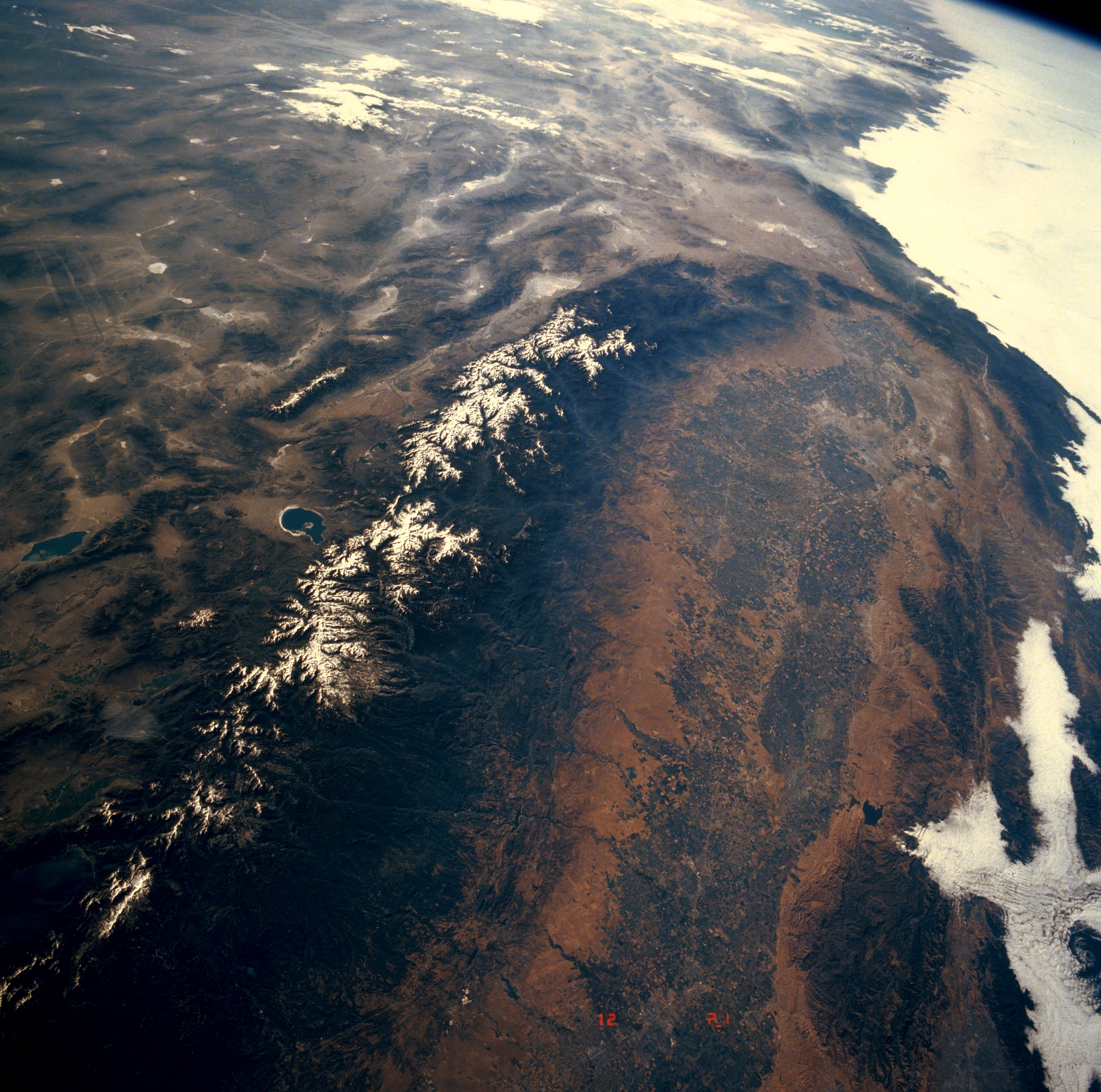
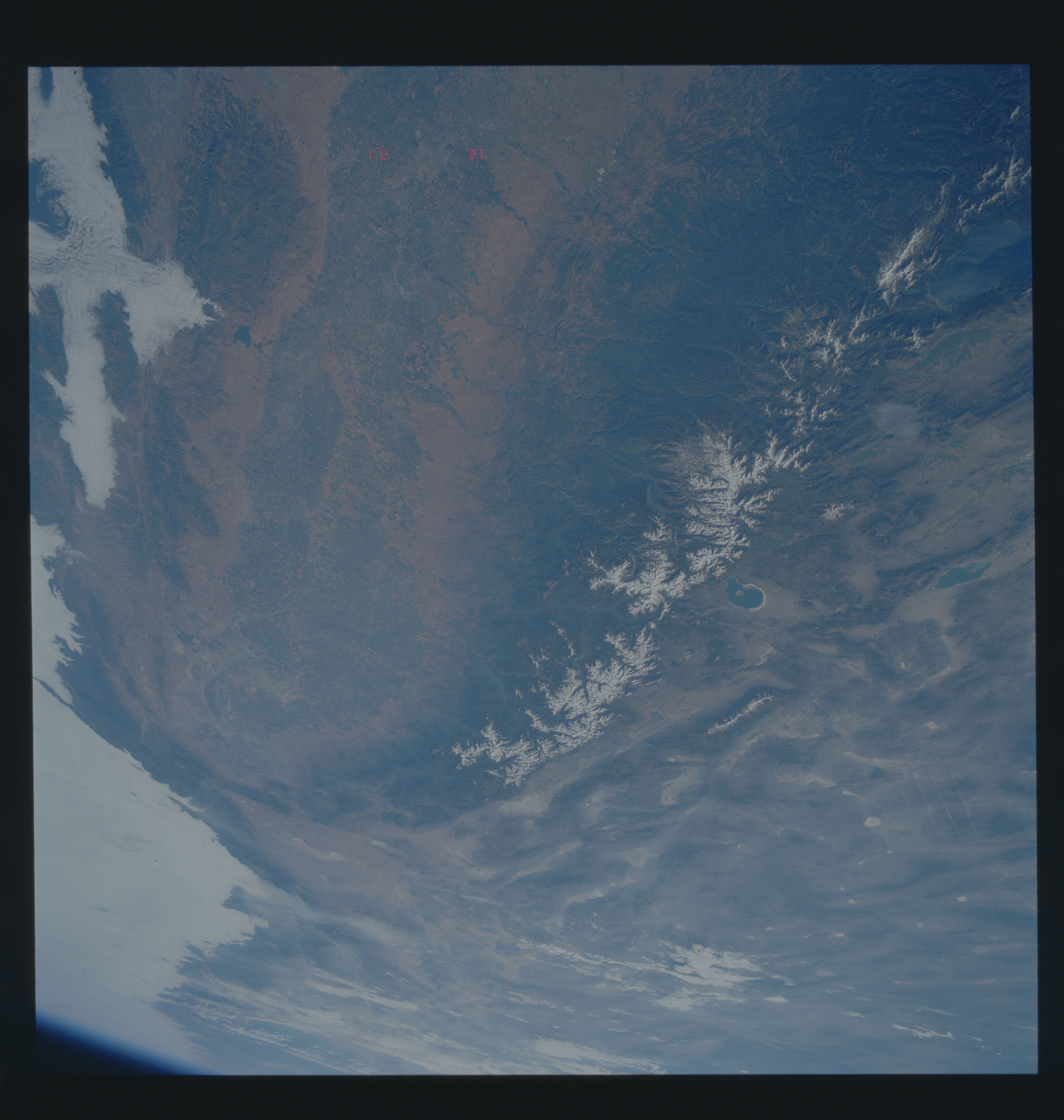
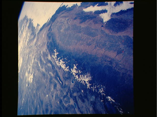
Image Caption: STS040-609-039 San Joaquin Valley and Sierra Nevada Mountains, California, U.S.A. June 1991
Parts of the Sierra Nevada Mountains and the San Joaquin Valley are featured in this synoptic, southeast-looking, oblique photograph of central California. Discernible are the basin range east of the snowcapped Sierra Nevada Mountains; the steep east slopes and the more gradual but deeply dissected west slopes; and the broad, fertile, irrigated San Joaquin Valley with its diversity of crops. Paralleling the Sierra Nevada Mountains on the western side of the San Joaquin Valley is the much lower Coast Range with crests averaging between 2000 and 4000 feet (600 and 800 meters). Low stratus clouds overhang the lower valleys along the coastline.
Parts of the Sierra Nevada Mountains and the San Joaquin Valley are featured in this synoptic, southeast-looking, oblique photograph of central California. Discernible are the basin range east of the snowcapped Sierra Nevada Mountains; the steep east slopes and the more gradual but deeply dissected west slopes; and the broad, fertile, irrigated San Joaquin Valley with its diversity of crops. Paralleling the Sierra Nevada Mountains on the western side of the San Joaquin Valley is the much lower Coast Range with crests averaging between 2000 and 4000 feet (600 and 800 meters). Low stratus clouds overhang the lower valleys along the coastline.
