STS040-604-62

| NASA Photo ID | STS040-604-62 |
| Focal Length | 100mm |
| Date taken | 1991.06.__ |
| Time taken | GMT |
Resolutions offered for this image:
3904 x 3904 pixels 639 x 639 pixels 5700 x 6000 pixels 500 x 526 pixels 640 x 480 pixels
3904 x 3904 pixels 639 x 639 pixels 5700 x 6000 pixels 500 x 526 pixels 640 x 480 pixels
Cloud masks available for this image:
Spacecraft nadir point:
Photo center point: 40.0° N, 112.0° W
Photo center point by machine learning:
Photo center point: 40.0° N, 112.0° W
Photo center point by machine learning:
Nadir to Photo Center:
Spacecraft Altitude: nautical miles (0km)
Country or Geographic Name: | USA-UTAH |
Features: | GREAT SALT LAKE, WASATCH RANGE |
| Features Found Using Machine Learning: | |
Cloud Cover Percentage: | 5 (1-10)% |
Sun Elevation Angle: | ° |
Sun Azimuth: | ° |
Camera: | Rolleiflex |
Focal Length: | 100mm |
Camera Tilt: | |
Format: | 5017: Kodak, natural color positive, Ektachrome, X Professional, ASA 64, standard base |
Film Exposure: | Normal |
| Additional Information | |
| Width | Height | Annotated | Cropped | Purpose | Links |
|---|---|---|---|---|---|
| 3904 pixels | 3904 pixels | No | No | Earth From Space collection | Download Image |
| 639 pixels | 639 pixels | No | No | Earth From Space collection | Download Image |
| 5700 pixels | 6000 pixels | No | No | Download Image | |
| 500 pixels | 526 pixels | No | No | Download Image | |
| 640 pixels | 480 pixels | No | No | Download Image |
Download Packaged File
Download a Google Earth KML for this Image
View photo footprint information
Download a GeoTIFF for this photo
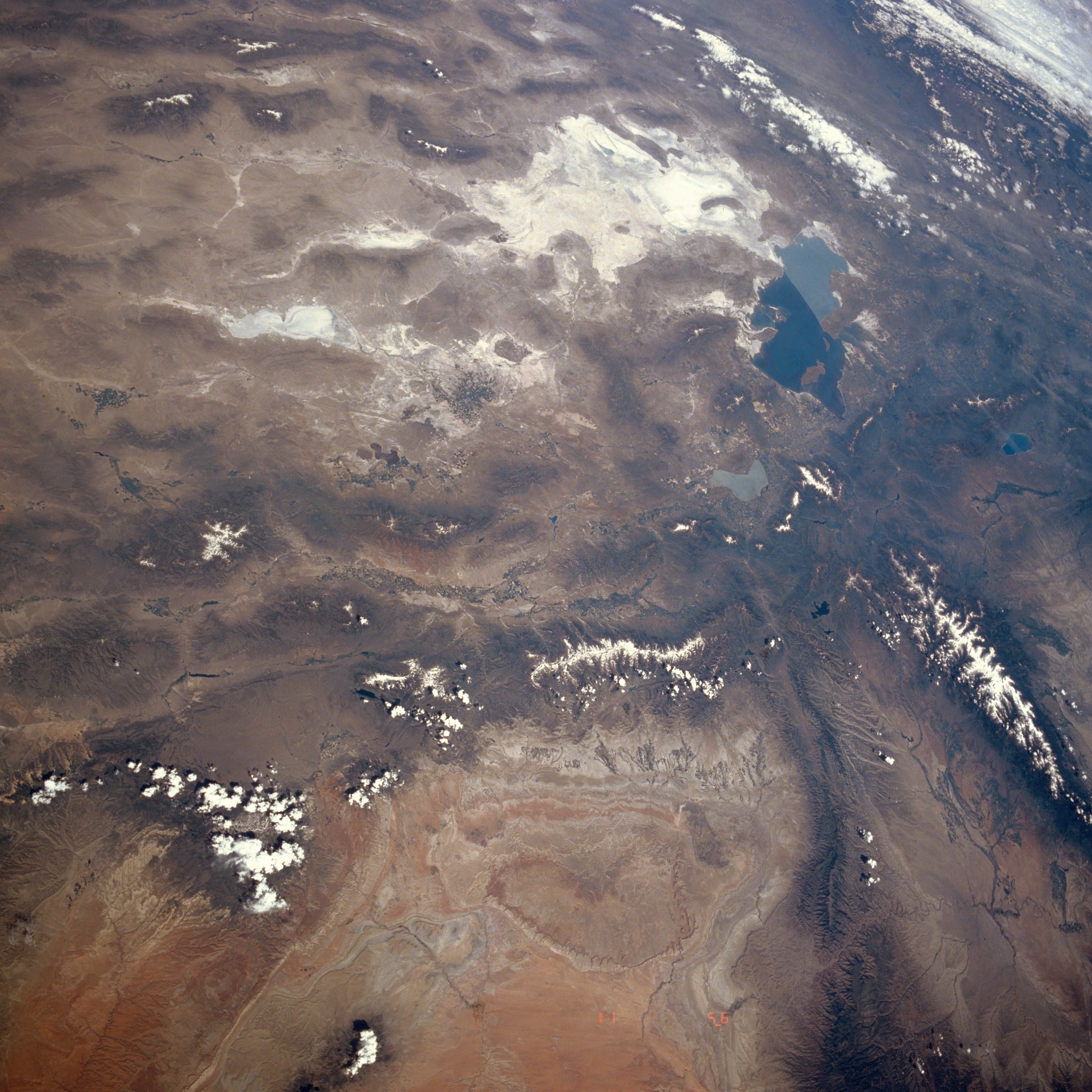
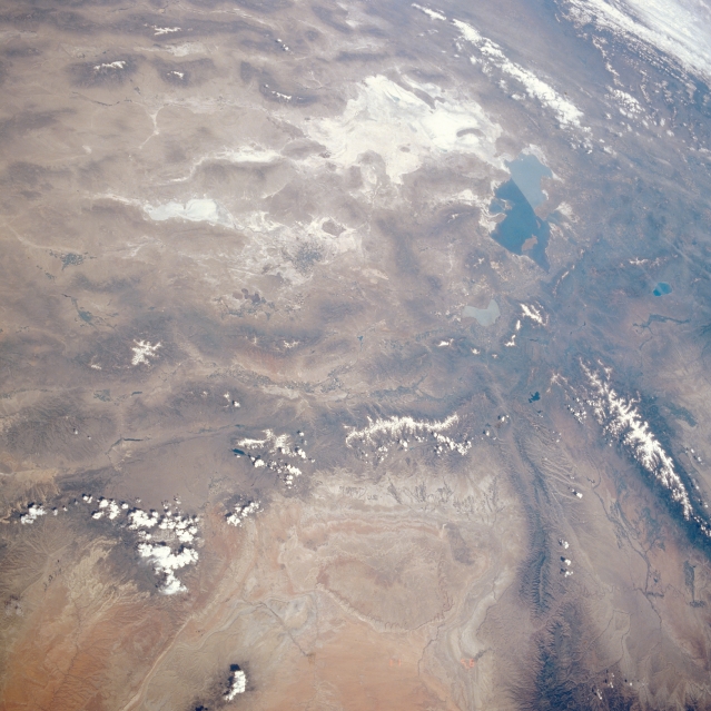
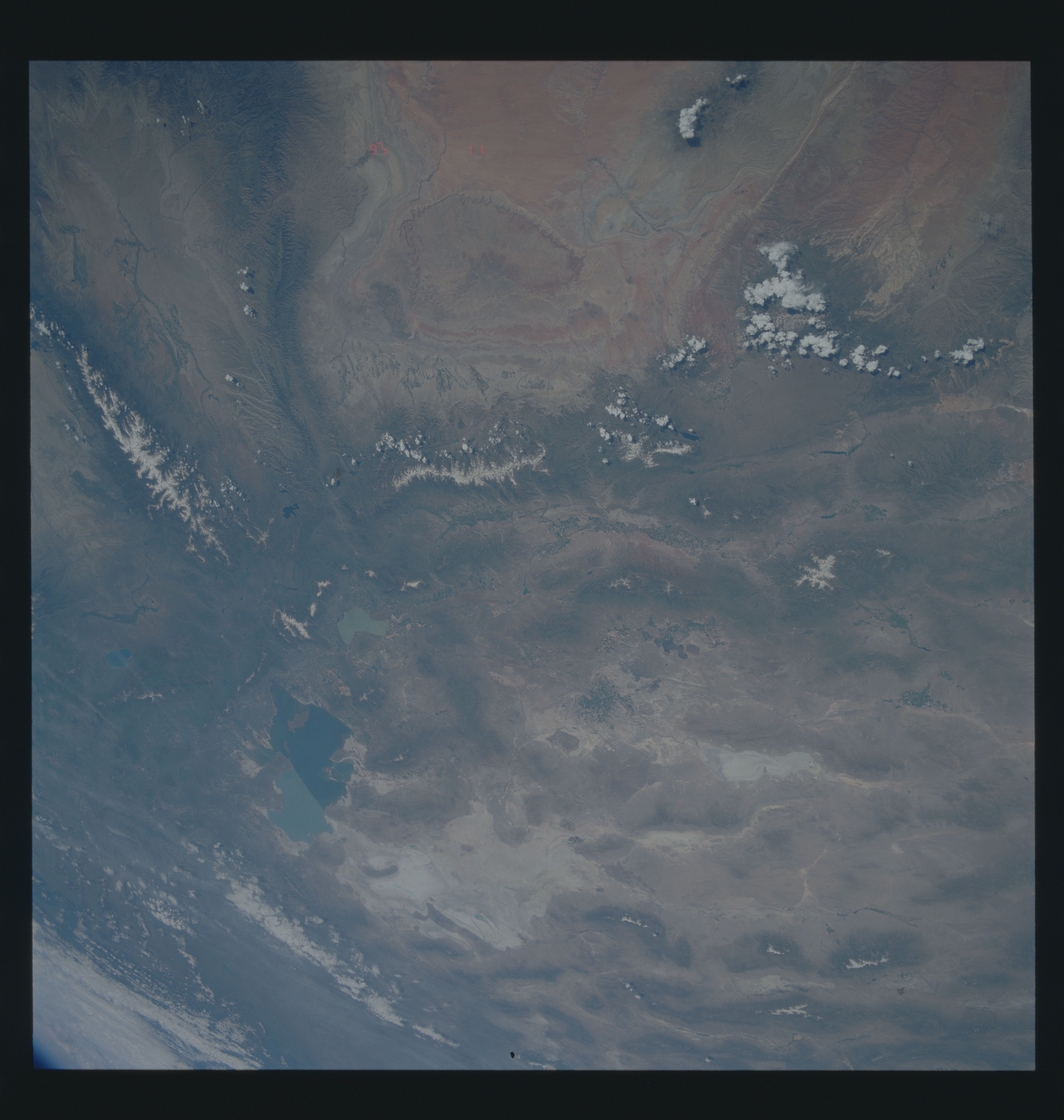
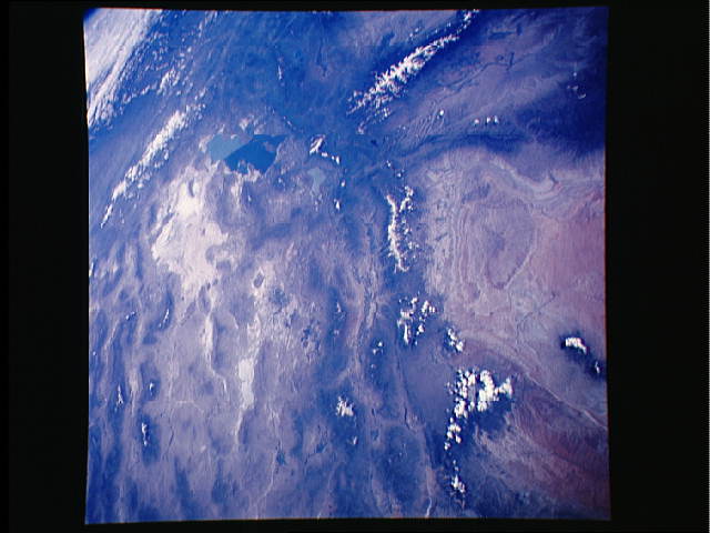
Image Caption: STS040-604-062 Central and Northern Utah, U.S.A. June 1992
This west-northwest-looking, low-oblique, panoramic photograph features the Great Salt Lake and the Great Salt Lake Desert of central and northern Utah and the valleys and mountain ranges of northeast Nevada. The north-south-trending Wasatch Range extends northward to east of the Great Salt Lake. The snow-covered, west-east-trending range visible in the lower portion of the photograph is the Uinta Mountains. The West and East Tavaputs Plateaus (bottom right to near the center of the photograph) join the Wasatch Range. Bear Lake and snakelike Flaming Gorge Reservoir lie northeast and east, respectively, of the Great Salt Lake.
This west-northwest-looking, low-oblique, panoramic photograph features the Great Salt Lake and the Great Salt Lake Desert of central and northern Utah and the valleys and mountain ranges of northeast Nevada. The north-south-trending Wasatch Range extends northward to east of the Great Salt Lake. The snow-covered, west-east-trending range visible in the lower portion of the photograph is the Uinta Mountains. The West and East Tavaputs Plateaus (bottom right to near the center of the photograph) join the Wasatch Range. Bear Lake and snakelike Flaming Gorge Reservoir lie northeast and east, respectively, of the Great Salt Lake.
