STS040-604-11
| NASA Photo ID | STS040-604-11 |
| Focal Length | 100mm |
| Date taken | 1991.06.__ |
| Time taken | GMT |
Resolutions offered for this image:
5300 x 5194 pixels 640 x 627 pixels 5700 x 6000 pixels 500 x 526 pixels 640 x 480 pixels
5300 x 5194 pixels 640 x 627 pixels 5700 x 6000 pixels 500 x 526 pixels 640 x 480 pixels
Cloud masks available for this image:
Spacecraft nadir point:
Photo center point: 40.0° N, 107.0° W
Photo center point by machine learning:
Photo center point: 40.0° N, 107.0° W
Photo center point by machine learning:
Nadir to Photo Center:
Spacecraft Altitude: nautical miles (0km)
Country or Geographic Name: | USA-COLORADO |
Features: | ROCKY MTS., DENVER |
| Features Found Using Machine Learning: | |
Cloud Cover Percentage: | 5 (1-10)% |
Sun Elevation Angle: | ° |
Sun Azimuth: | ° |
Camera: | Rolleiflex |
Focal Length: | 100mm |
Camera Tilt: | High Oblique |
Format: | 5017: Kodak, natural color positive, Ektachrome, X Professional, ASA 64, standard base |
Film Exposure: | Normal |
| Additional Information | |
| Width | Height | Annotated | Cropped | Purpose | Links |
|---|---|---|---|---|---|
| 5300 pixels | 5194 pixels | No | No | Earth From Space collection | Download Image |
| 640 pixels | 627 pixels | No | No | Earth From Space collection | Download Image |
| 5700 pixels | 6000 pixels | No | No | Download Image | |
| 500 pixels | 526 pixels | No | No | Download Image | |
| 640 pixels | 480 pixels | No | No | Download Image |
Download Packaged File
Download a Google Earth KML for this Image
View photo footprint information
Download a GeoTIFF for this photo
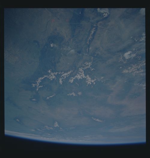
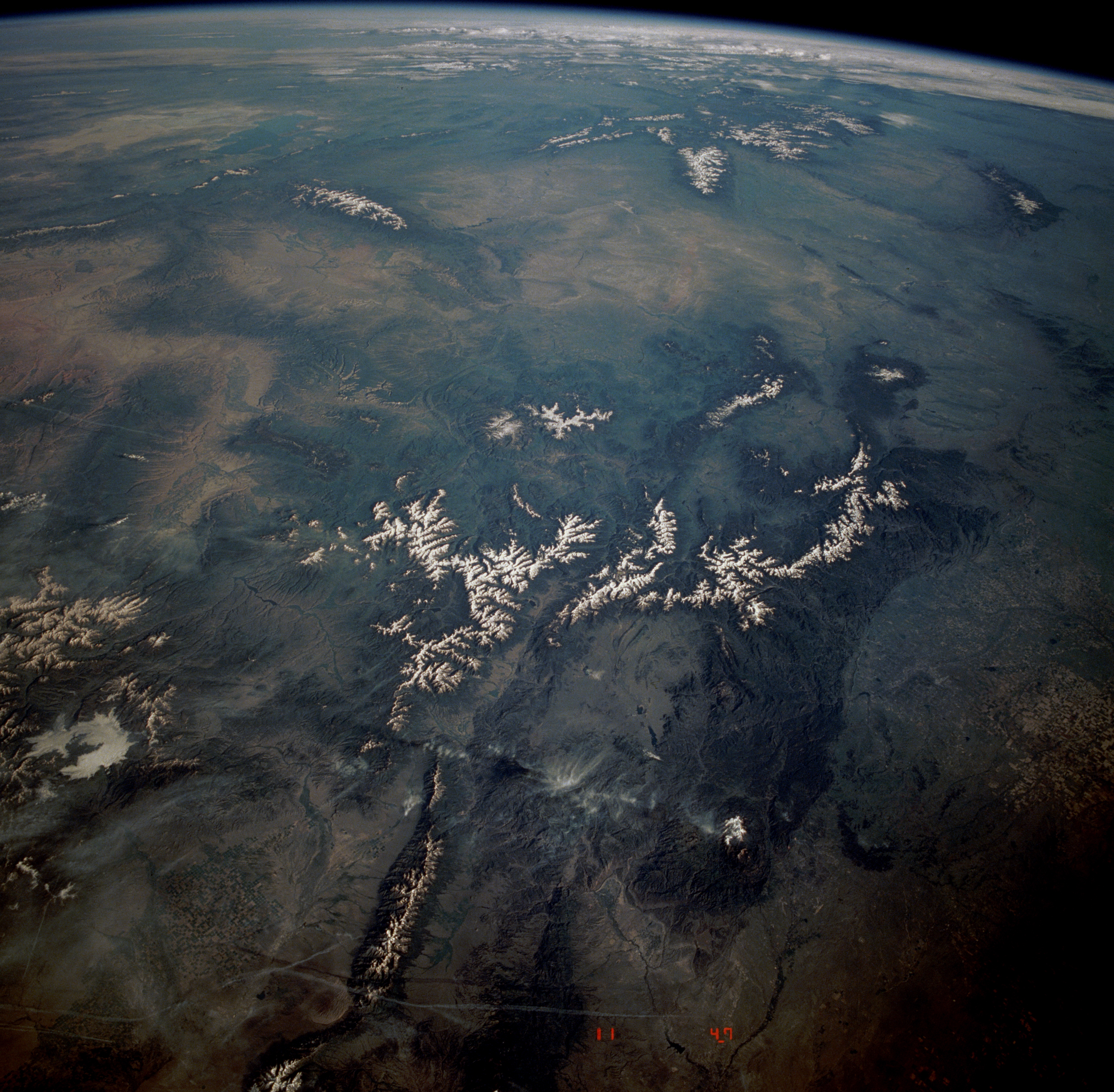
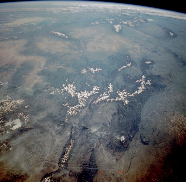
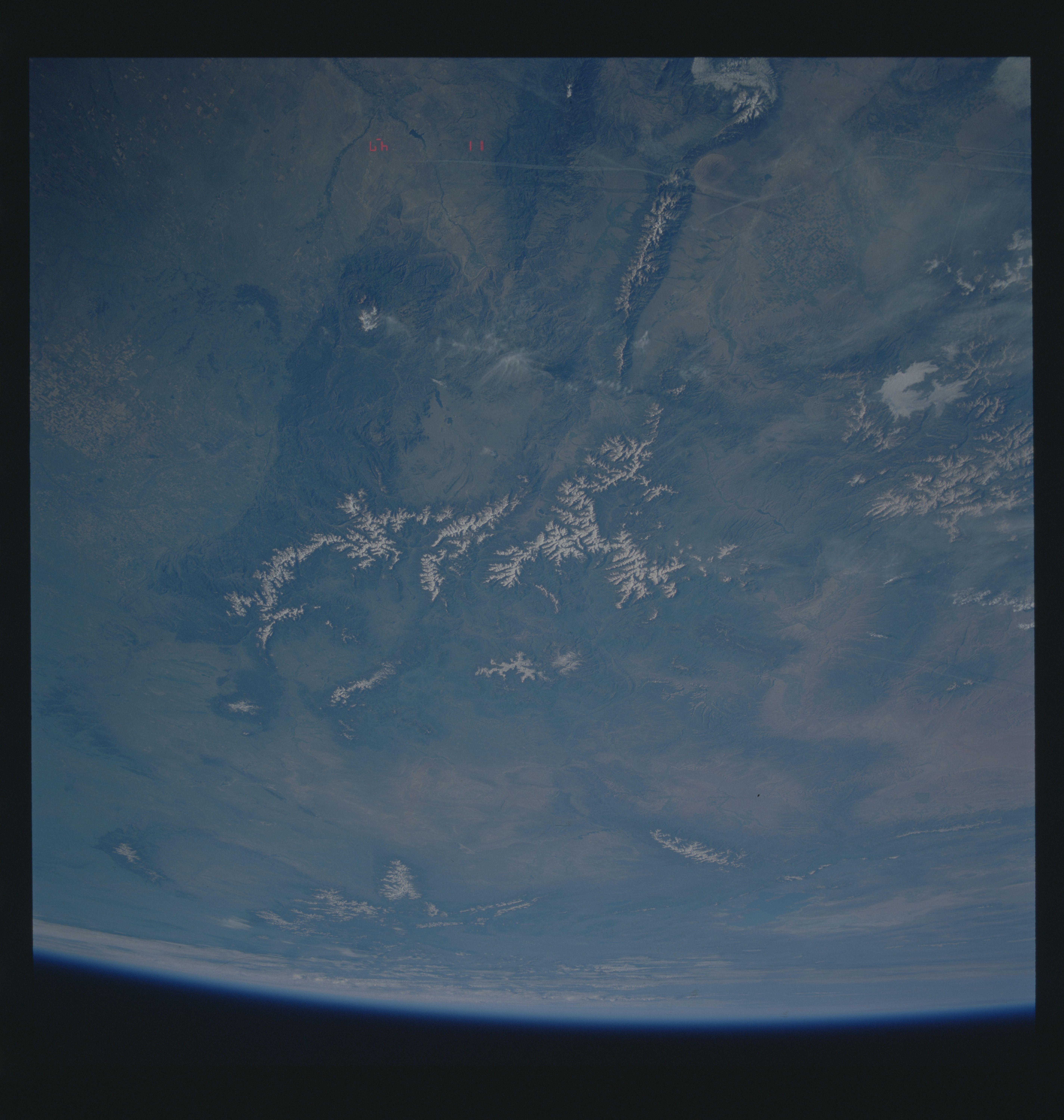
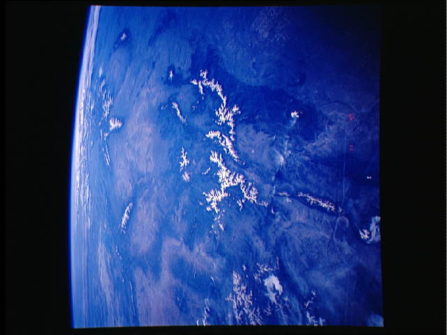
Image Caption: STS040-604-11 Central Rocky Mountains, Colorado, U.S.A. June 1991
The snow-capped, central Rocky Mountains are the focus of this northwest-looking, high-oblique photograph. Most of the snow-capped peaks in this photograph are at least 9000 feet (2700 meters) above sea level, with many of the taller peaks exceeding 13 000 feet (3900 meters). The Great Salt Lake and the Bonneville Salt Flats can be seen toward the upper left corner of the photograph. The Great Divide Basin is northwest of the Rocky Mountains. Major snow-capped mountains, including the Uinta Mountains, the Wind River Range, and the Bighorn Mountains, are visible northwest, north, and northeast, respectively, of the Great Divide Basin. The north-south trending mountain range near the bottom of the photograph is the Sangre de Cristo Range. Immediately west of the Sangre de Cristo Range is the San Luis Valley where center-pivot irrigation is used extensively for agriculture. East of the Sangre de Cristo Range, just south of Pikes Peak, the Arkansas River begins its long journey from the foothills of the Rocky Mountains to the Mississippi River south of Memphis, Tennessee. Although the street patterns of Denver (east of the mountains near the right-hand side of the photograph) and Colorado Springs (east of Pikes Peak and south of Denver) are not visible, the general areas of these cities can be identified. Large agricultural field patterns are visible east of Denver along the edge of the photograph.
The snow-capped, central Rocky Mountains are the focus of this northwest-looking, high-oblique photograph. Most of the snow-capped peaks in this photograph are at least 9000 feet (2700 meters) above sea level, with many of the taller peaks exceeding 13 000 feet (3900 meters). The Great Salt Lake and the Bonneville Salt Flats can be seen toward the upper left corner of the photograph. The Great Divide Basin is northwest of the Rocky Mountains. Major snow-capped mountains, including the Uinta Mountains, the Wind River Range, and the Bighorn Mountains, are visible northwest, north, and northeast, respectively, of the Great Divide Basin. The north-south trending mountain range near the bottom of the photograph is the Sangre de Cristo Range. Immediately west of the Sangre de Cristo Range is the San Luis Valley where center-pivot irrigation is used extensively for agriculture. East of the Sangre de Cristo Range, just south of Pikes Peak, the Arkansas River begins its long journey from the foothills of the Rocky Mountains to the Mississippi River south of Memphis, Tennessee. Although the street patterns of Denver (east of the mountains near the right-hand side of the photograph) and Colorado Springs (east of Pikes Peak and south of Denver) are not visible, the general areas of these cities can be identified. Large agricultural field patterns are visible east of Denver along the edge of the photograph.
