STS040-152-129
| NASA Photo ID | STS040-152-129 |
| Focal Length | 90mm |
| Date taken | 1991.06.13 |
| Time taken | 12:23:45 GMT |
Cloud masks available for this image:
Spacecraft nadir point: 39.1° N, 75.9° W
Photo center point: 39.0° N, 76.0° W
Photo center point by machine learning:
Photo center point: 39.0° N, 76.0° W
Photo center point by machine learning:
Nadir to Photo Center: Southwest
Spacecraft Altitude: 150 nautical miles (278km)
Country or Geographic Name: | USA-MARYLAND |
Features: | CHESAPEAKE, DELAWARE BAYS |
| Features Found Using Machine Learning: | |
Cloud Cover Percentage: | 0 (no clouds present) |
Sun Elevation Angle: | 29° |
Sun Azimuth: | 82° |
Camera: | Linhof |
Focal Length: | 90mm |
Camera Tilt: | 3 degrees |
Format: | QX868: Kodak, natural color positive, Ektachrome QX868(5017 emulsion), ASA 64, thin base |
Film Exposure: | Normal |
| Additional Information | |
| Width | Height | Annotated | Cropped | Purpose | Links |
|---|---|---|---|---|---|
| 5152 pixels | 4096 pixels | No | No | Earth From Space collection | Download Image |
| 640 pixels | 508 pixels | No | No | Earth From Space collection | Download Image |
| 640 pixels | 480 pixels | No | No | ISD 1 | Download Image |
Download Packaged File
Download a Google Earth KML for this Image
View photo footprint information
Download a GeoTIFF for this photo
Image Caption: STS040-152-129 Wilmington Area, Delaware, U.S.A. June 1991
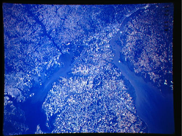
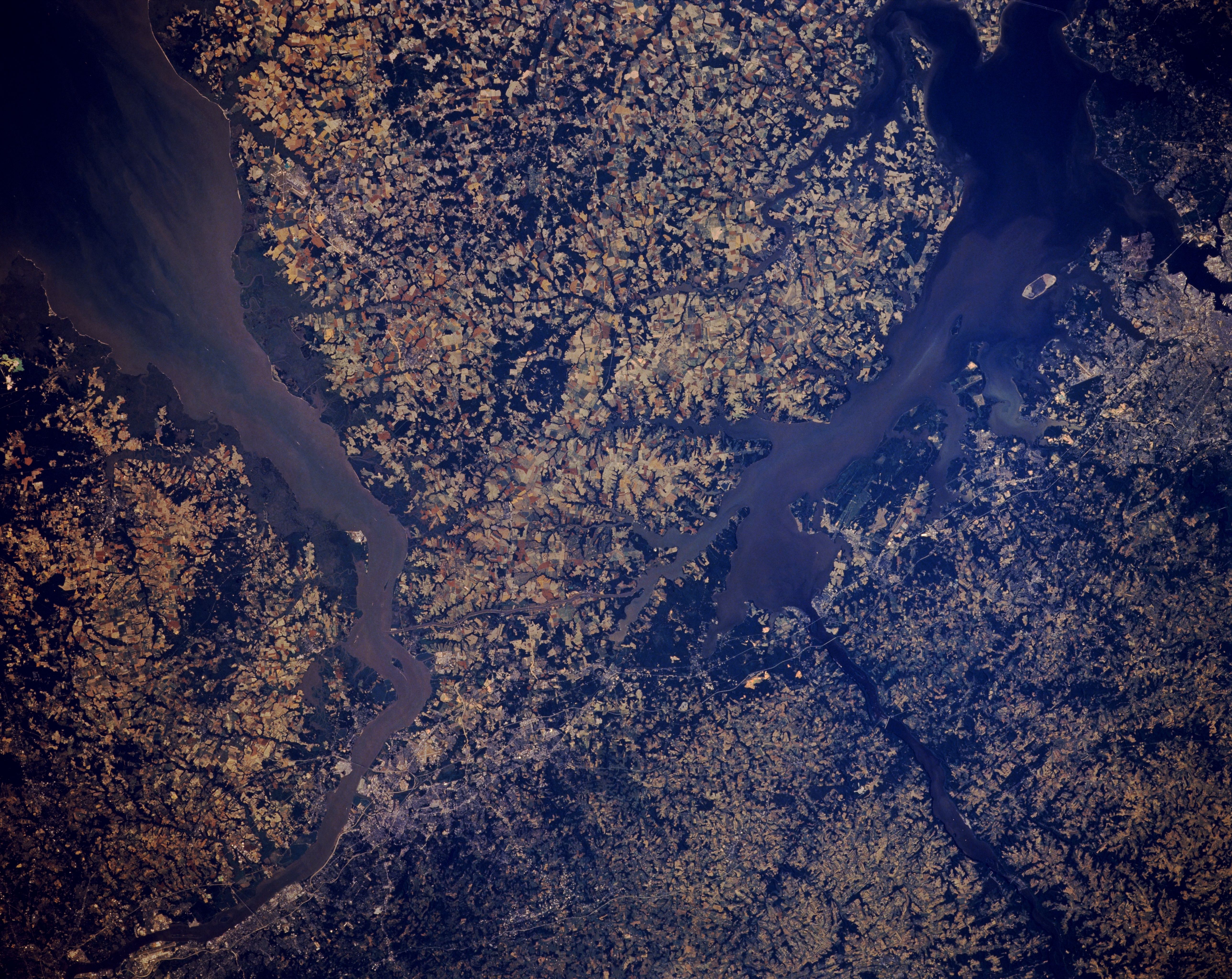
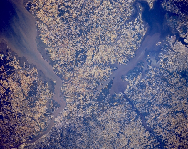
Parts of four states (Delaware, Maryland, Pennsylvania, and New Jersey) are viewed in this synoptic north-looking view of the northern end of the Chesapeake Bay (sediment laden water body on the left) and the mouth of the Delaware River (sediment plumes visible on the right side of the image) as it empties into Delaware Bay. The mouth of the southeasterly flowing Susquehanna River is easily identified as the river flows into the northern end of Chesapeake Bay. The Chesapeake and Delaware Canal, a man made waterway that connects these two bays (east-west aligned, linear feature), is barely discernible slightly above the center of the picture. The small scale of the image precludes a detailed identification of man made features; however, small sections of Interstate Highway 95 between Philadelphia and Baltimore can be traced along the northwest side of Chesapeake Bay. The Philadelphia International Airport runway (linear, light colored feature) can be identified along the north side of the Delaware River (upper right corner of the image) and the Frances Scott Key Bridge can be observed over Baltimore Harbor (along lower left edge of the image). The lighter colored terrain shows areas predominately used for agriculture and the darker landscape shows wooded areas. Many of the wooded areas are aligned with the drainage patterns, thereby helping to map smaller creeks and streams.
Parts of four states (Delaware, Maryland, Pennsylvania, and New Jersey) are viewed in this synoptic north-looking view of the northern end of the Chesapeake Bay (sediment laden water body on the left) and the mouth of the Delaware River (sediment plumes visible on the right side of the image) as it empties into Delaware Bay. The mouth of the southeasterly flowing Susquehanna River is easily identified as the river flows into the northern end of Chesapeake Bay. The Chesapeake and Delaware Canal, a man made waterway that connects these two bays (east-west aligned, linear feature), is barely discernible slightly above the center of the picture. The small scale of the image precludes a detailed identification of man made features; however, small sections of Interstate Highway 95 between Philadelphia and Baltimore can be traced along the northwest side of Chesapeake Bay. The Philadelphia International Airport runway (linear, light colored feature) can be identified along the north side of the Delaware River (upper right corner of the image) and the Frances Scott Key Bridge can be observed over Baltimore Harbor (along lower left edge of the image). The lighter colored terrain shows areas predominately used for agriculture and the darker landscape shows wooded areas. Many of the wooded areas are aligned with the drainage patterns, thereby helping to map smaller creeks and streams.
