STS040-151-23
| NASA Photo ID | STS040-151-23 |
| Focal Length | 90mm |
| Date taken | 1991.06.07 |
| Time taken | 16:43:21 GMT |
Cloud masks available for this image:
Spacecraft nadir point: 38.8° N, 105.2° W
Photo center point: 36.0° N, 106.0° W
Photo center point by machine learning:
Photo center point: 36.0° N, 106.0° W
Photo center point by machine learning:
Nadir to Photo Center: South
Spacecraft Altitude: 155 nautical miles (287km)
Country or Geographic Name: | USA-NEW MEXICO |
Features: | PANORAMA, NM. TO MEXICO |
| Features Found Using Machine Learning: | |
Cloud Cover Percentage: | 0 (no clouds present) |
Sun Elevation Angle: | 56° |
Sun Azimuth: | 108° |
Camera: | Linhof |
Focal Length: | 90mm |
Camera Tilt: | High Oblique |
Format: | QX868: Kodak, natural color positive, Ektachrome QX868(5017 emulsion), ASA 64, thin base |
Film Exposure: | Normal |
| Additional Information | |
| Width | Height | Annotated | Cropped | Purpose | Links |
|---|---|---|---|---|---|
| 5692 pixels | 4496 pixels | No | No | Earth From Space collection | Download Image |
| 639 pixels | 505 pixels | No | No | Earth From Space collection | Download Image |
| 640 pixels | 480 pixels | No | No | ISD 1 | Download Image |
Download Packaged File
Download a Google Earth KML for this Image
View photo footprint information
Download a GeoTIFF for this photo
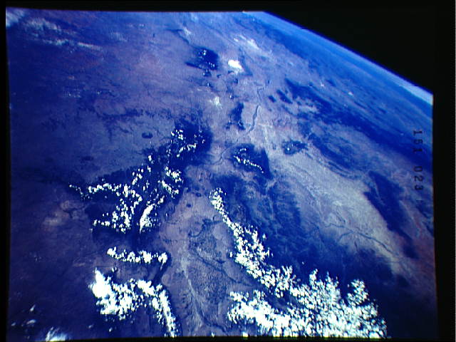
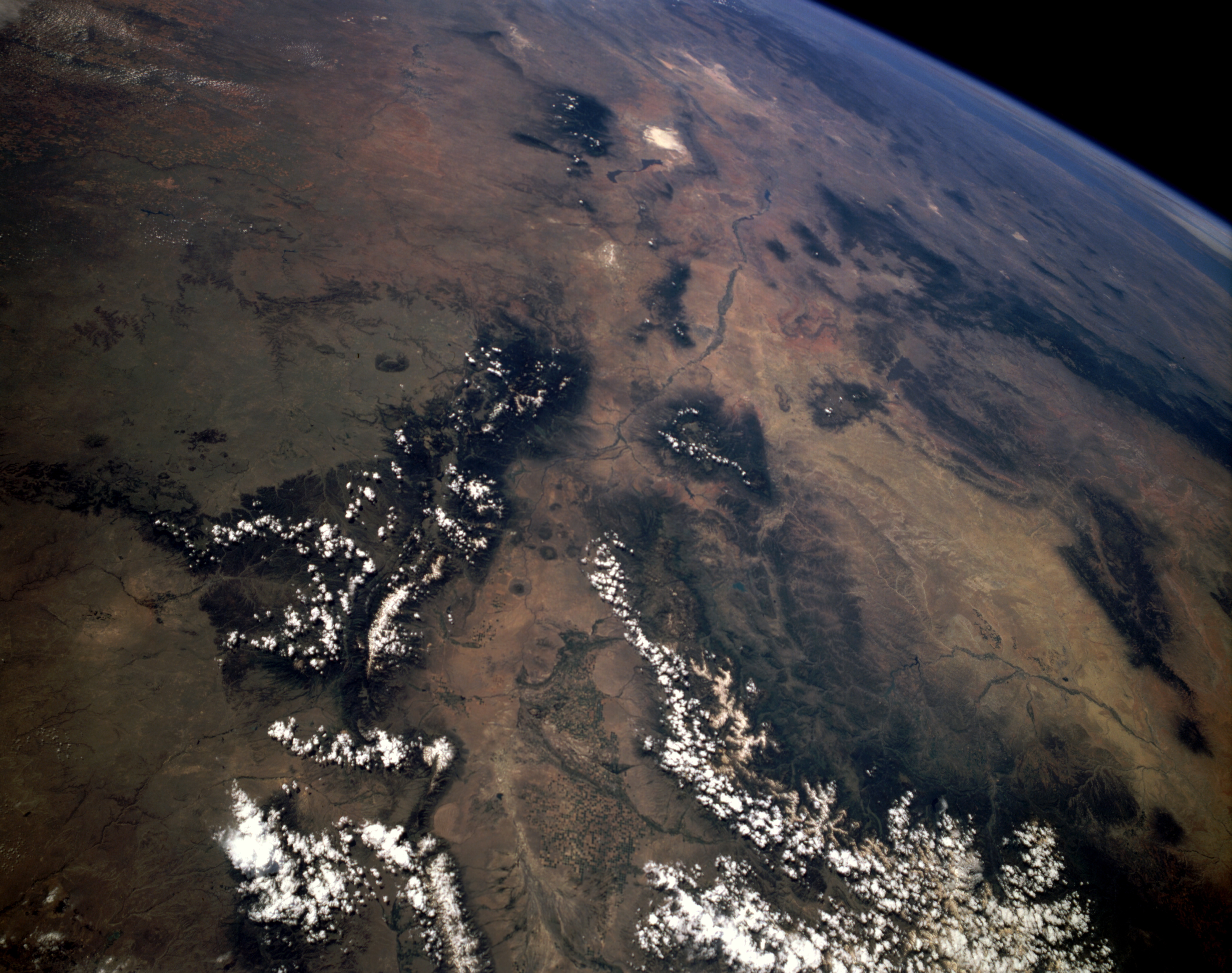
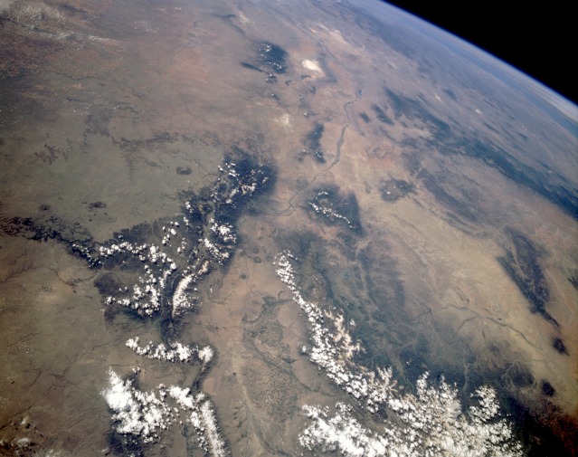
Image Caption: STS040-151-023 Southern Rocky Mountains, New Mexico, U.S.A. June 1991
This panoramic, south-looking photograph captures the physiographic relationship between the southern extent of the Rocky Mountains and the desert environment of south-central Colorado and most of New Mexico. In this photograph, the Rio Grande Rift Valley can be traced from its source in the San Juan Mountains of Colorado, through the San Luis Valley, and then southward until it starts to bend southeast and runs through the same mountain pass in which El Paso, Texas, is located. In the bottom center of the photograph, hundreds of center-pivot irrigation field patterns are visible in the vicinity of Alamosa, Colorado. The wide Rio Grande Rift Valley is flanked by the Sangre de Cristo Range to the east and the San Juan Mountains to the west. Farther to the west, several tributaries of the San Juan River are visible near Farmington, New Mexico. As the Rio Grande flows south, it passes the city of Albuquerque, New Mexico, and White Sands National Monument (near the top center of the photograph). The large uniform-looking region to the east of the Sangre de Cristo Range is a plateau where water erosion is slowly creating several large canyons.
This panoramic, south-looking photograph captures the physiographic relationship between the southern extent of the Rocky Mountains and the desert environment of south-central Colorado and most of New Mexico. In this photograph, the Rio Grande Rift Valley can be traced from its source in the San Juan Mountains of Colorado, through the San Luis Valley, and then southward until it starts to bend southeast and runs through the same mountain pass in which El Paso, Texas, is located. In the bottom center of the photograph, hundreds of center-pivot irrigation field patterns are visible in the vicinity of Alamosa, Colorado. The wide Rio Grande Rift Valley is flanked by the Sangre de Cristo Range to the east and the San Juan Mountains to the west. Farther to the west, several tributaries of the San Juan River are visible near Farmington, New Mexico. As the Rio Grande flows south, it passes the city of Albuquerque, New Mexico, and White Sands National Monument (near the top center of the photograph). The large uniform-looking region to the east of the Sangre de Cristo Range is a plateau where water erosion is slowly creating several large canyons.
