STS040-151-2
| NASA Photo ID | STS040-151-2 |
| Focal Length | 90mm |
| Date taken | 1991.06.07 |
| Time taken | 16:40:25 GMT |
Cloud masks available for this image:
Spacecraft nadir point: 36.9° N, 119.1° W
Photo center point: 37.0° N, 119.0° W
Photo center point by machine learning:
Photo center point: 37.0° N, 119.0° W
Photo center point by machine learning:
Nadir to Photo Center: Northeast
Spacecraft Altitude: 153 nautical miles (283km)
Country or Geographic Name: | USA-CALIFORNIA |
Features: | SAN JOAQUIN VLY, FRESNO |
| Features Found Using Machine Learning: | |
Cloud Cover Percentage: | 0 (no clouds present) |
Sun Elevation Angle: | 45° |
Sun Azimuth: | 94° |
Camera: | Linhof |
Focal Length: | 90mm |
Camera Tilt: | 3 degrees |
Format: | QX868: Kodak, natural color positive, Ektachrome QX868(5017 emulsion), ASA 64, thin base |
Film Exposure: | Normal |
| Additional Information | |
| Width | Height | Annotated | Cropped | Purpose | Links |
|---|---|---|---|---|---|
| 5056 pixels | 3968 pixels | No | No | Earth From Space collection | Download Image |
| 640 pixels | 502 pixels | No | No | Earth From Space collection | Download Image |
| 640 pixels | 480 pixels | No | No | ISD 1 | Download Image |
Download Packaged File
Download a Google Earth KML for this Image
View photo footprint information
Download a GeoTIFF for this photo
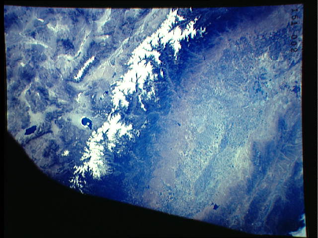
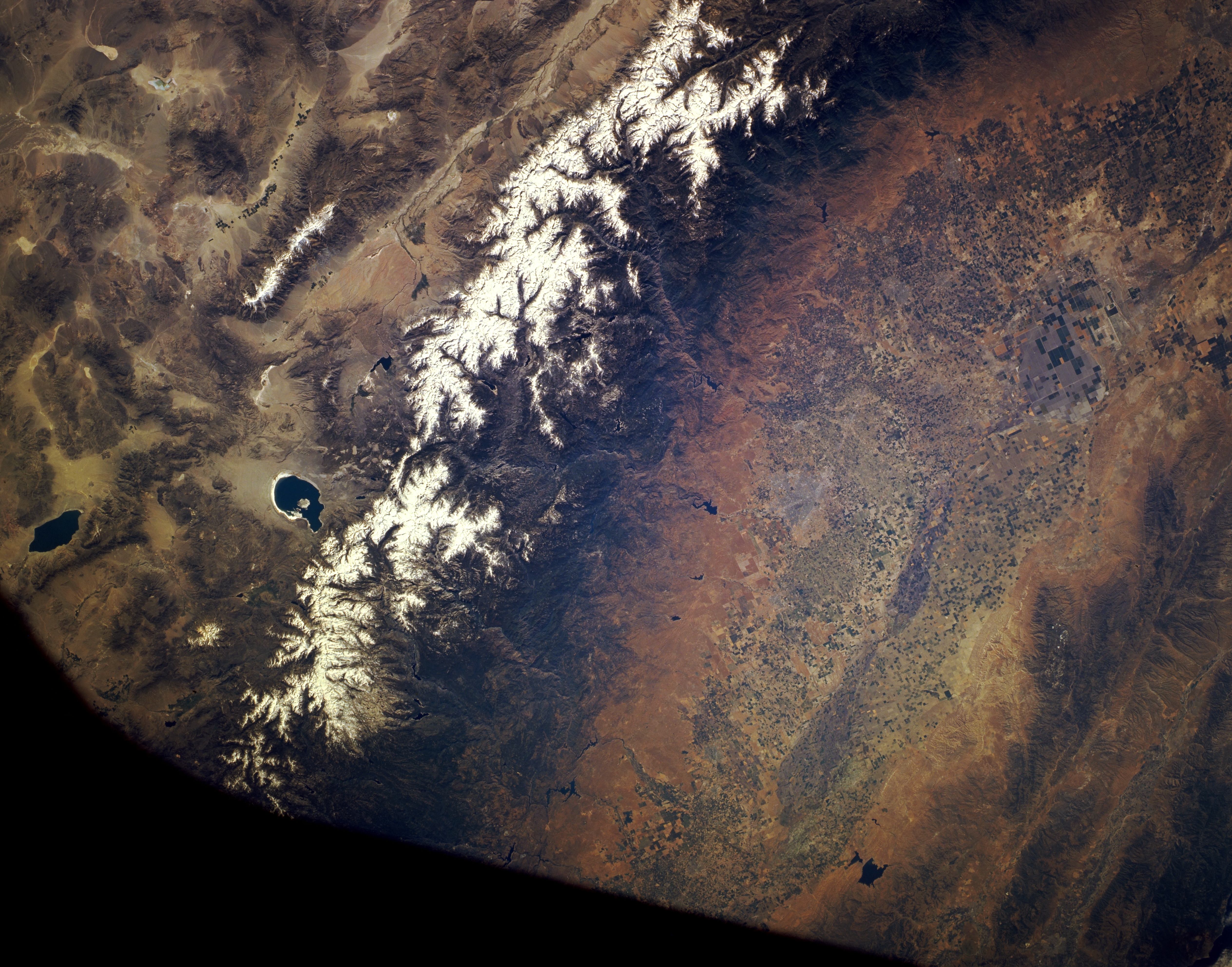
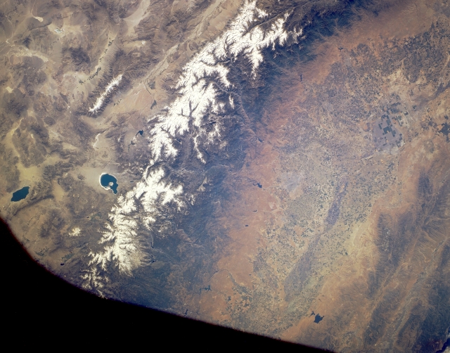
Image Caption: STS040-151-002 Central Sierra Nevada Mountains, California, U.S.A. June 1991
Although part of the photograph is obscured by the Shuttle window (blackness along upper left), the Sierra Nevadas are discernible. The green, irrigated San Joaquin Valley and its reservoirs contrast markedly with the arid conditions of the sparsely vegetated east side of the Sierra Nevada Range. The western slopes are more gradual than the precipitous eastern slopes and are characterized by a series of east-west trending, deeply eroded streams and canyons that transport large quantities of snowmelt. To the east, the Owens River Valley separates the Sierra Nevadas from the White Mountains, whose crest exceeds 14 000 feet (4265 meters). The White Mountains area is so cold, dry, and high that it qualifies as a cold desert. Apparent east of the Sierra Nevadas are Mono Lake and Walker Lake.
Although part of the photograph is obscured by the Shuttle window (blackness along upper left), the Sierra Nevadas are discernible. The green, irrigated San Joaquin Valley and its reservoirs contrast markedly with the arid conditions of the sparsely vegetated east side of the Sierra Nevada Range. The western slopes are more gradual than the precipitous eastern slopes and are characterized by a series of east-west trending, deeply eroded streams and canyons that transport large quantities of snowmelt. To the east, the Owens River Valley separates the Sierra Nevadas from the White Mountains, whose crest exceeds 14 000 feet (4265 meters). The White Mountains area is so cold, dry, and high that it qualifies as a cold desert. Apparent east of the Sierra Nevadas are Mono Lake and Walker Lake.
