STS040-151-117
| NASA Photo ID | STS040-151-117 |
| Focal Length | 90mm |
| Date taken | 1991.06.09 |
| Time taken | 15:13:42 GMT |
Cloud masks available for this image:
Spacecraft nadir point: 36.4° N, 114.5° W
Photo center point: 34.5° N, 115.0° W
Photo center point by machine learning:
Photo center point: 34.5° N, 115.0° W
Photo center point by machine learning:
Nadir to Photo Center: South
Spacecraft Altitude: 152 nautical miles (282km)
Country or Geographic Name: | USA-CALIFORNIA |
Features: | LAKE HAVASU |
| Features Found Using Machine Learning: | |
Cloud Cover Percentage: | 5 (1-10)% |
Sun Elevation Angle: | 32° |
Sun Azimuth: | 83° |
Camera: | Linhof |
Focal Length: | 90mm |
Camera Tilt: | 38 degrees |
Format: | QX868: Kodak, natural color positive, Ektachrome QX868(5017 emulsion), ASA 64, thin base |
Film Exposure: | Normal |
| Additional Information | |
| Width | Height | Annotated | Cropped | Purpose | Links |
|---|---|---|---|---|---|
| 5088 pixels | 4000 pixels | No | No | Earth From Space collection | Download Image |
| 640 pixels | 503 pixels | No | No | Earth From Space collection | Download Image |
| 640 pixels | 480 pixels | No | No | ISD 1 | Download Image |
Download Packaged File
Download a Google Earth KML for this Image
View photo footprint information
Download a GeoTIFF for this photo
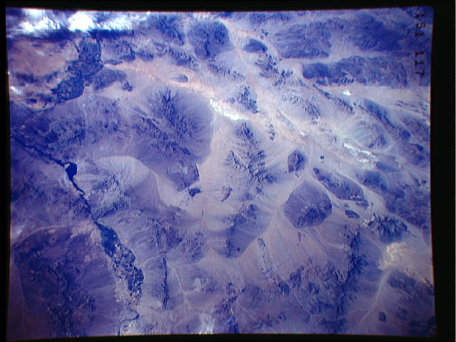
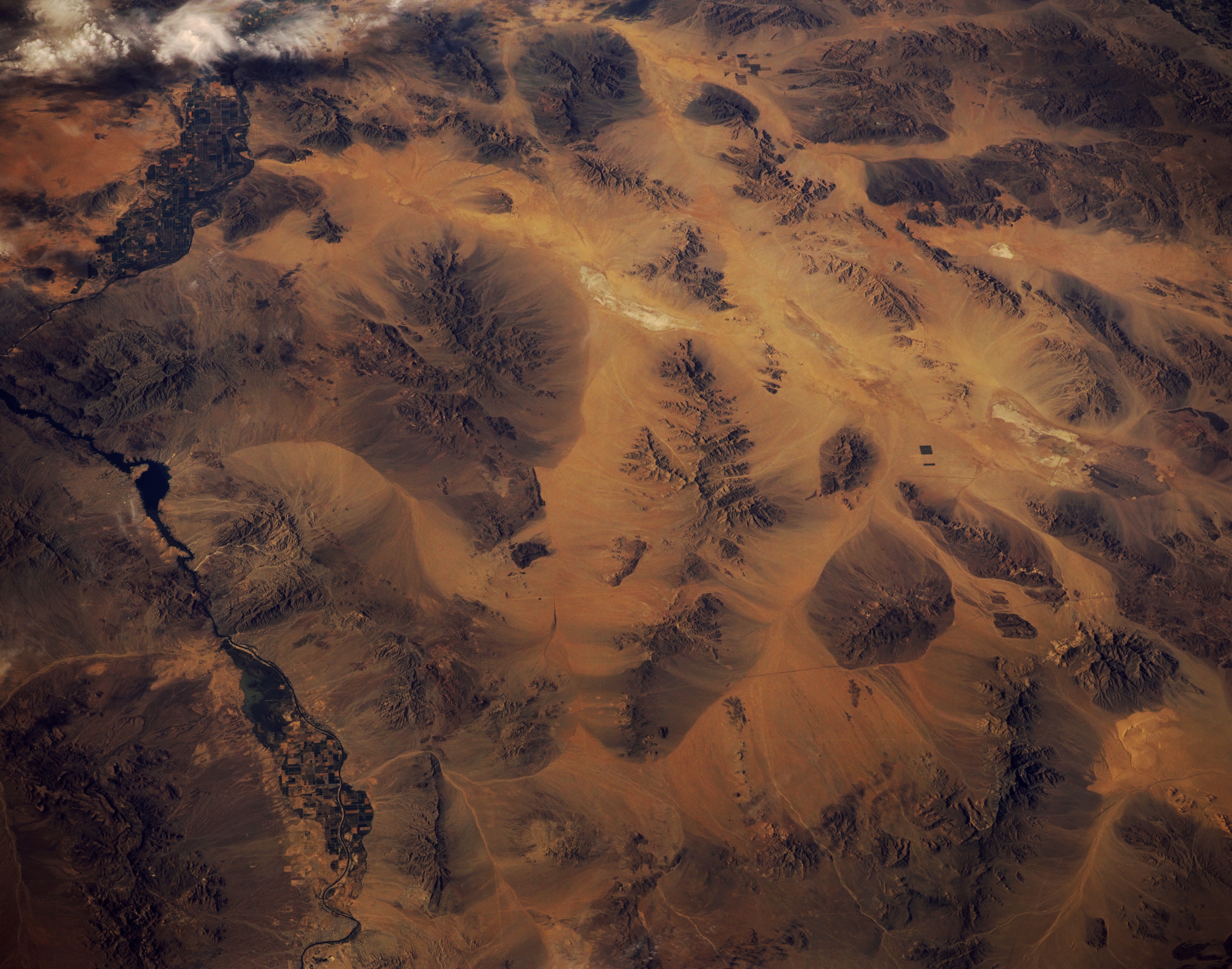
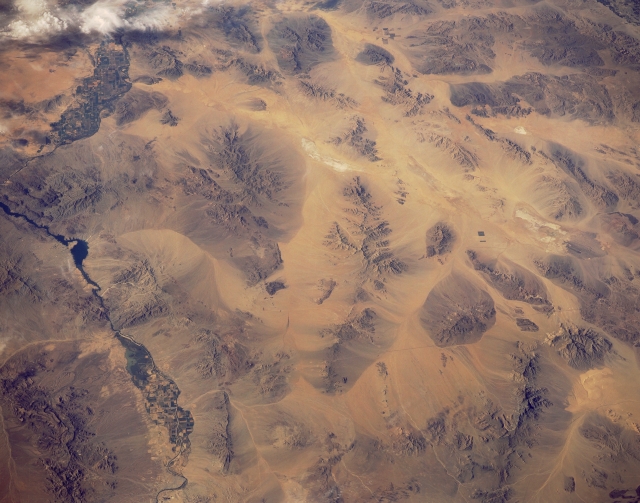
Image Caption: STS040-151-117 Whipple Mountains, Southern California, U.S.A. June 1991
A part of the Colorado River that forms the boundary between California and Arizona is evident near the eastern edge (left side) of the photograph. Irrigated agriculture field patterns are visible in two distinct floodplains along the river. The Whipple Mountains create an eastern protrusion of land that noticeably changes the course of the river. The northwest-southeast-trending Chemehuevi Mountains lie north of the Whipple Mountains, paralleling the Colorado River in California. Parker Dam (beyond the scope of the photograph) on the Colorado River created Lake Havasu, identified by the narrow peninsula that juts southeastward into the Colorado River. Color changes around the bases of the mountains provide visual evidence of erosion. Small segments of Interstate Highway 40 appear in a general east-west alignment.
A part of the Colorado River that forms the boundary between California and Arizona is evident near the eastern edge (left side) of the photograph. Irrigated agriculture field patterns are visible in two distinct floodplains along the river. The Whipple Mountains create an eastern protrusion of land that noticeably changes the course of the river. The northwest-southeast-trending Chemehuevi Mountains lie north of the Whipple Mountains, paralleling the Colorado River in California. Parker Dam (beyond the scope of the photograph) on the Colorado River created Lake Havasu, identified by the narrow peninsula that juts southeastward into the Colorado River. Color changes around the bases of the mountains provide visual evidence of erosion. Small segments of Interstate Highway 40 appear in a general east-west alignment.
