STS039-96-62
| NASA Photo ID | STS039-96-62 |
| Focal Length | 100mm |
| Date taken | 1991.05.02 |
| Time taken | 20:27:03 GMT |
Resolutions offered for this image:
3904 x 3868 pixels 639 x 634 pixels 5700 x 6000 pixels 500 x 526 pixels 640 x 480 pixels
3904 x 3868 pixels 639 x 634 pixels 5700 x 6000 pixels 500 x 526 pixels 640 x 480 pixels
Cloud masks available for this image:
Spacecraft nadir point: 47.7° N, 123.4° W
Photo center point: 47.3° N, 122.2° W
Photo center point by machine learning:
Photo center point: 47.3° N, 122.2° W
Photo center point by machine learning:
Nadir to Photo Center: East
Spacecraft Altitude: 141 nautical miles (261km)
Country or Geographic Name: | USA-WASHINGTON |
Features: | SEATTLE, TACOMA AREA |
| Features Found Using Machine Learning: | |
Cloud Cover Percentage: | 5 (1-10)% |
Sun Elevation Angle: | 48° |
Sun Azimuth: | 153° |
Camera: | Hasselblad |
Focal Length: | 100mm |
Camera Tilt: | 28 degrees |
Format: | 5017: Kodak, natural color positive, Ektachrome, X Professional, ASA 64, standard base |
Film Exposure: | Normal |
| Additional Information | |
| Width | Height | Annotated | Cropped | Purpose | Links |
|---|---|---|---|---|---|
| 3904 pixels | 3868 pixels | No | No | Earth From Space collection | Download Image |
| 639 pixels | 634 pixels | No | No | Earth From Space collection | Download Image |
| 5700 pixels | 6000 pixels | No | No | Download Image | |
| 500 pixels | 526 pixels | No | No | Download Image | |
| 640 pixels | 480 pixels | No | No | Download Image |
Download Packaged File
Download a Google Earth KML for this Image
View photo footprint information
Download a GeoTIFF for this photo
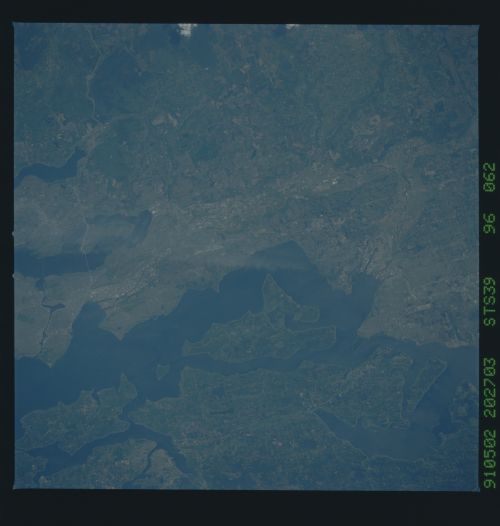
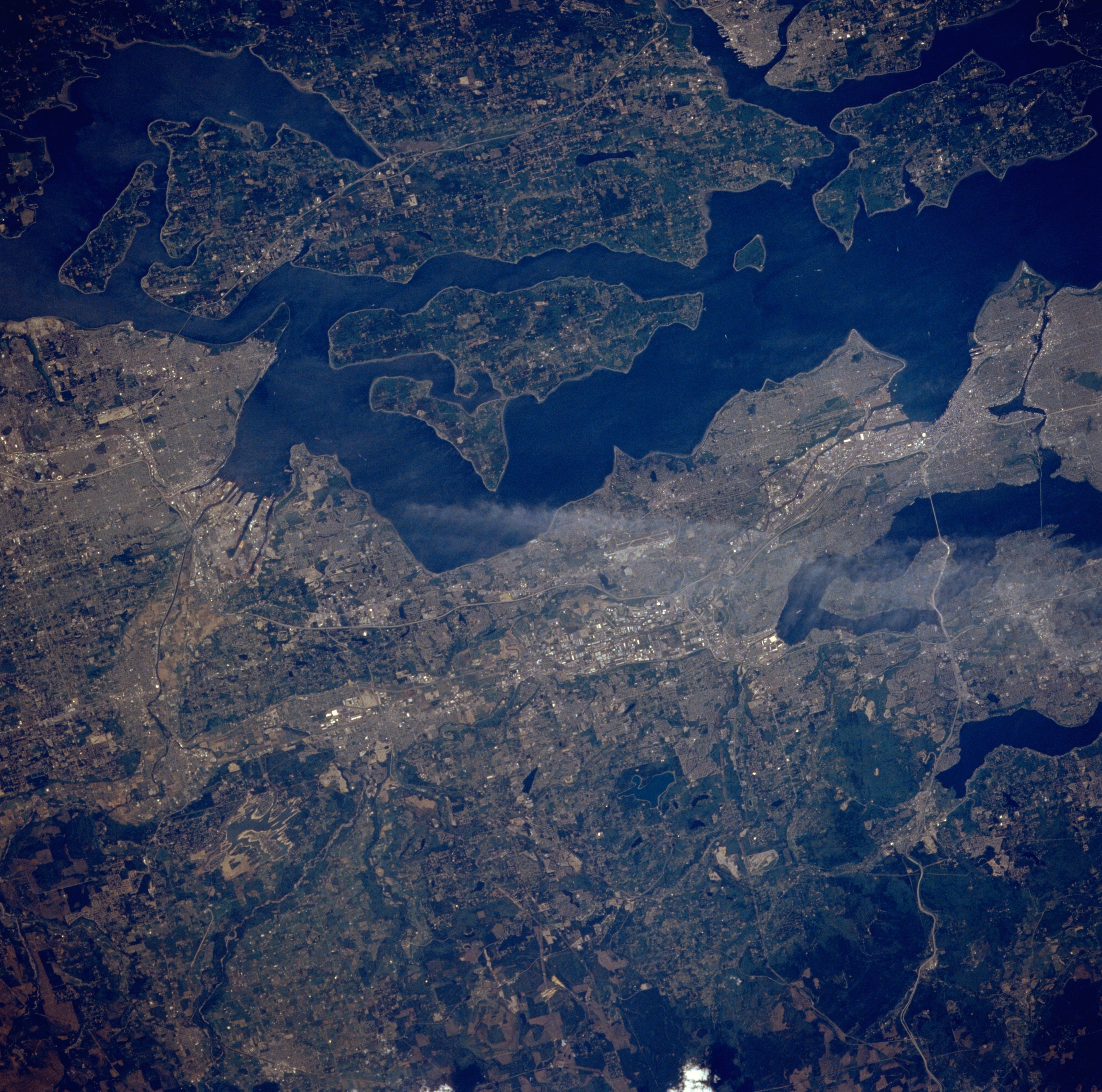
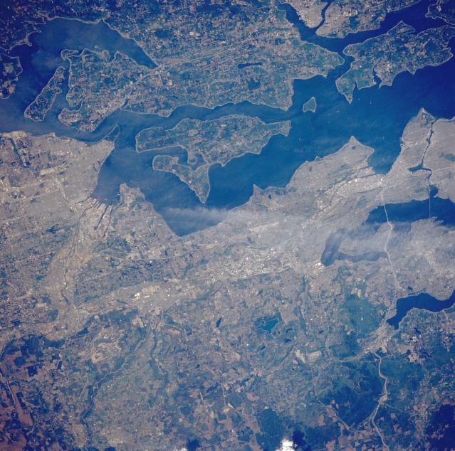
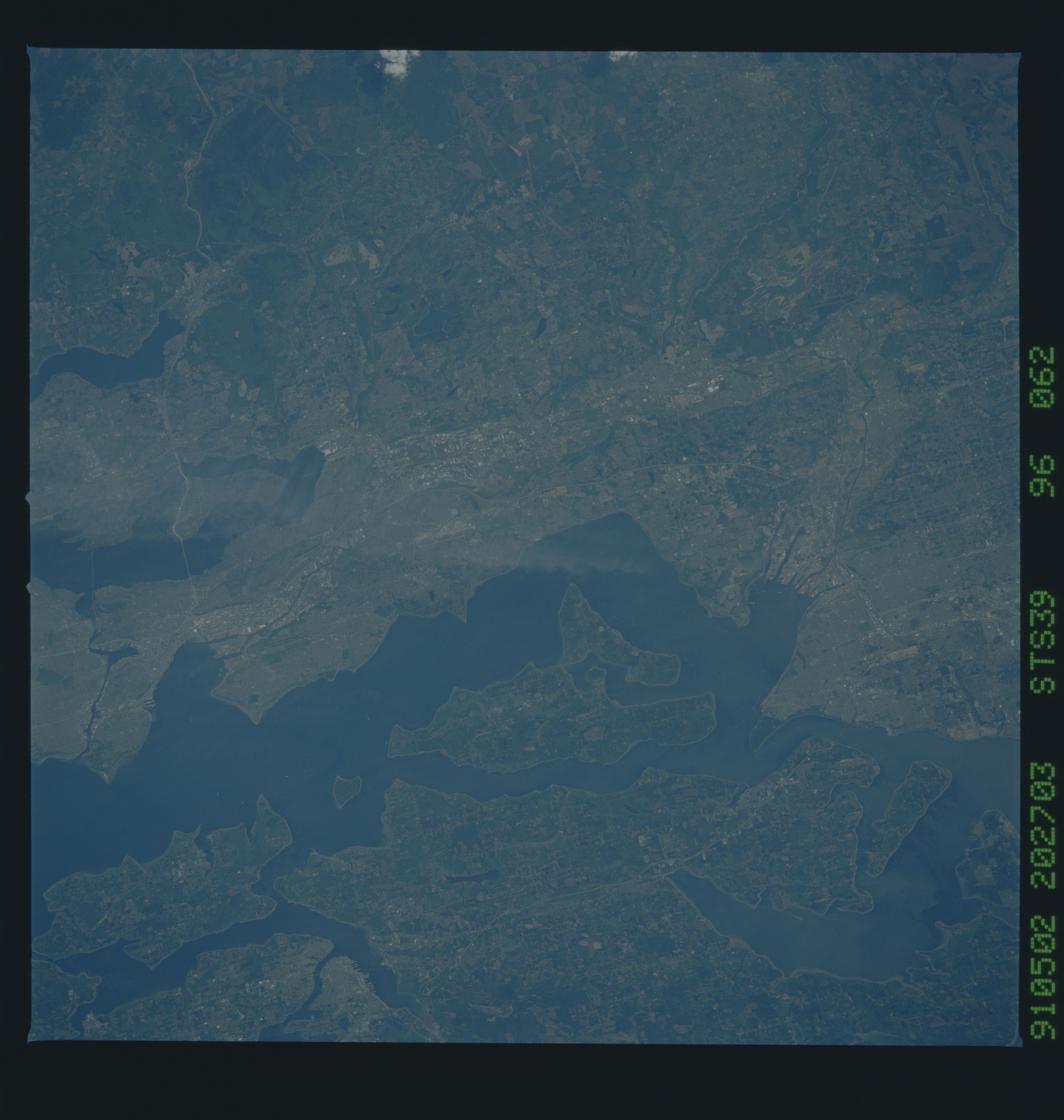
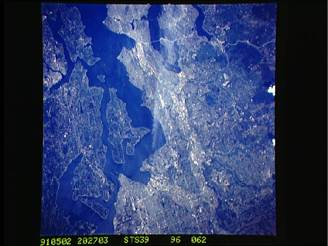
Image Caption: STS039-096-062 Puget Sound and Seattle/Tacoma Areas, Washington, U.S.A. May 1991
The areas of Seattle and Tacoma are the focus of this west-looking, low-oblique photograph. Tacoma, visible near the left center, is located on Puget Sound's Commencement Bay at the mouth of the Puyallup River. A major seaport and railroad terminus, the city is also one of the chief industrial cities of the Pacific Northwest, producing lumber, aluminum, candy, boats, and copper and wood products. It is home to several commercial fisheries and fish canneries and has a flourishing tourism industry. Seattle is visible near the right center of the photograph (see STS-036-152-013 for information about Seattle). Also discernible in this photograph are Puget Sound's Vashon Island, just west of Seattle; Bremerton and its naval shipyards; and the valleys of the Puyallup and Green Rivers. Not visible is Mount Rainier Volcano to the southeast whose eruption could result in the destruction of homes, businesses, and major transportation routes because of the debris from melted ice and snow cascading through these valleys.
The areas of Seattle and Tacoma are the focus of this west-looking, low-oblique photograph. Tacoma, visible near the left center, is located on Puget Sound's Commencement Bay at the mouth of the Puyallup River. A major seaport and railroad terminus, the city is also one of the chief industrial cities of the Pacific Northwest, producing lumber, aluminum, candy, boats, and copper and wood products. It is home to several commercial fisheries and fish canneries and has a flourishing tourism industry. Seattle is visible near the right center of the photograph (see STS-036-152-013 for information about Seattle). Also discernible in this photograph are Puget Sound's Vashon Island, just west of Seattle; Bremerton and its naval shipyards; and the valleys of the Puyallup and Green Rivers. Not visible is Mount Rainier Volcano to the southeast whose eruption could result in the destruction of homes, businesses, and major transportation routes because of the debris from melted ice and snow cascading through these valleys.
