STS039-85-38
| NASA Photo ID | STS039-85-38 |
| Focal Length | 250mm |
| Date taken | 1991.04.30 |
| Time taken | 20:49:36 GMT |
Resolutions offered for this image:
3904 x 3904 pixels 639 x 639 pixels 5700 x 6000 pixels 500 x 526 pixels 640 x 480 pixels
3904 x 3904 pixels 639 x 639 pixels 5700 x 6000 pixels 500 x 526 pixels 640 x 480 pixels
Cloud masks available for this image:
Spacecraft nadir point: 29.8° N, 94.4° W
Photo center point: 29.6° N, 95.1° W
Photo center point by machine learning:
Photo center point: 29.6° N, 95.1° W
Photo center point by machine learning:
Nadir to Photo Center: West
Spacecraft Altitude: 139 nautical miles (257km)
Country or Geographic Name: | USA-TEXAS |
Features: | SE. HOUSTON, CLEAR LAKE |
| Features Found Using Machine Learning: | |
Cloud Cover Percentage: | 15 (11-25)% |
Sun Elevation Angle: | 52° |
Sun Azimuth: | 251° |
Camera: | Hasselblad |
Focal Length: | 250mm |
Camera Tilt: | 17 degrees |
Format: | 5017: Kodak, natural color positive, Ektachrome, X Professional, ASA 64, standard base |
Film Exposure: | Normal |
| Additional Information | |
| Width | Height | Annotated | Cropped | Purpose | Links |
|---|---|---|---|---|---|
| 3904 pixels | 3904 pixels | No | No | Earth From Space collection | Download Image |
| 639 pixels | 639 pixels | No | No | Earth From Space collection | Download Image |
| 5700 pixels | 6000 pixels | No | No | Download Image | |
| 500 pixels | 526 pixels | No | No | Download Image | |
| 640 pixels | 480 pixels | No | No | Download Image |
Download Packaged File
Download a Google Earth KML for this Image
View photo footprint information
Download a GeoTIFF for this photo
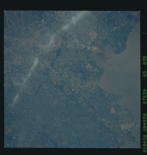
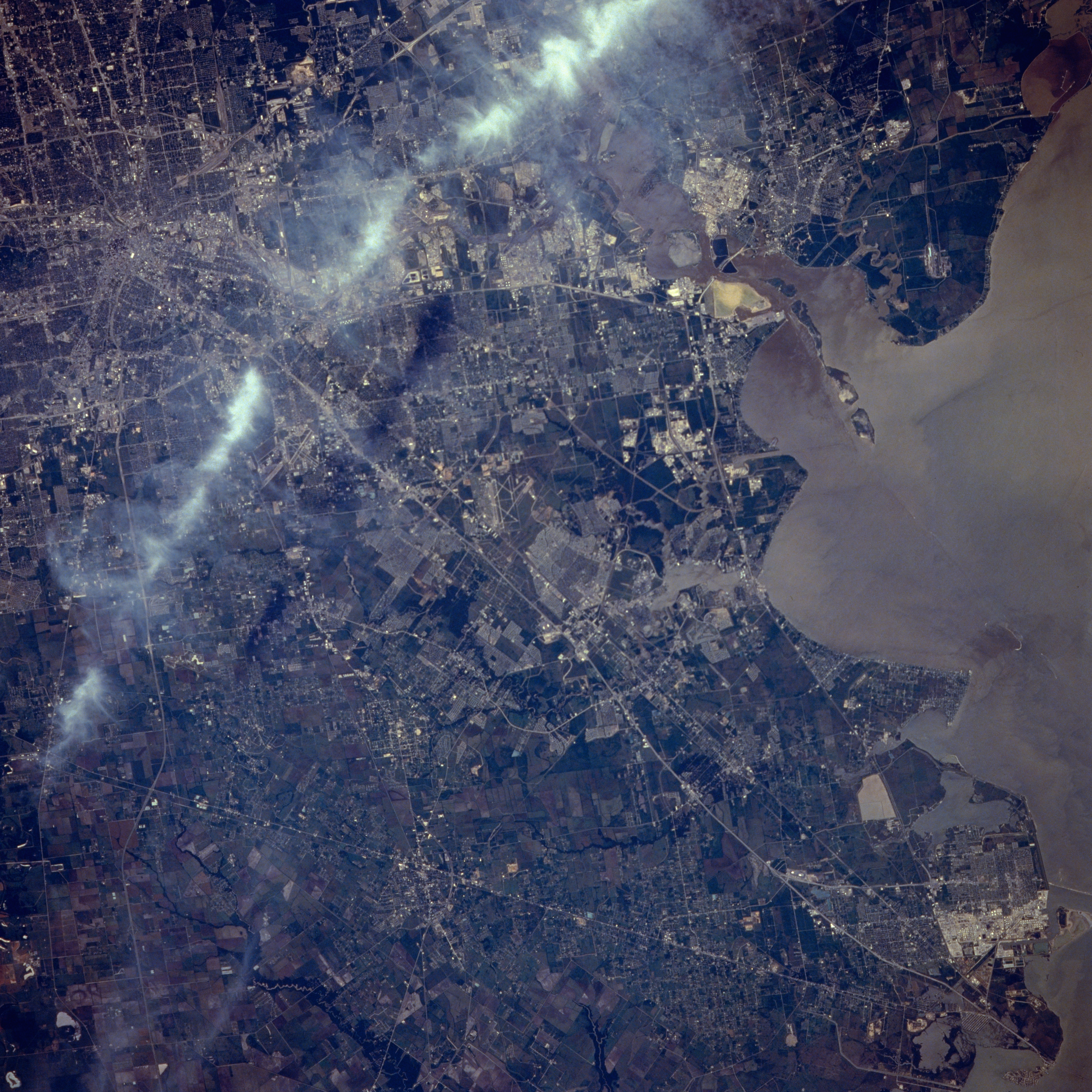
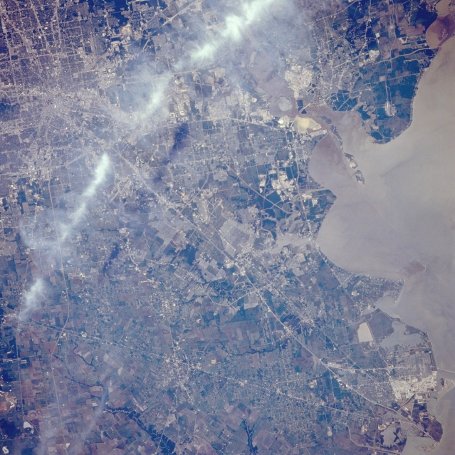
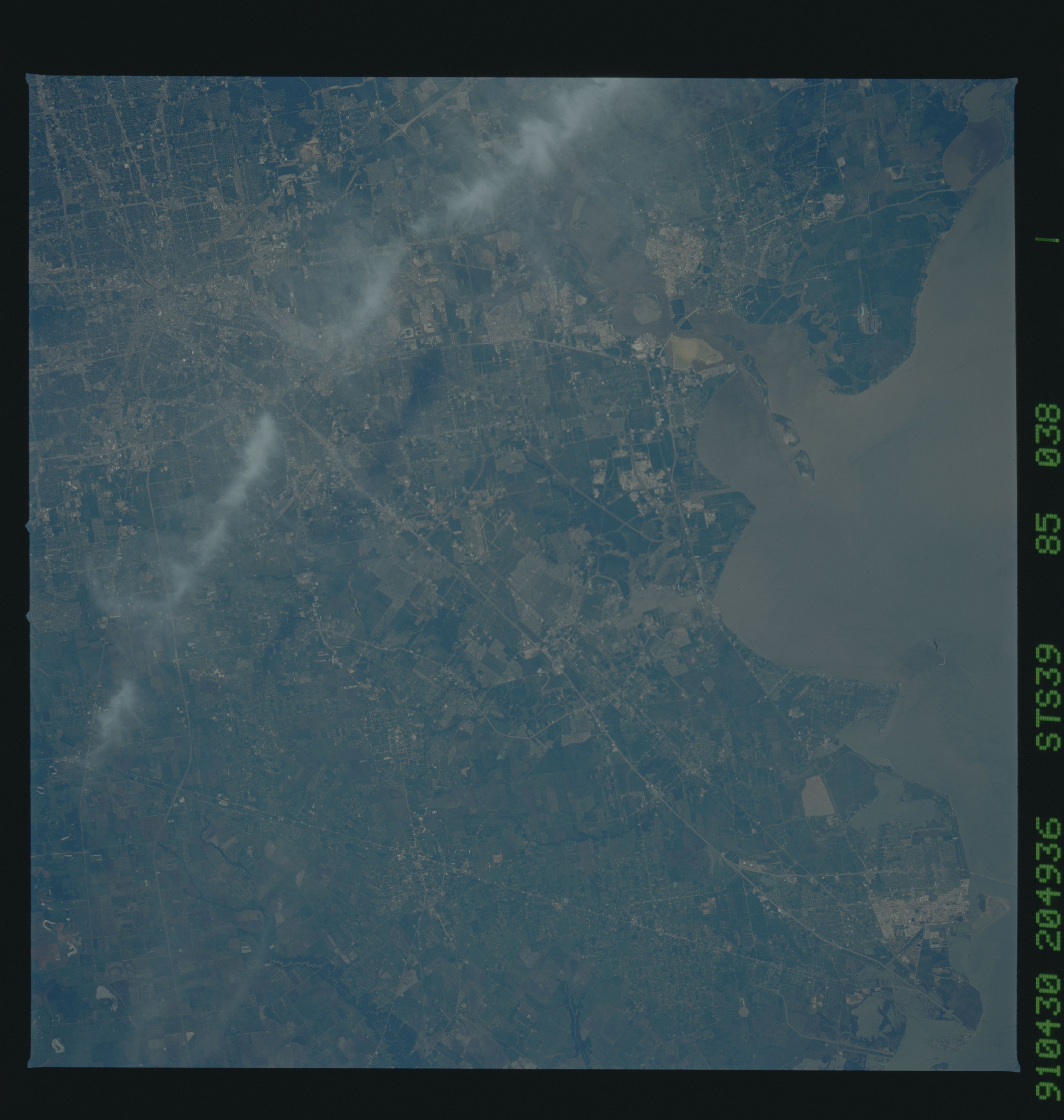
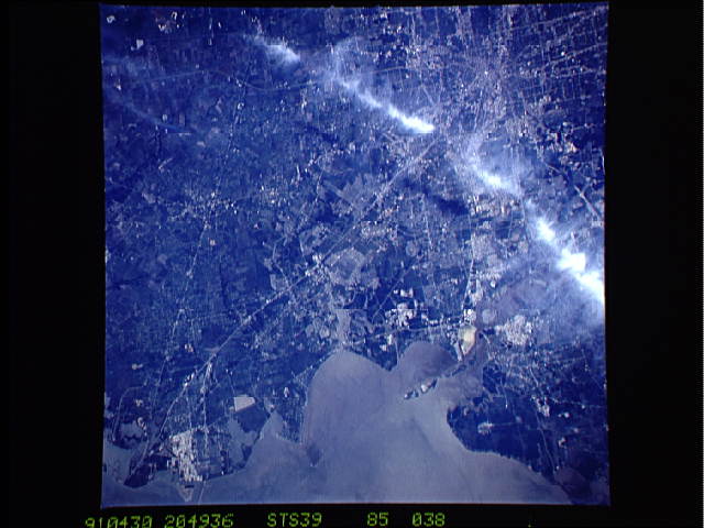
Image Caption: STS039-085-038 Southeast Houston, Texas, U.S.A. May 1991
A single line of clouds and shadows obscure some of the landscape from the central business district of Houston to Texas City to the southeast. Many linear features are highways, including Interstate Highway 45 (the Gulf Freeway) and surrounding highways; railroad rights-of-way; or combinations of a highway and a railroad in close proximity. The highly reflective features indicate large industrial plants (oil refineries and chemical plants) and commercial sites (strip shopping centers and malls). Large concentrations of manufacturing plants line the Houston Ship Channel and surround Texas City. The Lyndon B. Johnson Space Center sits on the north shore of Clear Lake. The single line of islands at the convergence of the San Jacinto River and the northwest corner of Galveston Bay was created by the dredged materials from the Houston Ship Channel. Rural areas outside the urban area are used for pastures or agricultural fields.
A single line of clouds and shadows obscure some of the landscape from the central business district of Houston to Texas City to the southeast. Many linear features are highways, including Interstate Highway 45 (the Gulf Freeway) and surrounding highways; railroad rights-of-way; or combinations of a highway and a railroad in close proximity. The highly reflective features indicate large industrial plants (oil refineries and chemical plants) and commercial sites (strip shopping centers and malls). Large concentrations of manufacturing plants line the Houston Ship Channel and surround Texas City. The Lyndon B. Johnson Space Center sits on the north shore of Clear Lake. The single line of islands at the convergence of the San Jacinto River and the northwest corner of Galveston Bay was created by the dredged materials from the Houston Ship Channel. Rural areas outside the urban area are used for pastures or agricultural fields.
