STS039-81-X
| NASA Photo ID | STS039-81-X |
| Focal Length | 250mm |
| Date taken | 1991.__.__ |
| Time taken | GMT |
Resolutions offered for this image:
4096 x 4096 pixels 640 x 640 pixels 5700 x 6000 pixels 500 x 526 pixels 640 x 480 pixels
4096 x 4096 pixels 640 x 640 pixels 5700 x 6000 pixels 500 x 526 pixels 640 x 480 pixels


Cloud masks available for this image:
Spacecraft nadir point:
Photo center point: 53.5° N, 159.5° E
Photo center point by machine learning:
Photo center point: 53.5° N, 159.5° E
Photo center point by machine learning:
Nadir to Photo Center:
Spacecraft Altitude: nautical miles (0km)
Country or Geographic Name: | RUSSIAN FEDERATION |
Features: | KAMCHATKA-C. SHIPUNSKIY |
| Features Found Using Machine Learning: | |
Cloud Cover Percentage: | 10 (1-10)% |
Sun Elevation Angle: | ° |
Sun Azimuth: | ° |
Camera: | Hasselblad |
Focal Length: | 250mm |
Camera Tilt: | |
Format: | 5017: Kodak, natural color positive, Ektachrome, X Professional, ASA 64, standard base |
Film Exposure: | Normal |
| Additional Information | |
| Width | Height | Annotated | Cropped | Purpose | Links |
|---|---|---|---|---|---|
| 4096 pixels | 4096 pixels | No | No | Earth From Space collection | Download Image |
| 640 pixels | 640 pixels | No | No | Earth From Space collection | Download Image |
| 5700 pixels | 6000 pixels | No | No | Download Image | |
| 500 pixels | 526 pixels | No | No | Download Image | |
| 640 pixels | 480 pixels | No | No | Download Image |
Download Packaged File
Download a Google Earth KML for this Image
View photo footprint information
Download a GeoTIFF for this photo
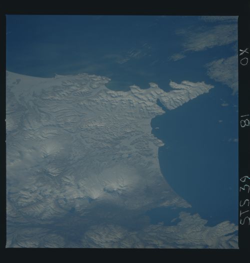
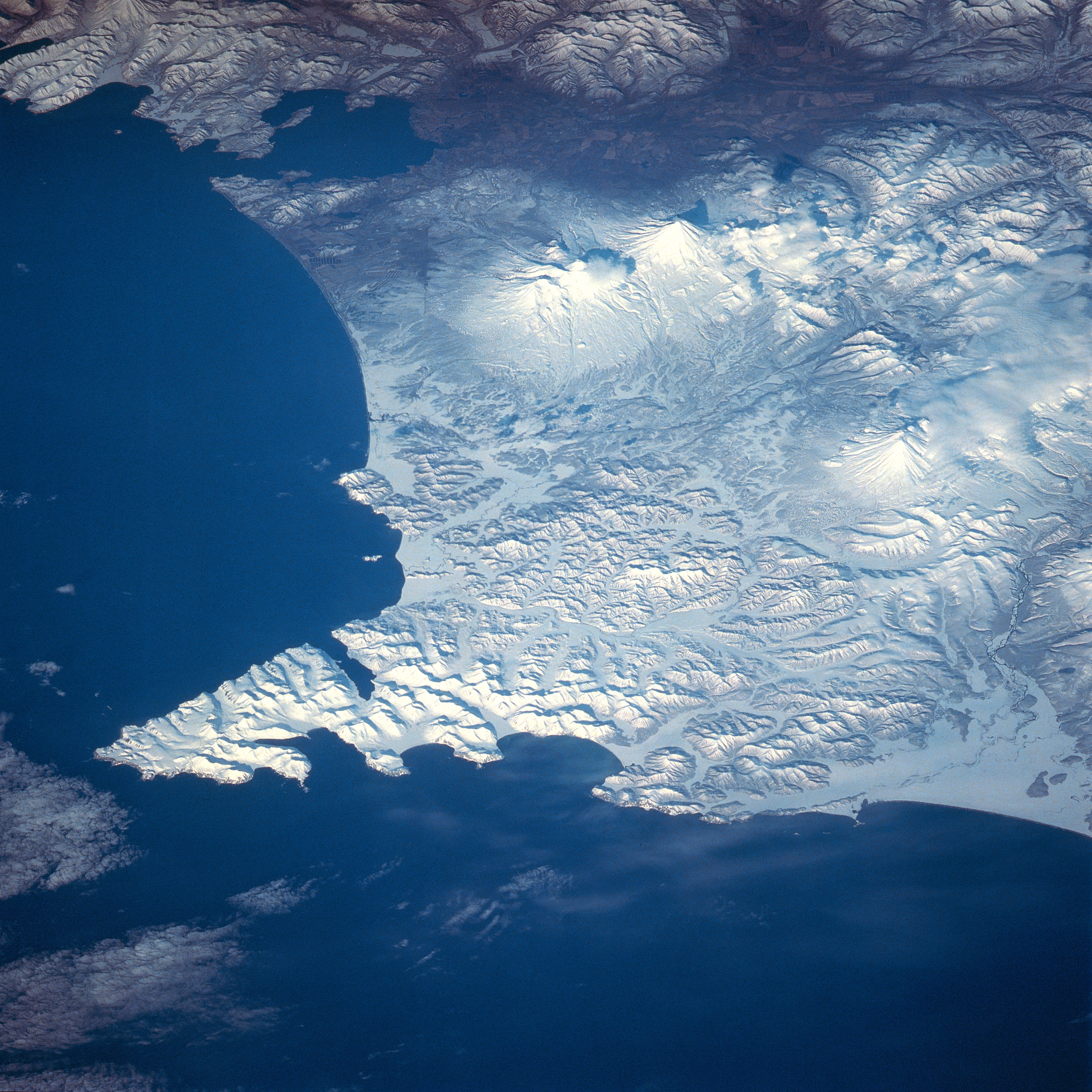
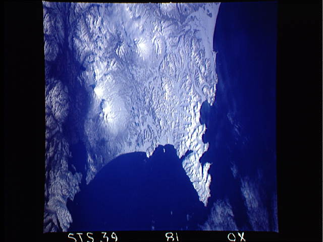
Image Caption: STS039-081-00X Shipunsk Peninsula, Kamchatka, Russia May 1991
The mountainous snow-covered Shipunsk Peninsula can be seen in this southwest-looking view. The Shipunsk Peninsula's (arrowhead-shaped feature) is located on the eastern coast of the rugged and volcanic 750 mile (1208 km) long Kamchatka Peninsula of far eastern Russia. In the upper left part of the image, Avachinsk Bay, an inlet of the Pacific Ocean, and home to the large Russian Naval Base at Petropavlovsk, is visible. The Avacha River Valley (not snow-covered) is discernible traversing northwest across the upper portion of the image. Slightly above the center of the image, the snow-covered stratovolcano, Avachinskaya, which last erupted in January 1991, is visible. To the right of Avachinskaya Volcano is the 11339-foot (3456 meters) high snow-covered stratovolcano Karyakskaya. This active volcano last erupted during the winter of 1956-1957. Below and slightly to the right of the two previously mentioned volcanoes, is the snow-covered and partially cloud covered Zhupanovskaya Volcano (near the right center of the image). This volcano last erupted in 1959.
The mountainous snow-covered Shipunsk Peninsula can be seen in this southwest-looking view. The Shipunsk Peninsula's (arrowhead-shaped feature) is located on the eastern coast of the rugged and volcanic 750 mile (1208 km) long Kamchatka Peninsula of far eastern Russia. In the upper left part of the image, Avachinsk Bay, an inlet of the Pacific Ocean, and home to the large Russian Naval Base at Petropavlovsk, is visible. The Avacha River Valley (not snow-covered) is discernible traversing northwest across the upper portion of the image. Slightly above the center of the image, the snow-covered stratovolcano, Avachinskaya, which last erupted in January 1991, is visible. To the right of Avachinskaya Volcano is the 11339-foot (3456 meters) high snow-covered stratovolcano Karyakskaya. This active volcano last erupted during the winter of 1956-1957. Below and slightly to the right of the two previously mentioned volcanoes, is the snow-covered and partially cloud covered Zhupanovskaya Volcano (near the right center of the image). This volcano last erupted in 1959.
