STS039-77-73

| NASA Photo ID | STS039-77-73 |
| Focal Length | 250mm |
| Date taken | 1991.04.29 |
| Time taken | 01:13:52 GMT |
Resolutions offered for this image:
4096 x 4096 pixels 640 x 640 pixels 5700 x 6000 pixels 500 x 526 pixels 640 x 480 pixels
4096 x 4096 pixels 640 x 640 pixels 5700 x 6000 pixels 500 x 526 pixels 640 x 480 pixels

Cloud masks available for this image:
Spacecraft nadir point: 52.8° N, 109.8° E
Photo center point: 54.0° N, 109.0° E
Photo center point by machine learning:
Photo center point: 54.0° N, 109.0° E
Photo center point by machine learning:
Nadir to Photo Center: Northwest
Spacecraft Altitude: 145 nautical miles (269km)
Country or Geographic Name: | RUSSIAN FEDERATION |
Features: | LAKE BAIKAL-SVYATOYNOS P |
| Features Found Using Machine Learning: | |
Cloud Cover Percentage: | 0 (no clouds present) |
Sun Elevation Angle: | 34° |
Sun Azimuth: | 113° |
Camera: | Hasselblad |
Focal Length: | 250mm |
Camera Tilt: | 31 degrees |
Format: | 5017: Kodak, natural color positive, Ektachrome, X Professional, ASA 64, standard base |
Film Exposure: | Normal |
| Additional Information | |
| Width | Height | Annotated | Cropped | Purpose | Links |
|---|---|---|---|---|---|
| 4096 pixels | 4096 pixels | No | No | Earth From Space collection | Download Image |
| 640 pixels | 640 pixels | No | No | Earth From Space collection | Download Image |
| 5700 pixels | 6000 pixels | No | No | Download Image | |
| 500 pixels | 526 pixels | No | No | Download Image | |
| 640 pixels | 480 pixels | No | No | Download Image |
Download Packaged File
Download a Google Earth KML for this Image
View photo footprint information
Download a GeoTIFF for this photo
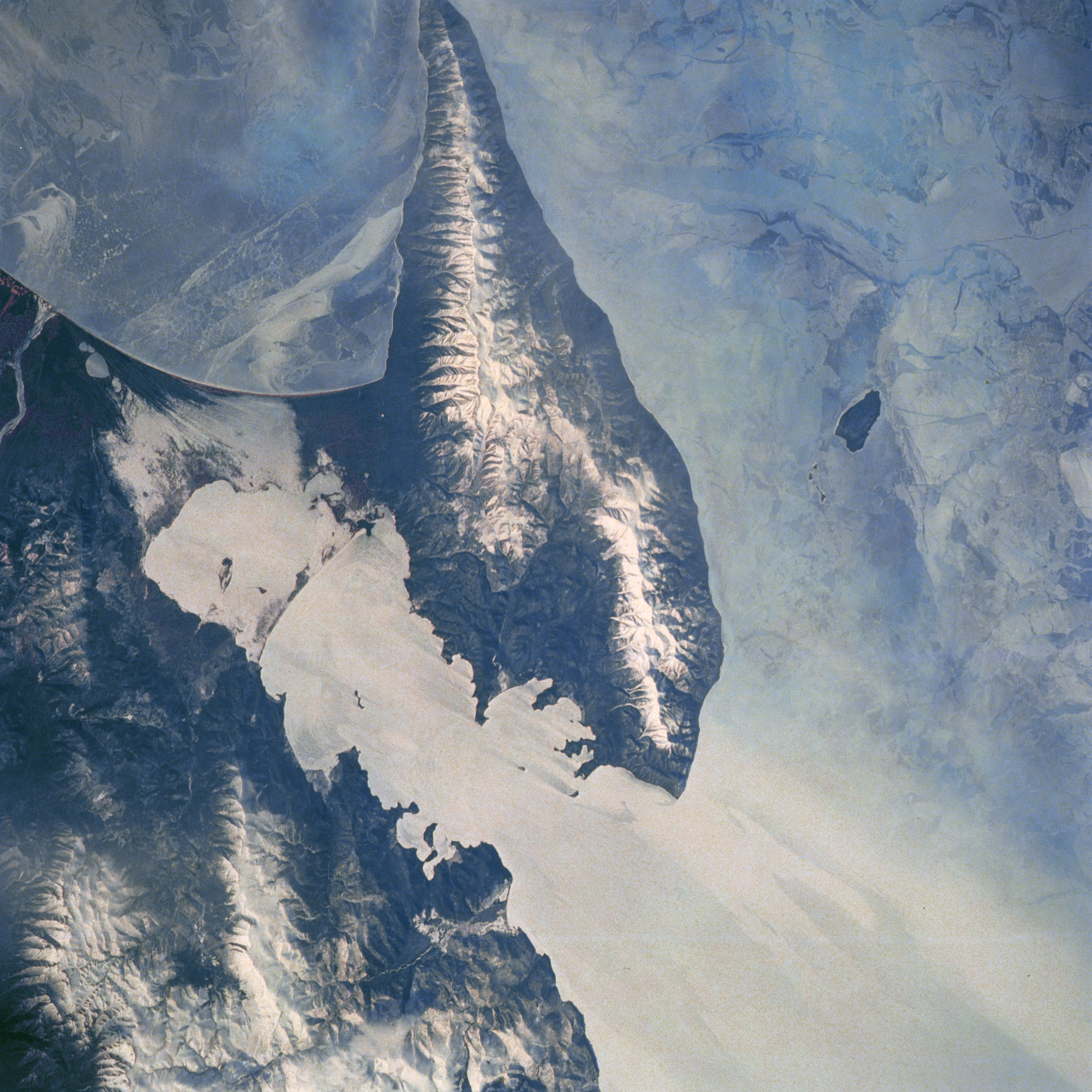
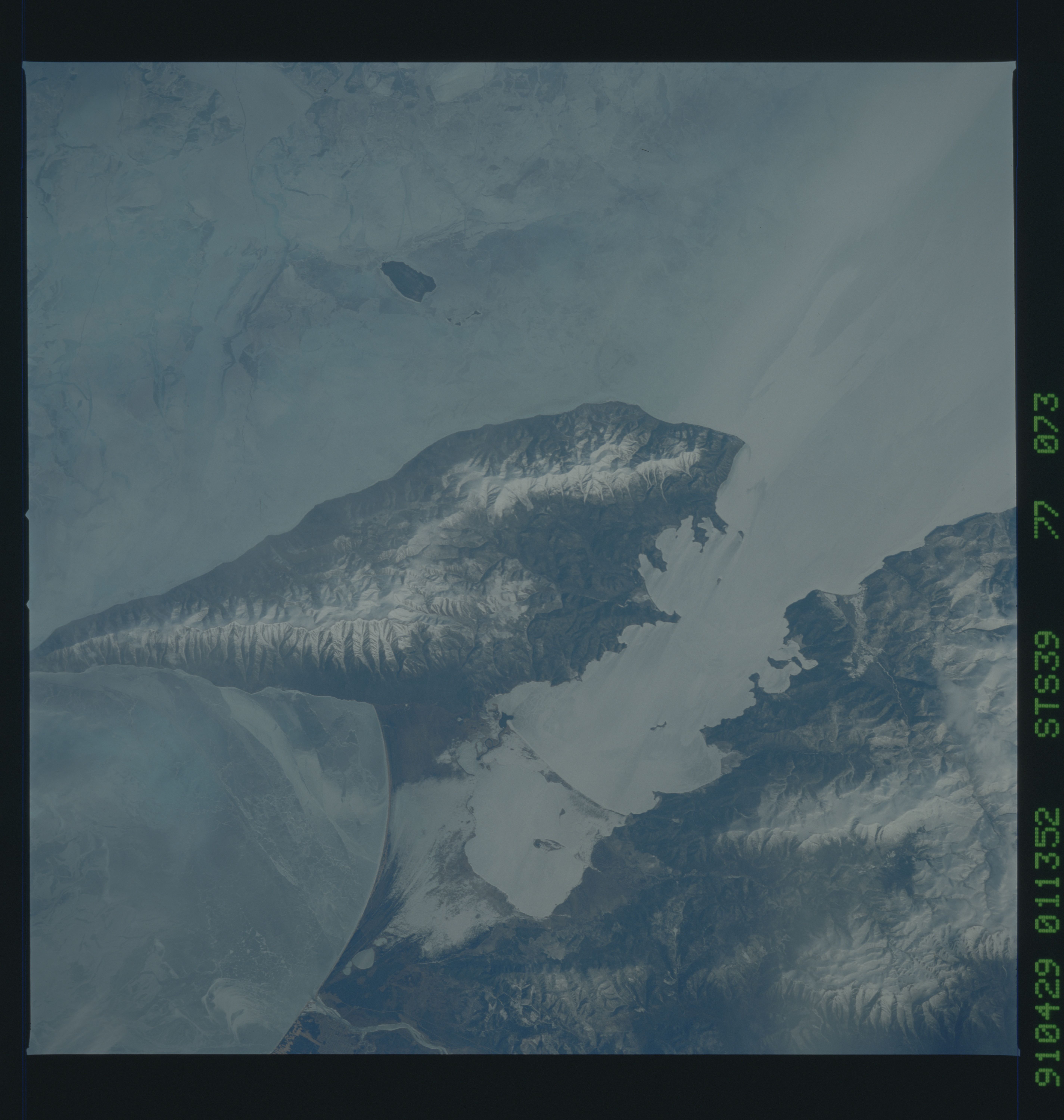
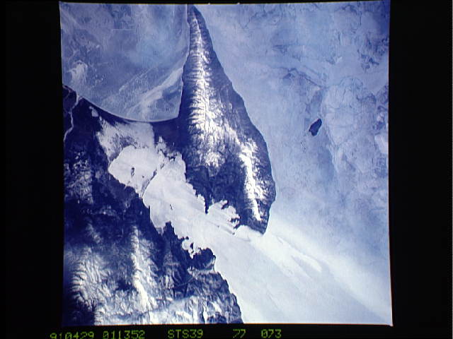
Image Caption: STS039-077-073 Svyatoy Peninsula and Lake Baykal, Russia May 1991
Even though this image was collected during the spring of 1991, the snow-covered mountainous landscape and ice-covered (extensive, light-colored surfaces) Lake Baykal presents a harsh-looking, cold environment. The wedge-shaped mountainous terrain with several snow capped peaks and ridgelines exceeding 5000 feet (1524 meters) above sea level is aligned in a northeast-southwest orientation. The dark feature west of the large, Svyatoy Peninsula is a small island that is surrounded by ice. The various patterns and color gradation within the ice that covers Lake Baykol indicates a variety of ice thicknesses. The Svyatoy Peninsula is connected to the mountainous eastern shore of the lake by a low-lying, swampy isthmus.
Even though this image was collected during the spring of 1991, the snow-covered mountainous landscape and ice-covered (extensive, light-colored surfaces) Lake Baykal presents a harsh-looking, cold environment. The wedge-shaped mountainous terrain with several snow capped peaks and ridgelines exceeding 5000 feet (1524 meters) above sea level is aligned in a northeast-southwest orientation. The dark feature west of the large, Svyatoy Peninsula is a small island that is surrounded by ice. The various patterns and color gradation within the ice that covers Lake Baykol indicates a variety of ice thicknesses. The Svyatoy Peninsula is connected to the mountainous eastern shore of the lake by a low-lying, swampy isthmus.
