STS039-609-62

| NASA Photo ID | STS039-609-62 |
| Focal Length | 250mm |
| Date taken | 1991.05.05 |
| Time taken | 09:47:00 GMT |
Resolutions offered for this image:
6946 x 6946 pixels 640 x 640 pixels 5700 x 6000 pixels 500 x 526 pixels 640 x 480 pixels 665 x 636 pixels
6946 x 6946 pixels 640 x 640 pixels 5700 x 6000 pixels 500 x 526 pixels 640 x 480 pixels 665 x 636 pixels

Cloud masks available for this image:
Spacecraft nadir point: 33.3° N, 42.0° E
Photo center point: 29.0° N, 48.0° E
Photo center point by machine learning:
Photo center point: 29.0° N, 48.0° E
Photo center point by machine learning:
Nadir to Photo Center: Southeast
Spacecraft Altitude: 142 nautical miles (263km)
Country or Geographic Name: | KUWAIT |
Features: | BURQAN, WAFRAH FIRES |
| Features Found Using Machine Learning: | |
Cloud Cover Percentage: | 0 (no clouds present) |
Sun Elevation Angle: | 71° |
Sun Azimuth: | 209° |
Camera: | Rolleiflex |
Focal Length: | 250mm |
Camera Tilt: | Low Oblique |
Format: | 5017: Kodak, natural color positive, Ektachrome, X Professional, ASA 64, standard base |
Film Exposure: | Normal |
| Additional Information | |
| Width | Height | Annotated | Cropped | Purpose | Links |
|---|---|---|---|---|---|
| 6946 pixels | 6946 pixels | No | No | Earth From Space collection | Download Image |
| 640 pixels | 640 pixels | No | No | Earth From Space collection | Download Image |
| 5700 pixels | 6000 pixels | No | No | Download Image | |
| 500 pixels | 526 pixels | No | No | Download Image | |
| 640 pixels | 480 pixels | No | No | Download Image | |
| 665 pixels | 636 pixels | No | No | Download Image |
Download Packaged File
Download a Google Earth KML for this Image
View photo footprint information
Download a GeoTIFF for this photo
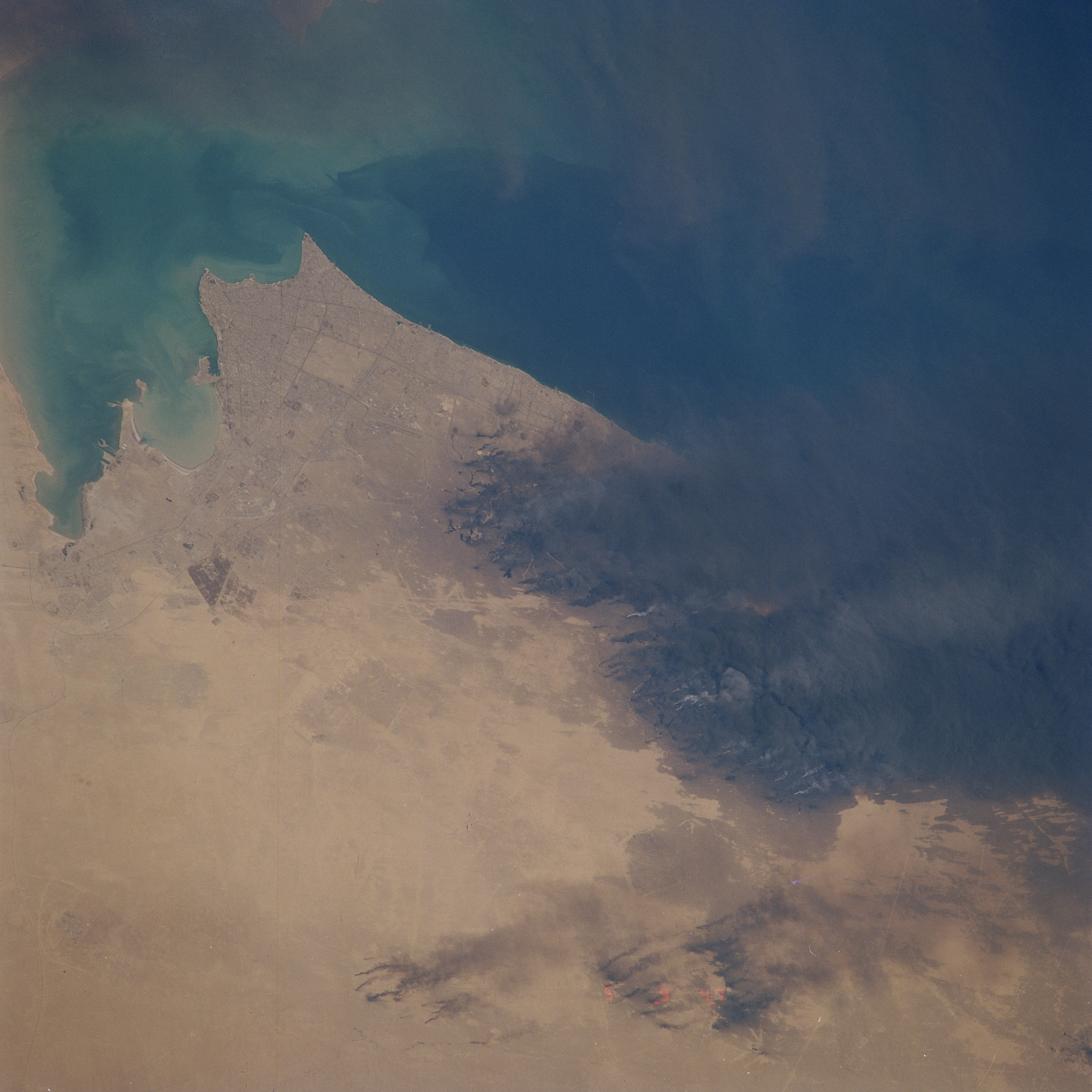
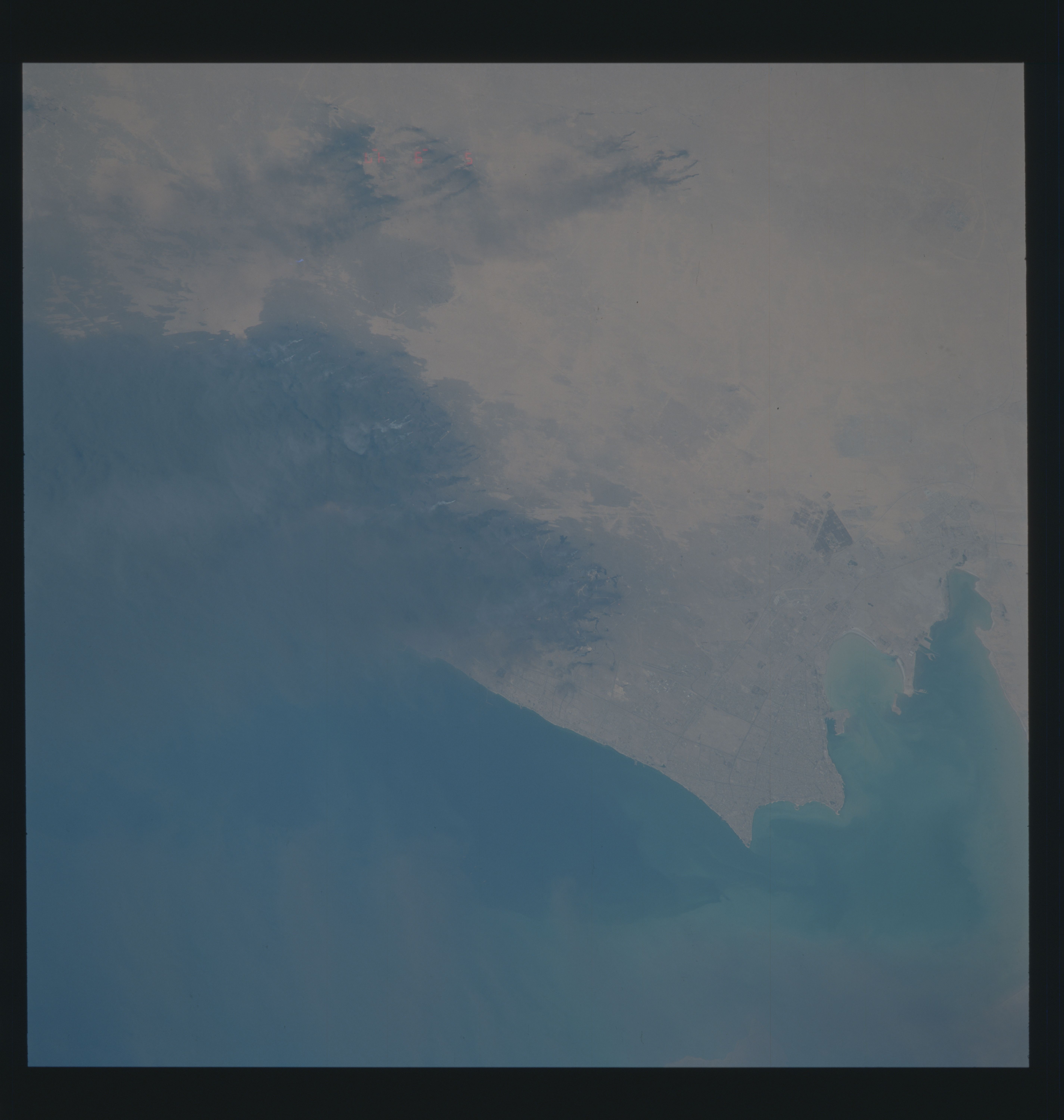
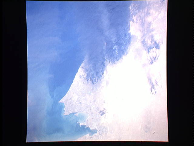
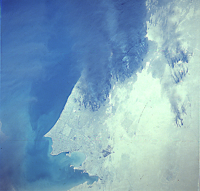
Image Caption: STS039-609-062 Al Burqan Oil Field Fires, Kuwait May 1991
The oil well fires started by the government of Iraq's military, in the Al Burqan oil field situated to the south of Kuwait City (left of the center of the image), can be seen in this northeast-looking view. The image was obtained nearly eight weeks after the fires were started in Kuwait as part of the Iraq's Government "scorched-earth" policy. At the time of this image, over 365 oil wells in the greater Al Burqan fields were burning, as were pools of oil around some wellheads. The thick black smoke from the burning oil wells was being blown by surface winds to the east-southeast out over the Persian Gulf towards southern Iran. Near the lower right of the image, oil-laden sands are visible. Discernible in the upper left portion of the image are some smoke plumes from the burning Al Rawdatayn and Al Sabiriyah oil fields north of Kuwait City.
The oil well fires started by the government of Iraq's military, in the Al Burqan oil field situated to the south of Kuwait City (left of the center of the image), can be seen in this northeast-looking view. The image was obtained nearly eight weeks after the fires were started in Kuwait as part of the Iraq's Government "scorched-earth" policy. At the time of this image, over 365 oil wells in the greater Al Burqan fields were burning, as were pools of oil around some wellheads. The thick black smoke from the burning oil wells was being blown by surface winds to the east-southeast out over the Persian Gulf towards southern Iran. Near the lower right of the image, oil-laden sands are visible. Discernible in the upper left portion of the image are some smoke plumes from the burning Al Rawdatayn and Al Sabiriyah oil fields north of Kuwait City.
