STS039-603-12

| NASA Photo ID | STS039-603-12 |
| Focal Length | 100mm |
| Date taken | 1991.04.30 |
| Time taken | 01:04:00 GMT |
Resolutions offered for this image:
5321 x 5321 pixels 639 x 639 pixels 5700 x 6000 pixels 500 x 526 pixels 640 x 480 pixels
5321 x 5321 pixels 639 x 639 pixels 5700 x 6000 pixels 500 x 526 pixels 640 x 480 pixels
Cloud masks available for this image:
Spacecraft nadir point: 44.9° N, 88.6° E
Photo center point: 47.5° N, 93.0° E
Photo center point by machine learning:
Photo center point: 47.5° N, 93.0° E
Photo center point by machine learning:
Nadir to Photo Center: Northeast
Spacecraft Altitude: 138 nautical miles (256km)
Country or Geographic Name: | MONGOLIA |
Features: | ALTAI MTS., V. OF LAKES |
| Features Found Using Machine Learning: | |
Cloud Cover Percentage: | 0 (no clouds present) |
Sun Elevation Angle: | 21° |
Sun Azimuth: | 90° |
Camera: | Rolleiflex |
Focal Length: | 100mm |
Camera Tilt: | Low Oblique |
Format: | 5017: Kodak, natural color positive, Ektachrome, X Professional, ASA 64, standard base |
Film Exposure: | Normal |
| Additional Information | |
| Width | Height | Annotated | Cropped | Purpose | Links |
|---|---|---|---|---|---|
| 5321 pixels | 5321 pixels | No | No | Earth From Space collection | Download Image |
| 639 pixels | 639 pixels | No | No | Earth From Space collection | Download Image |
| 5700 pixels | 6000 pixels | No | No | Download Image | |
| 500 pixels | 526 pixels | No | No | Download Image | |
| 640 pixels | 480 pixels | No | No | Download Image |
Download Packaged File
Download a Google Earth KML for this Image
View photo footprint information
Download a GeoTIFF for this photo
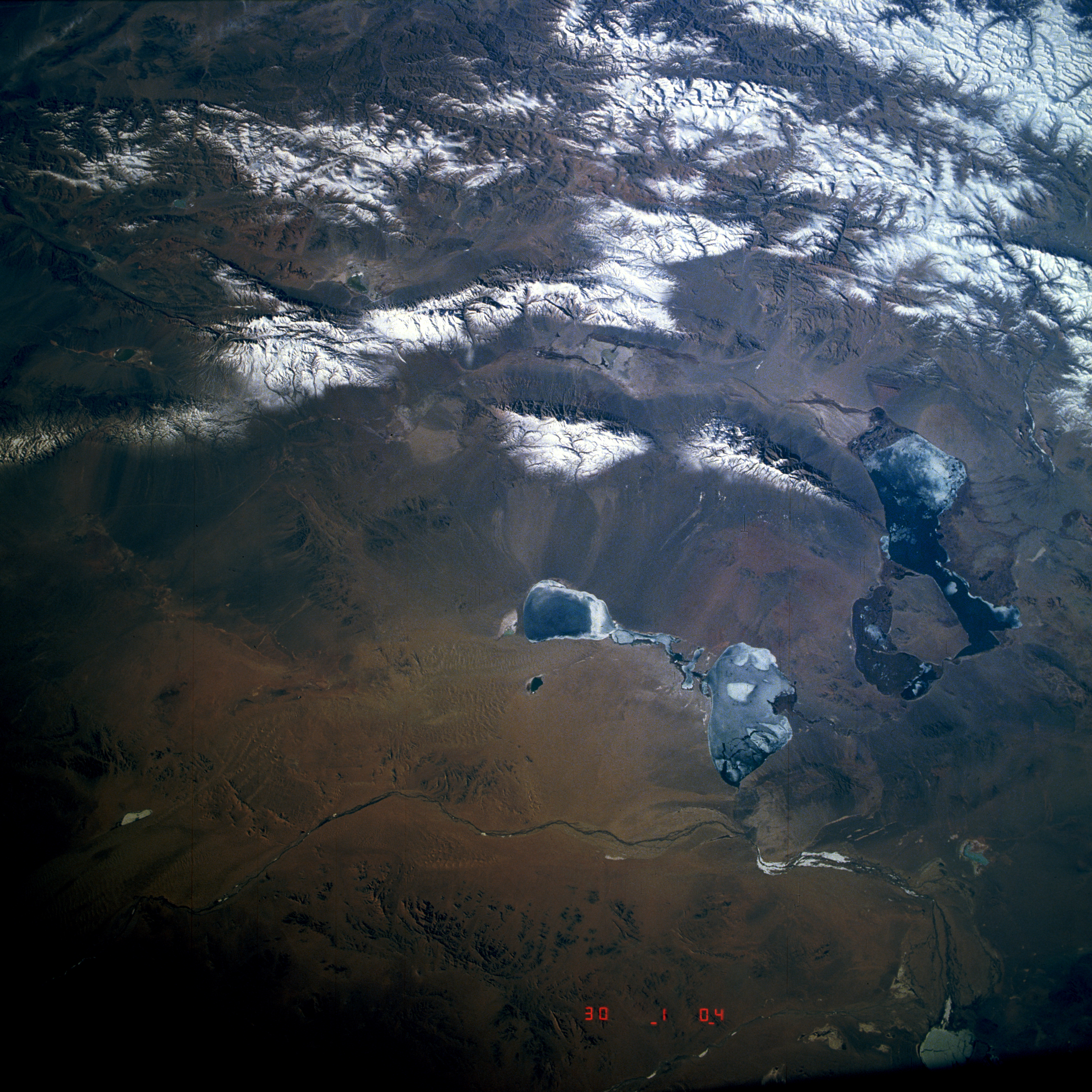
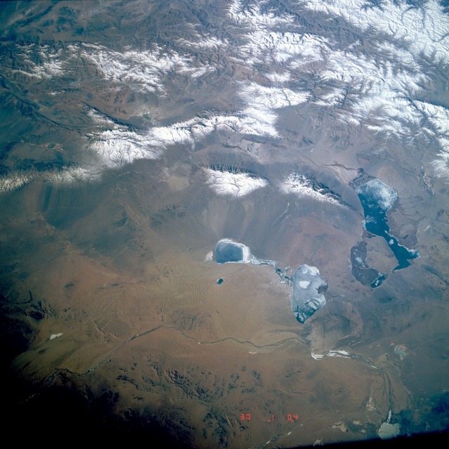
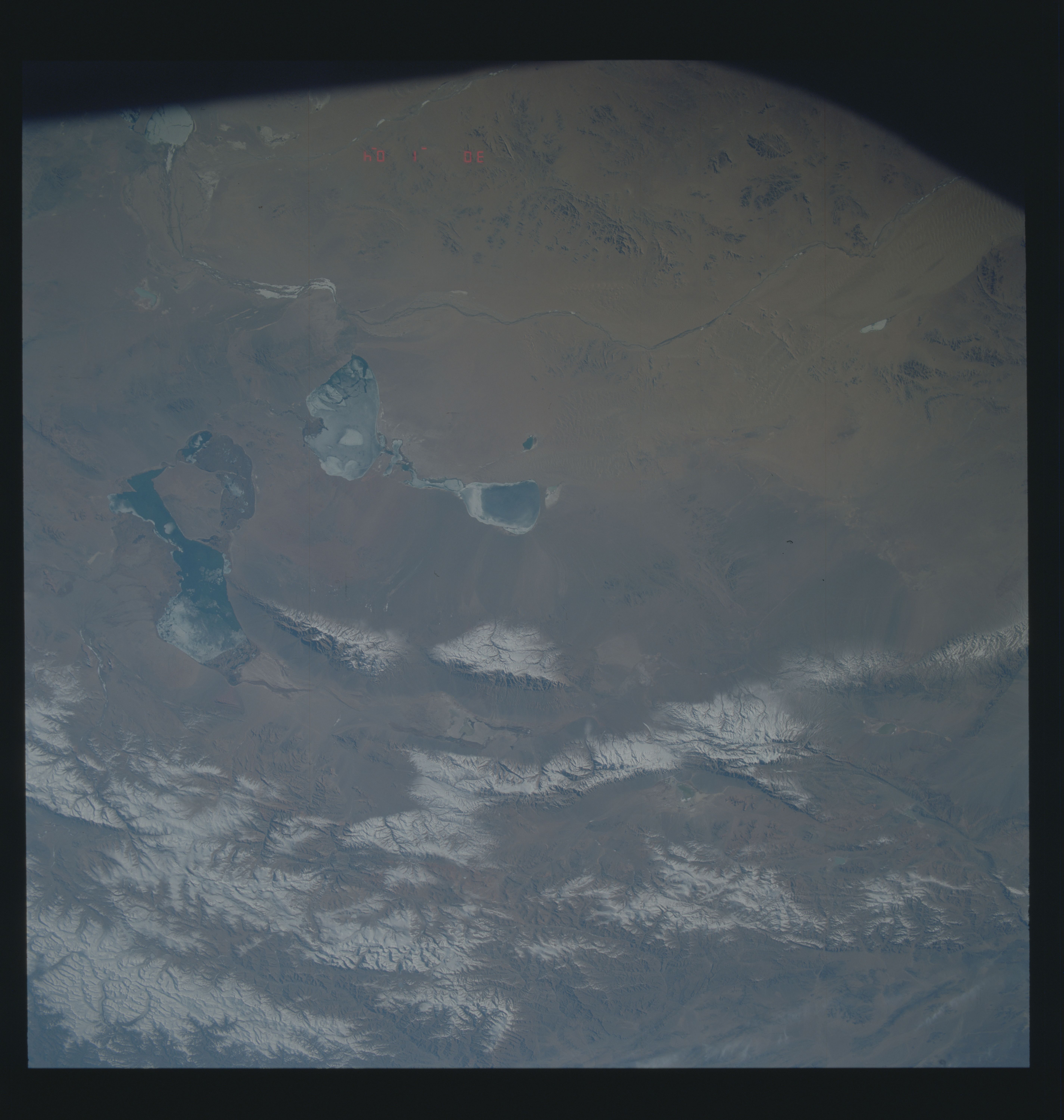
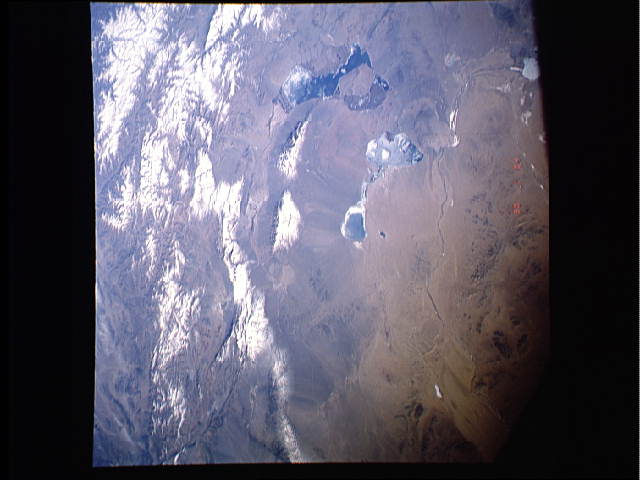
Image Caption: STS039-603-012 Altai Mountains, Mongolia May 1991
This south-southwest-looking, low-oblique photograph shows the central portion of the snow-covered Altai Mountains and the dry basin known as the Valley of the Lakes of northwestern Mongolia. The Altai Mountains are a complex, uplifted mountain system rich in deposits of gold, silver, mercury, iron, lead, zinc, and copper, but because of remoteness, many mineral resources have not been tapped fully. Precipitation in the basins is very sparse, but meltwater from glaciers feeds many small streams that descend into basins and form salt lakes. Winters are extremely cold, and summers can be very hot for short periods. Visible in this photograph are four salt lakes--Doroo Lake near the center of the photograph; Har Lake to its north; lobster-claw-shaped Har Us Lake, the largest of the lakes, whose length is almost 40 miles (64 kilometers); and Ayrag Lake to the far northeast into which the Dzavhan River empties.
This south-southwest-looking, low-oblique photograph shows the central portion of the snow-covered Altai Mountains and the dry basin known as the Valley of the Lakes of northwestern Mongolia. The Altai Mountains are a complex, uplifted mountain system rich in deposits of gold, silver, mercury, iron, lead, zinc, and copper, but because of remoteness, many mineral resources have not been tapped fully. Precipitation in the basins is very sparse, but meltwater from glaciers feeds many small streams that descend into basins and form salt lakes. Winters are extremely cold, and summers can be very hot for short periods. Visible in this photograph are four salt lakes--Doroo Lake near the center of the photograph; Har Lake to its north; lobster-claw-shaped Har Us Lake, the largest of the lakes, whose length is almost 40 miles (64 kilometers); and Ayrag Lake to the far northeast into which the Dzavhan River empties.
