STS039-602-46
| NASA Photo ID | STS039-602-46 |
| Focal Length | 100mm |
| Date taken | 1991.04.29 |
| Time taken | 14:34:00 GMT |
Resolutions offered for this image:
5197 x 5207 pixels 638 x 640 pixels 5700 x 6000 pixels 500 x 526 pixels 640 x 480 pixels
5197 x 5207 pixels 638 x 640 pixels 5700 x 6000 pixels 500 x 526 pixels 640 x 480 pixels


Cloud masks available for this image:
Spacecraft nadir point: 37.1° N, 122.1° W
Photo center point: 38.5° N, 118.5° W
Photo center point by machine learning:
Photo center point: 38.5° N, 118.5° W
Photo center point by machine learning:
Nadir to Photo Center: East
Spacecraft Altitude: 139 nautical miles (257km)
Country or Geographic Name: | USA-NEVADA |
Features: | MONO AND WALKER LAKES |
| Features Found Using Machine Learning: | |
Cloud Cover Percentage: | 5 (1-10)% |
Sun Elevation Angle: | 14° |
Sun Azimuth: | 82° |
Camera: | Rolleiflex |
Focal Length: | 100mm |
Camera Tilt: | Low Oblique |
Format: | 5017: Kodak, natural color positive, Ektachrome, X Professional, ASA 64, standard base |
Film Exposure: | Normal |
| Additional Information | |
| Width | Height | Annotated | Cropped | Purpose | Links |
|---|---|---|---|---|---|
| 5197 pixels | 5207 pixels | No | No | Earth From Space collection | Download Image |
| 638 pixels | 640 pixels | No | No | Earth From Space collection | Download Image |
| 5700 pixels | 6000 pixels | No | No | Download Image | |
| 500 pixels | 526 pixels | No | No | Download Image | |
| 640 pixels | 480 pixels | No | No | Download Image |
Download Packaged File
Download a Google Earth KML for this Image
View photo footprint information
Download a GeoTIFF for this photo
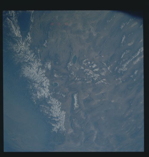
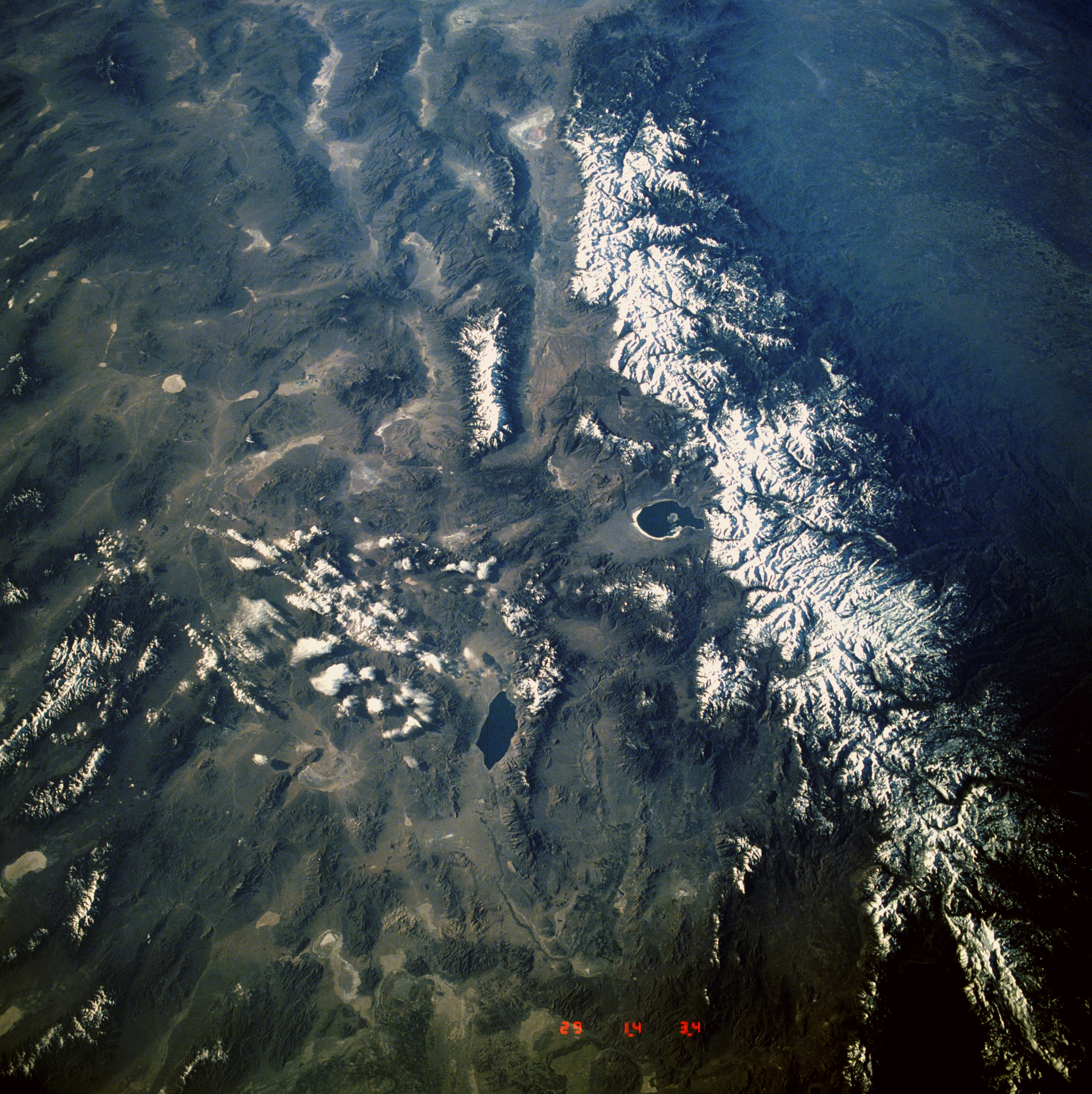
Image Caption: STS039-602-046 Sierra Nevada and Great Basin, California and Nevada, U.S.A. May 1991
The snow-covered Sierra Nevada, seen in this south-looking, low-oblique photograph, is the largest fault-block mountain range in the United States. Extending northwest-southeast, the mountain range, 400 miles (645 kilometers) long and 40 to 80 miles (65 to 130 kilometers) wide, rises sharply on its eastern side from the Great Basin, whereas its western slope descends gradually to the hills bordering the Central Valley of California (visible in the southwest corner of the photograph). Snow-fed streams supply irrigation water and generate hydroelectricity for the Central Valley and western Nevada. To the east of the Sierra Nevada, the western portions of the Great Basin can be seen. Aptly named because it sits between the Sierra Nevada to the west and the high Colorado Plateau and Wasatch Range to the east (not included in the photograph), the Great Basin comprises many smaller basins separated by fault-block mountain ranges rising 2000 to 3000 feet (600 to 900 meters) above the alluvium-filled floors of the basins. Three small bluish-colored lakes can be seen in the photograph. The southern portion of Lake Tahoe is barely discernible in the northwest corner of the photograph. East-southeast of Lake Tahoe is Walker Lake, and Mono Lake lies southeast of Lake Tahoe (near the center of the photograph).
The snow-covered Sierra Nevada, seen in this south-looking, low-oblique photograph, is the largest fault-block mountain range in the United States. Extending northwest-southeast, the mountain range, 400 miles (645 kilometers) long and 40 to 80 miles (65 to 130 kilometers) wide, rises sharply on its eastern side from the Great Basin, whereas its western slope descends gradually to the hills bordering the Central Valley of California (visible in the southwest corner of the photograph). Snow-fed streams supply irrigation water and generate hydroelectricity for the Central Valley and western Nevada. To the east of the Sierra Nevada, the western portions of the Great Basin can be seen. Aptly named because it sits between the Sierra Nevada to the west and the high Colorado Plateau and Wasatch Range to the east (not included in the photograph), the Great Basin comprises many smaller basins separated by fault-block mountain ranges rising 2000 to 3000 feet (600 to 900 meters) above the alluvium-filled floors of the basins. Three small bluish-colored lakes can be seen in the photograph. The southern portion of Lake Tahoe is barely discernible in the northwest corner of the photograph. East-southeast of Lake Tahoe is Walker Lake, and Mono Lake lies southeast of Lake Tahoe (near the center of the photograph).
