STS039-601-49
| NASA Photo ID | STS039-601-49 |
| Focal Length | 100mm |
| Date taken | 1991.04.29 |
| Time taken | 11:39:00 GMT |
Resolutions offered for this image:
5095 x 5095 pixels 640 x 640 pixels 5700 x 6000 pixels 500 x 526 pixels 640 x 480 pixels
5095 x 5095 pixels 640 x 640 pixels 5700 x 6000 pixels 500 x 526 pixels 640 x 480 pixels

Cloud masks available for this image:
Spacecraft nadir point: 48.4° N, 60.4° W
Photo center point:
Photo center point by machine learning:
Photo center point:
Photo center point by machine learning:
Nadir to Photo Center:
Spacecraft Altitude: 138 nautical miles (256km)
Country or Geographic Name: | CANADA-N |
Features: | JET STREAM, ICE FLOWS |
| Features Found Using Machine Learning: | |
Cloud Cover Percentage: | 50 (26-50)% |
Sun Elevation Angle: | 27° |
Sun Azimuth: | 99° |
Camera: | Rolleiflex |
Focal Length: | 100mm |
Camera Tilt: | High Oblique |
Format: | 5017: Kodak, natural color positive, Ektachrome, X Professional, ASA 64, standard base |
Film Exposure: | Normal |
| Additional Information | |
| Width | Height | Annotated | Cropped | Purpose | Links |
|---|---|---|---|---|---|
| 5095 pixels | 5095 pixels | No | No | Earth From Space collection | Download Image |
| 640 pixels | 640 pixels | No | No | Earth From Space collection | Download Image |
| 5700 pixels | 6000 pixels | No | No | Download Image | |
| 500 pixels | 526 pixels | No | No | Download Image | |
| 640 pixels | 480 pixels | No | No | Download Image |
Download Packaged File
Download a Google Earth KML for this Image
View photo footprint information
Download a GeoTIFF for this photo
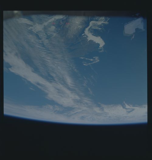
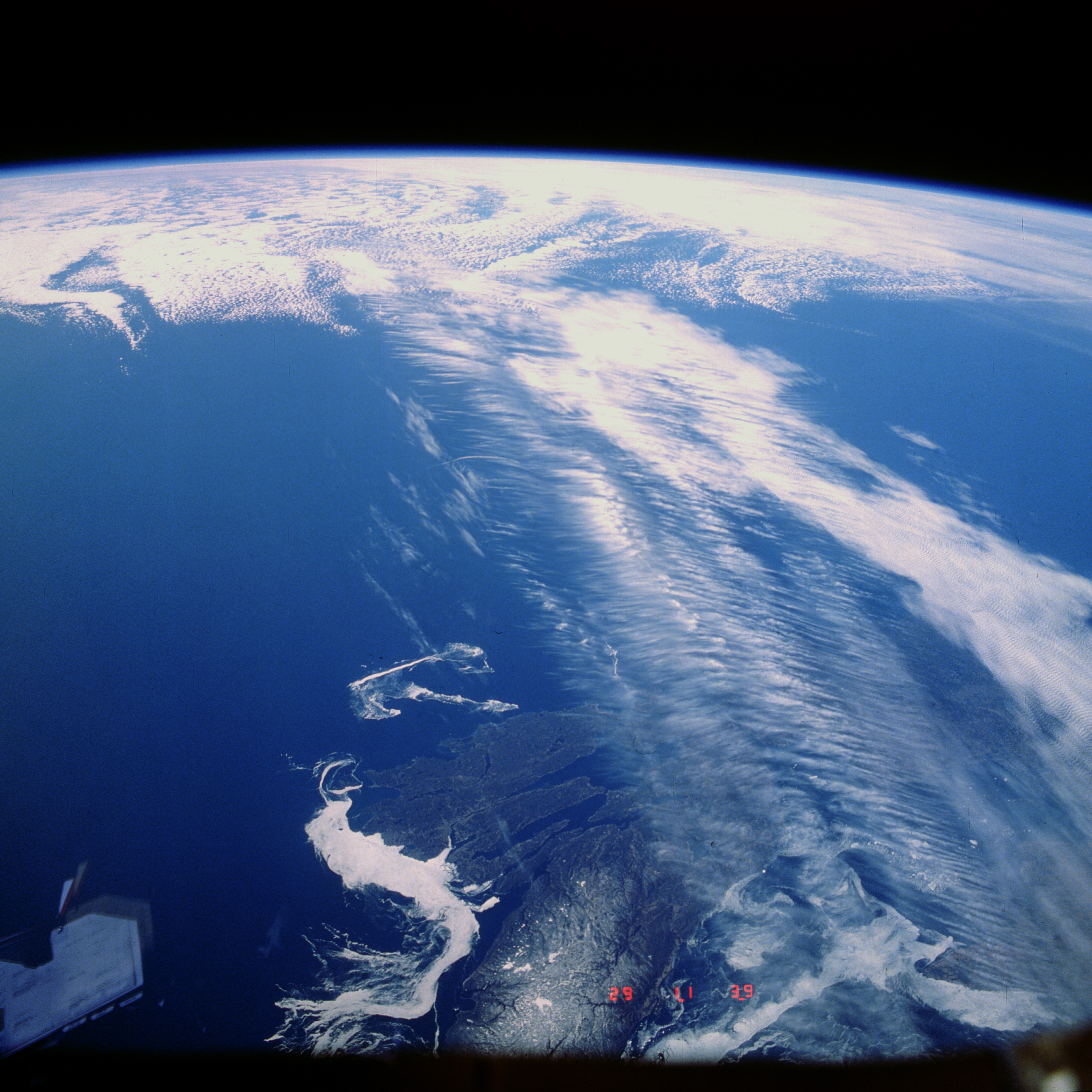
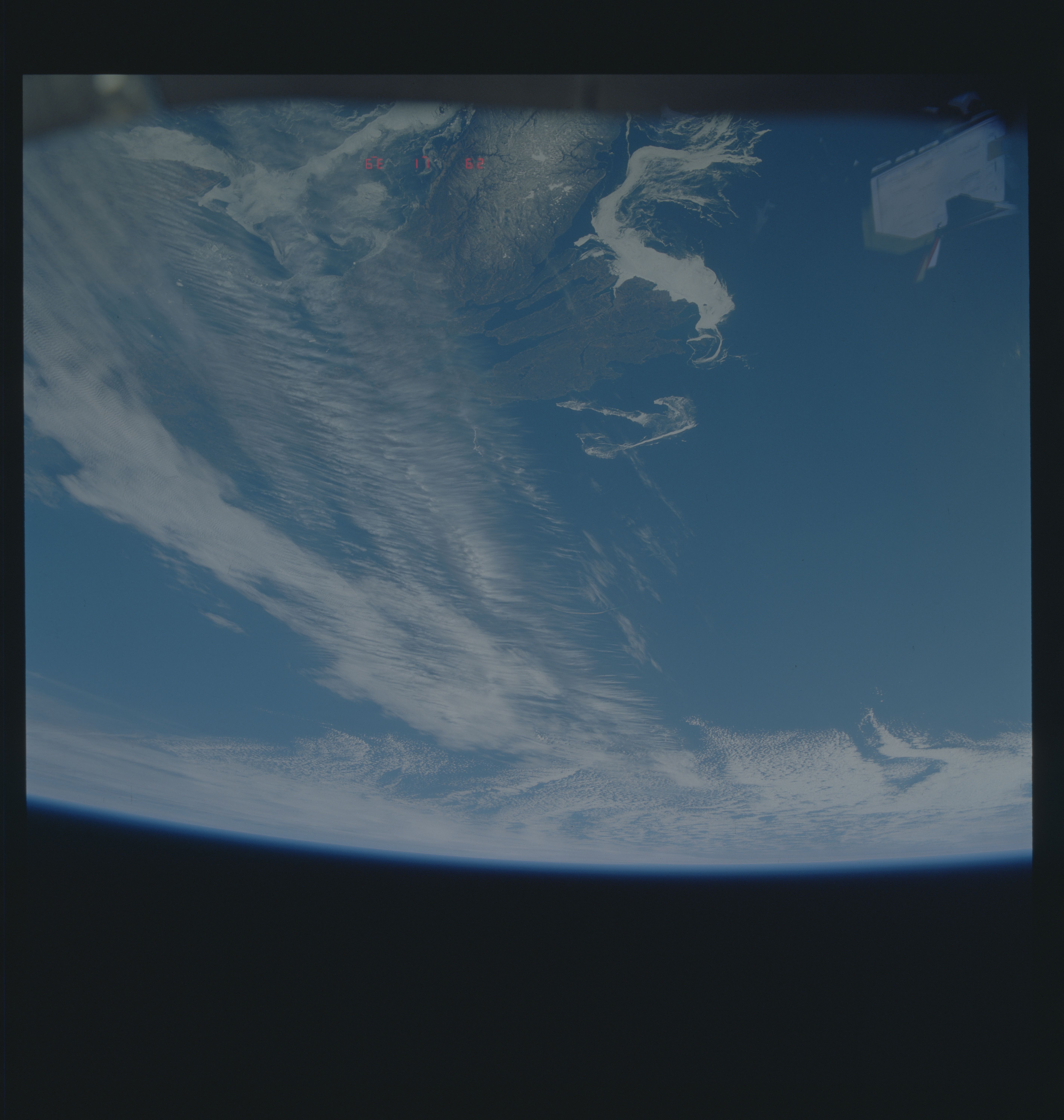
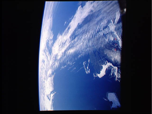
Image Caption: STS039-601-049 Jet Stream, Maritime Provinces, Canada May 1991
The Northern Hemisphere Jet Stream can be seen crossing Cape Breton Island in the Maritime Provinces of Eastern Canada. The Jet Stream is a narrow zone of high-speed winds typically found at altitudes of 4 to 8 miles (8-12 km) above the earth. They result from temperature contrasts between polar and tropical regions. The strongest Jet Stream winds are found in the winter when the contrast between polar and tropical regions is the greatest. Wind speeds can reach 90 to over 180 miles per hour (145 to over 290 km/h) from west to east. Jet Streams are found between latitudes 20 to near 55 north and south. During the winter months over the United States and southern Canada, the path taken by the Jet Stream can have a large influence on the weather conditions of this region.
The Northern Hemisphere Jet Stream can be seen crossing Cape Breton Island in the Maritime Provinces of Eastern Canada. The Jet Stream is a narrow zone of high-speed winds typically found at altitudes of 4 to 8 miles (8-12 km) above the earth. They result from temperature contrasts between polar and tropical regions. The strongest Jet Stream winds are found in the winter when the contrast between polar and tropical regions is the greatest. Wind speeds can reach 90 to over 180 miles per hour (145 to over 290 km/h) from west to east. Jet Streams are found between latitudes 20 to near 55 north and south. During the winter months over the United States and southern Canada, the path taken by the Jet Stream can have a large influence on the weather conditions of this region.
