STS039-151-172
| NASA Photo ID | STS039-151-172 |
| Focal Length | 250mm |
| Date taken | 1991.04.30 |
| Time taken | 20:48:27 GMT |
Resolutions offered for this image:
4096 x 3259 pixels 1142 x 907 pixels 5712 x 4513 pixels 640 x 505 pixels 3259 x 4096 pixels 640 x 480 pixels 2258 x 2827 pixels
4096 x 3259 pixels 1142 x 907 pixels 5712 x 4513 pixels 640 x 505 pixels 3259 x 4096 pixels 640 x 480 pixels 2258 x 2827 pixels

Cloud masks available for this image:
Spacecraft nadir point: 33.2° N, 97.3° W
Photo center point: 32.5° N, 97.0° W
Photo center point by machine learning:
Photo center point: 32.5° N, 97.0° W
Photo center point by machine learning:
Nadir to Photo Center: South
Spacecraft Altitude: 139 nautical miles (257km)
Country or Geographic Name: | USA-TEXAS |
Features: | DALLAS-FORT WORTH AREA |
| Features Found Using Machine Learning: | |
Cloud Cover Percentage: | 5 (1-10)% |
Sun Elevation Angle: | 53° |
Sun Azimuth: | 244° |
Camera: | Linhof |
Focal Length: | 250mm |
Camera Tilt: | 18 degrees |
Format: | QX868: Kodak, natural color positive, Ektachrome QX868(5017 emulsion), ASA 64, thin base |
Film Exposure: | Normal |
| Additional Information | |
| Width | Height | Annotated | Cropped | Purpose | Links |
|---|---|---|---|---|---|
| 4096 pixels | 3259 pixels | Cities collection | Download Image | ||
| 1142 pixels | 907 pixels | No | No | Cities collection | Download Image |
| 5712 pixels | 4513 pixels | No | No | Earth From Space collection | Download Image |
| 640 pixels | 505 pixels | No | No | Earth From Space collection | Download Image |
| 3259 pixels | 4096 pixels | No | No | Download Image | |
| 640 pixels | 480 pixels | No | No | ISD 1 | Download Image |
| 2258 pixels | 2827 pixels | No | No | Download Image |
Download Packaged File
Download a Google Earth KML for this Image
View photo footprint information
Download a GeoTIFF for this photo
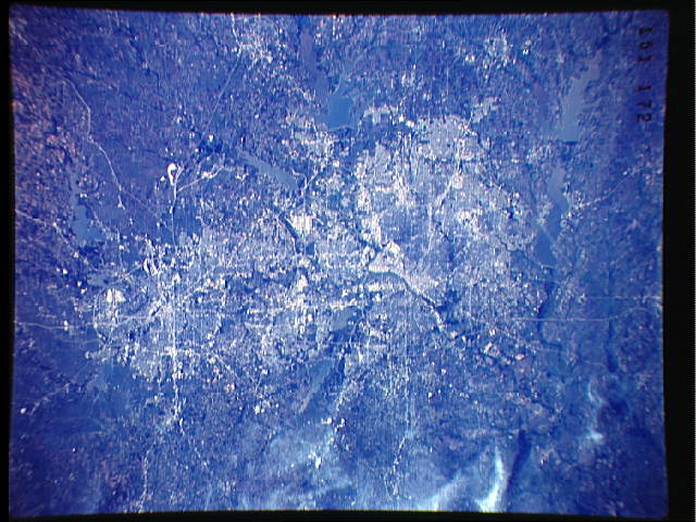
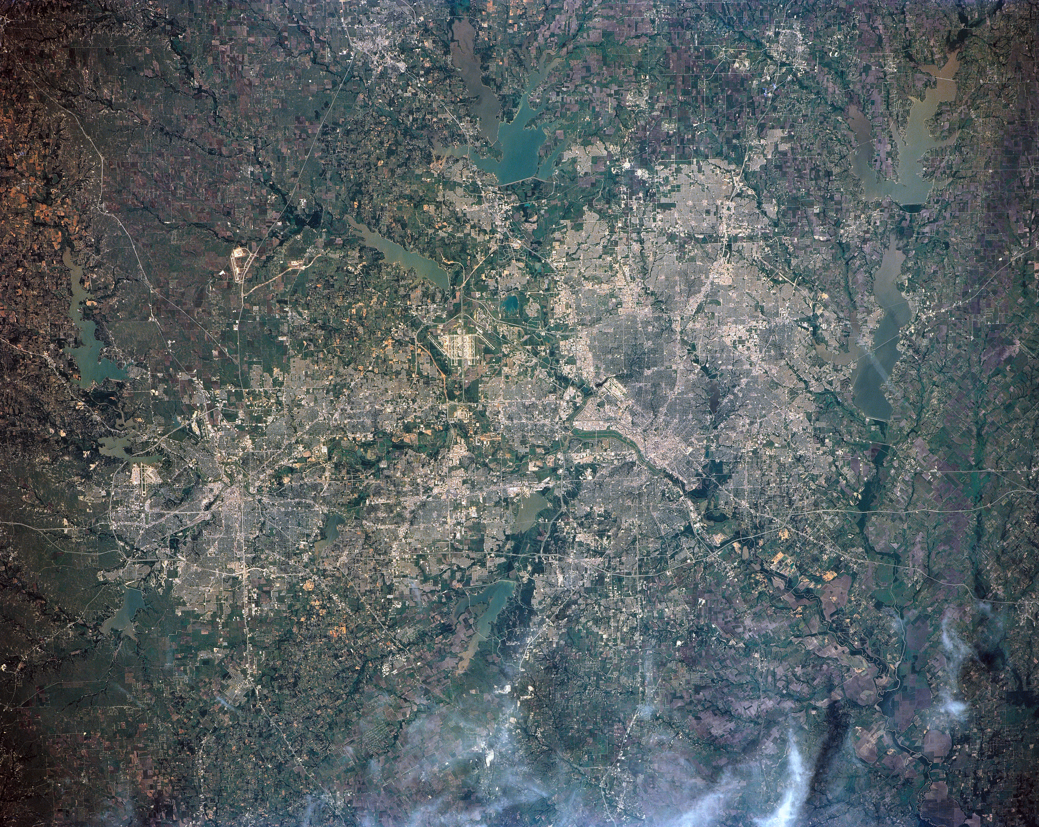
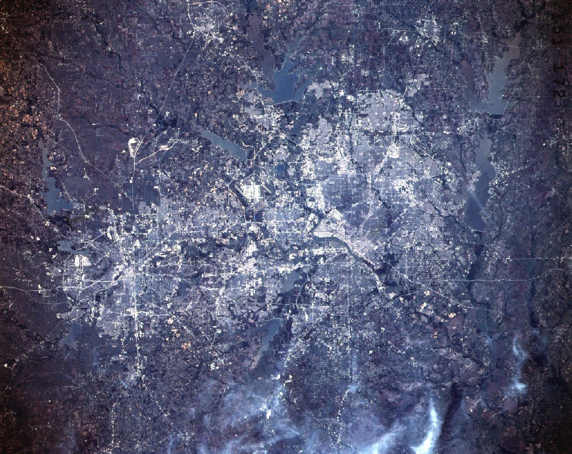
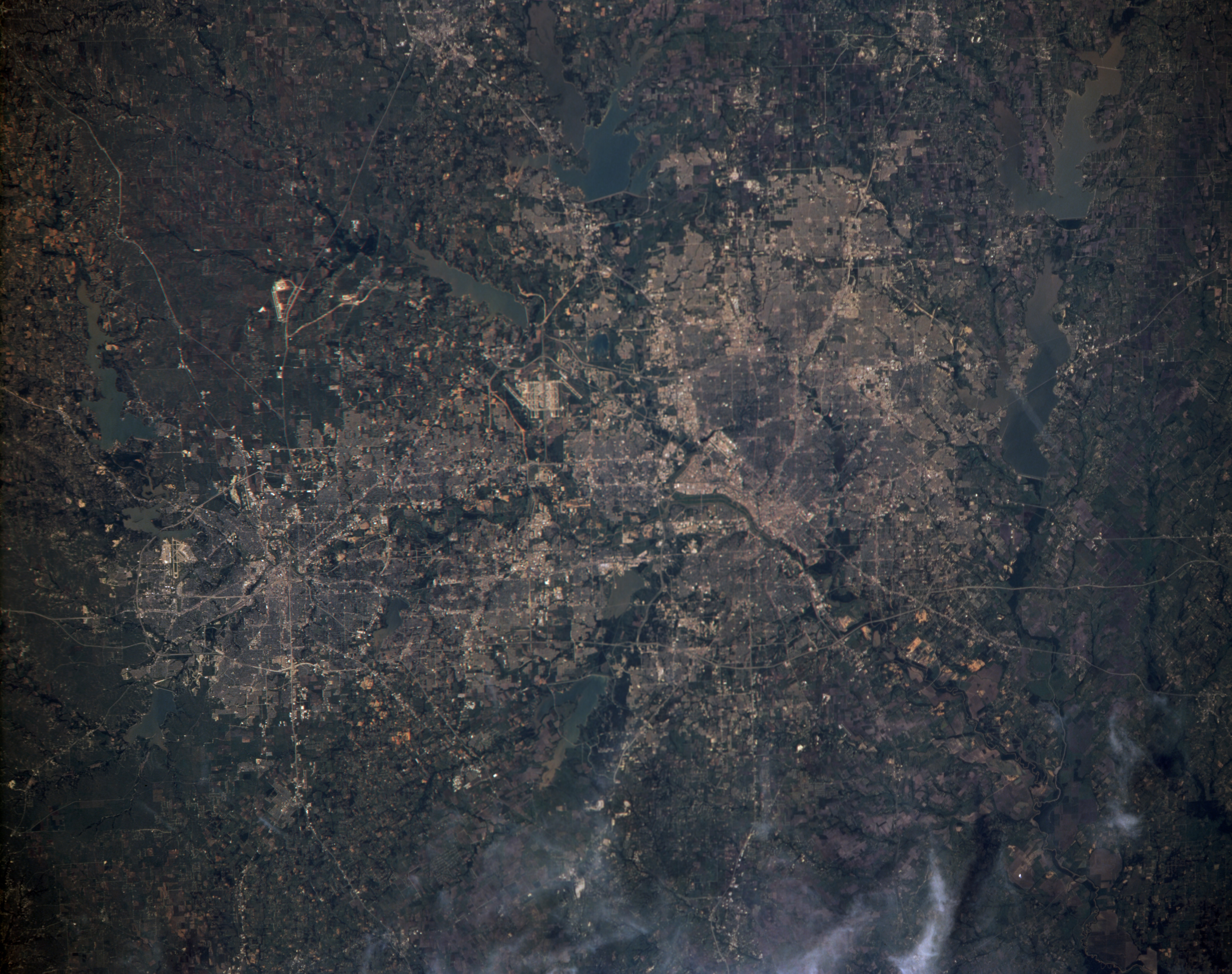
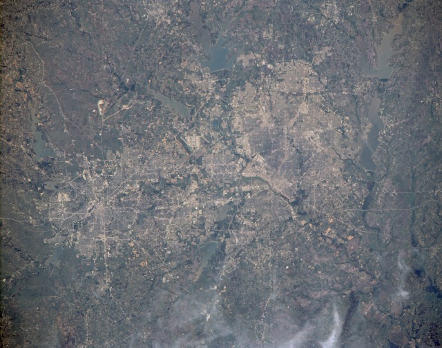
Image Caption: STS039-151-172 Dallas-Fort Worth Metroplex, Texas, U.S.A. April 1991
The sprawling Dallas-Fort Worth metroplex is shown in this near-vertical photograph. Near the center of the photograph, situated between Dallas to the east and Fort Worth to the west, is Dallas-Fort Worth International Airport (DFW), one of the largest commercial airports in the world. The communities between Dallas and Fort Worth, which are 33 miles (53 kilometers) apart, have grown rapidly since the 1970s, adding to the metroplex's standing as a leading commercial, financial, transportation, agricultural, and oil-producing center in the southwest United States. Many interstate highways can be seen running in all directions throughout the metroplex. Agricultural field patterns and numerous lakes and reservoirs fringe the metroplex. Clockwise from Lewisville Reservoir at "noon," the lakes visible in the photograph include Lake Ray Hubbard (just east of Dallas), Lake Lavon (northeast of Dallas), Lewisville Reservoir (northwest of Dallas), Grapevine Reservoir (just north of DFW), Eagle Mountain Lake (northwest of Fort Worth), Lake Worth (just north of Carswell Air Force Base in Fort Worth), Benbrook Lake (southwest of Fort Worth), Lake Arlington (southeast of Fort Worth), Mountain Creek Lake (southwest edge of Dallas), and Joe Pool Lake (an elongated lake just south of Mountain Creek Lake).
In this best ever view of Dallas and Ft. Worth, Texas, USA (32.5N, 97.0W) the detail is good enough to use as a road map of the major highways throughout the area. The new Dallas/Ft. Worth International Airport is near the center of the scene. Almost twenty lakes and reservoirs in the area, reflecting the recent heavy spring rainfall, by their high water levels, are easily delineated in the view.
