STS038-86-14
| NASA Photo ID | STS038-86-14 |
| Focal Length | 250mm |
| Date taken | 1990.11.18 |
| Time taken | 21:51:10 GMT |
Resolutions offered for this image:
3904 x 3830 pixels 639 x 627 pixels 5700 x 6000 pixels 500 x 526 pixels 640 x 480 pixels
3904 x 3830 pixels 639 x 627 pixels 5700 x 6000 pixels 500 x 526 pixels 640 x 480 pixels


Cloud masks available for this image:
Spacecraft nadir point: 26.5° N, 97.9° W
Photo center point: 26.5° N, 97.0° W
Photo center point by machine learning:
Photo center point: 26.5° N, 97.0° W
Photo center point by machine learning:
Nadir to Photo Center: East
Spacecraft Altitude: 116 nautical miles (215km)
Country or Geographic Name: | USA-TEXAS |
Features: | LAGUNA MADRE |
| Features Found Using Machine Learning: | |
Cloud Cover Percentage: | 0 (no clouds present) |
Sun Elevation Angle: | 21° |
Sun Azimuth: | 234° |
Camera: | Hasselblad |
Focal Length: | 250mm |
Camera Tilt: | 25 degrees |
Format: | 5017: Kodak, natural color positive, Ektachrome, X Professional, ASA 64, standard base |
Film Exposure: | Normal |
| Additional Information | |
| Width | Height | Annotated | Cropped | Purpose | Links |
|---|---|---|---|---|---|
| 3904 pixels | 3830 pixels | No | No | Earth From Space collection | Download Image |
| 639 pixels | 627 pixels | No | No | Earth From Space collection | Download Image |
| 5700 pixels | 6000 pixels | No | No | Download Image | |
| 500 pixels | 526 pixels | No | No | Download Image | |
| 640 pixels | 480 pixels | No | No | Download Image |
Download Packaged File
Download a Google Earth KML for this Image
View photo footprint information
Download a GeoTIFF for this photo
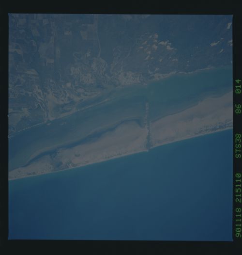
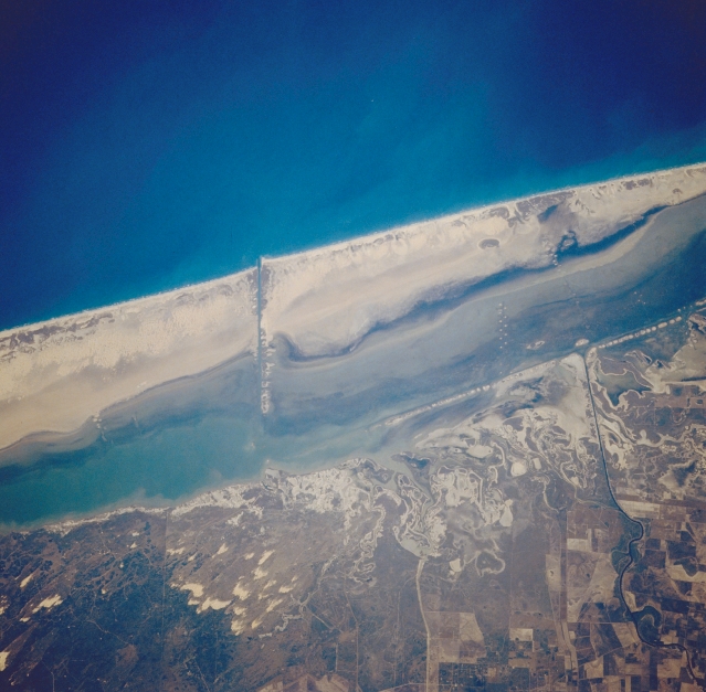
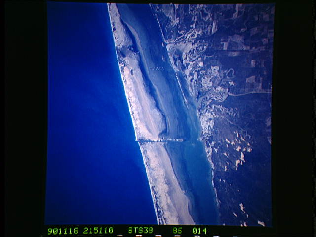
Image Caption: STS038-86-14 Padre Island, Texas, U.S.A. November 1990
Featured in this photograph is a small section of Padre Island, an elongated, sandy barrier island in the Gulf of Mexico just north of Brownsville. This barrier island, which separates the Texas mainland from the Gulf of Mexico, creates Laguna Madre, a wide lagoon that produces a dynamic, ever-changing, sandy landscape. Pockets of sand dunes are apparent inland from the coast (bottom center). Two linear features are discernible--the Intracoastal Waterway between Padre Island and the mainland and an east-west-oriented dredged canal that cuts through the island. Cultivated field patterns are visible (lower right corner).
Near-vertical view of southern Padre Island centered on the Mansfield Cut. Excellent depiction of sediment patterns in Laguna Madre, dune vegetation on Padre Island, eastern edge of the coastal dune field onshore.
