STS038-86-104
| NASA Photo ID | STS038-86-104 |
| Focal Length | 250mm |
| Date taken | 1990.11.19 |
| Time taken | 04:55:47 GMT |
Resolutions offered for this image:
6876 x 6876 pixels 639 x 639 pixels 5700 x 6000 pixels 500 x 526 pixels 640 x 480 pixels 657 x 640 pixels
6876 x 6876 pixels 639 x 639 pixels 5700 x 6000 pixels 500 x 526 pixels 640 x 480 pixels 657 x 640 pixels


Cloud masks available for this image:
Spacecraft nadir point: 8.0° S, 72.4° E
Photo center point: 7.5° S, 72.5° E
Photo center point by machine learning:
Photo center point: 7.5° S, 72.5° E
Photo center point by machine learning:
Nadir to Photo Center: North
Spacecraft Altitude: 130 nautical miles (241km)
Country or Geographic Name: | CHAGOS ARCHIPELAGO |
Features: | DIEGO GARCIA |
| Features Found Using Machine Learning: | |
Cloud Cover Percentage: | 45 (26-50)% |
Sun Elevation Angle: | 59° |
Sun Azimuth: | 115° |
Camera: | Hasselblad |
Focal Length: | 250mm |
Camera Tilt: | 13 degrees |
Format: | 5017: Kodak, natural color positive, Ektachrome, X Professional, ASA 64, standard base |
Film Exposure: | Normal |
| Additional Information | |
| Width | Height | Annotated | Cropped | Purpose | Links |
|---|---|---|---|---|---|
| 6876 pixels | 6876 pixels | No | No | Earth From Space collection | Download Image |
| 639 pixels | 639 pixels | No | No | Earth From Space collection | Download Image |
| 5700 pixels | 6000 pixels | No | No | Download Image | |
| 500 pixels | 526 pixels | No | No | Download Image | |
| 640 pixels | 480 pixels | No | No | Download Image | |
| 657 pixels | 640 pixels | No | No | Download Image |
Download Packaged File
Download a Google Earth KML for this Image
View photo footprint information
Download a GeoTIFF for this photo
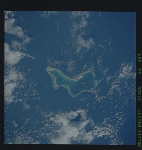
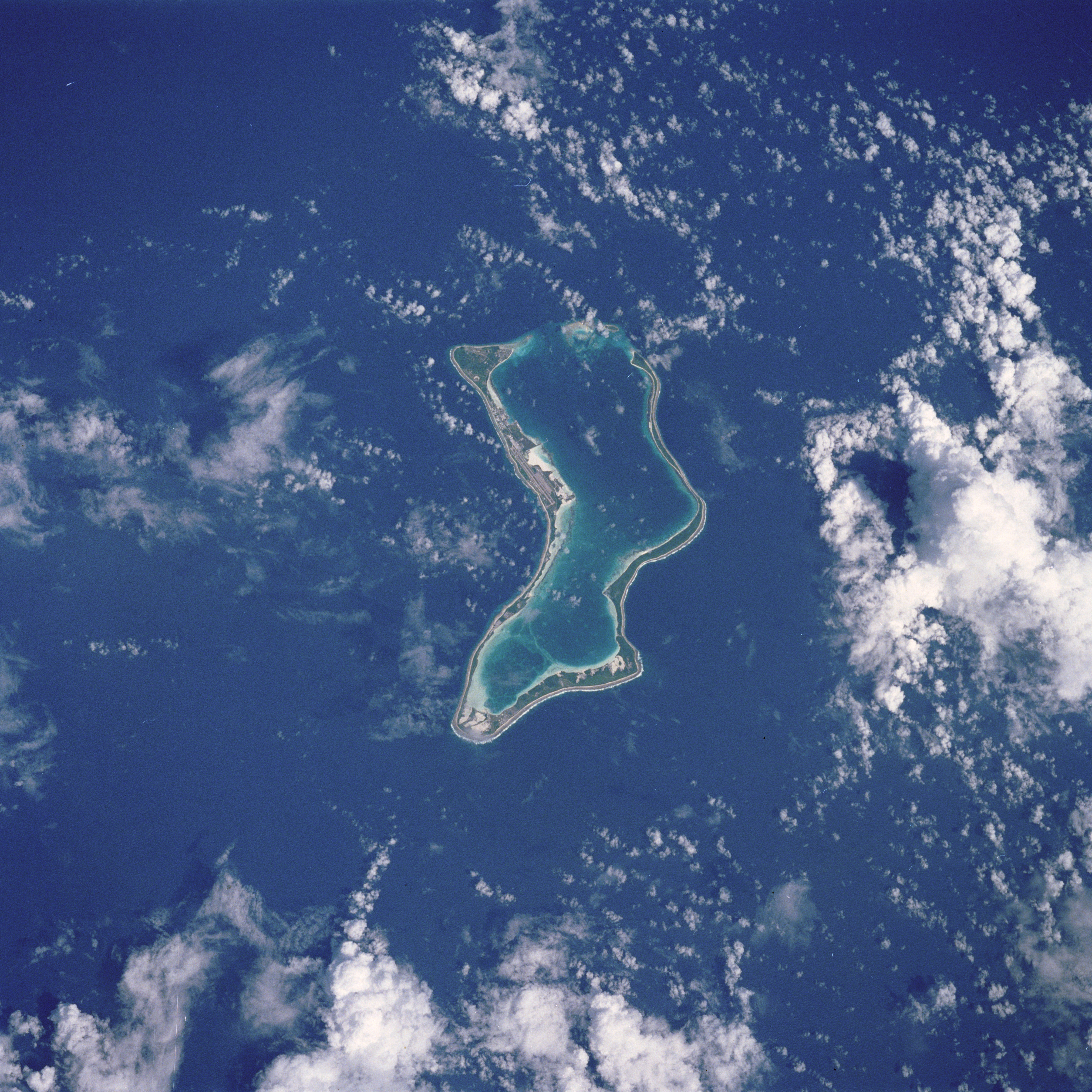
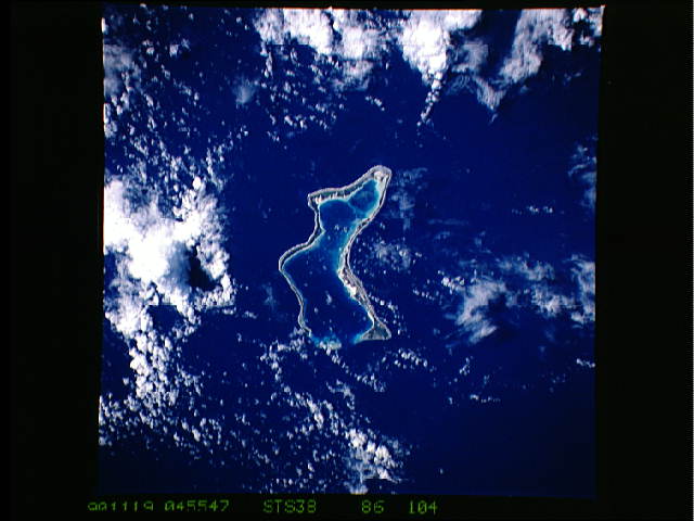
Image Caption: STS038-086-104 Diego Garcia, Chagos Archipelago November 1990
The largest of the coral atolls of the Chagos Archipelago, Diego Garcia, is visible in this northwest-looking view. Diego Garcia is approximately 350 miles (560 km) south of the Maldive Islands in the central Indian Ocean. The crescent shape of the coral island encloses a lagoon that forms the harbor. Diego Garcia is the site of a large Anglo-American Naval Air and Communications facility located on the northwest part of the atoll.
The largest of the coral atolls of the Chagos Archipelago, Diego Garcia, is visible in this northwest-looking view. Diego Garcia is approximately 350 miles (560 km) south of the Maldive Islands in the central Indian Ocean. The crescent shape of the coral island encloses a lagoon that forms the harbor. Diego Garcia is the site of a large Anglo-American Naval Air and Communications facility located on the northwest part of the atoll.
