STS038-85-104
| NASA Photo ID | STS038-85-104 |
| Focal Length | 250mm |
| Date taken | 1990.11.18 |
| Time taken | 20:20:14 GMT |
Resolutions offered for this image:
3904 x 3856 pixels 639 x 632 pixels 5700 x 6000 pixels 500 x 526 pixels 640 x 480 pixels 5186 x 4927 pixels
3904 x 3856 pixels 639 x 632 pixels 5700 x 6000 pixels 500 x 526 pixels 640 x 480 pixels 5186 x 4927 pixels

Cloud masks available for this image:
Spacecraft nadir point: 25.0° N, 82.0° W
Photo center point: 24.5° N, 81.5° W
Photo center point by machine learning:
Photo center point: 24.5° N, 81.5° W
Photo center point by machine learning:
Nadir to Photo Center: Southeast
Spacecraft Altitude: 116 nautical miles (215km)
Country or Geographic Name: | USA-FLORIDA |
Features: | FLORIDA KEYS |
| Features Found Using Machine Learning: | |
Cloud Cover Percentage: | 0 (no clouds present) |
Sun Elevation Angle: | 27° |
Sun Azimuth: | 230° |
Camera: | Hasselblad |
Focal Length: | 250mm |
Camera Tilt: | 20 degrees |
Format: | 5017: Kodak, natural color positive, Ektachrome, X Professional, ASA 64, standard base |
Film Exposure: | Normal |
| Additional Information | |
| Width | Height | Annotated | Cropped | Purpose | Links |
|---|---|---|---|---|---|
| 3904 pixels | 3856 pixels | No | No | Earth From Space collection | Download Image |
| 639 pixels | 632 pixels | No | No | Earth From Space collection | Download Image |
| 5700 pixels | 6000 pixels | No | No | Download Image | |
| 500 pixels | 526 pixels | No | No | Download Image | |
| 640 pixels | 480 pixels | No | No | Download Image | |
| 5186 pixels | 4927 pixels | Yes | Reef RS | Download Image |
Download Packaged File
Download a Google Earth KML for this Image
View photo footprint information
Download a GeoTIFF for this photo
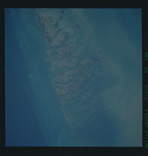
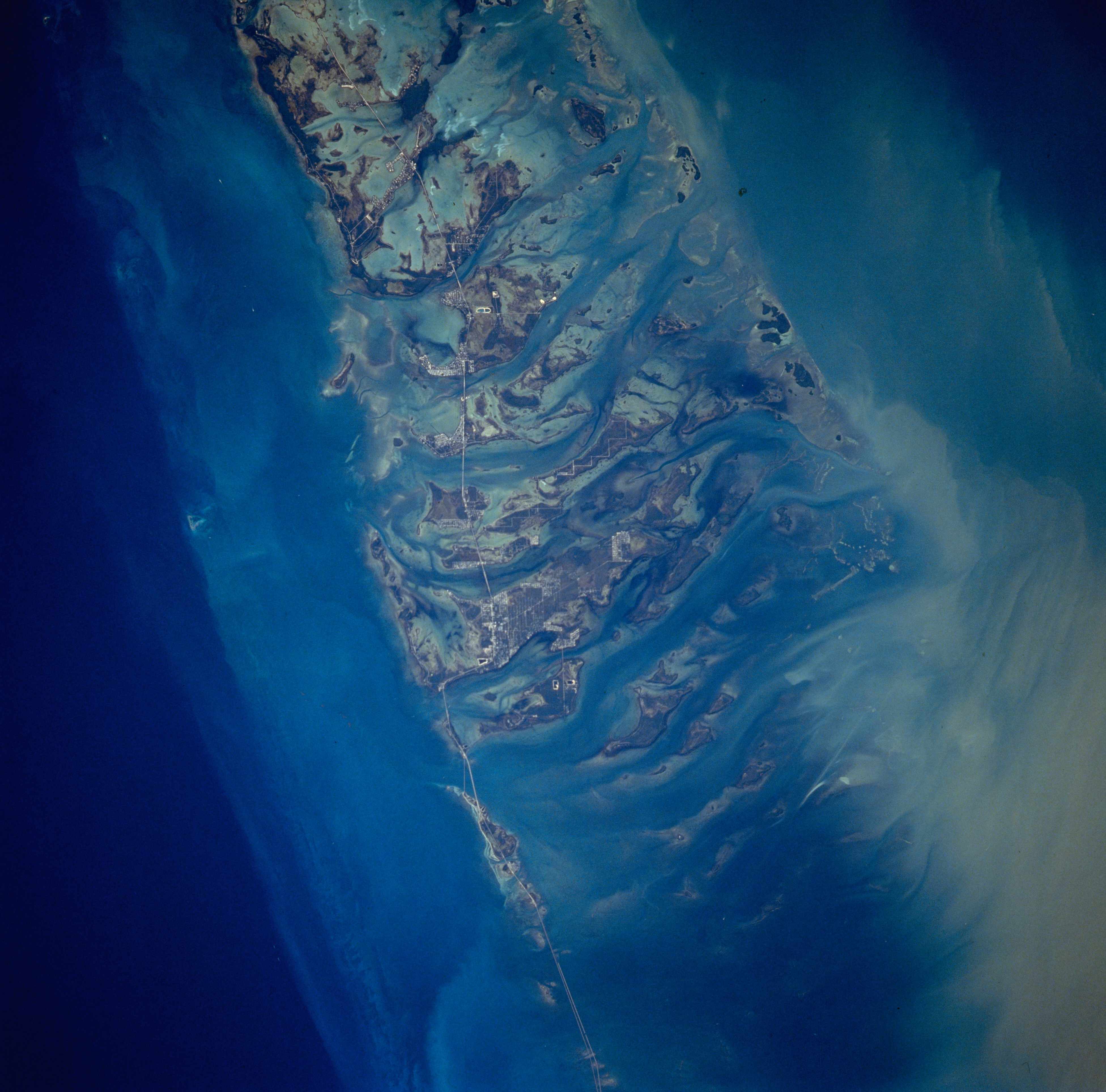
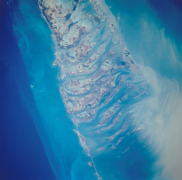
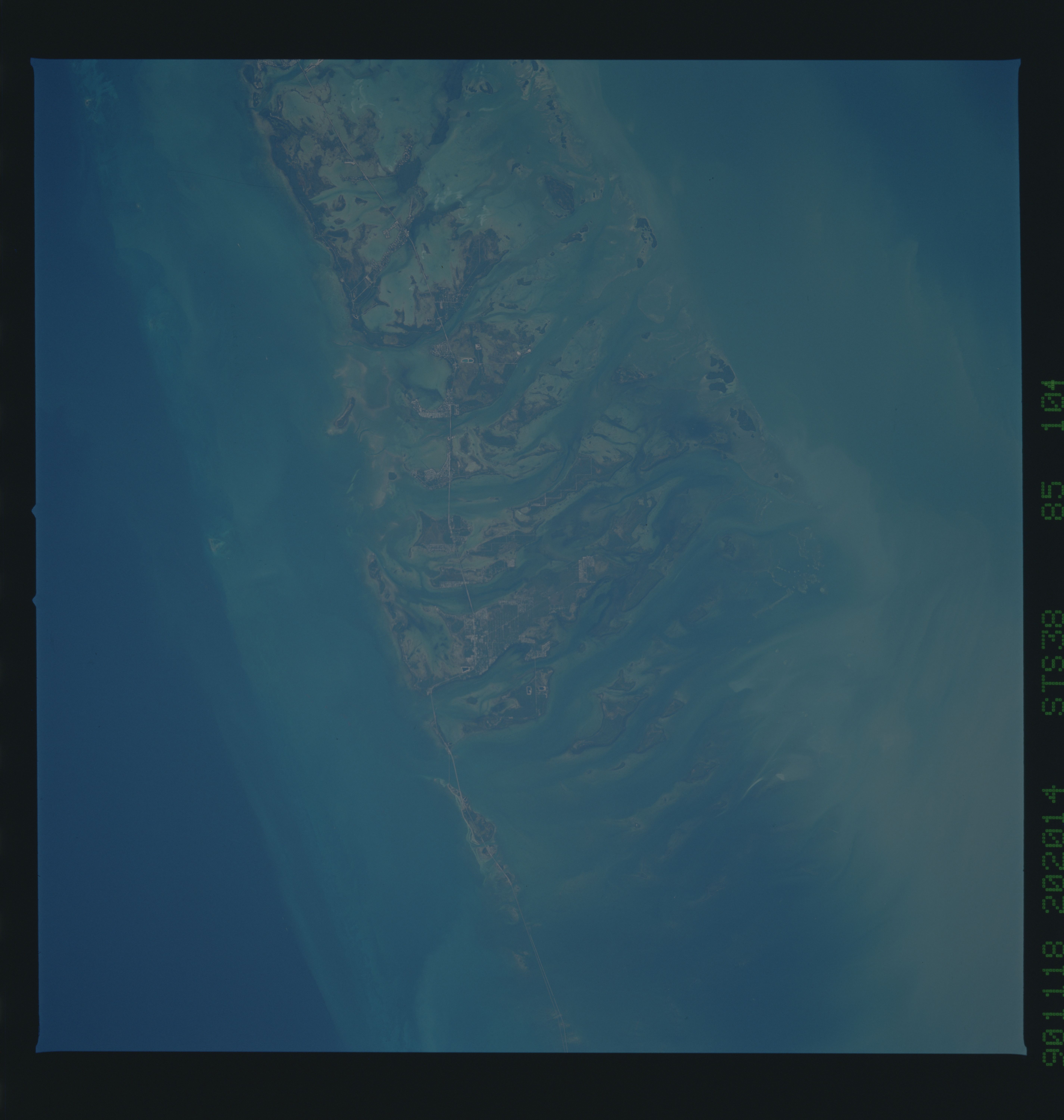
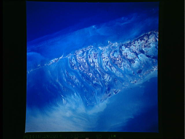
Image Caption: STS-038-085-104 Florida Keys, Florida, U.S.A. November 1990
The Florida Keys, a line of narrow, low islands that begins at Key Largo extend in a gently curving, southwesterly arc along U. S. Highway 1 to Key West. Visible in this photograph are keys from Big Pine Key (near bottom center) to Sugarloaf Key (top center). Atlantic Ocean and Gulf of Mexico tides cut numerous channels through the coral and granular limestone sand (oolite) to create the islands (keys), which have thick growths of mangrove (darker areas) and many bays. The sediment plumes appear to be moving northwesterly into the Gulf of Mexico from the southeast (Atlantic Ocean). Because of the clarity of water throughout the region, water depth can be determined by different shades of blue--deeper water is darker and shallow water is lighter. In many instances these colors can represent differences in depth of tens to hundreds of feet (meters).
The Florida Keys, a line of narrow, low islands that begins at Key Largo extend in a gently curving, southwesterly arc along U. S. Highway 1 to Key West. Visible in this photograph are keys from Big Pine Key (near bottom center) to Sugarloaf Key (top center). Atlantic Ocean and Gulf of Mexico tides cut numerous channels through the coral and granular limestone sand (oolite) to create the islands (keys), which have thick growths of mangrove (darker areas) and many bays. The sediment plumes appear to be moving northwesterly into the Gulf of Mexico from the southeast (Atlantic Ocean). Because of the clarity of water throughout the region, water depth can be determined by different shades of blue--deeper water is darker and shallow water is lighter. In many instances these colors can represent differences in depth of tens to hundreds of feet (meters).
