STS038-83-15
| NASA Photo ID | STS038-83-15 |
| Focal Length | 100mm |
| Date taken | 1990.11.18 |
| Time taken | 09:47:32 GMT |
Resolutions offered for this image:
4032 x 4032 pixels 640 x 640 pixels 5700 x 6000 pixels 500 x 526 pixels 640 x 480 pixels 2511 x 2521 pixels 648 x 646 pixels
4032 x 4032 pixels 640 x 640 pixels 5700 x 6000 pixels 500 x 526 pixels 640 x 480 pixels 2511 x 2521 pixels 648 x 646 pixels


Cloud masks available for this image:
Spacecraft nadir point: 12.6° N, 45.5° E
Photo center point: 13.0° N, 45.0° E
Photo center point by machine learning:
Photo center point: 13.0° N, 45.0° E
Photo center point by machine learning:
Nadir to Photo Center: Northwest
Spacecraft Altitude: 121 nautical miles (224km)
Camera: | Hasselblad |
Focal Length: | 100mm |
Camera Tilt: | 18 degrees |
Format: | 5017: Kodak, natural color positive, Ektachrome, X Professional, ASA 64, standard base |
Film Exposure: | Normal |
| Additional Information | |
| Width | Height | Annotated | Cropped | Purpose | Links |
|---|---|---|---|---|---|
| 4032 pixels | 4032 pixels | No | No | Earth From Space collection | Download Image |
| 640 pixels | 640 pixels | No | No | Earth From Space collection | Download Image |
| 5700 pixels | 6000 pixels | No | No | Download Image | |
| 500 pixels | 526 pixels | No | No | Download Image | |
| 640 pixels | 480 pixels | No | No | Download Image | |
| 2511 pixels | 2521 pixels | No | No | ReefBase 2 | Download Image |
| 648 pixels | 646 pixels | No | No | Download Image |
Download Packaged File
Download a Google Earth KML for this Image
View photo footprint information
Download a GeoTIFF for this photo
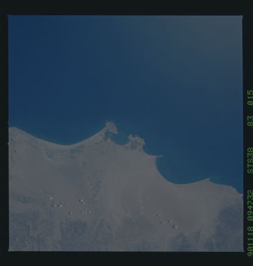
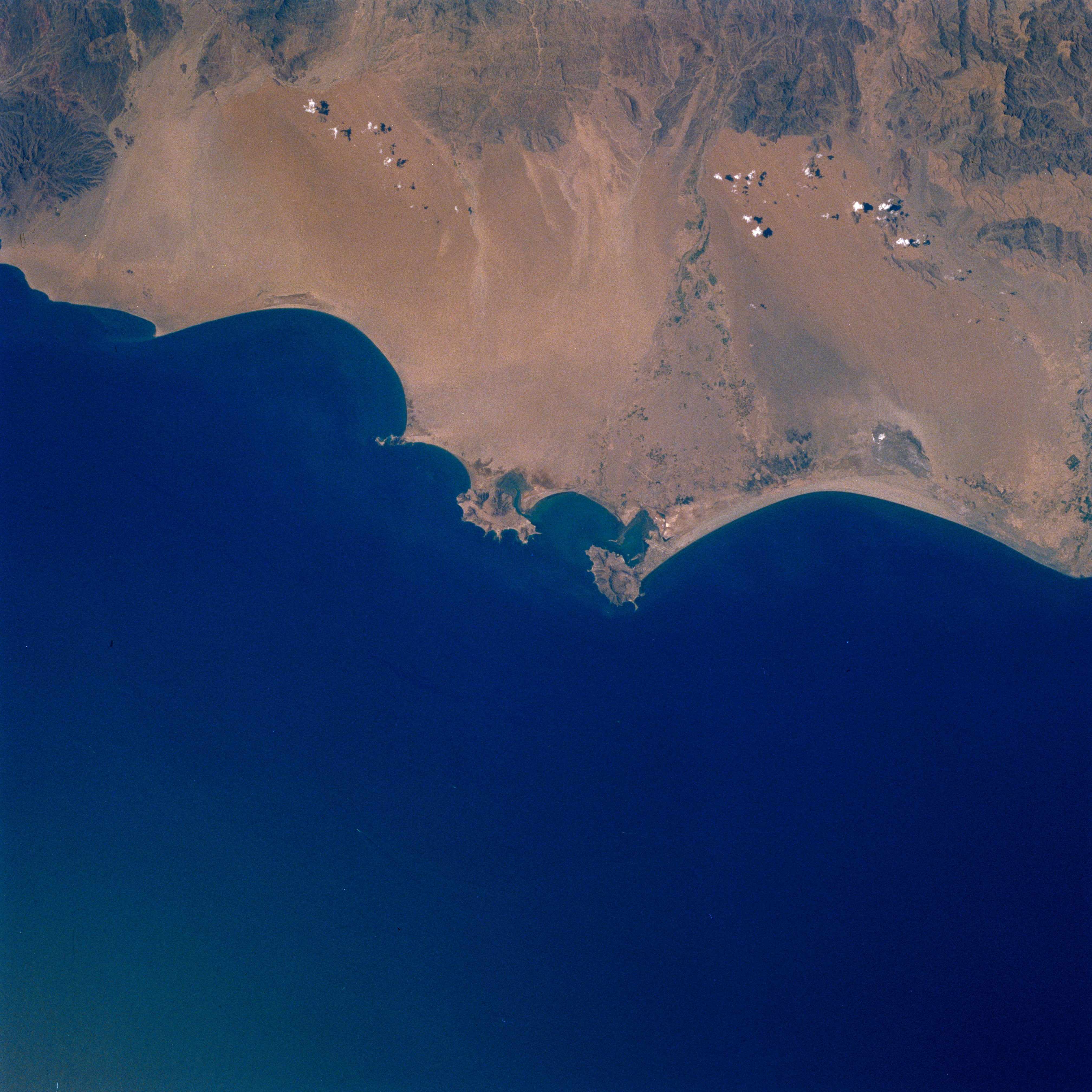
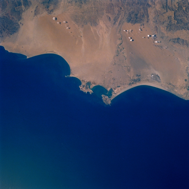
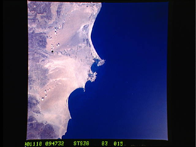
Image Caption: STS038-083-015 Krytar Coast, Aden, Yemen November 1990
The narrow, arid Krytar Coast and the important coastal city of Aden can be seen in this northwest-looking view. The southern Asir Mountains are visible across the top portion of the image. The waters of the Gulf of Aden covers the bottom half of the image. Strategically located just to the east of the Strait of Mandab, the entrance into the Red Sea (not on image), the city of Aden (near the center of the image) is the capital and chief port of southern Yemen. It has a large oil refinery and industries that manufacture soap, cigarettes, and salt. The city and its major port is a major refueling stop for ships and a trading center. Numerous wadis (waterways), which can carry water to the coast during the short rainy season, can be seen coming out of the mountains to the north and reaching southward toward the Gulf of Aden. The irrigated area along the right center of the image is part of a river valley that extends to the coast and the city of Zinjibar.
The narrow, arid Krytar Coast and the important coastal city of Aden can be seen in this northwest-looking view. The southern Asir Mountains are visible across the top portion of the image. The waters of the Gulf of Aden covers the bottom half of the image. Strategically located just to the east of the Strait of Mandab, the entrance into the Red Sea (not on image), the city of Aden (near the center of the image) is the capital and chief port of southern Yemen. It has a large oil refinery and industries that manufacture soap, cigarettes, and salt. The city and its major port is a major refueling stop for ships and a trading center. Numerous wadis (waterways), which can carry water to the coast during the short rainy season, can be seen coming out of the mountains to the north and reaching southward toward the Gulf of Aden. The irrigated area along the right center of the image is part of a river valley that extends to the coast and the city of Zinjibar.
