STS037-84-61
| NASA Photo ID | STS037-84-61 |
| Focal Length | 250mm |
| Date taken | 1991.04.__ |
| Time taken | GMT |
Resolutions offered for this image:
5212 x 5212 pixels 640 x 640 pixels 5700 x 6000 pixels 500 x 526 pixels 640 x 480 pixels
5212 x 5212 pixels 640 x 640 pixels 5700 x 6000 pixels 500 x 526 pixels 640 x 480 pixels

Cloud masks available for this image:
Spacecraft nadir point:
Photo center point: 14.5° N, 17.5° W
Photo center point by machine learning:
Photo center point: 14.5° N, 17.5° W
Photo center point by machine learning:
Nadir to Photo Center:
Spacecraft Altitude: nautical miles (0km)
Country or Geographic Name: | SENEGAL |
Features: | DAKAR |
| Features Found Using Machine Learning: | |
Cloud Cover Percentage: | 0 (no clouds present) |
Sun Elevation Angle: | ° |
Sun Azimuth: | ° |
Camera: | Hasselblad |
Focal Length: | 250mm |
Camera Tilt: | Near Vertical |
Format: | 5017: Kodak, natural color positive, Ektachrome, X Professional, ASA 64, standard base |
Film Exposure: | Normal |
| Additional Information | |
| Width | Height | Annotated | Cropped | Purpose | Links |
|---|---|---|---|---|---|
| 5212 pixels | 5212 pixels | No | No | Earth From Space collection | Download Image |
| 640 pixels | 640 pixels | No | No | Earth From Space collection | Download Image |
| 5700 pixels | 6000 pixels | No | No | Download Image | |
| 500 pixels | 526 pixels | No | No | Download Image | |
| 640 pixels | 480 pixels | No | No | Download Image |
Download Packaged File
Download a Google Earth KML for this Image
View photo footprint information
Download a GeoTIFF for this photo
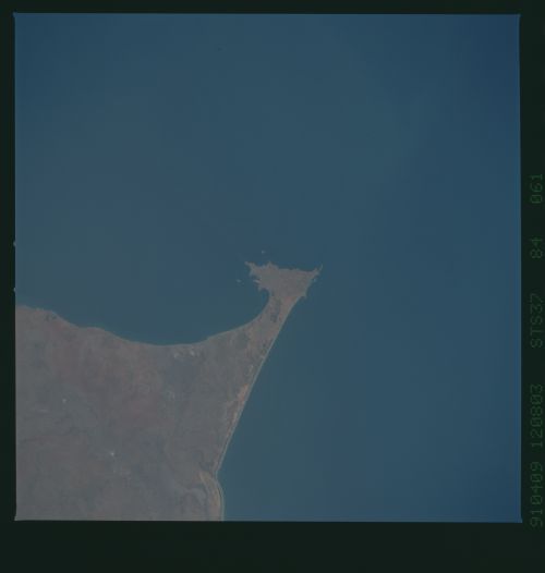
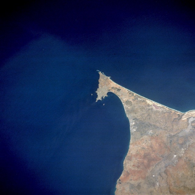
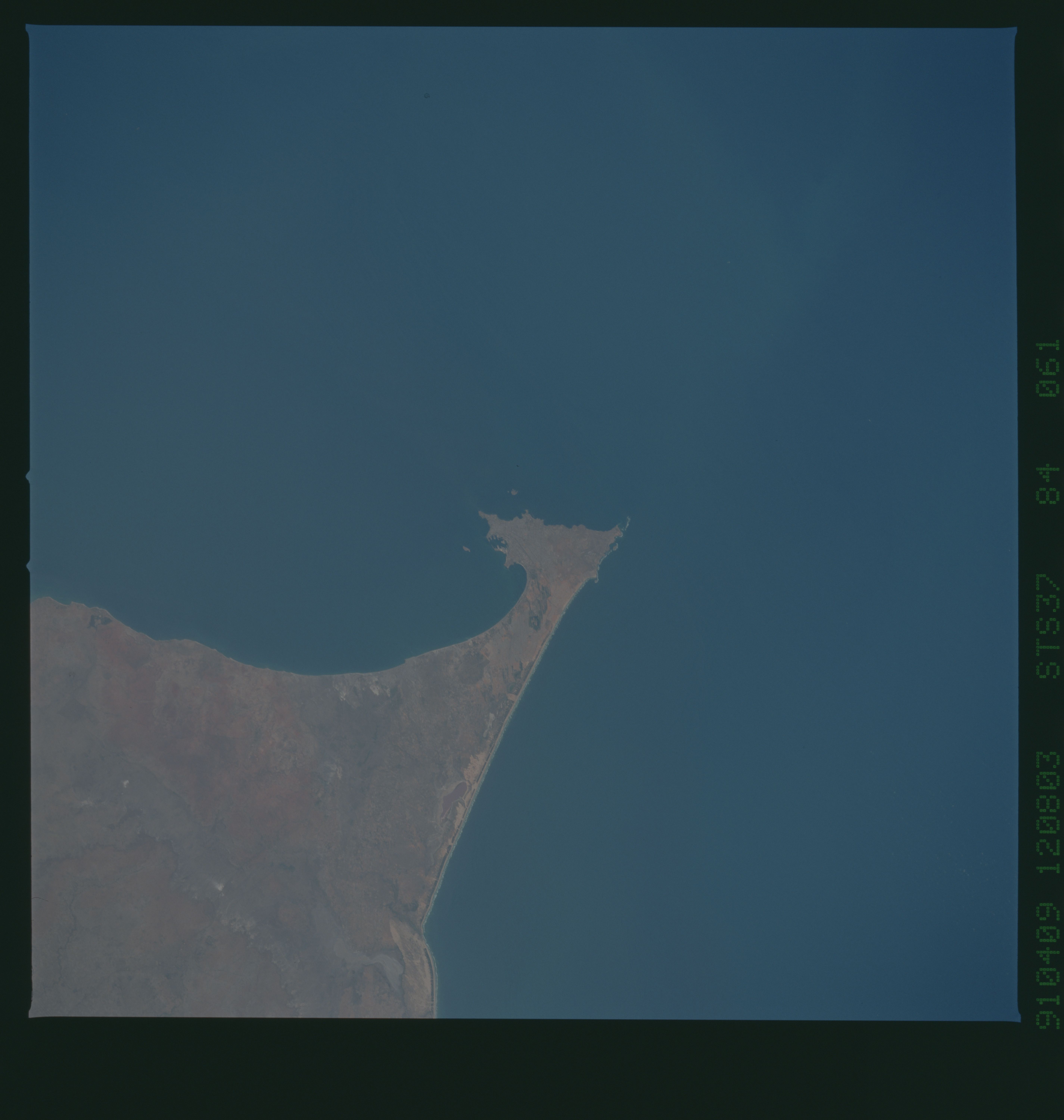
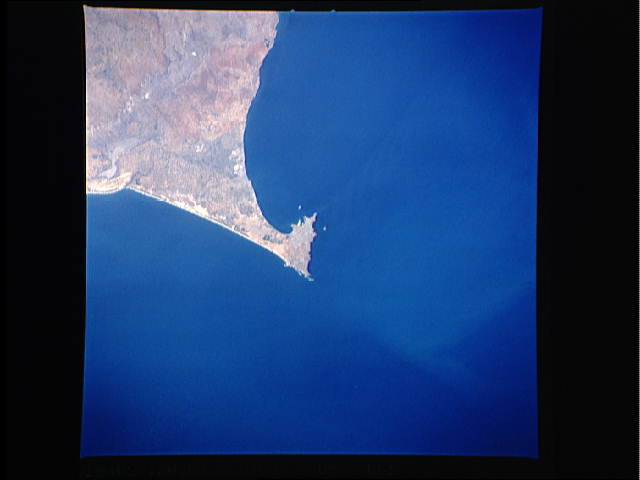
Image Caption: STS037-084-061 Dakar, Senegal April 1991
Dakar, the capital of Senegal, appears in this northeast-looking, low-oblique photograph. The city, with a population of almost 2 million on the southern tip of the Cape Verde Peninsula, has one of the best harbors on the Atlantic coast of Africa. Dakar has several distinctions--it is the westernmost point of the African continent, the African city closest to South America, the sub-Saharan port nearest to western Europe, and an important station on the western trade route to and from South Africa. Dakar's strategic location has made it an intercontinental maritime and air center, as well as an international rail terminus for Africa. Manufacturing industries include refined sugar, peanut oil, fertilizers, cement, textiles, fishing products, food processing, and handicrafts. Dakar is blessed with some of the finest medical facilities in Africa, including the Pasteur Institute.
Dakar, the capital of Senegal, appears in this northeast-looking, low-oblique photograph. The city, with a population of almost 2 million on the southern tip of the Cape Verde Peninsula, has one of the best harbors on the Atlantic coast of Africa. Dakar has several distinctions--it is the westernmost point of the African continent, the African city closest to South America, the sub-Saharan port nearest to western Europe, and an important station on the western trade route to and from South Africa. Dakar's strategic location has made it an intercontinental maritime and air center, as well as an international rail terminus for Africa. Manufacturing industries include refined sugar, peanut oil, fertilizers, cement, textiles, fishing products, food processing, and handicrafts. Dakar is blessed with some of the finest medical facilities in Africa, including the Pasteur Institute.
