STS037-84-3
| NASA Photo ID | STS037-84-3 |
| Focal Length | 250mm |
| Date taken | 1991.04.__ |
| Time taken | GMT |
Resolutions offered for this image:
5321 x 5321 pixels 639 x 639 pixels 5700 x 6000 pixels 500 x 526 pixels 640 x 480 pixels
5321 x 5321 pixels 639 x 639 pixels 5700 x 6000 pixels 500 x 526 pixels 640 x 480 pixels
Cloud masks available for this image:
Spacecraft nadir point:
Photo center point: 12.0° N, 37.5° E
Photo center point by machine learning:
Photo center point: 12.0° N, 37.5° E
Photo center point by machine learning:
Nadir to Photo Center:
Spacecraft Altitude: nautical miles (0km)
Country or Geographic Name: | ETHIOPIA |
Features: | LAKE TANA |
| Features Found Using Machine Learning: | |
Cloud Cover Percentage: | 5 (1-10)% |
Sun Elevation Angle: | ° |
Sun Azimuth: | ° |
Camera: | Hasselblad |
Focal Length: | 250mm |
Camera Tilt: | Low Oblique |
Format: | 5017: Kodak, natural color positive, Ektachrome, X Professional, ASA 64, standard base |
Film Exposure: | Normal |
| Additional Information | |
| Width | Height | Annotated | Cropped | Purpose | Links |
|---|---|---|---|---|---|
| 5321 pixels | 5321 pixels | No | No | Earth From Space collection | Download Image |
| 639 pixels | 639 pixels | No | No | Earth From Space collection | Download Image |
| 5700 pixels | 6000 pixels | No | No | Download Image | |
| 500 pixels | 526 pixels | No | No | Download Image | |
| 640 pixels | 480 pixels | No | No | Download Image |
Download Packaged File
Download a Google Earth KML for this Image
View photo footprint information
Download a GeoTIFF for this photo
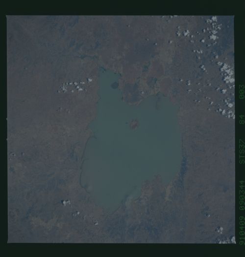
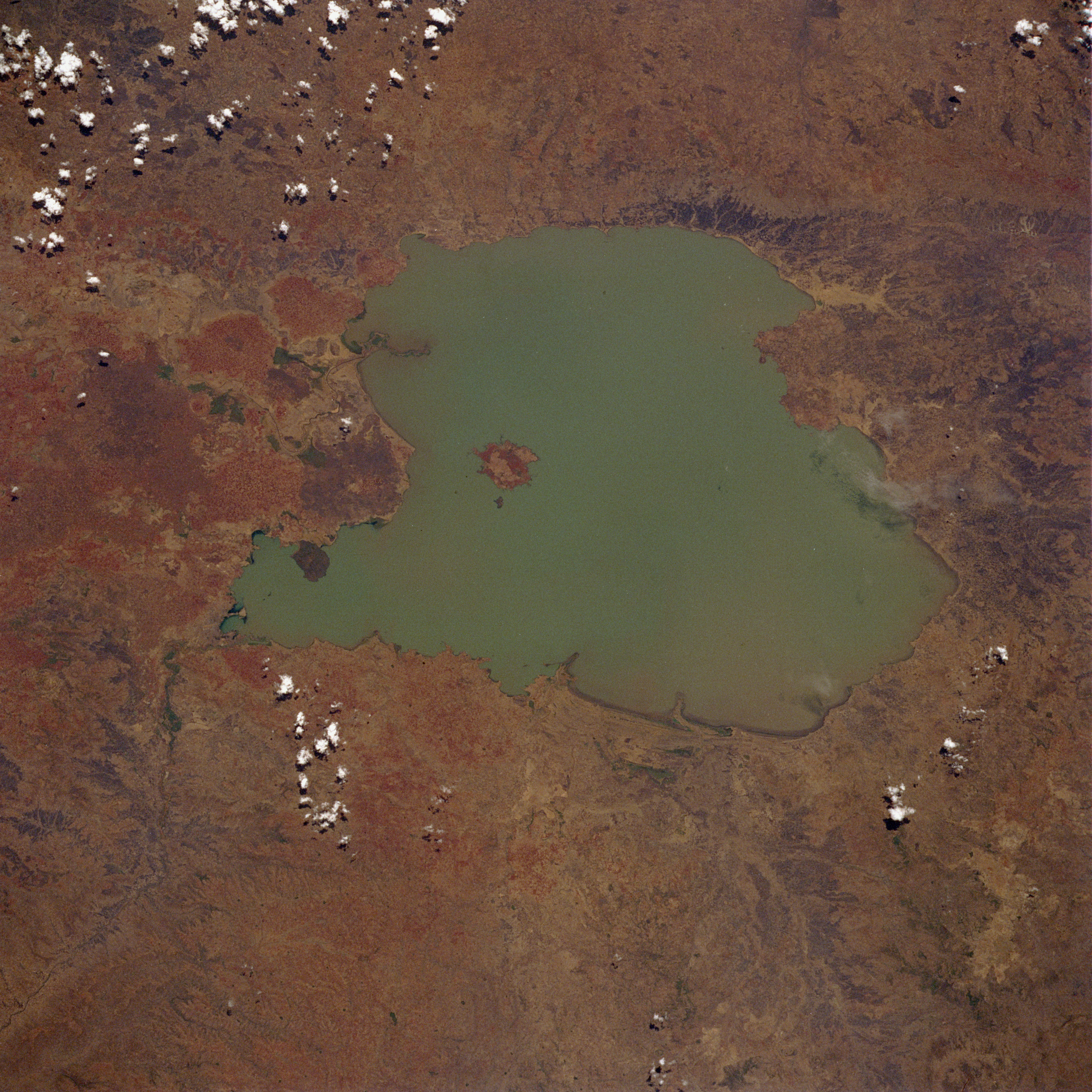
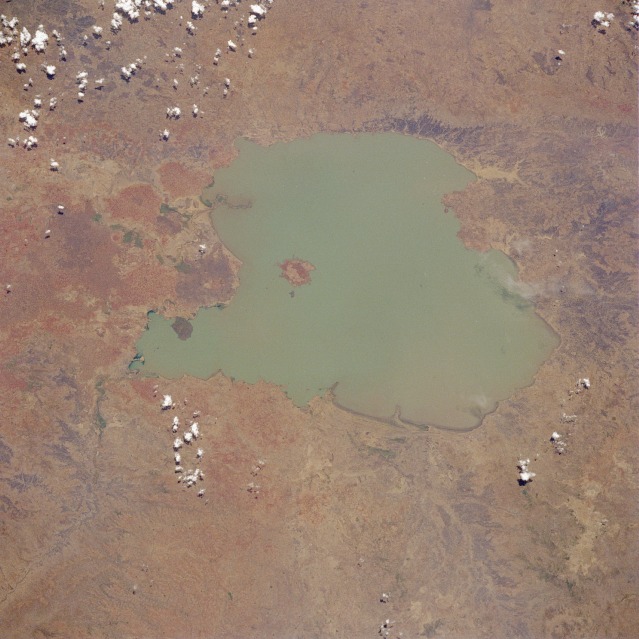
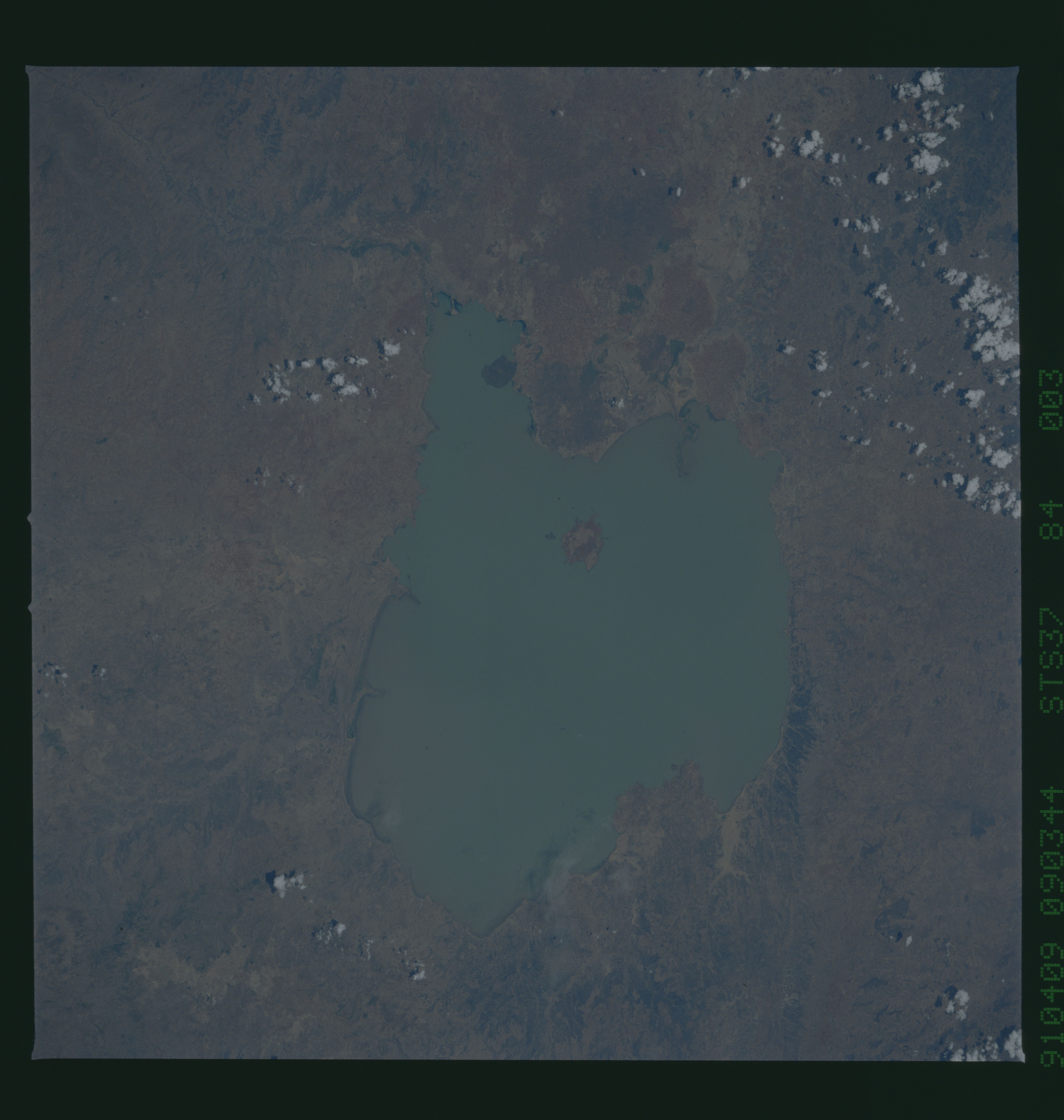
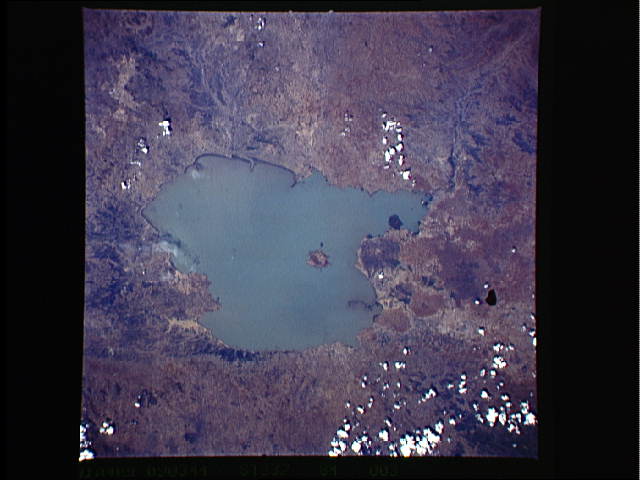
Image Caption: STS037-084-003 Lake Tana, Ethiopia April 1991
Considered the source of the Blue Nile River, Lake Tana is visible in this spectacular, low-oblique, west-looking photograph. Located in the central highlands of Ethiopia, Lake Tana, the country's largest lake, covers 1400 square miles (3625 square kilometers). The lake is 47 miles (76 kilometers) long and 44 miles (71 kilometers) wide and sits at an elevation of 6000 feet (1830 meters) above sea level. Lake Tana has become sediment-filled because of many small streams flowing into it and area deforestation. At its southern end, the lake drains into the Blue Nile, which shortly thereafter [6 miles (9 kilometers)] plunges over the Tisisat Falls and turns eastward, then southeastward, into a series of rugged canyons. Near the south-southwest portion of the lake, the small delta of the Abbai River, which rises in the Choke Mountains south of the lake, is seen. The delta has been extending into the lake since the 1940s. The islands of Dega and Dek, near the center of the lake, are sites of former monasteries.
Considered the source of the Blue Nile River, Lake Tana is visible in this spectacular, low-oblique, west-looking photograph. Located in the central highlands of Ethiopia, Lake Tana, the country's largest lake, covers 1400 square miles (3625 square kilometers). The lake is 47 miles (76 kilometers) long and 44 miles (71 kilometers) wide and sits at an elevation of 6000 feet (1830 meters) above sea level. Lake Tana has become sediment-filled because of many small streams flowing into it and area deforestation. At its southern end, the lake drains into the Blue Nile, which shortly thereafter [6 miles (9 kilometers)] plunges over the Tisisat Falls and turns eastward, then southeastward, into a series of rugged canyons. Near the south-southwest portion of the lake, the small delta of the Abbai River, which rises in the Choke Mountains south of the lake, is seen. The delta has been extending into the lake since the 1940s. The islands of Dega and Dek, near the center of the lake, are sites of former monasteries.
