STS036-91-111
| NASA Photo ID | STS036-91-111 |
| Focal Length | 100mm |
| Date taken | 1990.03.03 |
| Time taken | 10:53:12 GMT |

Cloud masks available for this image:
Spacecraft nadir point: 13.0° N, 15.4° E
Photo center point: 13.5° N, 14.5° E
Photo center point by machine learning:
Photo center point: 13.5° N, 14.5° E
Photo center point by machine learning:
Nadir to Photo Center: Northwest
Spacecraft Altitude: 128 nautical miles (237km)
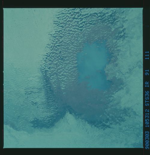
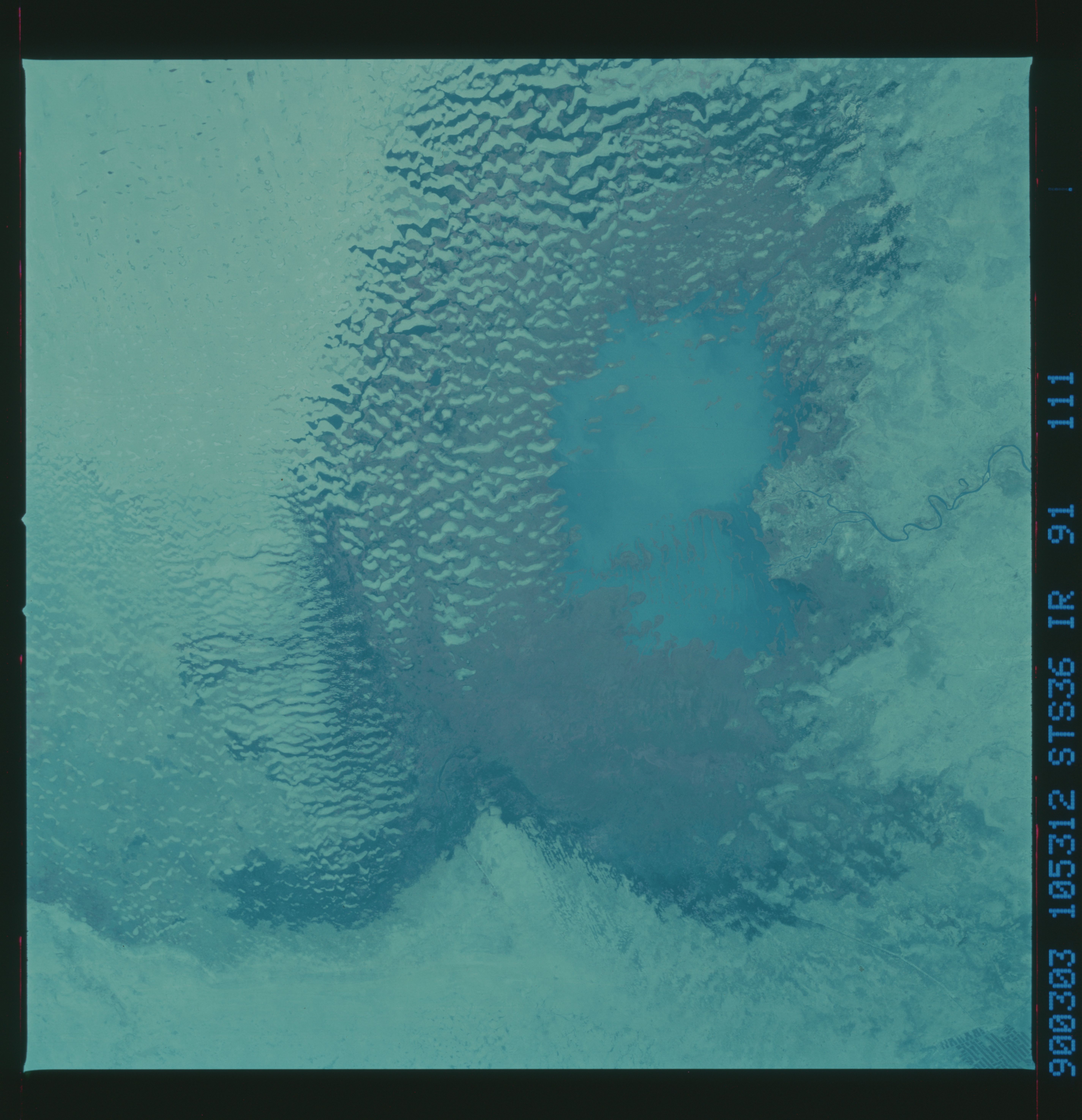
Country or Geographic Name: | CHAD |
Features: | LAKE CHAD |
| Features Found Using Machine Learning: | |
Cloud Cover Percentage: | 0 (no clouds present) |
Sun Elevation Angle: | 70° |
Sun Azimuth: | 168° |
Camera: | Hasselblad |
Focal Length: | 100mm |
Camera Tilt: | 26 degrees |
Format: | 2443: Kodak Aerochrome 2443, color IR, thin base, EA-5 process thru June 1999, E-6 process afterward |
Film Exposure: | Normal |
| Additional Information | |
| Width | Height | Annotated | Cropped | Purpose | Links |
|---|---|---|---|---|---|
| 5700 pixels | 5900 pixels | No | No | Download Image | |
| 500 pixels | 518 pixels | No | No | Download Image | |
| 640 pixels | 480 pixels | No | No | Download Image |
Download Packaged File
Download a Google Earth KML for this Image
View photo footprint information
Download a GeoTIFF for this photo
Image Caption: An infra-red view of Lake Chad, Africa (13.5N, 14.5E) showing the sparse vegetation still remaining on the shores and dry bed of this almost extinct lake. First noticed about 25 to 30 years ago that the lake was undergoing change and was drying up, astronauts since then have been photographing it on a regular basis to record the diminishing lake bed. This lake was once the aproximate size of Lake Erie but is now only about half that size.
