STS036-90-21

| NASA Photo ID | STS036-90-21 |
| Focal Length | 250mm |
| Date taken | 1990.03.02 |
| Time taken | 15:23:54 GMT |
Cloud masks available for this image:
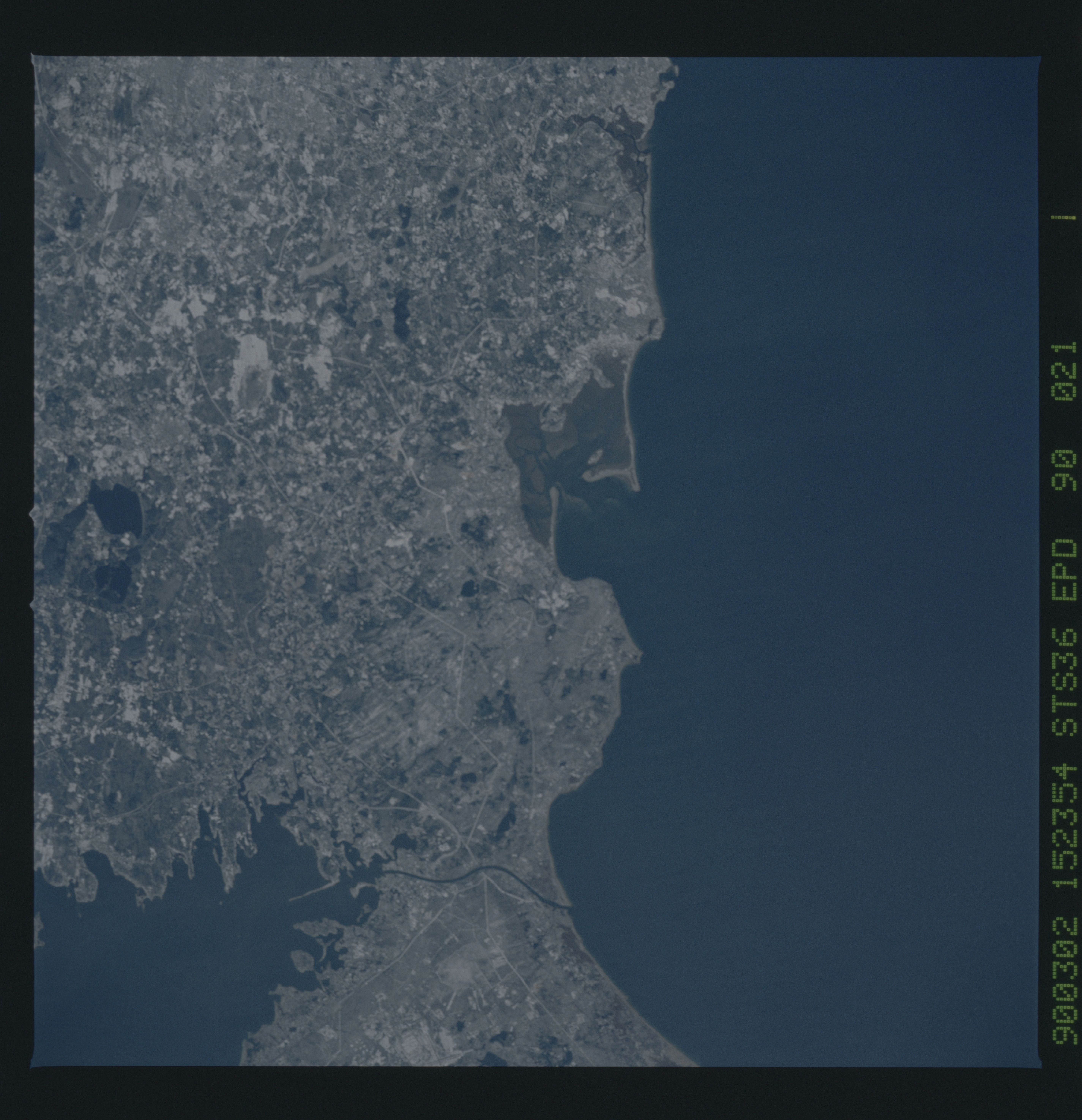
Spacecraft nadir point: 42.8° N, 70.3° W
Photo center point: 42.0° N, 70.5° W
Photo center point by machine learning:
Photo center point: 42.0° N, 70.5° W
Photo center point by machine learning:
Nadir to Photo Center: South
Spacecraft Altitude: 125 nautical miles (232km)
Country or Geographic Name: | USA-MASSACHUSETTS |
Features: | BOSTON, PLYMOUTH AREA |
| Features Found Using Machine Learning: | |
Cloud Cover Percentage: | 0 (no clouds present) |
Sun Elevation Angle: | 36° |
Sun Azimuth: | 152° |
Camera: | Hasselblad |
Focal Length: | 250mm |
Camera Tilt: | 22 degrees |
Format: | 5036: Kodak, natural color positive, Ektachrome 5036,200 Professional, ASA 200, stand |
Film Exposure: | Out of Focus |
| Additional Information | |
| Width | Height | Annotated | Cropped | Purpose | Links |
|---|---|---|---|---|---|
| 5700 pixels | 5900 pixels | No | No | Download Image | |
| 500 pixels | 518 pixels | No | No | Download Image | |
| 640 pixels | 480 pixels | No | No | Download Image |
Download Packaged File
Download a Google Earth KML for this Image
View photo footprint information
Download a GeoTIFF for this photo
Image Caption: Site of the original Plymouth Colony in Massachusetts (42.0N, 70.5), This detailed photo is rich in early American history. Plymouth Rock, the Pilgrims first stepping stone on North America and site of Plymouth Colony is located just behind the natural breakwater on the south shore of Plymouth Bay seen in the middle of the photo. The through canal to the south is part of the Intercoastal Canal system. Cape Cod is just south of the canal.
