STS036-89-60
| NASA Photo ID | STS036-89-60 |
| Focal Length | 100mm |
| Date taken | 1990.03.01 |
| Time taken | 08:12:25 GMT |

Cloud masks available for this image:
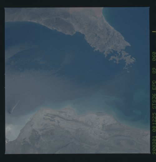
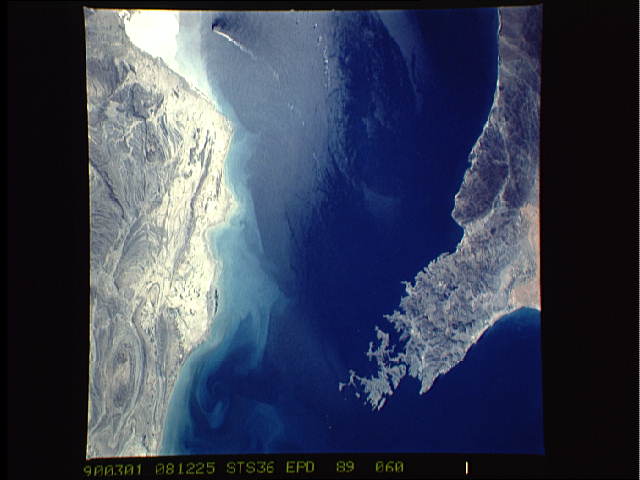
Spacecraft nadir point: 27.1° N, 57.7° E
Photo center point: 26.0° N, 57.0° E
Photo center point by machine learning:
Photo center point: 26.0° N, 57.0° E
Photo center point by machine learning:
Nadir to Photo Center: Southwest
Spacecraft Altitude: 134 nautical miles (248km)
Country or Geographic Name: | IRAN |
Features: | STR. HORMUZ, EDDY, SHIP FIR |
| Features Found Using Machine Learning: | |
Cloud Cover Percentage: | 0 (no clouds present) |
Sun Elevation Angle: | 55° |
Sun Azimuth: | 176° |
Camera: | Hasselblad |
Focal Length: | 100mm |
Camera Tilt: | 30 degrees |
Format: | 5036: Kodak, natural color positive, Ektachrome 5036,200 Professional, ASA 200, stand |
Film Exposure: | Normal |
| Additional Information | |
| Width | Height | Annotated | Cropped | Purpose | Links |
|---|---|---|---|---|---|
| 5700 pixels | 5900 pixels | No | No | Download Image | |
| 500 pixels | 518 pixels | No | No | Download Image | |
| 640 pixels | 480 pixels | No | No | Download Image |
Download Packaged File
Download a Google Earth KML for this Image
View photo footprint information
Download a GeoTIFF for this photo
Image Caption: Portions of Oman, The United Arab Emirates and Iran are seen at the Strait of Hormuz (26.0N, 56.0E) in this view. A prominent oil slick from a ship flushing its tanks can be seen south of the strait. Sunglint in the Gulf of Oman, south of the strait, accentuates the complex currents and oil slicks, seen as dark toned blue streaks on the surface.
