STS036-79-10

| NASA Photo ID | STS036-79-10 |
| Focal Length | 100mm |
| Date taken | 1990.03.02 |
| Time taken | 06:26:40 GMT |

Cloud masks available for this image:
Spacecraft nadir point: 47.3° N, 60.2° E
Photo center point: 46.5° N, 60.5° E
Photo center point by machine learning:
Photo center point: 46.5° N, 60.5° E
Photo center point by machine learning:
Nadir to Photo Center: South
Spacecraft Altitude: 126 nautical miles (233km)
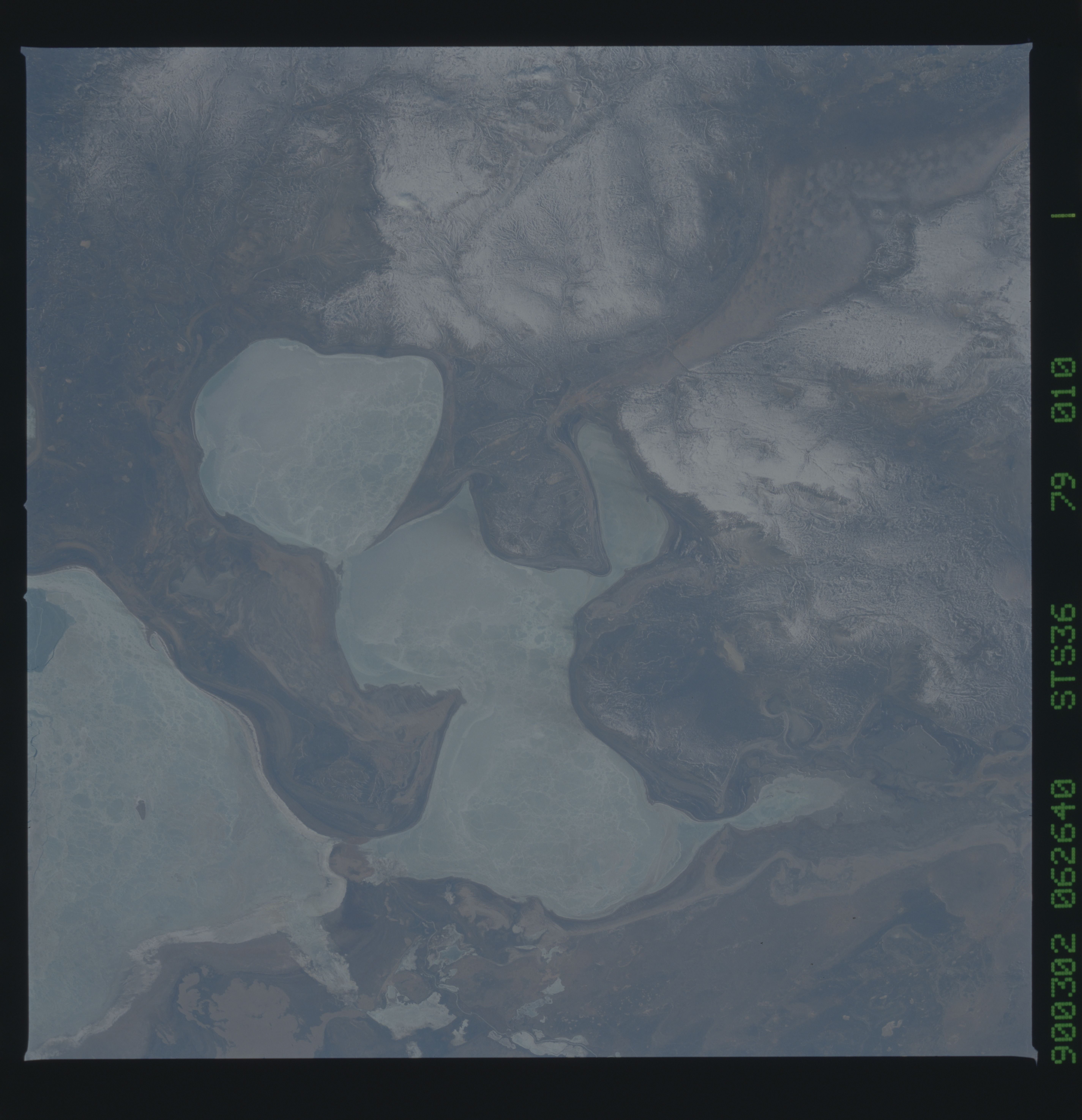
Country or Geographic Name: | KAZAKHSTAN |
Features: | ARAL SEA |
| Features Found Using Machine Learning: | |
Cloud Cover Percentage: | 0 (no clouds present) |
Sun Elevation Angle: | 31° |
Sun Azimuth: | 149° |
Camera: | Hasselblad |
Focal Length: | 100mm |
Camera Tilt: | 22 degrees |
Format: | 5017: Kodak, natural color positive, Ektachrome, X Professional, ASA 64, standard base |
Film Exposure: | Normal |
| Additional Information | |
| Width | Height | Annotated | Cropped | Purpose | Links |
|---|---|---|---|---|---|
| 5700 pixels | 5900 pixels | No | No | Download Image | |
| 500 pixels | 518 pixels | No | No | Download Image | |
| 640 pixels | 480 pixels | No | No | Download Image |
Download Packaged File
Download a Google Earth KML for this Image
View photo footprint information
Download a GeoTIFF for this photo
Image Caption: This detailed scene of the Aral Sea, Kazakhstan, CIS (46.5N, 60.5E) shows a surrealistic view of the fractured frozen shallow waters at the north end of this salt lake. Fed mainly from waters of the Amu Darya River, mostly with snowmelt runoff from the distant Tyan-Shan Mountains near the Afghanistan- China border, the lake has been slowly disappearing as more and more of the river water has been diverted to support agriculture in the region.
