STS036-75-24

| NASA Photo ID | STS036-75-24 |
| Focal Length | 100mm |
| Date taken | 1990.03.03 |
| Time taken | 09:17:50 GMT |
Resolutions offered for this image:
5266 x 5266 pixels 639 x 639 pixels 5700 x 5900 pixels 500 x 518 pixels 640 x 480 pixels
5266 x 5266 pixels 639 x 639 pixels 5700 x 5900 pixels 500 x 518 pixels 640 x 480 pixels
Cloud masks available for this image:
Spacecraft nadir point: 34.7° N, 25.2° E
Photo center point: 32.5° N, 27.5° E
Photo center point by machine learning:
Photo center point: 32.5° N, 27.5° E
Photo center point by machine learning:
Nadir to Photo Center: Southeast
Spacecraft Altitude: 126 nautical miles (233km)
Country or Geographic Name: | EGYPT |
Features: | SUNGLINT |
| Features Found Using Machine Learning: | |
Cloud Cover Percentage: | 10 (1-10)% |
Sun Elevation Angle: | 45° |
Sun Azimuth: | 154° |
Camera: | Hasselblad |
Focal Length: | 100mm |
Camera Tilt: | Low Oblique |
Format: | 5017: Kodak, natural color positive, Ektachrome, X Professional, ASA 64, standard base |
Film Exposure: | Normal |
| Additional Information | |
| Width | Height | Annotated | Cropped | Purpose | Links |
|---|---|---|---|---|---|
| 5266 pixels | 5266 pixels | No | No | Earth From Space collection | Download Image |
| 639 pixels | 639 pixels | No | No | Earth From Space collection | Download Image |
| 5700 pixels | 5900 pixels | No | No | Download Image | |
| 500 pixels | 518 pixels | No | No | Download Image | |
| 640 pixels | 480 pixels | No | No | Download Image |
Download Packaged File
Download a Google Earth KML for this Image
View photo footprint information
Download a GeoTIFF for this photo
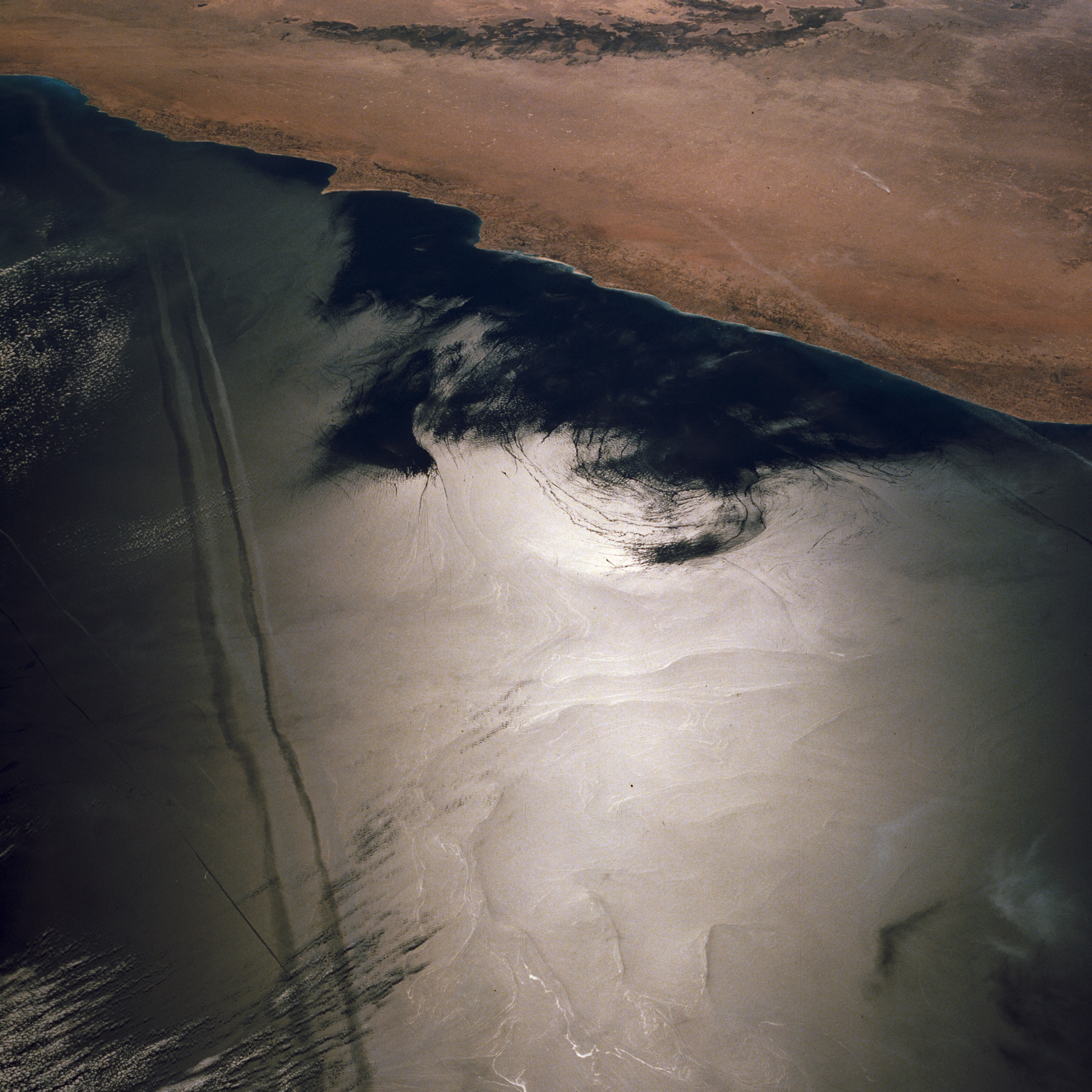
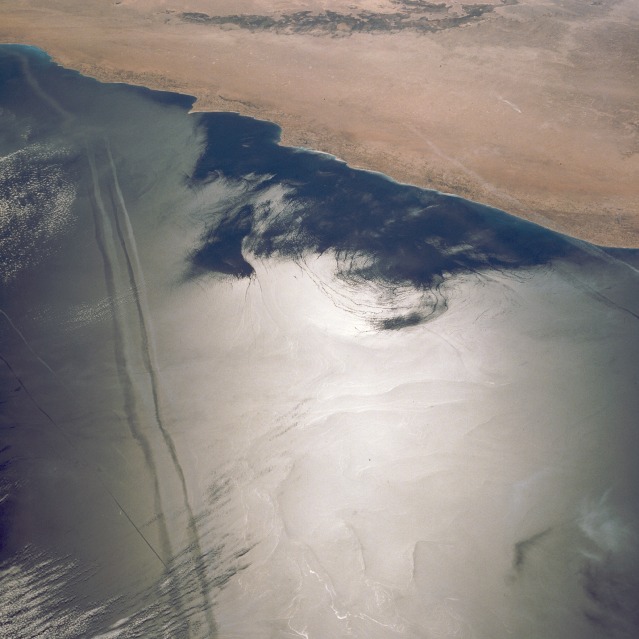
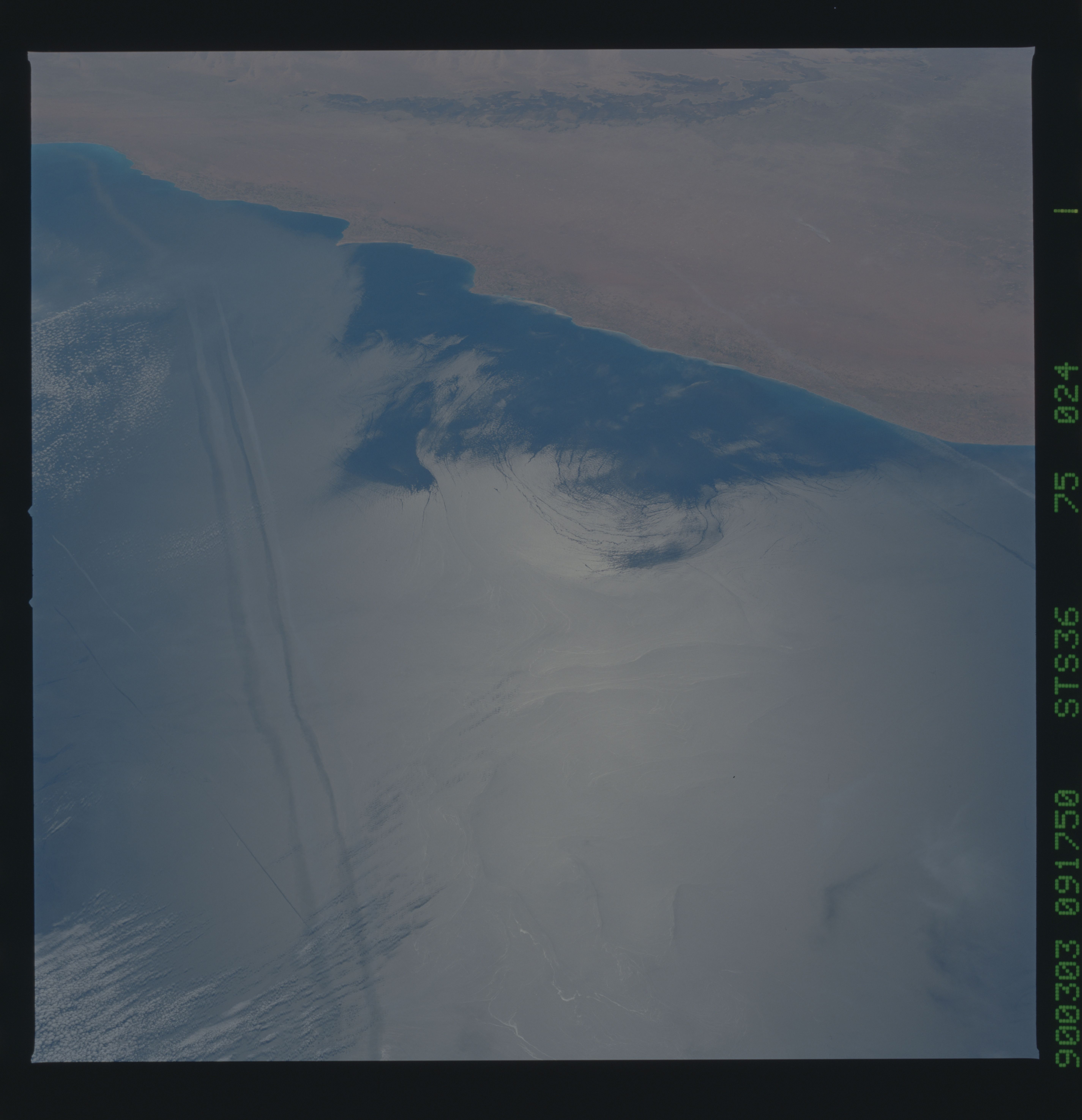
Image Caption: STS036-075-024 Sun Glint Patterns, Mediterranean Sea March, 1990
Spiral eddies can be seen off the northern coast of Egypt west of Cape Alam el Rum, in the Mediterranean Sea. As seen in the sun's reflection off the water, the lighter-colored areas are more tranquil and therefore smooth. The darker blue-colored areas near the shore are rougher due to surface winds. A spiral eddy, refracted in the sunglint, is visible halfway between the tranquil and less tranquil waters (ear-shaped feature near center of the image). From upper left and traversing the image towards bottom center, two airplane contrails and their shadows are discernible.
Spiral eddies can be seen off the northern coast of Egypt west of Cape Alam el Rum, in the Mediterranean Sea. As seen in the sun's reflection off the water, the lighter-colored areas are more tranquil and therefore smooth. The darker blue-colored areas near the shore are rougher due to surface winds. A spiral eddy, refracted in the sunglint, is visible halfway between the tranquil and less tranquil waters (ear-shaped feature near center of the image). From upper left and traversing the image towards bottom center, two airplane contrails and their shadows are discernible.
