STS036-73-94

| NASA Photo ID | STS036-73-94 |
| Focal Length | 100mm |
| Date taken | 1990.03.02 |
| Time taken | 12:45:30 GMT |

Cloud masks available for this image:
Spacecraft nadir point: 28.0° S, 15.4° E
Photo center point: 27.5° S, 14.5° E
Photo center point by machine learning:
Photo center point: 27.5° S, 14.5° E
Photo center point by machine learning:
Nadir to Photo Center: Northwest
Spacecraft Altitude: 132 nautical miles (244km)
Country or Geographic Name: | NAMIBIA |
Features: | SUNGLINT |
| Features Found Using Machine Learning: | |
Cloud Cover Percentage: | 0 (no clouds present) |
Sun Elevation Angle: | 59° |
Sun Azimuth: | 308° |
Camera: | Hasselblad |
Focal Length: | 100mm |
Camera Tilt: | 25 degrees |
Format: | 5017: Kodak, natural color positive, Ektachrome, X Professional, ASA 64, standard base |
Film Exposure: | Normal |
| Additional Information | |
| Width | Height | Annotated | Cropped | Purpose | Links |
|---|---|---|---|---|---|
| 5700 pixels | 5900 pixels | No | No | Download Image | |
| 500 pixels | 518 pixels | No | No | Download Image | |
| 640 pixels | 480 pixels | No | No | Download Image |
Download Packaged File
Download a Google Earth KML for this Image
View photo footprint information
Download a GeoTIFF for this photo
Image Caption:
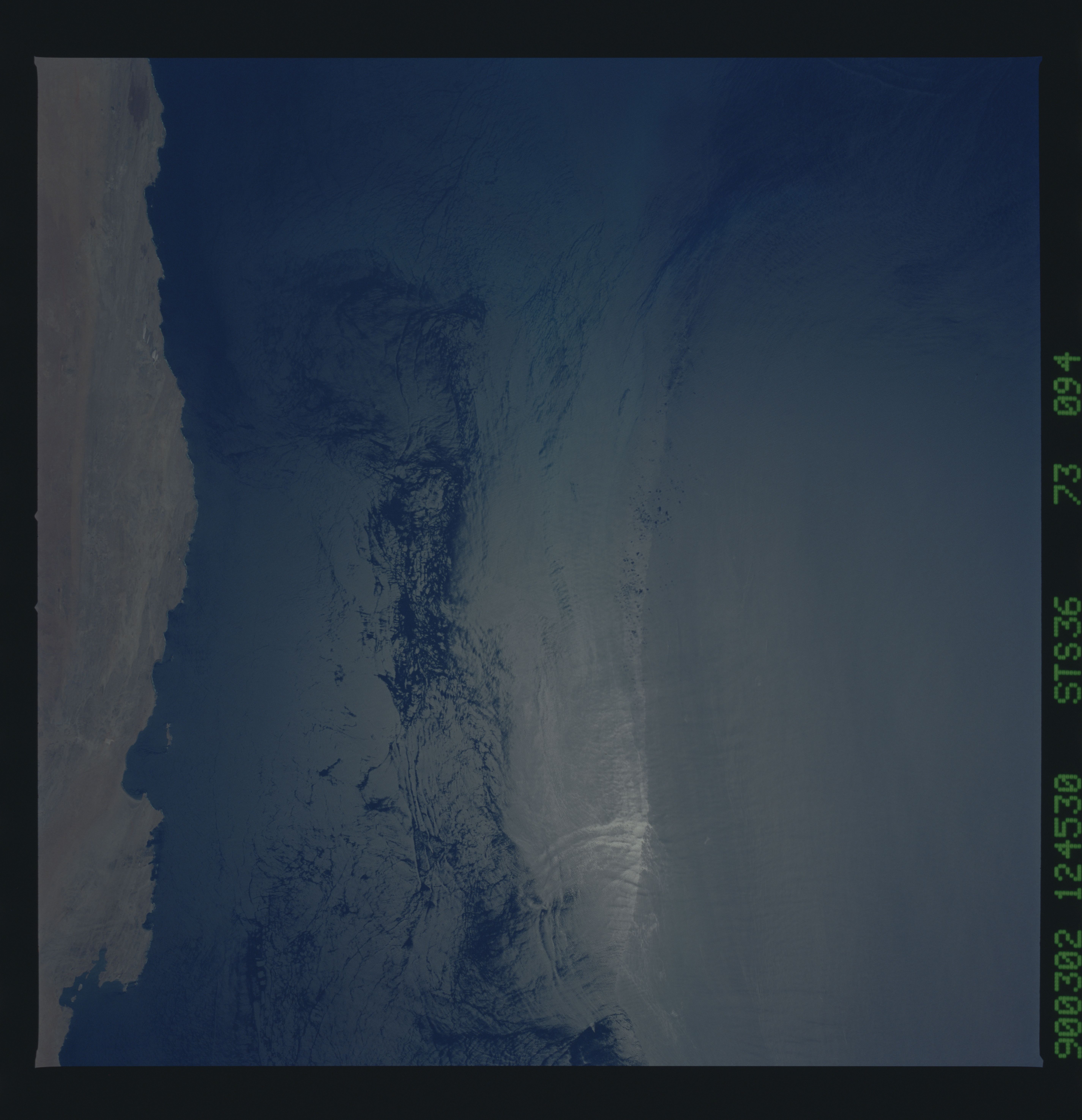
Coastal upwelling along the coastal boundary of the Benguela
Current (Coast of Namibia; 27.5S, 14.5E)
The cold upwelled water is adjacent to the coastline and extends
about 65 km (35 n.mi.) offshore. The cold water stabilizes the
atmospheric boundary layer and results in a smoother water sur-
face, relative to the roughened, offshore water. In the sunglint
pattern, the smoother, upwelled water reflects sunlight more like
a mirror, concentrating the sunglint to a smaller area. Outside
the bright central disc, the sunglint highlights internal waves
which are refracting around submarine topography. (S36-73-094)
