STS036-152-248
| NASA Photo ID | STS036-152-248 |
| Focal Length | 90mm |
| Date taken | 1990.03.04 |
| Time taken | 10:28:57 GMT |

Cloud masks available for this image:
Spacecraft nadir point: 43.4° N, 6.5° W
Photo center point: 43.0° N, 6.5° W
Photo center point by machine learning:
Photo center point: 43.0° N, 6.5° W
Photo center point by machine learning:
Nadir to Photo Center: South
Spacecraft Altitude: 115 nautical miles (213km)
Country or Geographic Name: | SPAIN |
Features: | BISCAY COAST, CANTABRICA MT |
| Features Found Using Machine Learning: | |
Cloud Cover Percentage: | 10 (1-10)% |
Sun Elevation Angle: | 32° |
Sun Azimuth: | 141° |
Camera: | Linhof |
Focal Length: | 90mm |
Camera Tilt: | 12 degrees |
Format: | QX868: Kodak, natural color positive, Ektachrome QX868(5017 emulsion), ASA 64, thin base |
Film Exposure: | Normal |
| Additional Information | |
| Width | Height | Annotated | Cropped | Purpose | Links |
|---|---|---|---|---|---|
| 5248 pixels | 4096 pixels | No | No | Earth From Space collection | Download Image |
| 640 pixels | 499 pixels | No | No | Earth From Space collection | Download Image |
| 640 pixels | 480 pixels | No | No | ISD 1 | Download Image |
Download Packaged File
Download a Google Earth KML for this Image
View photo footprint information
Download a GeoTIFF for this photo
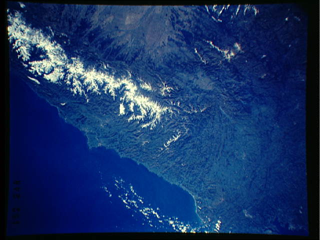
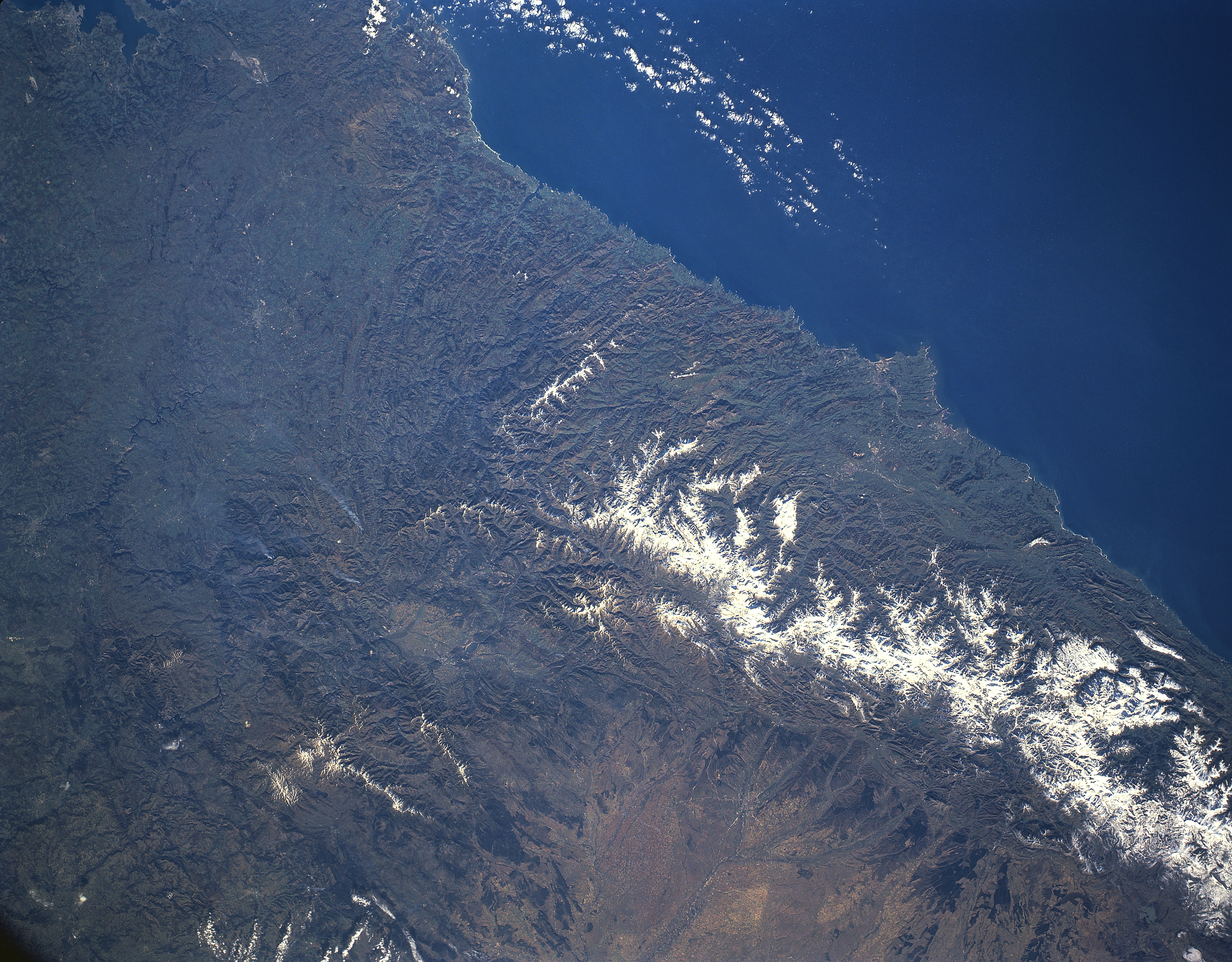
Image Caption: STS036-152-248 Cantabrian Mountains, Spain March 1990
The Cantabrian Mountains are a physical and climatic barrier to northern Spain. The east to west trending limestone mountains extend for 300 miles (483 km) along the northern coastline of Spain. The mountains' northern slopes drop steeply toward the Asturias Coast while the southern mountain slopes descend more gradually toward the arid interior. This late winter image accentuates the fact (through marked color differences) that the windward (north) side of the mountains receives substantially more precipitation than the drier leeward (south) slopes. This image also shows that an accumulation of snow is visible on the higher elevations, usually exceeding 7000 feet (2134 meters) above sea level. The Cantabrian Mountains have provided a constant source of iron and coal for Spain during the last few centuries.
The Cantabrian Mountains are a physical and climatic barrier to northern Spain. The east to west trending limestone mountains extend for 300 miles (483 km) along the northern coastline of Spain. The mountains' northern slopes drop steeply toward the Asturias Coast while the southern mountain slopes descend more gradually toward the arid interior. This late winter image accentuates the fact (through marked color differences) that the windward (north) side of the mountains receives substantially more precipitation than the drier leeward (south) slopes. This image also shows that an accumulation of snow is visible on the higher elevations, usually exceeding 7000 feet (2134 meters) above sea level. The Cantabrian Mountains have provided a constant source of iron and coal for Spain during the last few centuries.
