STS036-152-229
| NASA Photo ID | STS036-152-229 |
| Focal Length | 90mm |
| Date taken | 1990.03.04 |
| Time taken | 08:57:43 GMT |

Cloud masks available for this image:
Spacecraft nadir point: 49.9° N, 7.7° E
Photo center point: 47.5° N, 8.0° E
Photo center point by machine learning:
Photo center point: 47.5° N, 8.0° E
Photo center point by machine learning:
Nadir to Photo Center: South
Spacecraft Altitude: 115 nautical miles (213km)
Country or Geographic Name: | SWITZERLAND |
Features: | PAN-ALPS, RHINE RIVER |
| Features Found Using Machine Learning: | |
Cloud Cover Percentage: | 20 (11-25)% |
Sun Elevation Angle: | 24° |
Sun Azimuth: | 135° |
Camera: | Linhof |
Focal Length: | 90mm |
Camera Tilt: | High Oblique |
Format: | QX868: Kodak, natural color positive, Ektachrome QX868(5017 emulsion), ASA 64, thin base |
Film Exposure: | Normal |
| Additional Information | |
| Width | Height | Annotated | Cropped | Purpose | Links |
|---|---|---|---|---|---|
| 5641 pixels | 4513 pixels | No | No | Earth From Space collection | Download Image |
| 640 pixels | 512 pixels | No | No | Earth From Space collection | Download Image |
| 640 pixels | 480 pixels | No | No | ISD 1 | Download Image |
Download Packaged File
Download a Google Earth KML for this Image
View photo footprint information
Download a GeoTIFF for this photo
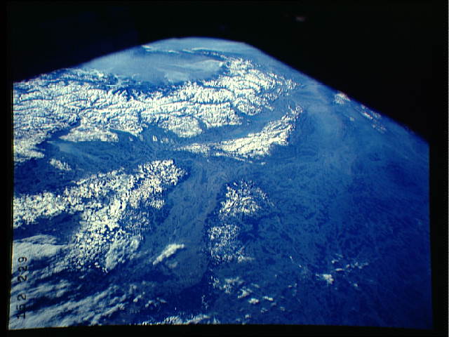
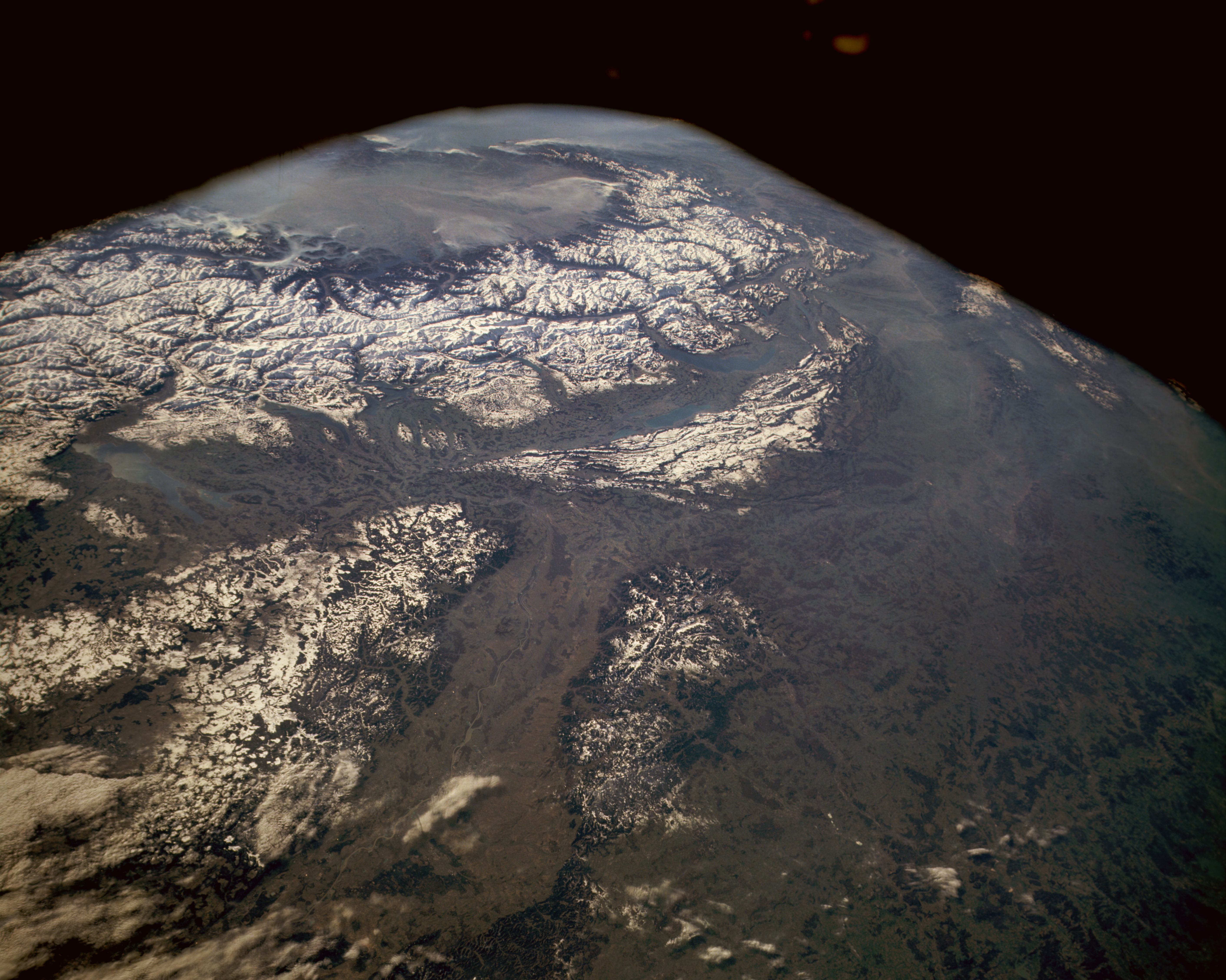
Image Caption: STS036-152-229 The Alps, Rhine River Valley, South-Central Europe May 1989
The impressive snow-covered Alpine mountains and the hills and low mountains of eastern France, northern Italy, Switzerland, and southern Germany are seen in this low-oblique, south-looking photograph of south-central Europe. Two snow-covered areas are distinguishable viewing clockwise from the north--part of the complex series of the Alps of eastern France, northern Italy, and Switzerland and the large heavily forested hills and low mountains that range from 2000 to 3000 feet (610 to 915 meters) above sea level, which include the Vosges Mountains of eastern France and the Black Forest of southern Germany, separated by the north-flowing Rhine River and its valley. The Alps do not have extremely high elevations in comparison with other continental mountain systems; however, many of the peaks exceed 10 000 feet (3500 meters). While the hazy, cloud-filled Po River Valley of Italy is visible across the southern horizon, the Rhone River Valley and Lake Geneva are barely visible.
The impressive snow-covered Alpine mountains and the hills and low mountains of eastern France, northern Italy, Switzerland, and southern Germany are seen in this low-oblique, south-looking photograph of south-central Europe. Two snow-covered areas are distinguishable viewing clockwise from the north--part of the complex series of the Alps of eastern France, northern Italy, and Switzerland and the large heavily forested hills and low mountains that range from 2000 to 3000 feet (610 to 915 meters) above sea level, which include the Vosges Mountains of eastern France and the Black Forest of southern Germany, separated by the north-flowing Rhine River and its valley. The Alps do not have extremely high elevations in comparison with other continental mountain systems; however, many of the peaks exceed 10 000 feet (3500 meters). While the hazy, cloud-filled Po River Valley of Italy is visible across the southern horizon, the Rhone River Valley and Lake Geneva are barely visible.
