STS036-152-113
| NASA Photo ID | STS036-152-113 |
| Focal Length | 250mm |
| Date taken | 1990.03.03 |
| Time taken | 16:41:22 GMT |
Cloud masks available for this image:
Spacecraft nadir point: 40.7° N, 92.9° W
Photo center point: 41.0° N, 93.0° W
Photo center point by machine learning:
Photo center point: 41.0° N, 93.0° W
Photo center point by machine learning:
Nadir to Photo Center: North
Spacecraft Altitude: 115 nautical miles (213km)
Country or Geographic Name: | USA-IOWA |
Features: | L. RATHBURN, L. RED ROCK, AG |
| Features Found Using Machine Learning: | |
Cloud Cover Percentage: | 0 (no clouds present) |
Sun Elevation Angle: | 37° |
Sun Azimuth: | 147° |
Camera: | Linhof |
Focal Length: | 250mm |
Camera Tilt: | 9 degrees |
Format: | QX868: Kodak, natural color positive, Ektachrome QX868(5017 emulsion), ASA 64, thin base |
Film Exposure: | Normal |
| Additional Information | |
| Width | Height | Annotated | Cropped | Purpose | Links |
|---|---|---|---|---|---|
| 5184 pixels | 4096 pixels | No | No | Earth From Space collection | Download Image |
| 640 pixels | 505 pixels | No | No | Earth From Space collection | Download Image |
| 640 pixels | 480 pixels | No | No | ISD 1 | Download Image |
Download Packaged File
Download a Google Earth KML for this Image
View photo footprint information
Download a GeoTIFF for this photo
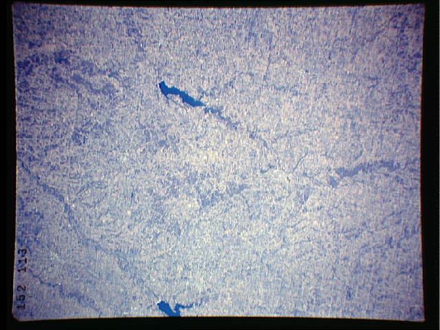
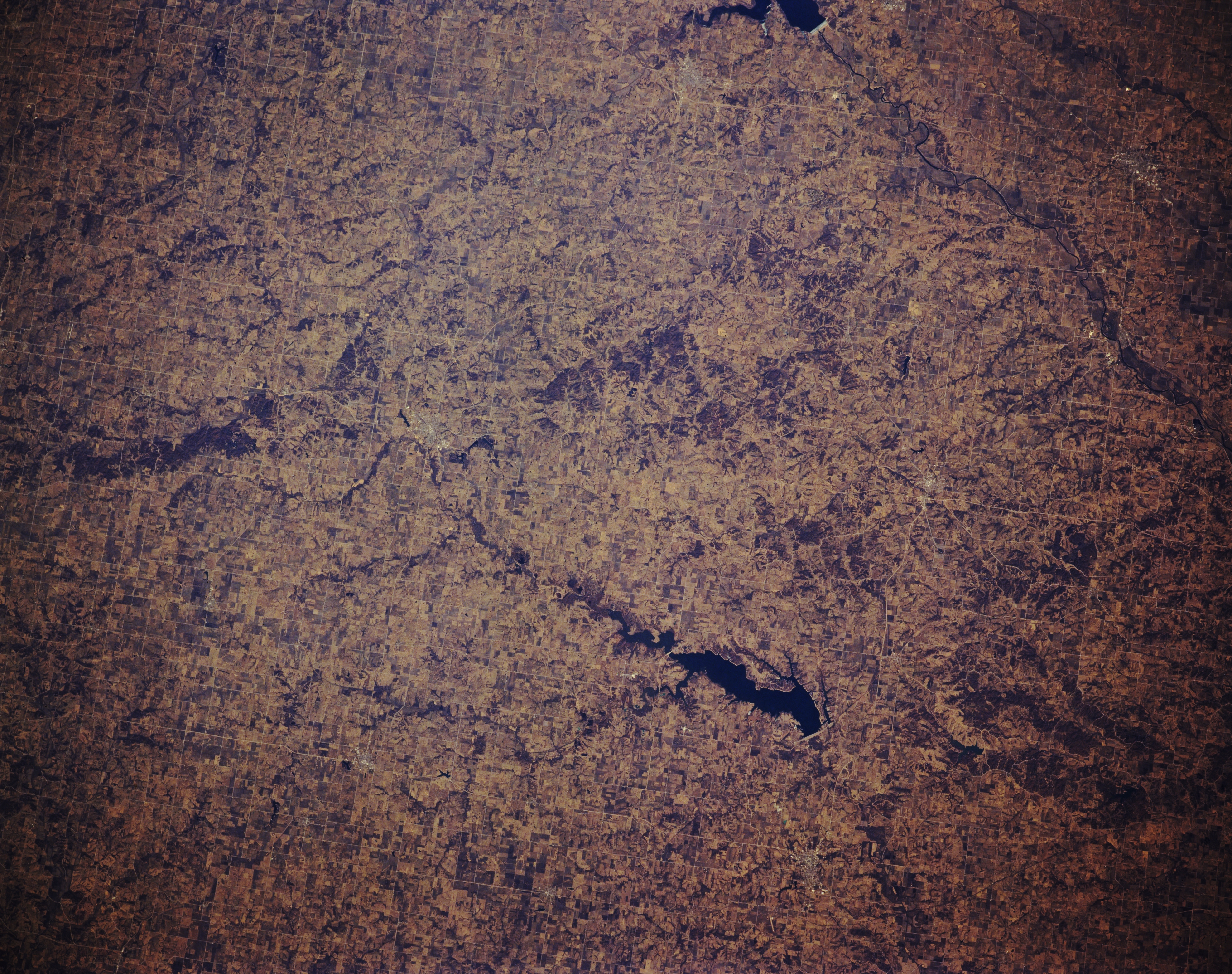
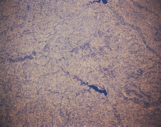
Image Caption: STS036-152-113 South-Central Iowa, U.S.A. March 1990
The gently rolling agricultural lands of south-central Iowa are visible in this north-northwest-looking, low-oblique photograph. Discernible are two bodies of water--dark blue Lake Rathbun, which supplies some irrigation but is primarily a recreational area for the surrounding communities, and the southeastern portion of Red Rock Reservoir (near top center), a recreational facility on the Des Moines River.
The gently rolling agricultural lands of south-central Iowa are visible in this north-northwest-looking, low-oblique photograph. Discernible are two bodies of water--dark blue Lake Rathbun, which supplies some irrigation but is primarily a recreational area for the surrounding communities, and the southeastern portion of Red Rock Reservoir (near top center), a recreational facility on the Des Moines River.
