STS035-76-56
| NASA Photo ID | STS035-76-56 |
| Focal Length | 250mm |
| Date taken | 1990.12.08 |
| Time taken | 05:30:38 GMT |
Resolutions offered for this image:
3936 x 3872 pixels 639 x 629 pixels 5700 x 6000 pixels 500 x 526 pixels 640 x 480 pixels
3936 x 3872 pixels 639 x 629 pixels 5700 x 6000 pixels 500 x 526 pixels 640 x 480 pixels

Cloud masks available for this image:
Spacecraft nadir point: 19.9° S, 120.7° E
Photo center point: 20.0° S, 119.0° E
Photo center point by machine learning:
Photo center point: 20.0° S, 119.0° E
Photo center point by machine learning:
Nadir to Photo Center: West
Spacecraft Altitude: 187 nautical miles (346km)
Country or Geographic Name: | AUSTRALIA-WA |
Features: | COAST-SHAW R.-GREY R. |
| Features Found Using Machine Learning: | |
Cloud Cover Percentage: | 0 (no clouds present) |
Sun Elevation Angle: | 66° |
Sun Azimuth: | 258° |
Camera: | Hasselblad |
Focal Length: | 250mm |
Camera Tilt: | 29 degrees |
Format: | 5017: Kodak, natural color positive, Ektachrome, X Professional, ASA 64, standard base |
Film Exposure: | Normal |
| Additional Information | |
| Width | Height | Annotated | Cropped | Purpose | Links |
|---|---|---|---|---|---|
| 3936 pixels | 3872 pixels | No | No | Earth From Space collection | Download Image |
| 639 pixels | 629 pixels | No | No | Earth From Space collection | Download Image |
| 5700 pixels | 6000 pixels | No | No | Download Image | |
| 500 pixels | 526 pixels | No | No | Download Image | |
| 640 pixels | 480 pixels | No | No | Download Image |
Download Packaged File
Download a Google Earth KML for this Image
View photo footprint information
Download a GeoTIFF for this photo
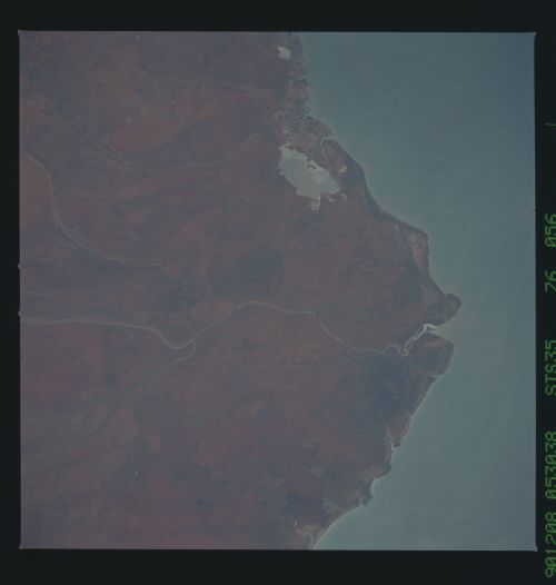
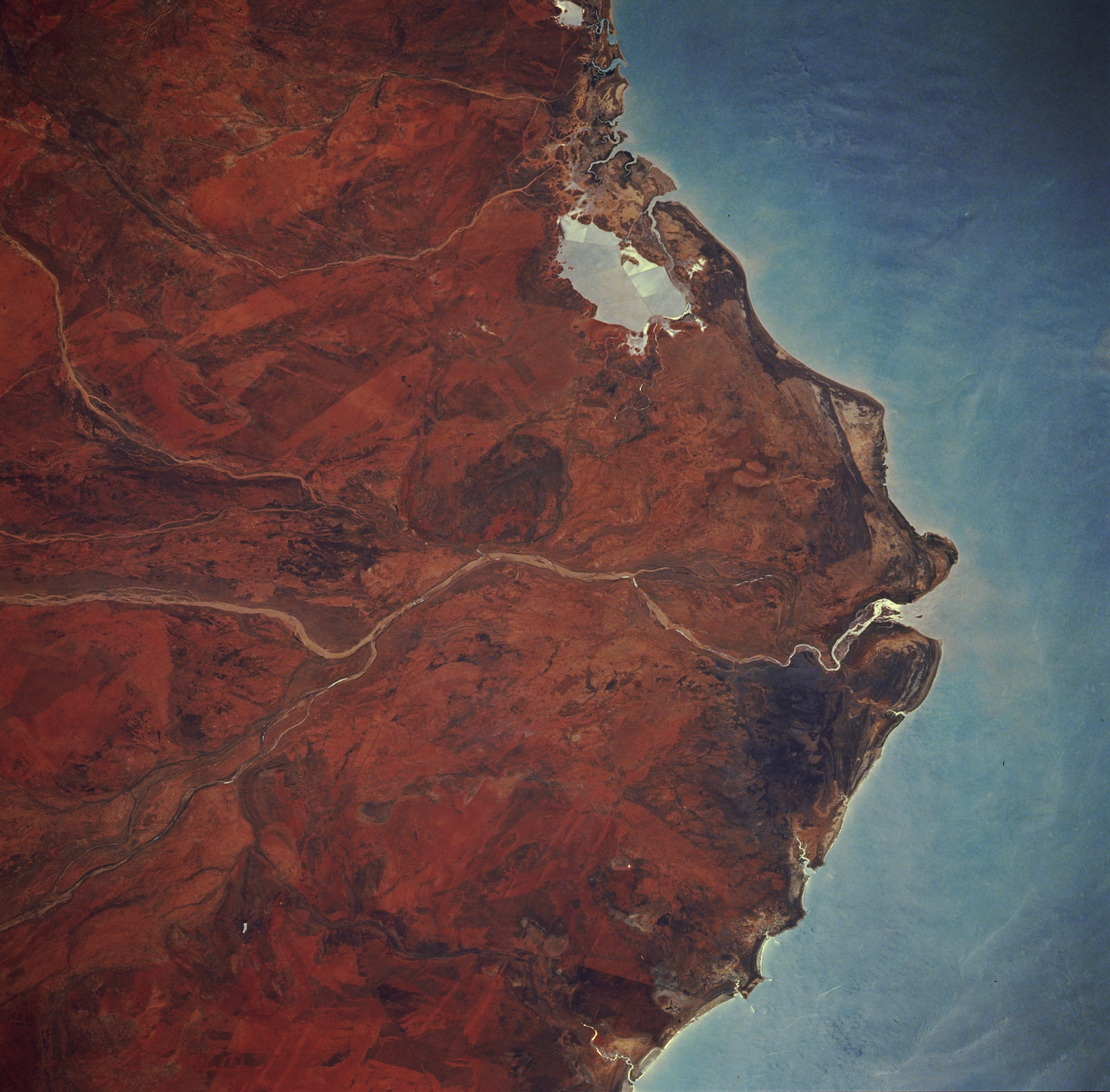
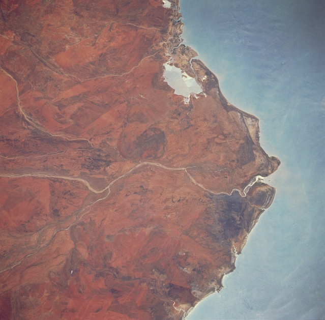
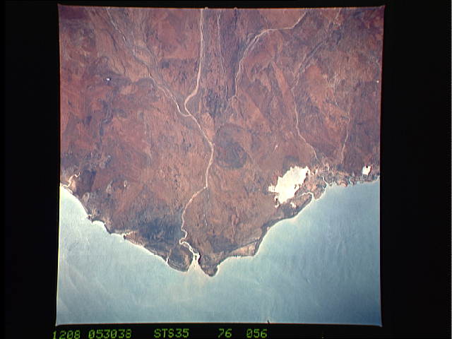
Image Caption: STS035-076-056 DeGrey River, Western Australia, Australia December 1990
Partial sunglint helps outline the northwest coastal region of Western Australia. The light-colored stream beds help to identify the confluence of the DeGrey and Shaw Rivers (slightly left of center) as the resultant DeGrey River flows northward into the Indian Ocean. The stream channels generally sustain flow only during the summer months when tropical thunderstorms rumble through this region. The two coastal lagoons near the top center of the image are evaporating ponds which are part of a salt mining operation based out of Port Hedland. (Refer to STS035-076-054 to see the adjacent scene west of this frame. Notice that the aqueduct that connects the two salt evaporating processing areas is more visible on the adjoining, overlapping frame.)
Partial sunglint helps outline the northwest coastal region of Western Australia. The light-colored stream beds help to identify the confluence of the DeGrey and Shaw Rivers (slightly left of center) as the resultant DeGrey River flows northward into the Indian Ocean. The stream channels generally sustain flow only during the summer months when tropical thunderstorms rumble through this region. The two coastal lagoons near the top center of the image are evaporating ponds which are part of a salt mining operation based out of Port Hedland. (Refer to STS035-076-054 to see the adjacent scene west of this frame. Notice that the aqueduct that connects the two salt evaporating processing areas is more visible on the adjoining, overlapping frame.)
