STS034-84-36
| NASA Photo ID | STS034-84-36 |
| Focal Length | 100mm |
| Date taken | 1989.10.22 |
| Time taken | 01:03:47 GMT |
Resolutions offered for this image:
5284 x 5284 pixels 640 x 640 pixels 5700 x 5900 pixels 500 x 518 pixels 640 x 480 pixels
5284 x 5284 pixels 640 x 640 pixels 5700 x 5900 pixels 500 x 518 pixels 640 x 480 pixels

Cloud masks available for this image:
Spacecraft nadir point: 28.5° N, 131.6° E
Photo center point: 31.5° N, 131.0° E
Photo center point by machine learning:
Photo center point: 31.5° N, 131.0° E
Photo center point by machine learning:
Nadir to Photo Center: North
Spacecraft Altitude: 180 nautical miles (333km)
Country or Geographic Name: | JAPAN |
Features: | KYUSHU |
| Features Found Using Machine Learning: | |
Cloud Cover Percentage: | 30 (26-50)% |
Sun Elevation Angle: | 41° |
Sun Azimuth: | 140° |
Camera: | Hasselblad |
Focal Length: | 100mm |
Camera Tilt: | 45 degrees |
Format: | 5017: Kodak, natural color positive, Ektachrome, X Professional, ASA 64, standard base |
Film Exposure: | Normal |
| Additional Information | |
| Width | Height | Annotated | Cropped | Purpose | Links |
|---|---|---|---|---|---|
| 5284 pixels | 5284 pixels | No | No | Earth From Space collection | Download Image |
| 640 pixels | 640 pixels | No | No | Earth From Space collection | Download Image |
| 5700 pixels | 5900 pixels | No | No | Download Image | |
| 500 pixels | 518 pixels | No | No | Download Image | |
| 640 pixels | 480 pixels | No | No | Download Image |
Download Packaged File
Download a Google Earth KML for this Image
View photo footprint information
Download a GeoTIFF for this photo
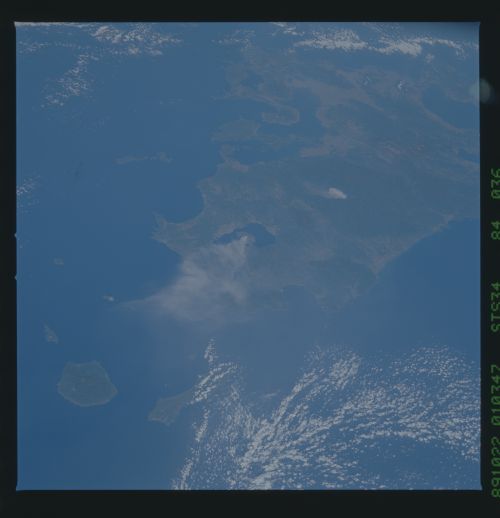
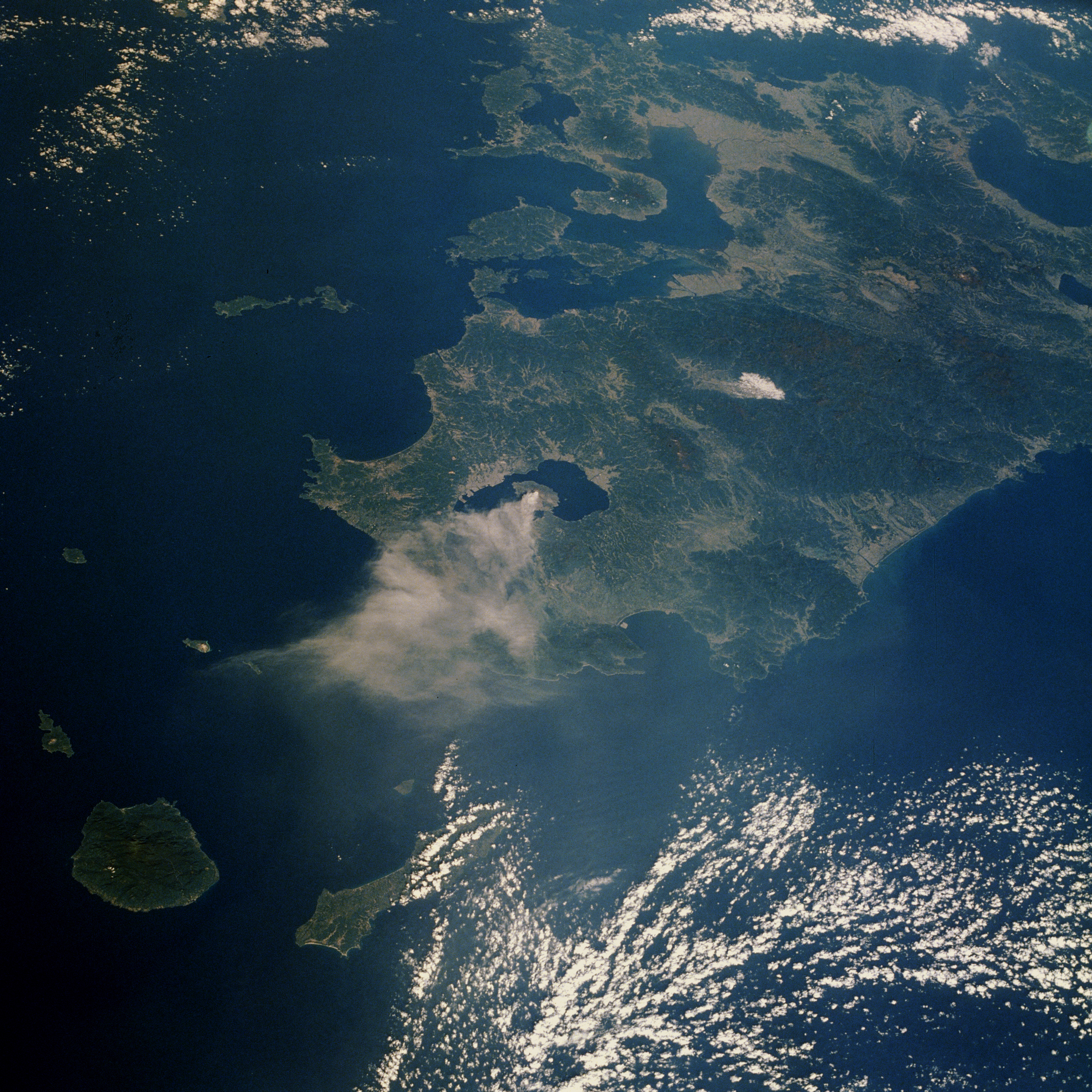
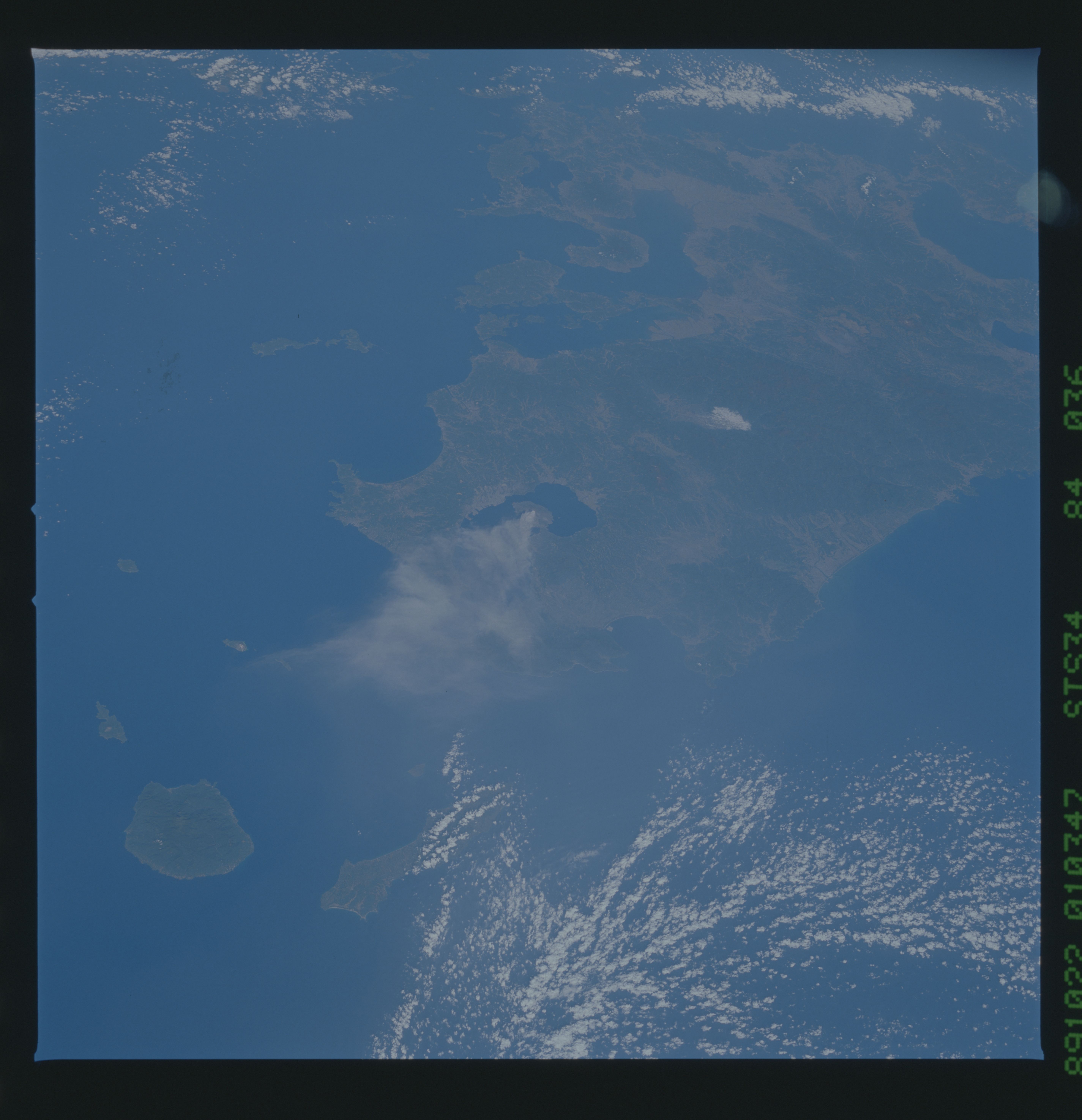
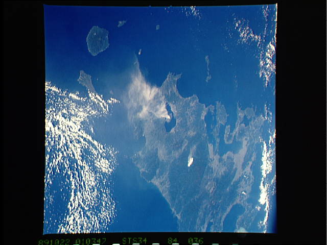
Image Caption: STS034-084-036 Kyushu Island, Japan October 1989
The rugged physiography of Japan is captured in this low-oblique, north-looking photograph that shows most of Kyushu Island, Japan's southernmost large island. Much of Japan is mountainous and steep-sloped, geologically young, earthquake prone, and volcanic. Only about 18 percent of Japan's land is usable for human habitation; available arable land for farming is also at a premium. This photograph confirms the lack of habitable space--the extensive darker green areas are hills and mountains; many of the regions have peaks that exceed 3000 feet (915 meters). Highly reflective urban areas appear primarily along the coast and in some valleys. Mount Sakura-jima, located on a peninsula in Kagoshima Bay, has almost daily, and sometimes explosive, eruptions; its ash plume is visible in this photograph.
The rugged physiography of Japan is captured in this low-oblique, north-looking photograph that shows most of Kyushu Island, Japan's southernmost large island. Much of Japan is mountainous and steep-sloped, geologically young, earthquake prone, and volcanic. Only about 18 percent of Japan's land is usable for human habitation; available arable land for farming is also at a premium. This photograph confirms the lack of habitable space--the extensive darker green areas are hills and mountains; many of the regions have peaks that exceed 3000 feet (915 meters). Highly reflective urban areas appear primarily along the coast and in some valleys. Mount Sakura-jima, located on a peninsula in Kagoshima Bay, has almost daily, and sometimes explosive, eruptions; its ash plume is visible in this photograph.
