STS034-83-69

| NASA Photo ID | STS034-83-69 |
| Focal Length | 250mm |
| Date taken | 1989.10.21 |
| Time taken | 17:38:53 GMT |
Resolutions offered for this image:
3820 x 3904 pixels 626 x 639 pixels 5700 x 5900 pixels 500 x 518 pixels 640 x 480 pixels
3820 x 3904 pixels 626 x 639 pixels 5700 x 5900 pixels 500 x 518 pixels 640 x 480 pixels

Cloud masks available for this image:
Spacecraft nadir point: 34.4° N, 75.3° W
Photo center point: 35.0° N, 75.5° W
Photo center point by machine learning:
Photo center point: 35.0° N, 75.5° W
Photo center point by machine learning:
Nadir to Photo Center: North
Spacecraft Altitude: 177 nautical miles (328km)
Country or Geographic Name: | USA-NORTH CAROLINA |
Features: | CAPE HATTERAS |
| Features Found Using Machine Learning: | |
Cloud Cover Percentage: | 0 (no clouds present) |
Sun Elevation Angle: | 43° |
Sun Azimuth: | 197° |
Camera: | Hasselblad |
Focal Length: | 250mm |
Camera Tilt: | 12 degrees |
Format: | 5017: Kodak, natural color positive, Ektachrome, X Professional, ASA 64, standard base |
Film Exposure: | Normal |
| Additional Information | |
| Width | Height | Annotated | Cropped | Purpose | Links |
|---|---|---|---|---|---|
| 3820 pixels | 3904 pixels | No | No | Earth From Space collection | Download Image |
| 626 pixels | 639 pixels | No | No | Earth From Space collection | Download Image |
| 5700 pixels | 5900 pixels | No | No | Download Image | |
| 500 pixels | 518 pixels | No | No | Download Image | |
| 640 pixels | 480 pixels | No | No | Download Image |
Download Packaged File
Download a Google Earth KML for this Image
View photo footprint information
Download a GeoTIFF for this photo
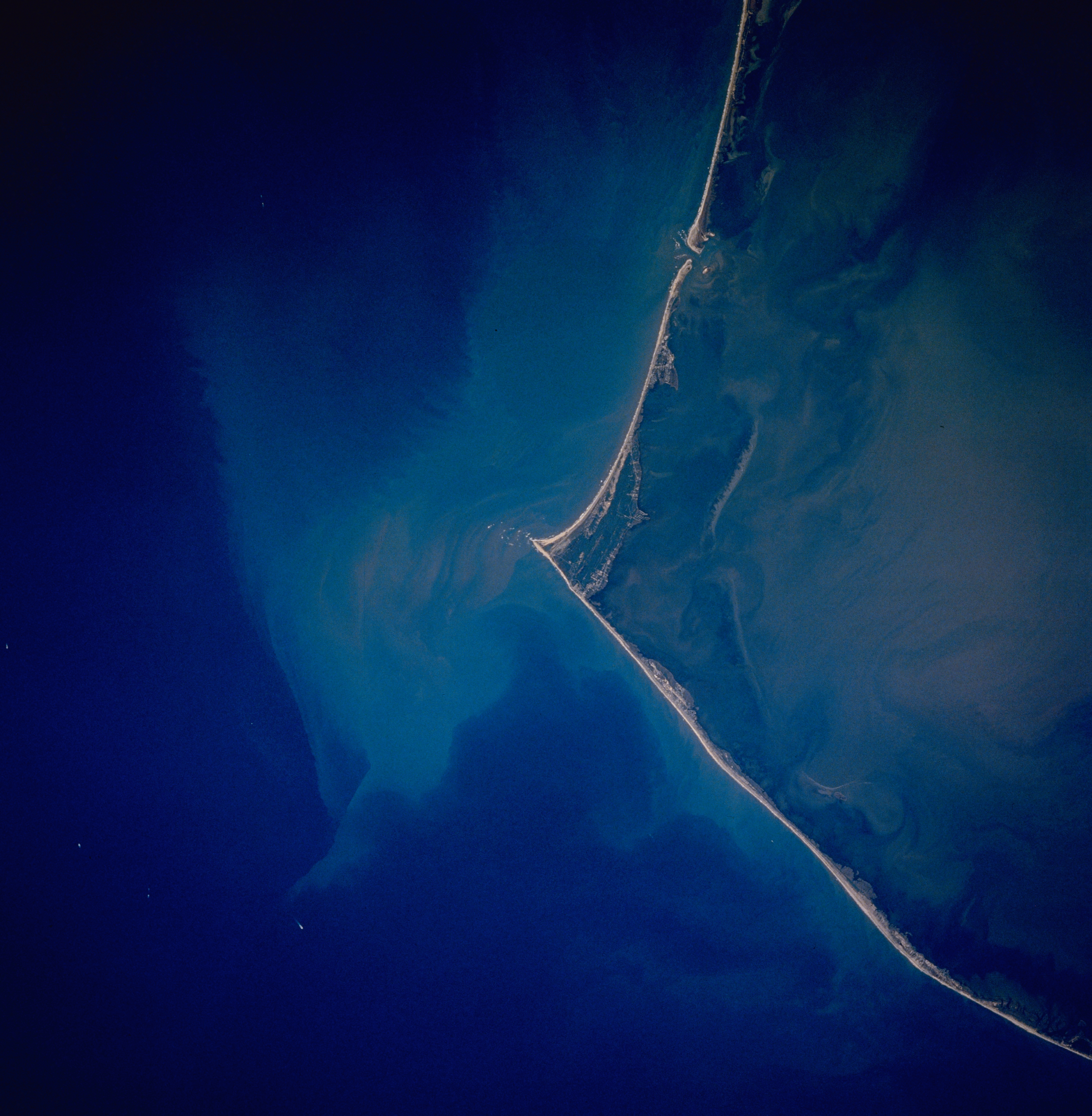
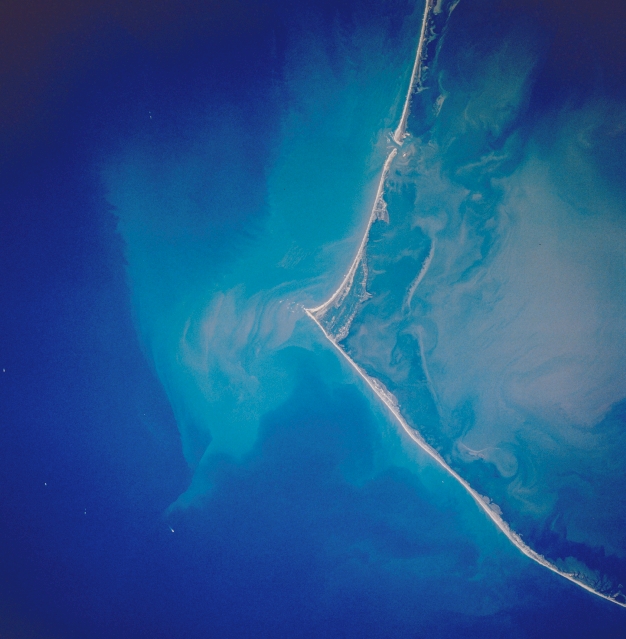
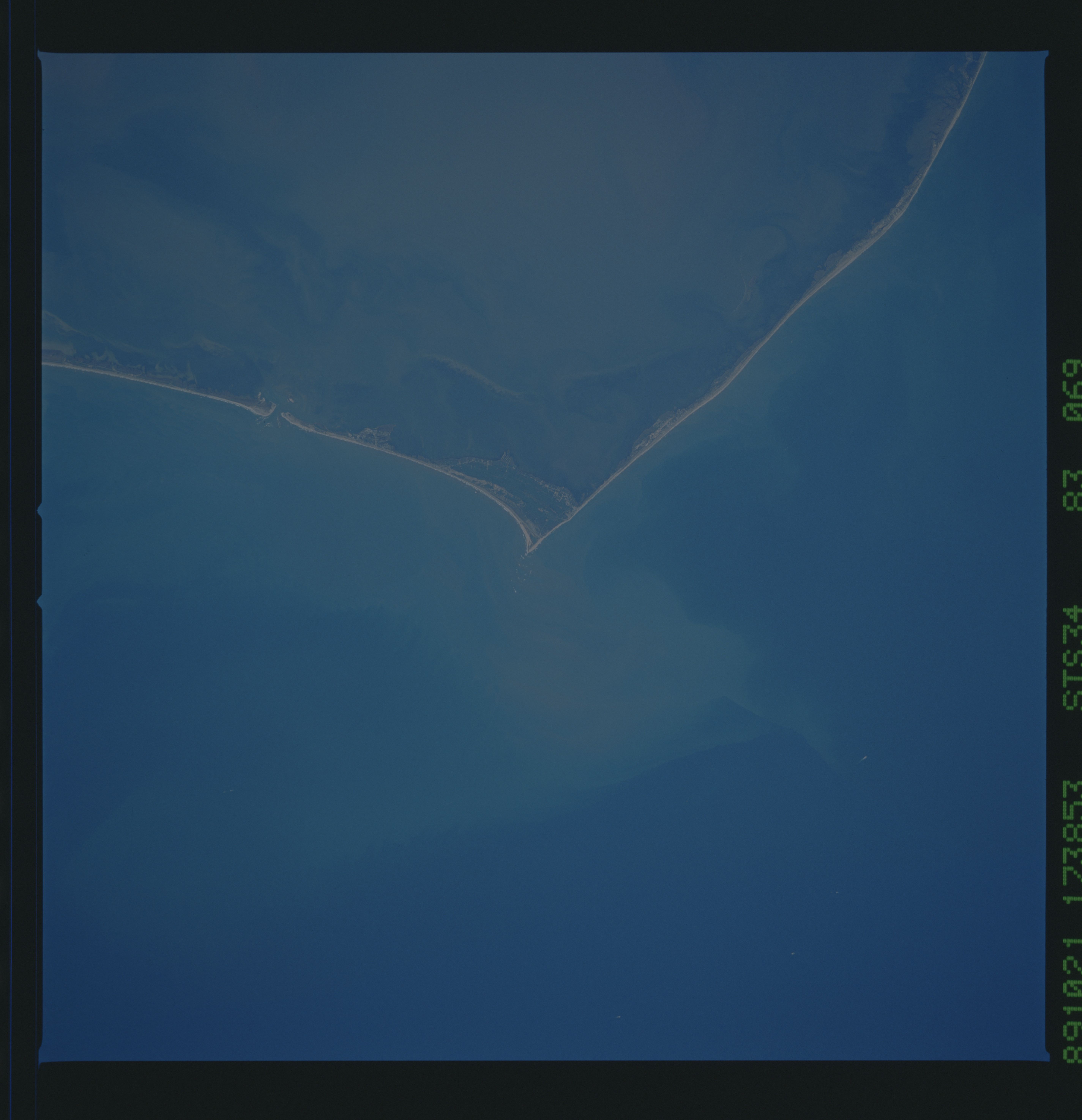
Image Caption: STS034-83-69 Cape Hatteras, North Carolina, U.S.A. October 1989
The famous barrier island coast of Cape Hatteras, is visible in this near vertical of the North Carolina coast. This barrier island system is protected as the Cape Hatteras National Seashore, with Pamlico Sound to the west and the Atlantic Ocean to the east. A plume of sediment, visible off of the tip of Cape Hatteras, creates a light blue color in the Atlantic Ocean waters. This outflow is from the precipitation runoff of Hurricane Hugo (Sept. 1989) which was still evident during the STS-34 mission (Oct. 1989). This same delayed or extended runoff phenomenon was also very marked along the periphery of the Yucatan Peninsula following Hurricane Gilbert in 1988.
The famous barrier island coast of Cape Hatteras, is visible in this near vertical of the North Carolina coast. This barrier island system is protected as the Cape Hatteras National Seashore, with Pamlico Sound to the west and the Atlantic Ocean to the east. A plume of sediment, visible off of the tip of Cape Hatteras, creates a light blue color in the Atlantic Ocean waters. This outflow is from the precipitation runoff of Hurricane Hugo (Sept. 1989) which was still evident during the STS-34 mission (Oct. 1989). This same delayed or extended runoff phenomenon was also very marked along the periphery of the Yucatan Peninsula following Hurricane Gilbert in 1988.
