STS034-83-67
| NASA Photo ID | STS034-83-67 |
| Focal Length | 250mm |
| Date taken | 1989.10.21 |
| Time taken | 17:38:37 GMT |
Resolutions offered for this image:
3904 x 3820 pixels 639 x 626 pixels 5700 x 5900 pixels 500 x 518 pixels 640 x 480 pixels
3904 x 3820 pixels 639 x 626 pixels 5700 x 5900 pixels 500 x 518 pixels 640 x 480 pixels

Cloud masks available for this image:
Spacecraft nadir point: 34.4° N, 76.5° W
Photo center point: 35.5° N, 77.0° W
Photo center point by machine learning:
Photo center point: 35.5° N, 77.0° W
Photo center point by machine learning:
Nadir to Photo Center: North
Spacecraft Altitude: 177 nautical miles (328km)
Country or Geographic Name: | USA-NORTH CAROLINA |
Features: | PAMLICO RIVER |
| Features Found Using Machine Learning: | |
Cloud Cover Percentage: | 0 (no clouds present) |
Sun Elevation Angle: | 43° |
Sun Azimuth: | 196° |
Camera: | Hasselblad |
Focal Length: | 250mm |
Camera Tilt: | 22 degrees |
Format: | 5017: Kodak, natural color positive, Ektachrome, X Professional, ASA 64, standard base |
Film Exposure: | Normal |
| Additional Information | |
| Width | Height | Annotated | Cropped | Purpose | Links |
|---|---|---|---|---|---|
| 3904 pixels | 3820 pixels | No | No | Earth From Space collection | Download Image |
| 639 pixels | 626 pixels | No | No | Earth From Space collection | Download Image |
| 5700 pixels | 5900 pixels | No | No | Download Image | |
| 500 pixels | 518 pixels | No | No | Download Image | |
| 640 pixels | 480 pixels | No | No | Download Image |
Download Packaged File
Download a Google Earth KML for this Image
View photo footprint information
Download a GeoTIFF for this photo
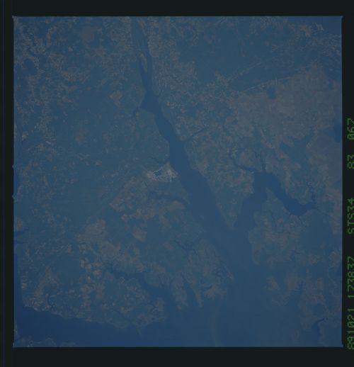
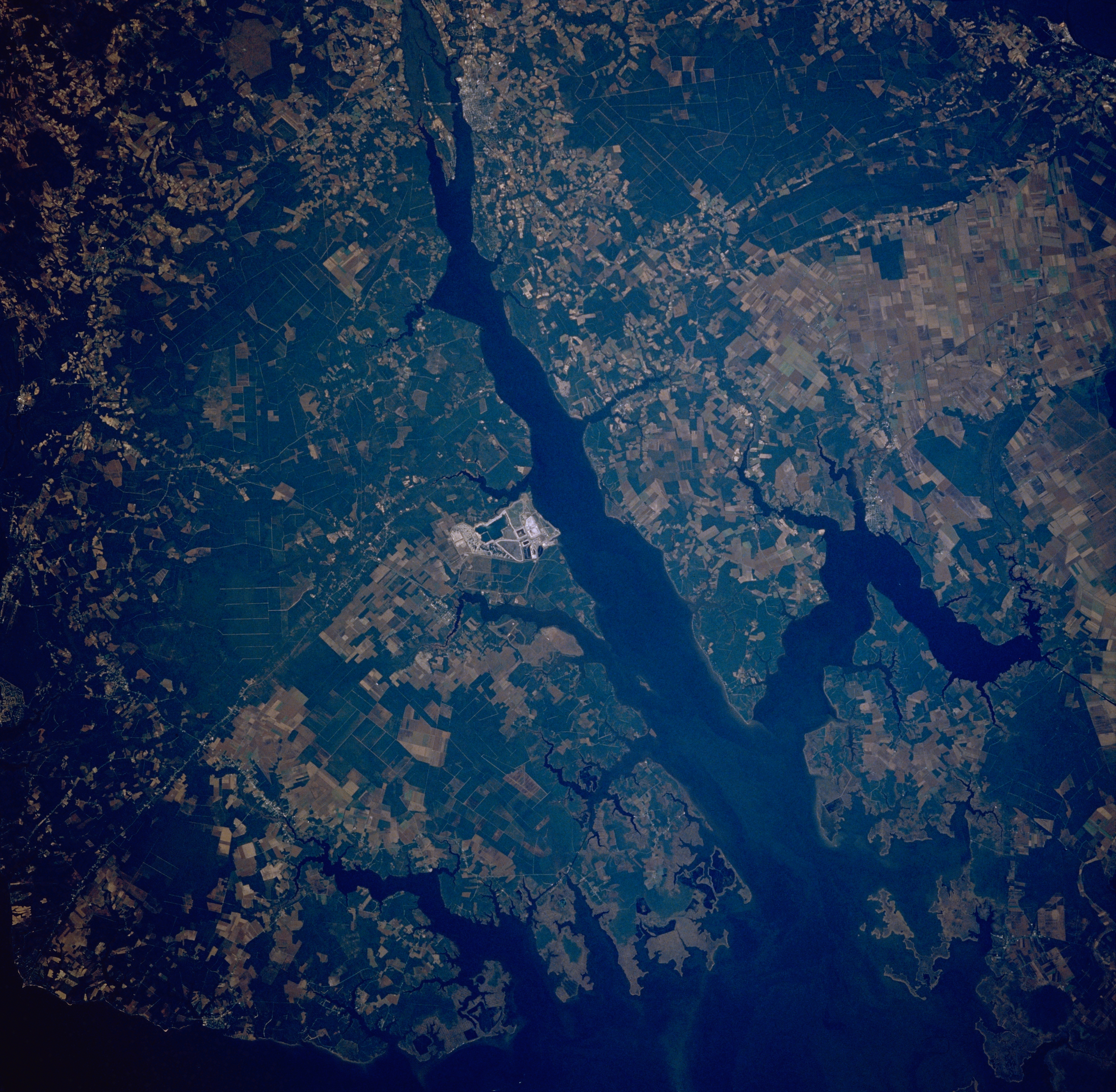
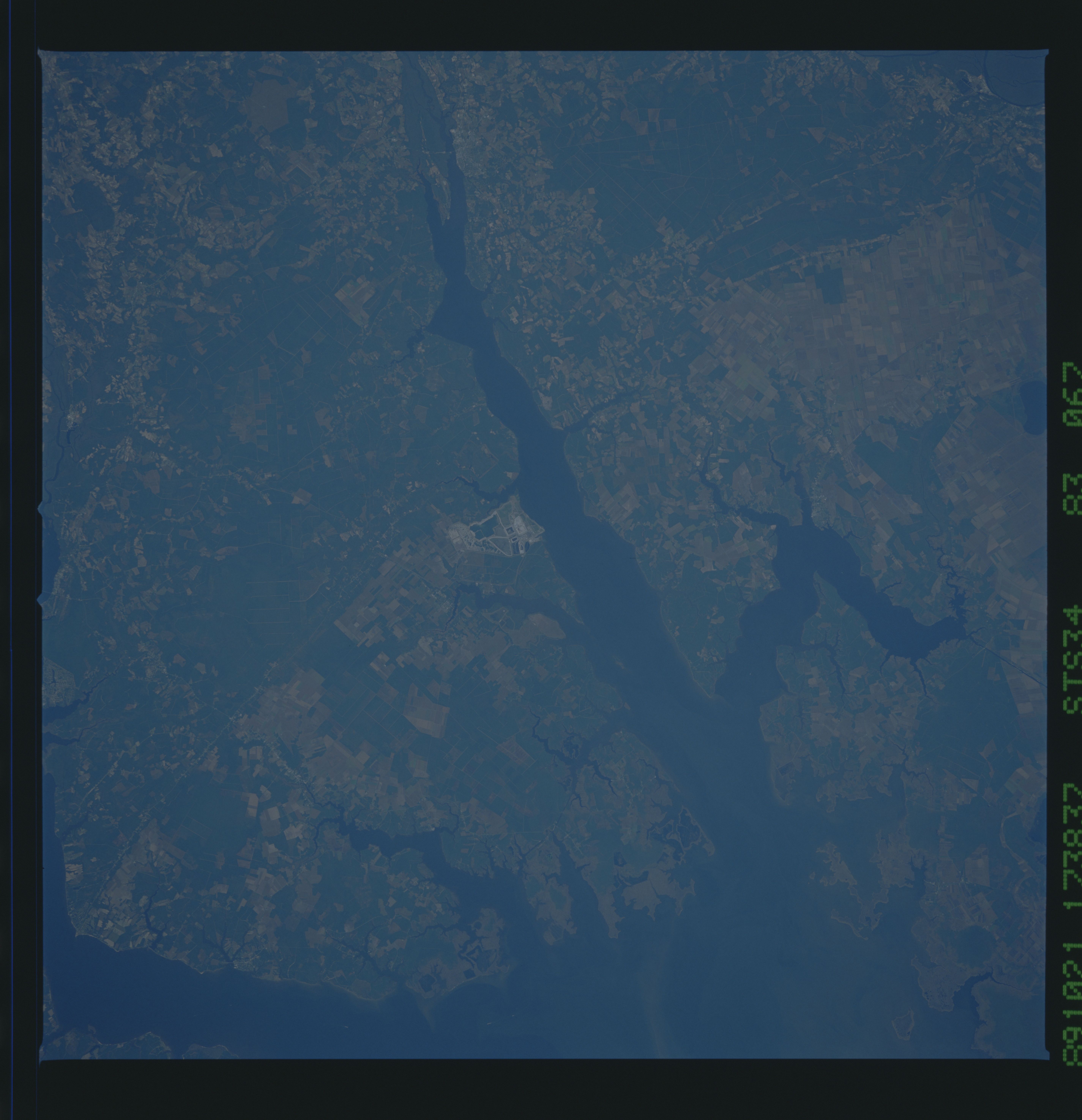
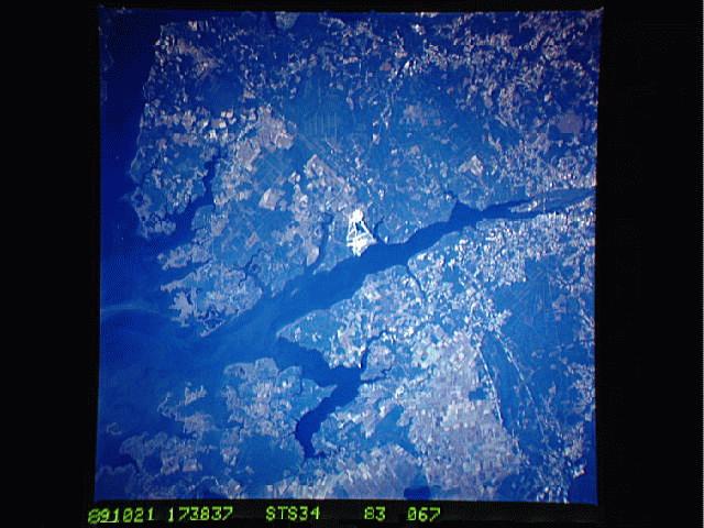
Image Caption: STS034-083-067 Pamlico River, North Carolina, U.S.A. October 1989
The east-southeast-flowing Pamlico River, shown here as a wide estuary, is visible as it empties into Pamlico Sound along the east coast of North Carolina. The broad estuary of the much shorter Pungo River can be seen as it flows into the north side of the Pamlico River near its mouth. The light colored area in the center of the image is an operating phosphate mine and a single runway. Most of the lighter colored landscape, consisting of angular shaped field patterns, are used for agriculture; while the darker terrain tends to be extensive woodlands.
The east-southeast-flowing Pamlico River, shown here as a wide estuary, is visible as it empties into Pamlico Sound along the east coast of North Carolina. The broad estuary of the much shorter Pungo River can be seen as it flows into the north side of the Pamlico River near its mouth. The light colored area in the center of the image is an operating phosphate mine and a single runway. Most of the lighter colored landscape, consisting of angular shaped field patterns, are used for agriculture; while the darker terrain tends to be extensive woodlands.
