STS034-77-29
| NASA Photo ID | STS034-77-29 |
| Focal Length | 100mm |
| Date taken | 1989.10.__ |
| Time taken | GMT |
Resolutions offered for this image:
5248 x 5248 pixels 640 x 640 pixels 5700 x 5900 pixels 500 x 518 pixels 640 x 480 pixels
5248 x 5248 pixels 640 x 640 pixels 5700 x 5900 pixels 500 x 518 pixels 640 x 480 pixels


Cloud masks available for this image:
Spacecraft nadir point:
Photo center point: 17.0° N, 81.0° E
Photo center point by machine learning:
Photo center point: 17.0° N, 81.0° E
Photo center point by machine learning:
Nadir to Photo Center:
Spacecraft Altitude: nautical miles (0km)
Country or Geographic Name: | INDIA |
Features: | DELTAS-GODAVARI/KRISHNA |
| Features Found Using Machine Learning: | |
Cloud Cover Percentage: | 0 (no clouds present) |
Sun Elevation Angle: | ° |
Sun Azimuth: | ° |
Camera: | Hasselblad |
Focal Length: | 100mm |
Camera Tilt: | Low Oblique |
Format: | 5017: Kodak, natural color positive, Ektachrome, X Professional, ASA 64, standard base |
Film Exposure: | Normal |
| Additional Information | |
| Width | Height | Annotated | Cropped | Purpose | Links |
|---|---|---|---|---|---|
| 5248 pixels | 5248 pixels | No | No | Earth From Space collection | Download Image |
| 640 pixels | 640 pixels | No | No | Earth From Space collection | Download Image |
| 5700 pixels | 5900 pixels | No | No | Download Image | |
| 500 pixels | 518 pixels | No | No | Download Image | |
| 640 pixels | 480 pixels | No | No | Download Image |
Download Packaged File
Download a Google Earth KML for this Image
View photo footprint information
Download a GeoTIFF for this photo
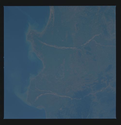
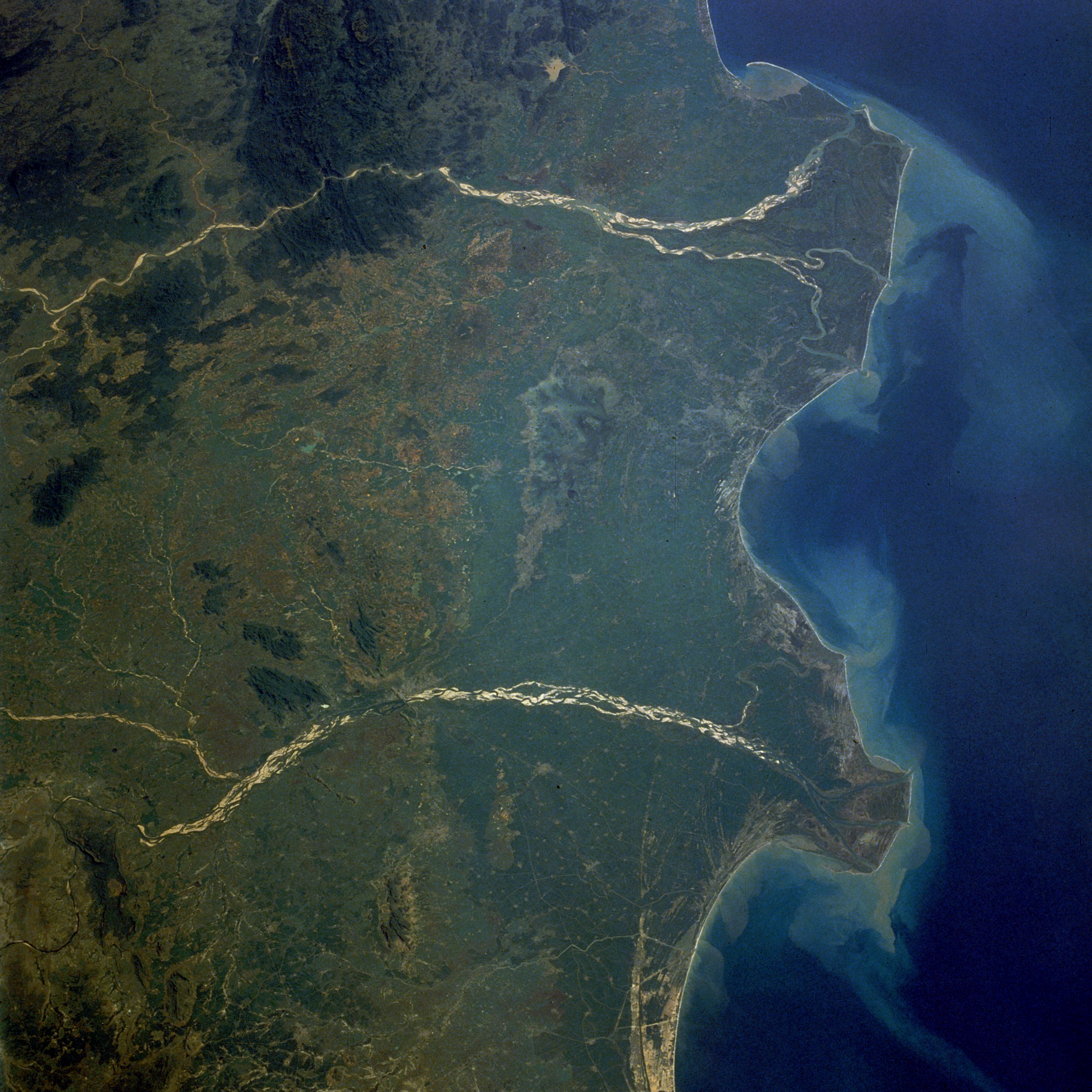
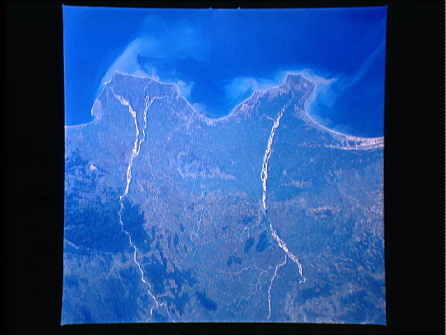
Image Caption: STS034-077-029 Godavari and Krishna River Deltas, India October 1989
The mouths of the Godavari River (east) and the Krishna River (west) empty into the Bay of Bengal in this low-oblique, northwest-looking photograph. The Godavari River, 900 miles (1450 kilometers) long, rises in the Western Ghats and flows across the Deccan Plateau toward the Bay of Bengal in eastern India. Below the city of Rajahmundry, the river divides into two streams that form the huge delta, which is the site of some of the earliest European settlements in India. The Krishna River, more than 800 miles (1290 kilometers) long, also rises in the Western Ghats only 40 miles (64 kilometers) from the Arabian Sea. The river also traverses the Deccan Plateau and empties into the Bay of Bengal southwest of the Godavari River Delta. The two rivers have several common characteristics--they are quite wide and have conspicuous deltas, both have heavy discharges of water during the monsoon season (June to early September) followed by low discharges during the dry season (October through late May), both discharge sediment into the Bay of Bengal, and both are sacred rivers of the Hindu religion.
The mouths of the Godavari River (east) and the Krishna River (west) empty into the Bay of Bengal in this low-oblique, northwest-looking photograph. The Godavari River, 900 miles (1450 kilometers) long, rises in the Western Ghats and flows across the Deccan Plateau toward the Bay of Bengal in eastern India. Below the city of Rajahmundry, the river divides into two streams that form the huge delta, which is the site of some of the earliest European settlements in India. The Krishna River, more than 800 miles (1290 kilometers) long, also rises in the Western Ghats only 40 miles (64 kilometers) from the Arabian Sea. The river also traverses the Deccan Plateau and empties into the Bay of Bengal southwest of the Godavari River Delta. The two rivers have several common characteristics--they are quite wide and have conspicuous deltas, both have heavy discharges of water during the monsoon season (June to early September) followed by low discharges during the dry season (October through late May), both discharge sediment into the Bay of Bengal, and both are sacred rivers of the Hindu religion.
