STS033-79-35
| NASA Photo ID | STS033-79-35 |
| Focal Length | 250mm |
| Date taken | 1989.11.24 |
| Time taken | 01:54:12 GMT |
Resolutions offered for this image:
3904 x 3936 pixels 634 x 639 pixels 5700 x 5900 pixels 500 x 518 pixels 640 x 480 pixels
3904 x 3936 pixels 634 x 639 pixels 5700 x 5900 pixels 500 x 518 pixels 640 x 480 pixels

Cloud masks available for this image:
Spacecraft nadir point: 16.3° S, 128.1° E
Photo center point: 15.0° S, 128.0° E
Photo center point by machine learning:
Photo center point: 15.0° S, 128.0° E
Photo center point by machine learning:
Nadir to Photo Center: North
Spacecraft Altitude: 215 nautical miles (398km)
Country or Geographic Name: | AUSTRALIA-WA |
Features: | CAMBRIDGE GULF |
| Features Found Using Machine Learning: | |
Cloud Cover Percentage: | 0 (no clouds present) |
Sun Elevation Angle: | 71° |
Sun Azimuth: | 106° |
Camera: | Hasselblad |
Focal Length: | 250mm |
Camera Tilt: | 20 degrees |
Format: | 5017: Kodak, natural color positive, Ektachrome, X Professional, ASA 64, standard base |
Film Exposure: | Normal |
| Additional Information | |
| Width | Height | Annotated | Cropped | Purpose | Links |
|---|---|---|---|---|---|
| 3904 pixels | 3936 pixels | No | No | Earth From Space collection | Download Image |
| 634 pixels | 639 pixels | No | No | Earth From Space collection | Download Image |
| 5700 pixels | 5900 pixels | No | No | Download Image | |
| 500 pixels | 518 pixels | No | No | Download Image | |
| 640 pixels | 480 pixels | No | No | Download Image |
Download Packaged File
Download a Google Earth KML for this Image
View photo footprint information
Download a GeoTIFF for this photo
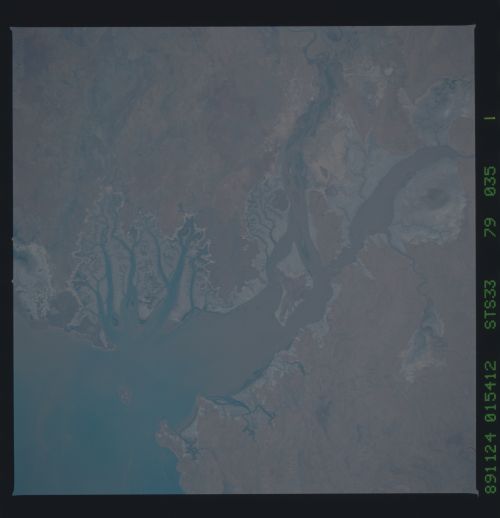
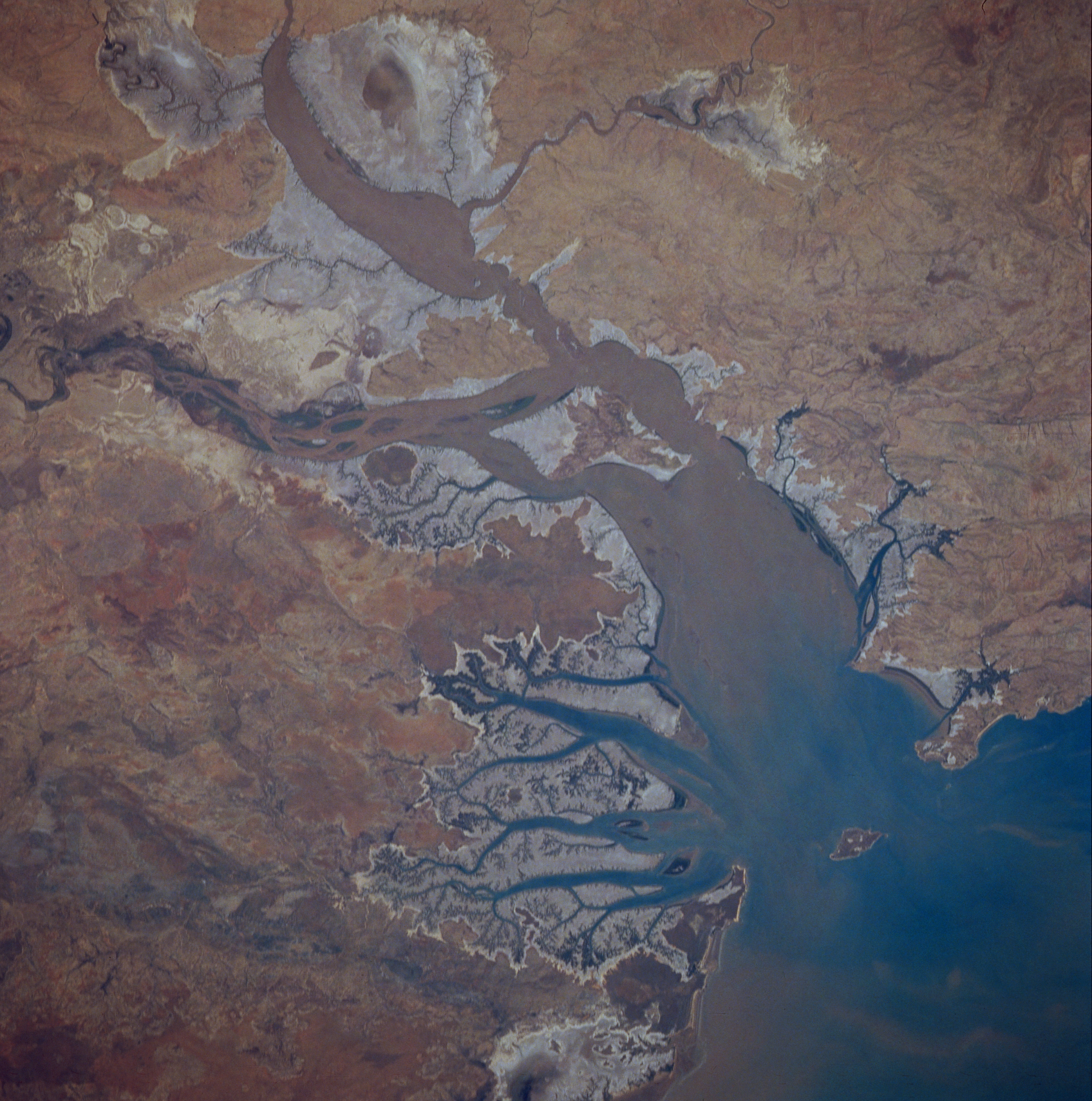
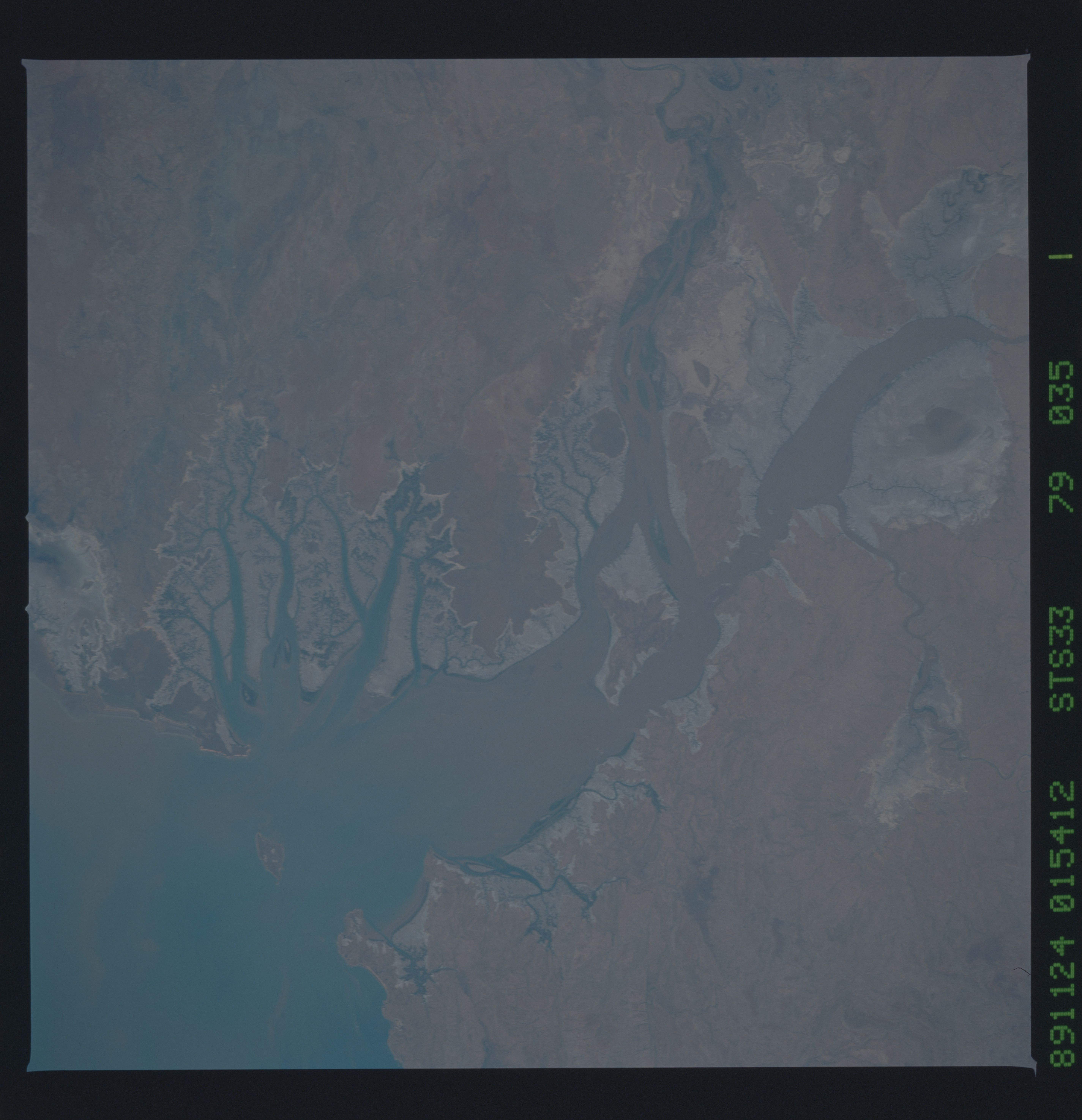
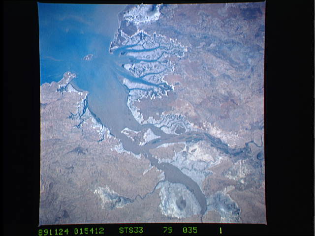
Image Caption: STS033-079-035 Cambridge Gulf, Western Australia, Australia November 1989
Sediment-laden Cambridge Gulf can be seen emptying into the southwest corner of the much larger Joseph Bonaparte Gulf onthe north coast of Australia . Much of this coastal zone consists of saline tidal flats (lighter colored, grayish looking area). Several short flowing rivers drain into the Cambridge Gulf bringing water and light brown sediment from the Kimberley Plateau south of the gulf. Several distributary channels of the Ord River are visible (left center part of image) where the river discharges into the southeast side of Cambridge Gulf.
Sediment-laden Cambridge Gulf can be seen emptying into the southwest corner of the much larger Joseph Bonaparte Gulf onthe north coast of Australia . Much of this coastal zone consists of saline tidal flats (lighter colored, grayish looking area). Several short flowing rivers drain into the Cambridge Gulf bringing water and light brown sediment from the Kimberley Plateau south of the gulf. Several distributary channels of the Ord River are visible (left center part of image) where the river discharges into the southeast side of Cambridge Gulf.
